©Copyright 2018 GEOSCIENCE RESEARCH INSTITUTE
11060 Campus Street • Loma Linda, California 92350 • 909-558-4548

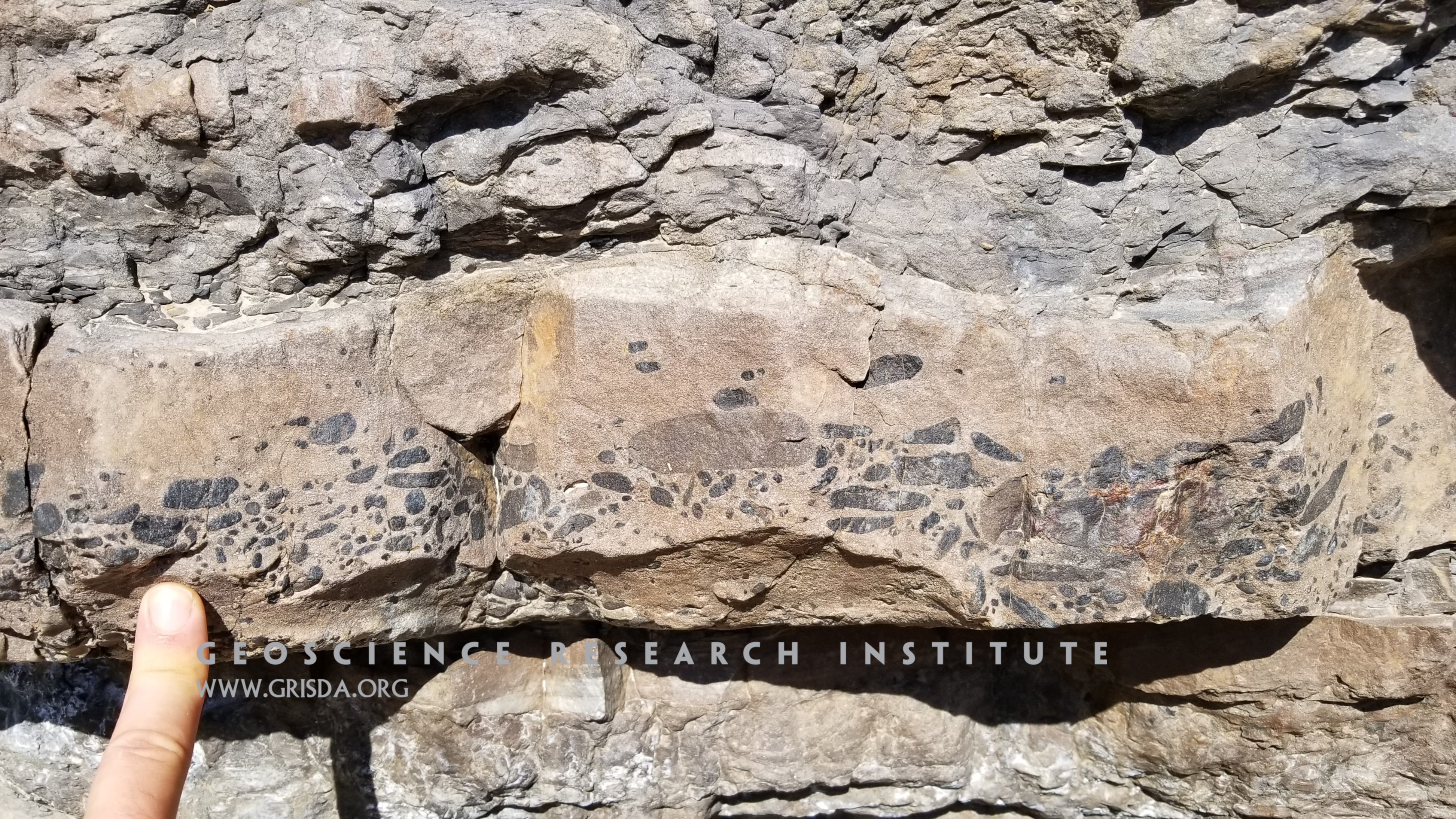
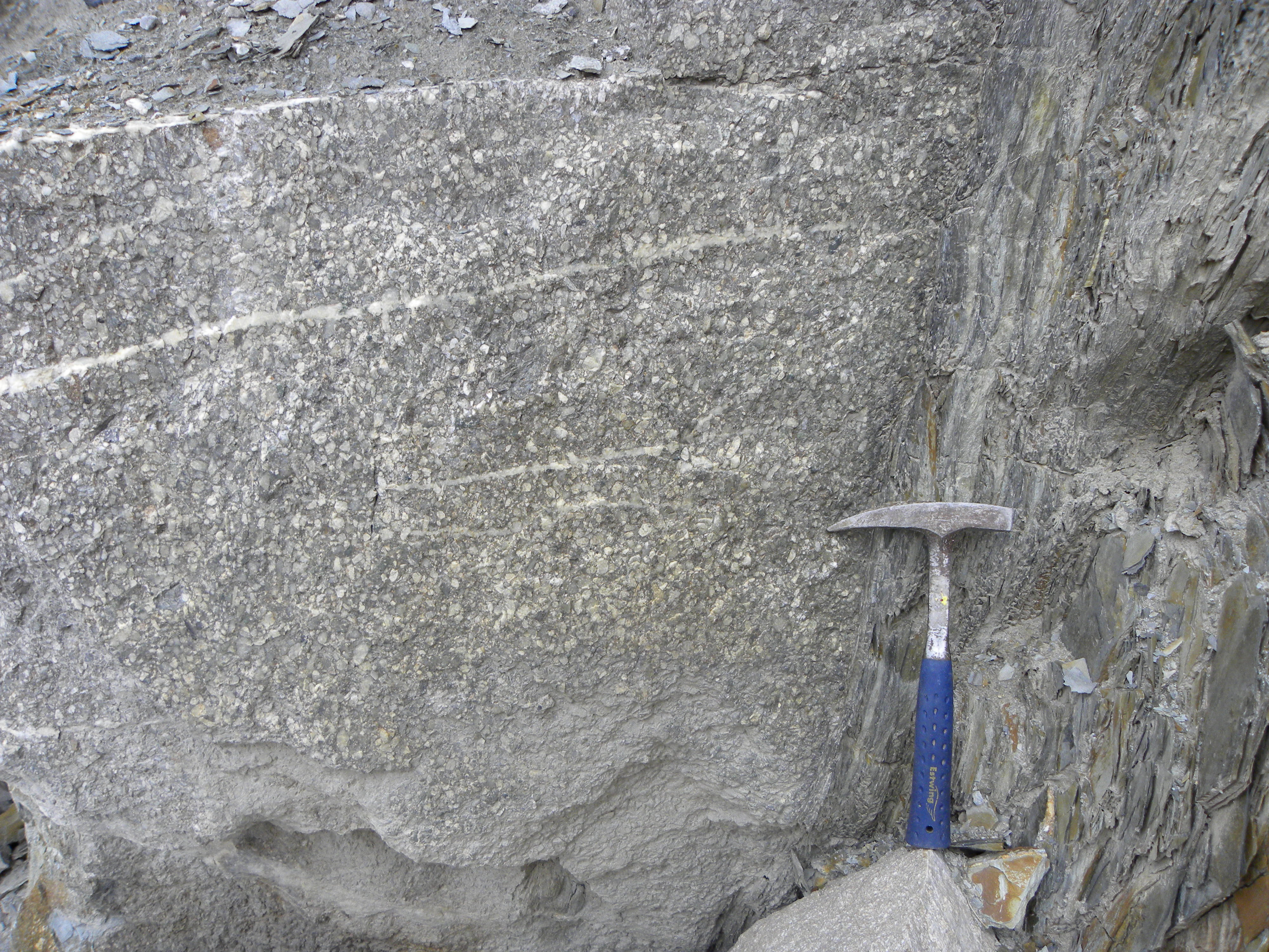
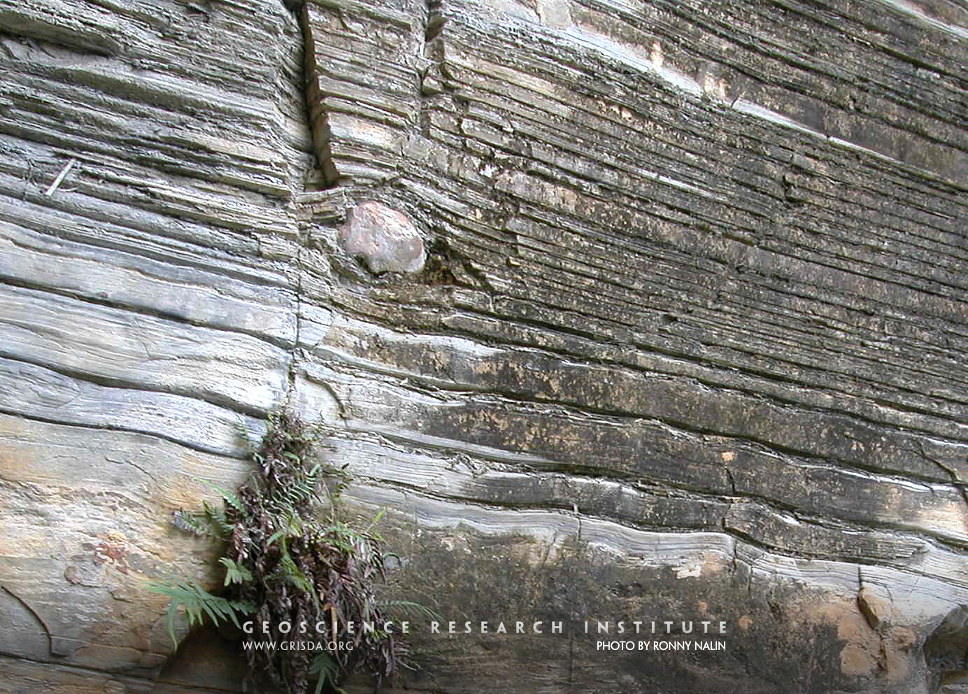
Pebbly layer
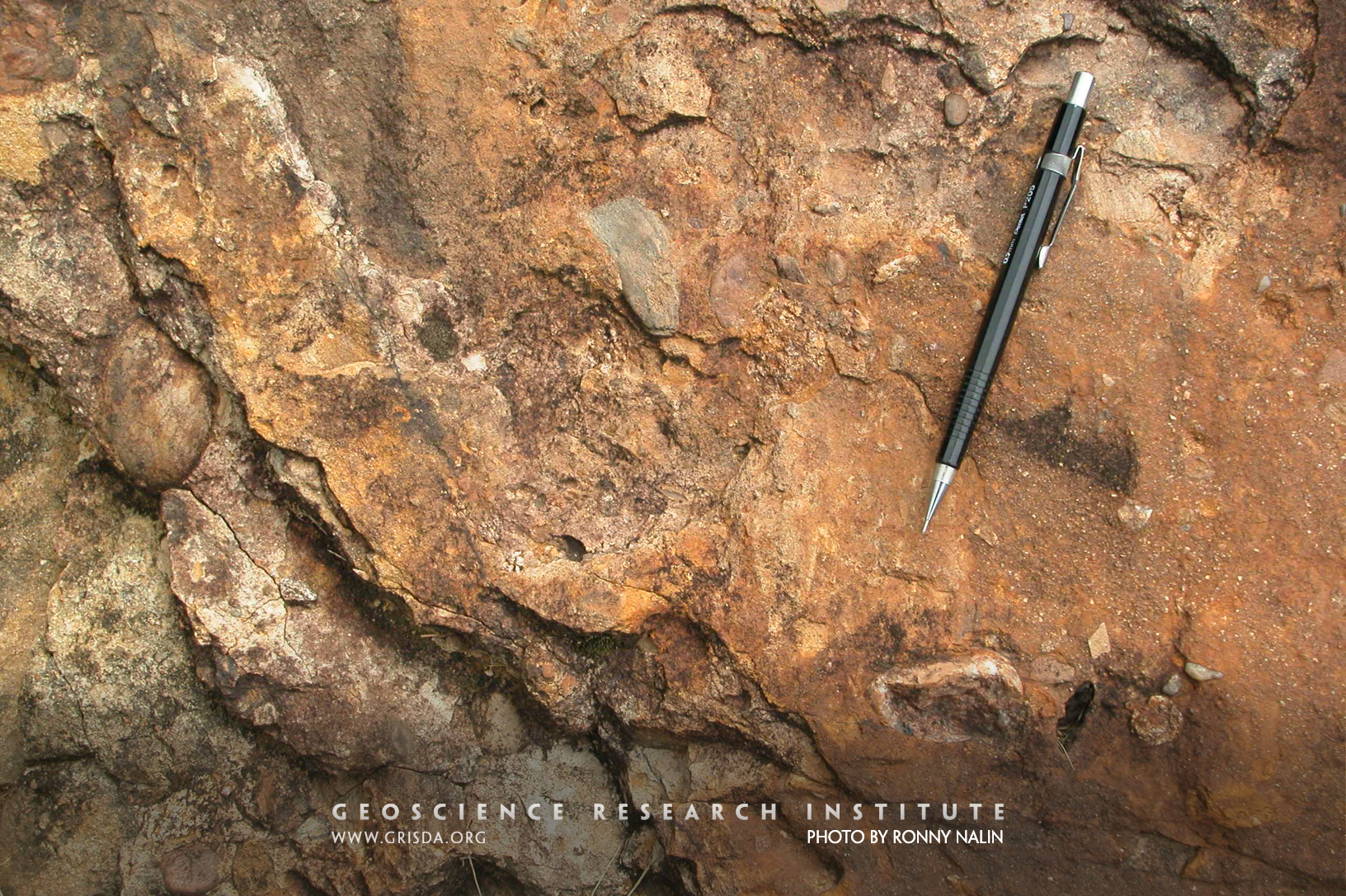
Elongated pebbles concentrated at the base of a sandstone bed. Some pebbles show evidence of boring. They probably were transported during a sediment gravity flow from shallower to deeper marine settings. Photo taken along the Quebrada Morochata, Bolivia.
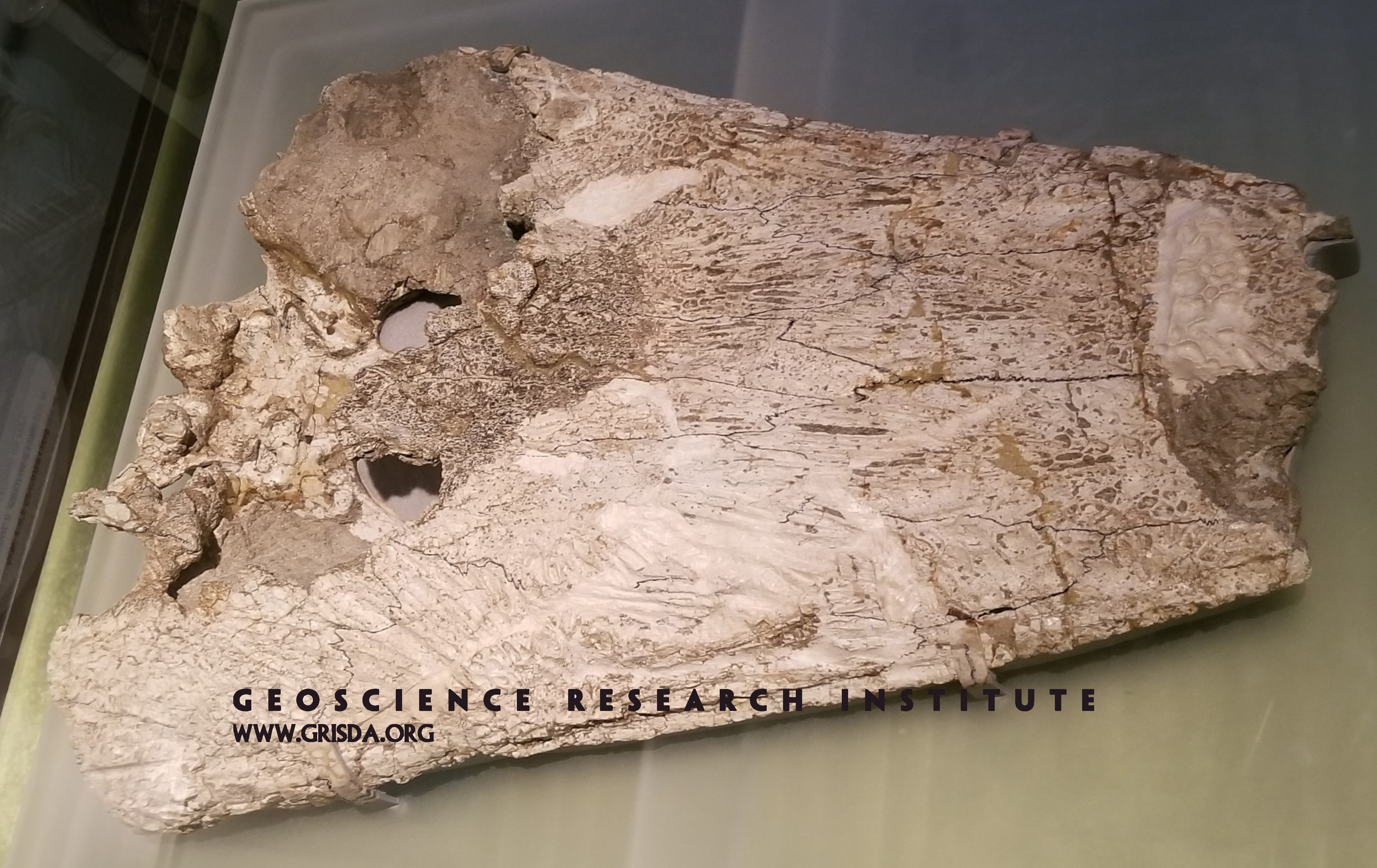
Antarctosuchus
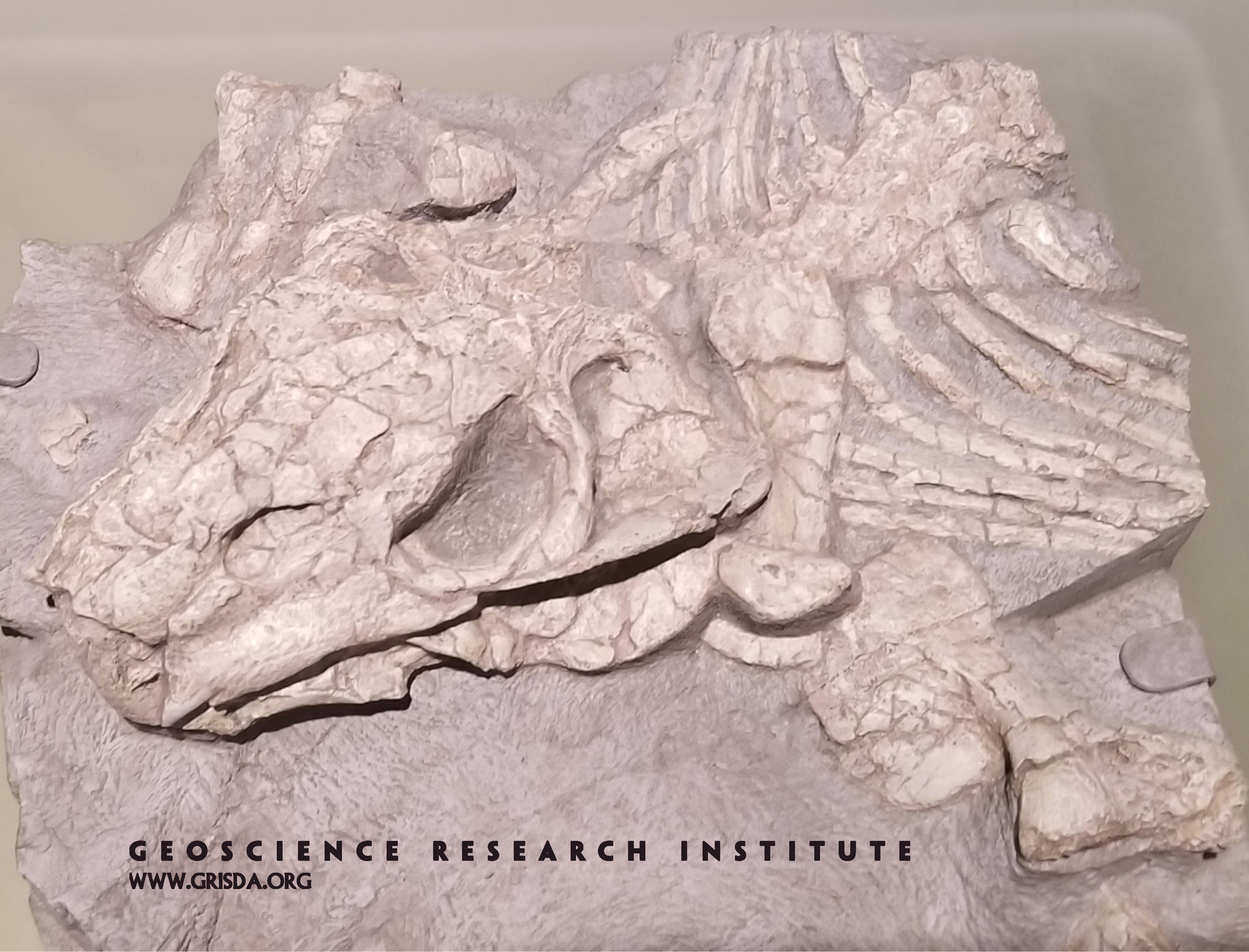
This relatively complete skull of an amphibian was excavated from Mid-Triassic layers of the Transantarctic Mountains, in Antarctica. It's fascinating to see that this large landmass mostly covered in ice contains a fossil record indicative of very different conditions than the present glacial environment. Specimen, about half meter in size, on display at The Chicago Field Museum of Natural History.
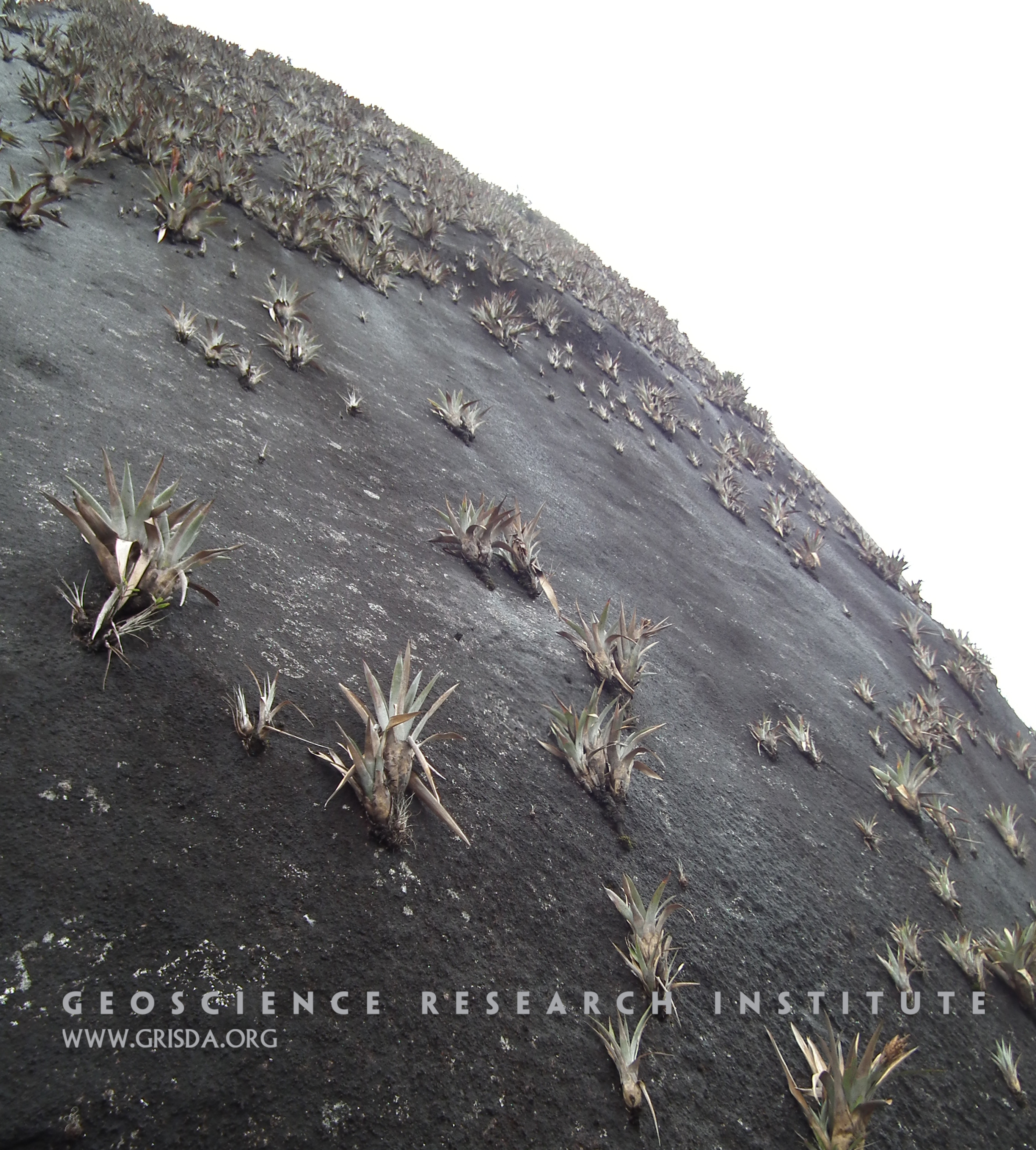
Epiphytic plants
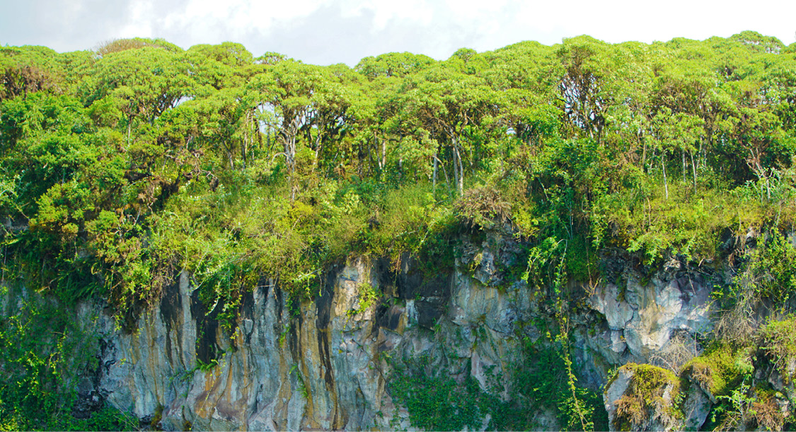
Epiphytic plants growing on a sheer vertical granitic wall of El Peñón de Guatapé, a rock formation in the region of Antioquia, Colombia.
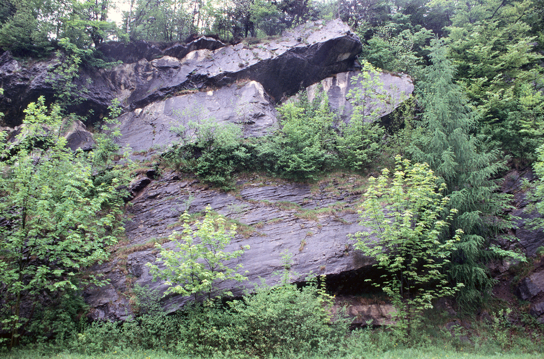
Lofer Cyclothems
Cyclothems are sequences of deposits interpreted as alternating between marine and terrestrial. The sediments in the photo are composed of Triassic limestones of the Dachstein Formation at Pass Lueg, Austria. For more details, see the Introduction to this gallery.
Red Rocks Park Amphitheater
Red Rocks Amphitheater, west Denver --- Tilted layers of Fountain Formation are sand and conglomerate deposited from erosion of the ancestral Rocky Mountains.
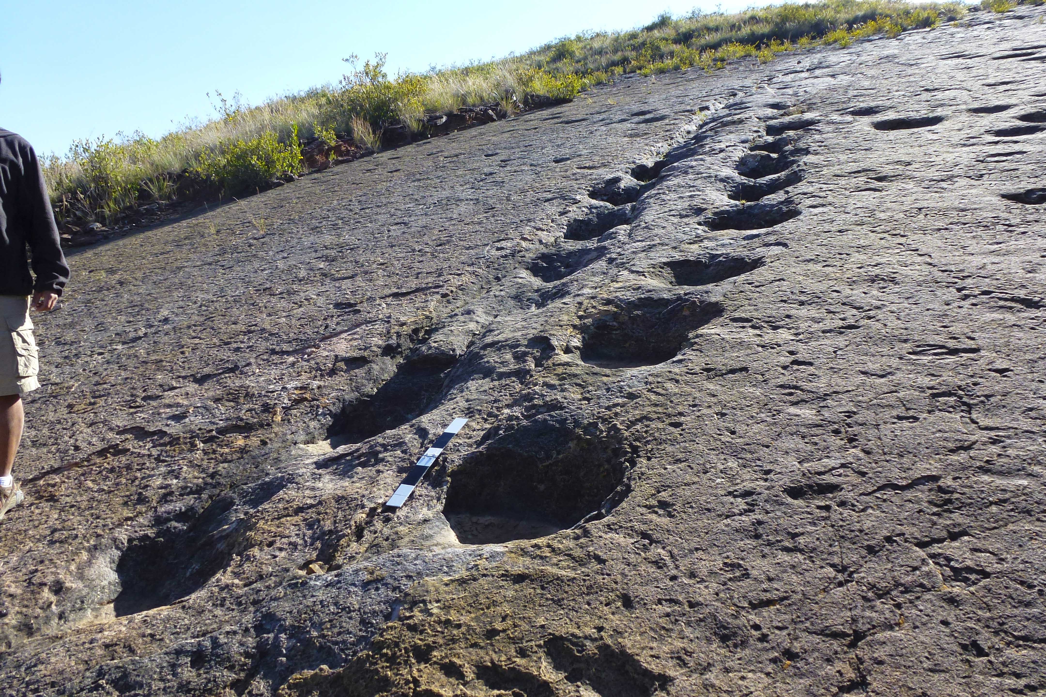
Torotoro syncline
Dinosaur footprints in the town of Torotoro. Torotoro is located in a valley formed by synclinal folding of sedimentary layers, forming a U-shaped regional structure. In the distance, one of the sides of the syncline can be seen, and the other occupies the bottom part of the photo, where the footprints are exposed
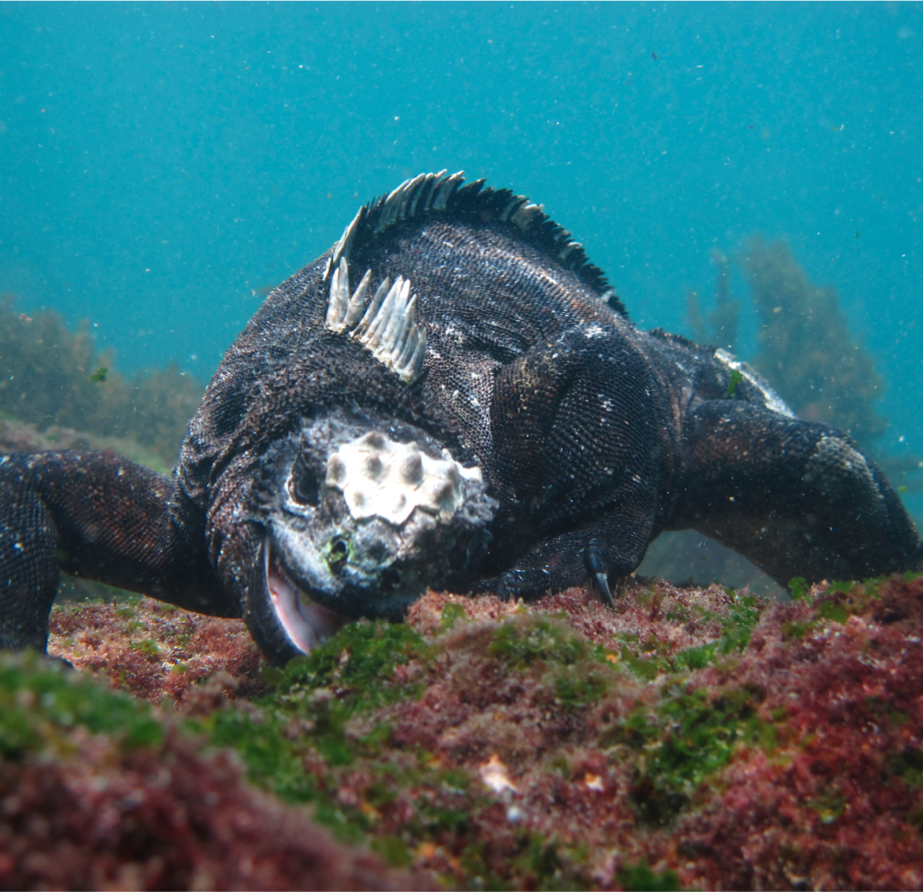
Marine iguana
The Galapagos marine iguana ( Amblyrhynchus cristatus) is a reptile that is found exclusively on these islands and that feeds on algae. It can stay submerged up to a depth of 9 m, although it usually feeds in the intertidal coastal zone.
Cerro-Blanco
Cerro Blanco seen from the outskirts of the town of Ocucaje, Peru. These hills consist of layers of sandy, clay and diatomaceous sediments that contain fossils of marine vertebrates.
Benthic foraminifers
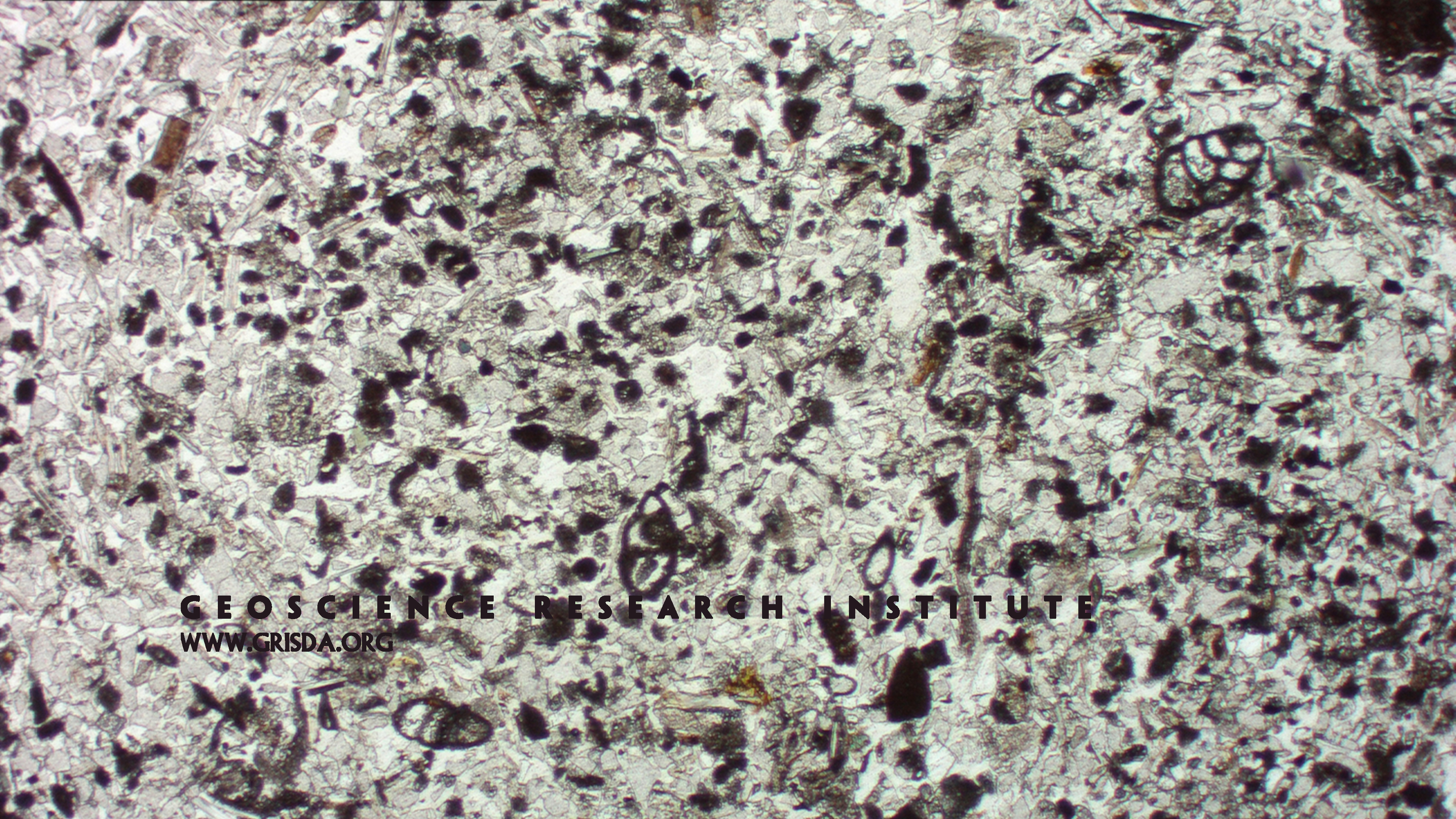
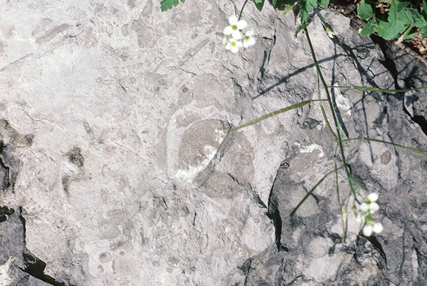
Thin section microphotograph (in plane parallel light) of a fine-grained, mixed siliciclastic-carbonate sandstone from Pliocene strata of the Sorbas Basin, Spain, containing tests of miliolid benthic foraminifers.
Icaronycteris index
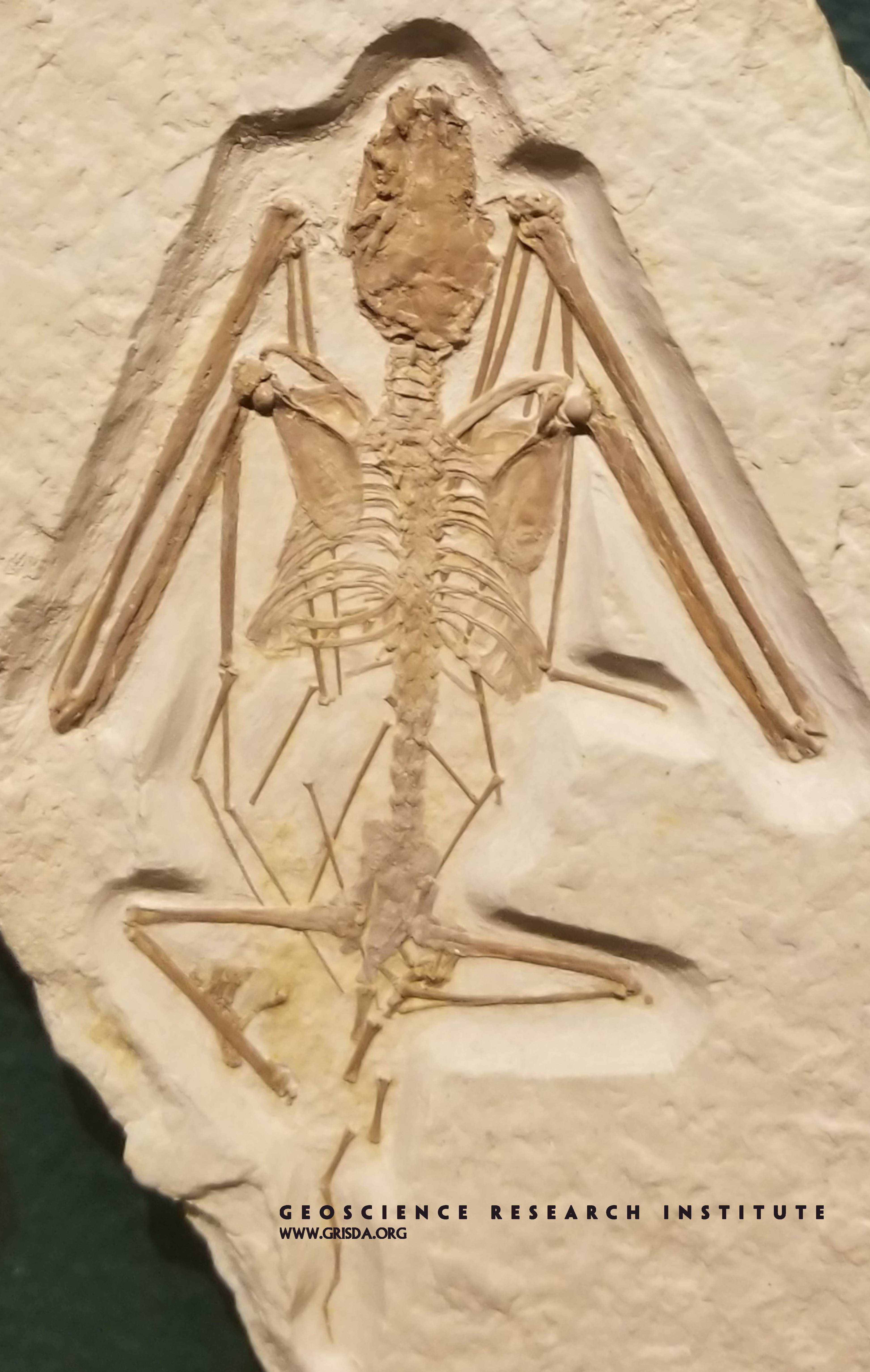
Bats are an example of abrupt appearance in the fossils record, without much subsequent modification of their body plan. This exquisitely preserved and articulated specimen (about 15 cm in size) is on display at the Field Museum of Natural History, Chicago, and comes from Eocene strata of Fossil Lake Basin, Wyoming.
Hartebeest
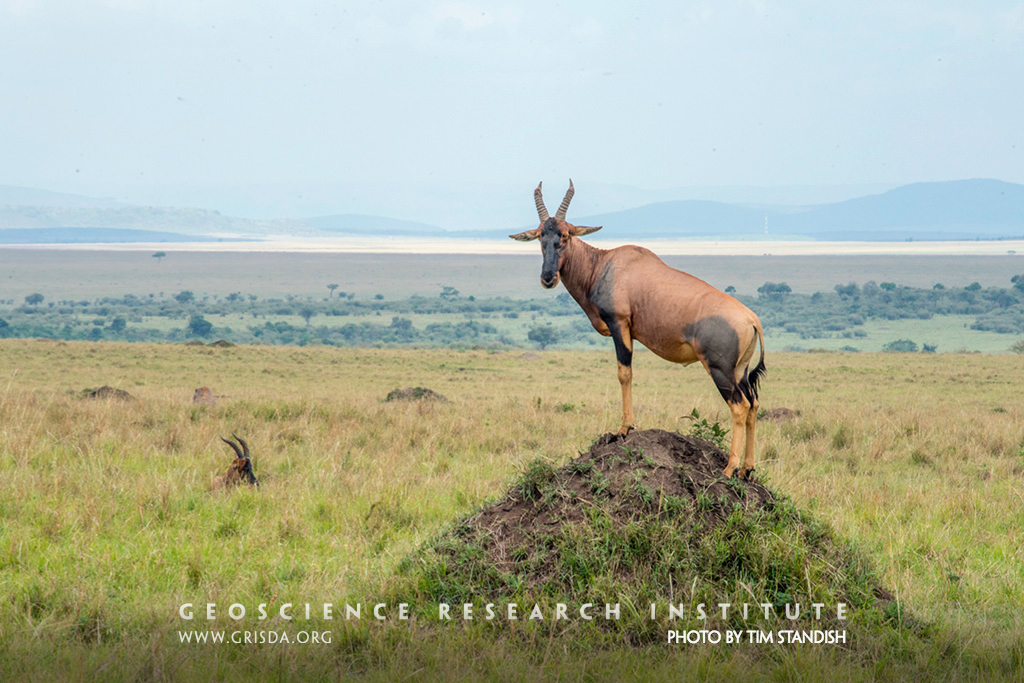
It is tempting to think that all the action in the savannah is going on with the abundant large mammals, but the anthill reveals that there is another unseen world underground; a world of unexpected dynamism that interacts with what is happening on the surface. Hartebeest love to perch on top of these anthills and this behavior reminds us that nature tends to be interconnected. Photo taken in Masai Mara, Kenya.
Glarus Overthurst
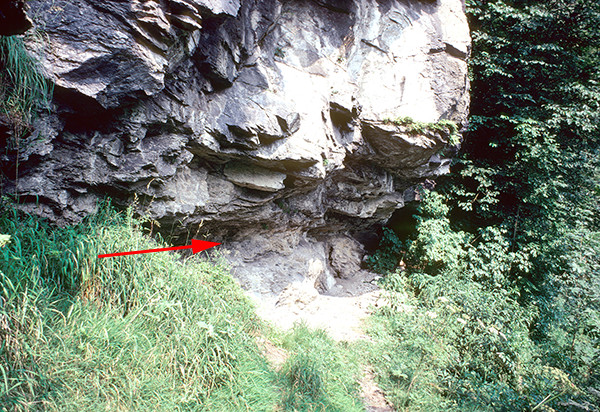
Thrust fault contact between the Eocene flysch (below) and the Permian Verrucano (above) near Schwanden. The arrow points to the fine contact line.
Load Casts at Pass Lueg
View looking up at the underside of a C unit in a Lofer cyclothem. The numerous bulbous forms which project downwards are called load casts. Load casts are often associated with turbidites. One bulb would be around 10-20 cm in diameter.
Garden Of Gods Visitors Center
Garden of the Gods and Pikes Peak, Colorado Springs --- The red Lyons Formation sandstone layers were uplifted vertically when the Rocky Mountains were uplifted. The 14,000 foot Pikes Peak in the background is a lone Precambrian granite intrusion.
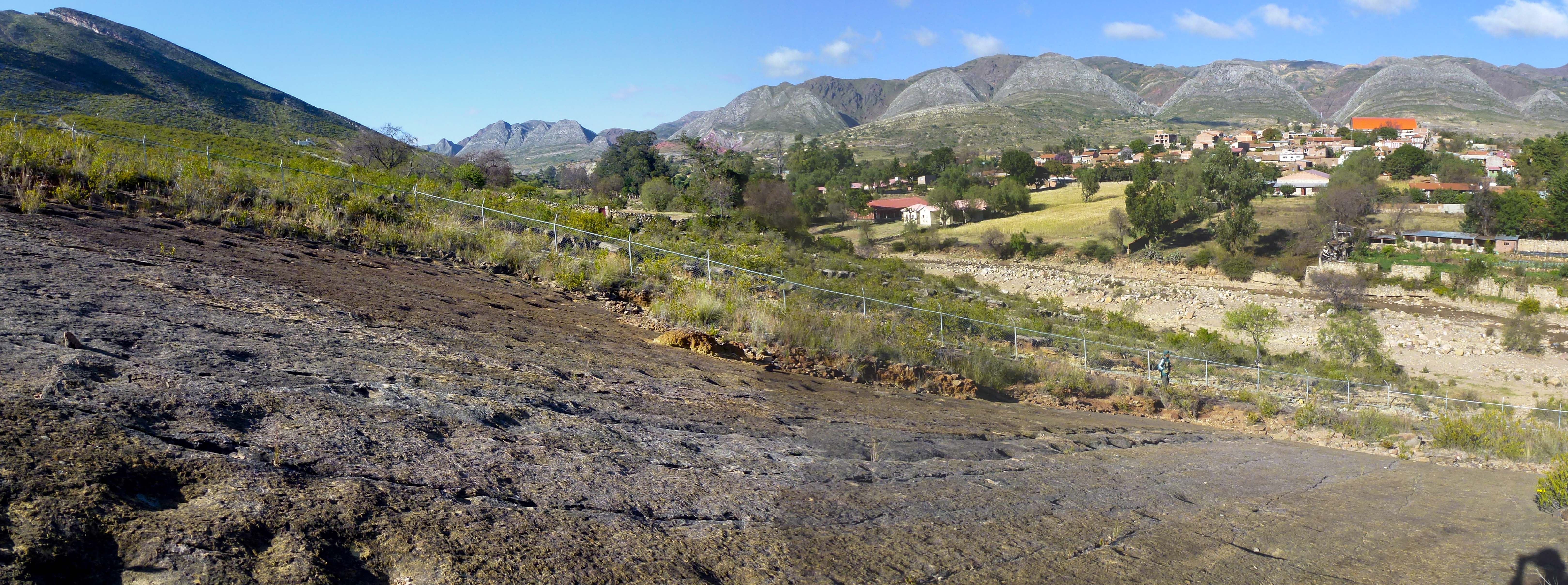
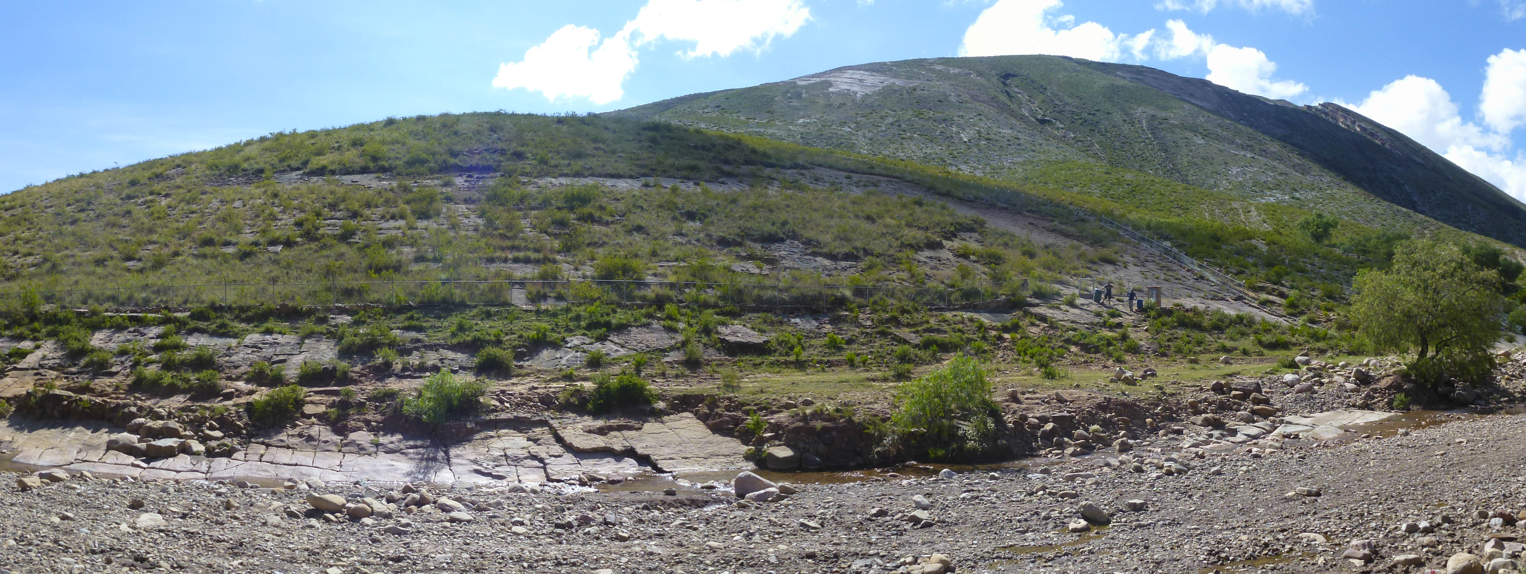
Torotoro site
Panorama of the main site with dinosaur footprints in Torotoro National Park. This place is right at the entrance of the town of Torotoro. Most of the tracks are within a fenced area, which can be visited with local guides under the supervision of the National Park authorities.
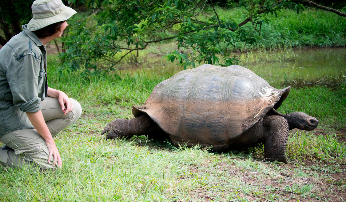
Chelonoidis
The giant Galapagos tortoise ( Chelonoidis nigra) is the largest land turtle in the world. These vegetarian giants can reach a meter and a half in length and weigh more than 400 kilos.
Panorama-Amara
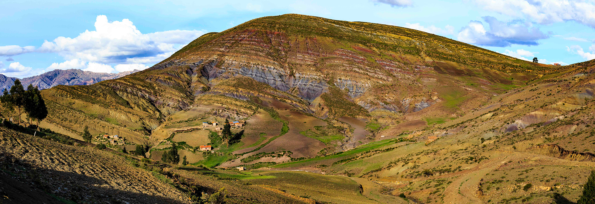
Amara Valley with Yesmara de Amara Hill on the right and Submarino and Buque hills on the left. Fossil cetaceans and evidence of storms in the past have been discovered in this valley.
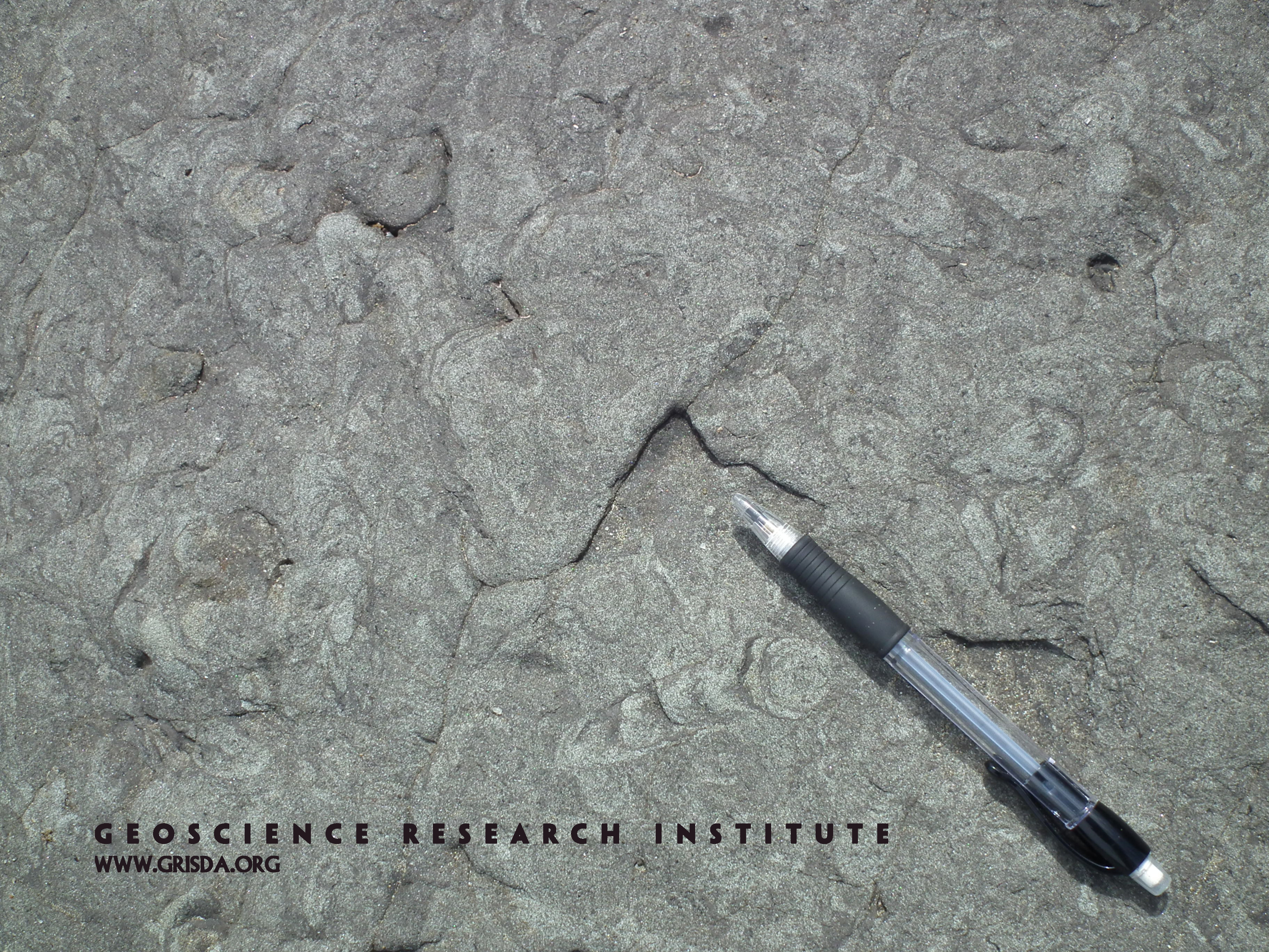
Bioturbation
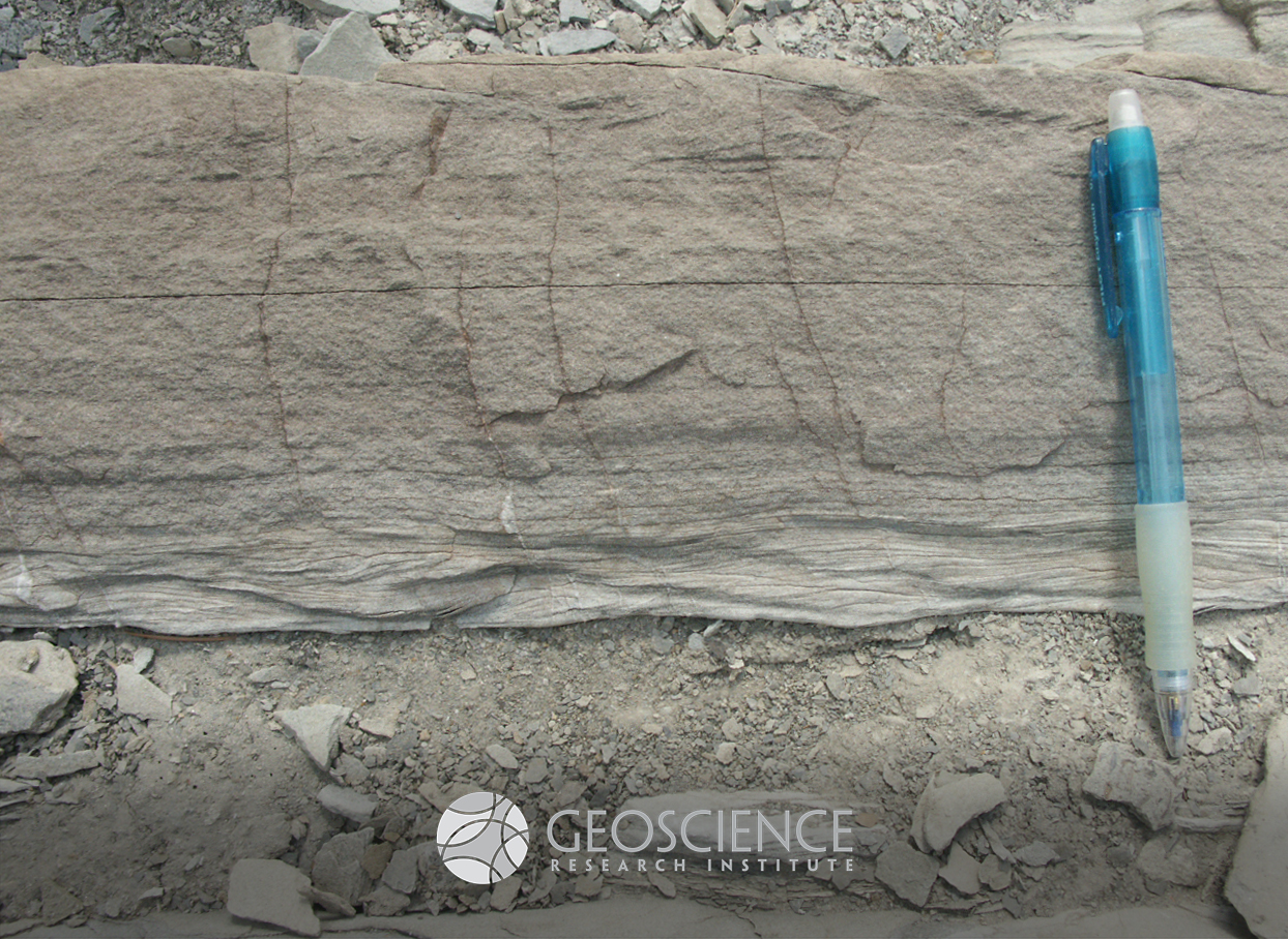
A variety of invertebrate organisms live and feed within the soft sediment accumulating under water. The activity of these organisms, known as bioturbation, can leave traces in the sediments of the substrate. These traces can become fossilized, as is the case for this Cretaceous sandstone from the coast of Chile. The meniscate patterns in the sand are indicative of bioturbation. Surface view of bed, pencil for scale.
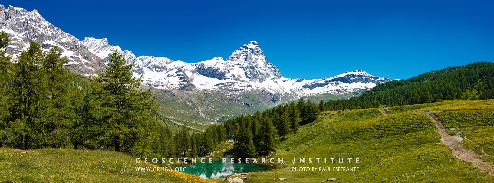
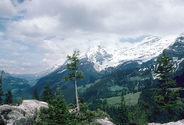
Cervino (Matterhorn)
The snowy peak of the Cervino. The Alps are a majestic mountain chain that records a history of continental collision and mountain rising. Glaciers and rivers have sculpted many valleys and contributed to the beauty of this natural landscape. Photo taken from Blue Lake, Cervinia-Breuil, Aosta, Italy.
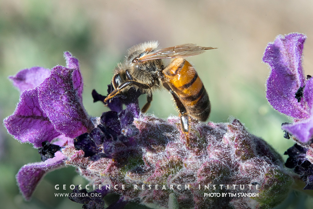
Bee on Lavender
Just about everywhere we look in the world, there is something beautiful to see. Each organism is a masterpiece and its relationship with others is beautiful. The bee is given nectar by the lavender while returning the favor by carrying pollen from one flower to the next. Biology is full of these mutually beneficial relationships, reminding us that—while we see the horrifying results of sin in death and suffering—life could not exist without cooperation between organisms.
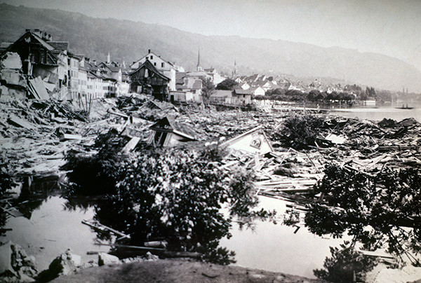
Catastrophic Shore Collapse
The city of Zug is built in part on the unconsolidated sands of an old delta. The shoreline along this old delta was being extended and a retaining wall was built. On July 5, 1887, at 15:35, two houses and a section of sea wall sank suddenly into the lake. At 18:55, an area extending 150 m along the shore and 80 m inland had sunk 78 m, destroying more houses.
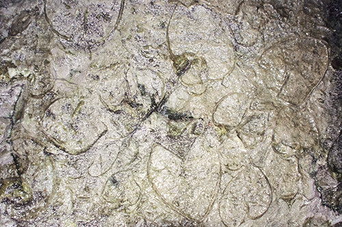
Fossil Clams at Pass Lueg
Fossils of the bivalve Conchodus infraliasicus in the Dachstein Formation as seen in the “Klamm.” The larger shells are about 10 cm long. Note that many of the shells are closed, indicating rapid burial while alive.
Cave of Winds Canyon
Limestone cliffs of Williams Canyon, just west of Colorado Springs --- Ordovician to Mississippian limestone forms the canyon cliffs. The limestone was dissolved to form the Cave of the Winds tourist attraction with its entrance seen on the cliff.
Ankilosaur footprints
Trail of ankilosaur footprints. This track is right at the entrance of the town of Torotoro.
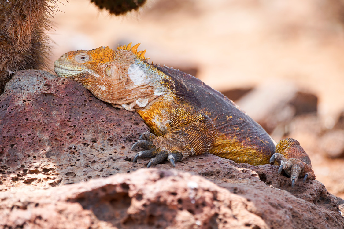
Conolophus
The land iguana is a species of lizard of the family Iguanidae, and one of the three species of the genus Conolophus. It is endemic to the Galapagos Islands. During the day, these animals spend many hours sunbathing on hot rocks and at night they take refuge in holes in the ground to conserve heat. They are fundamentally herbivorous, although sometimes they feed on insects, centipedes and decaying corpses.
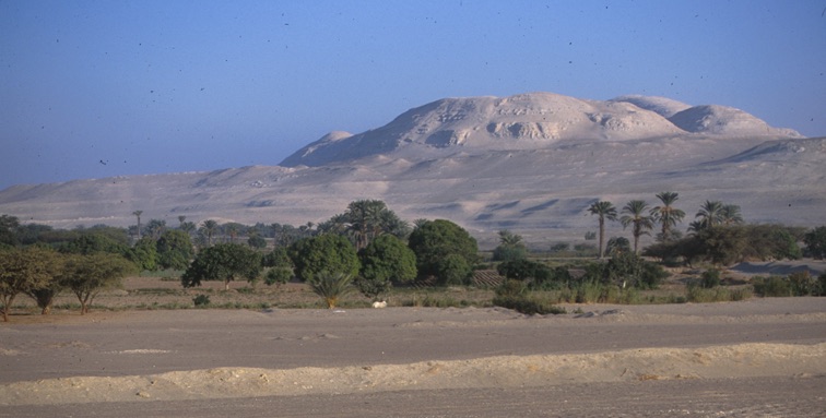
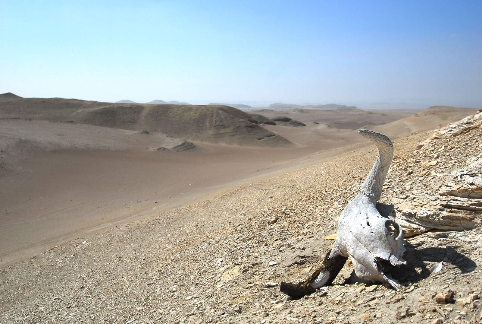
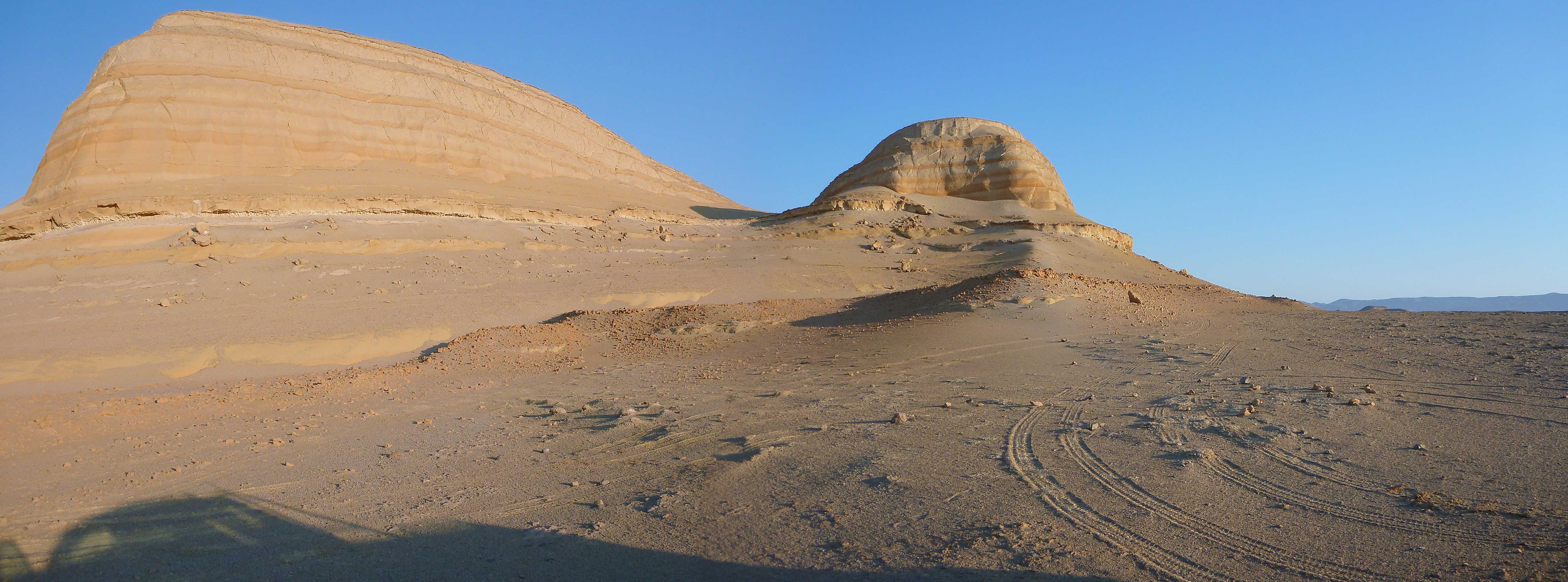
Desert
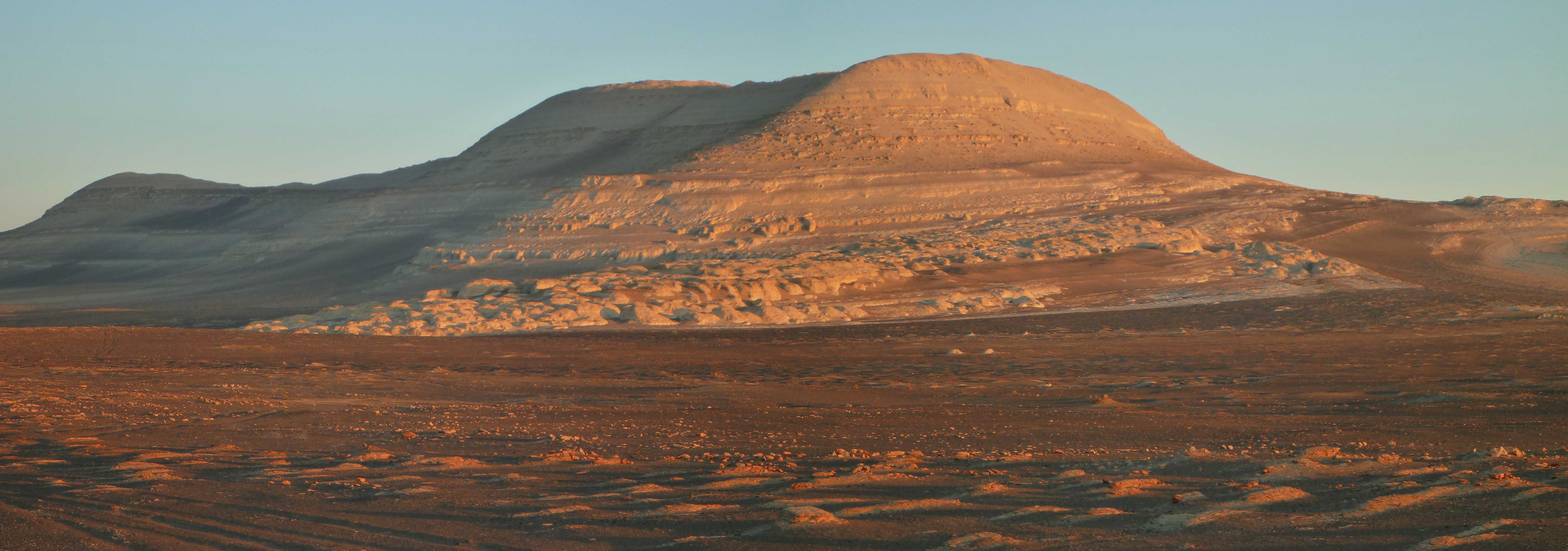
The arid landscape that characterizes the coastal desert of southern Peru favors excellent outcrop exposure.
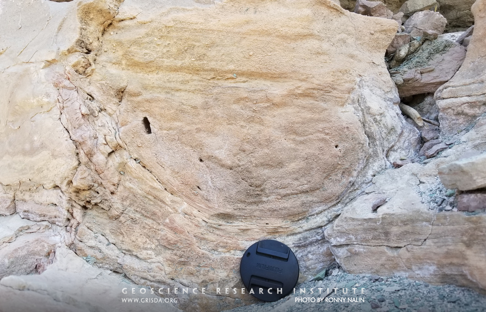
Cross-sets
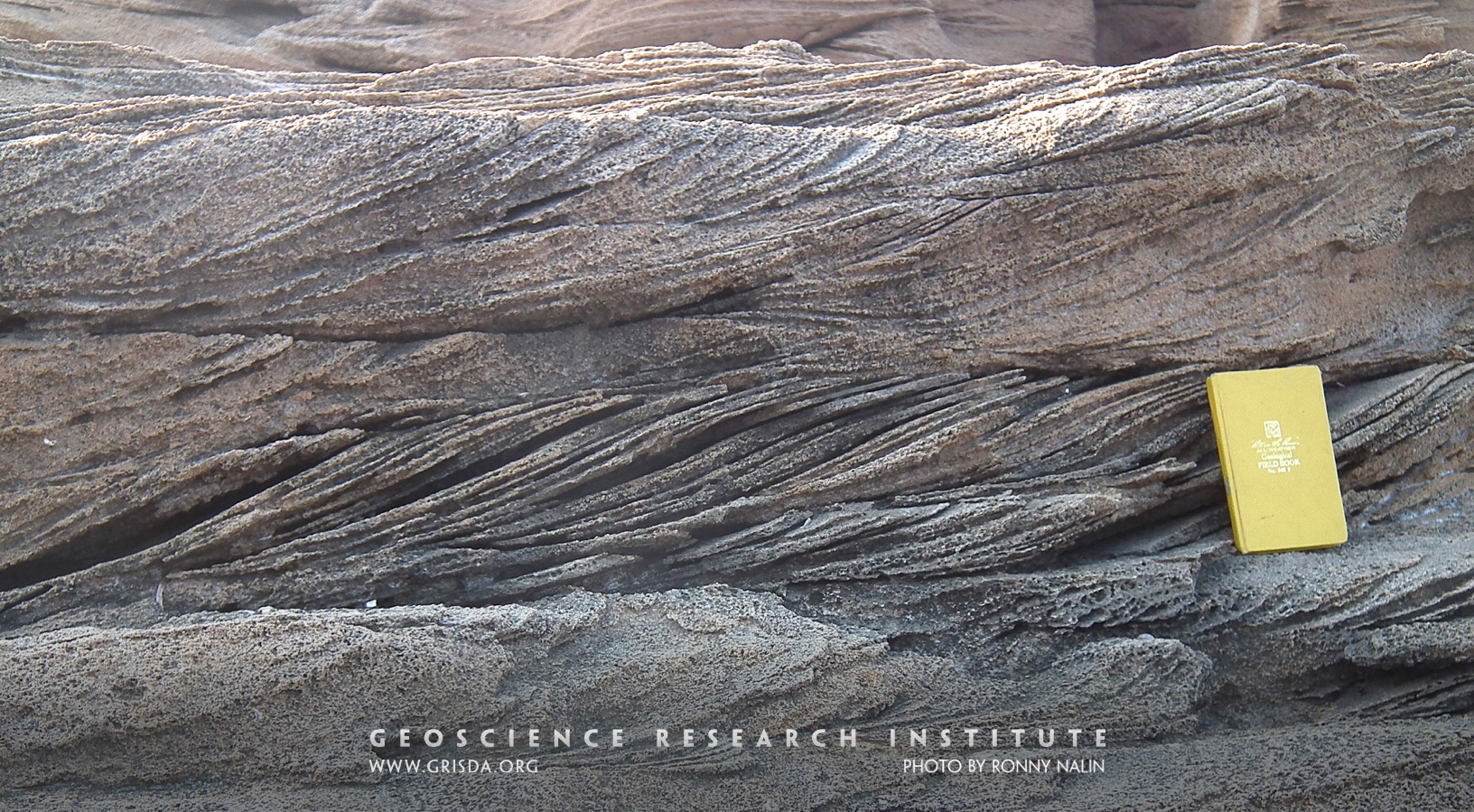
Sedimentary structures like these cross-sets form through the migration of sand dunes on the sea bottom under the action of a current. They can be used to infer flow directions and energy, and even aid in the interpretation of the general depositional system. Pleistocene calcarenites from Le Castella, Calabria, Italy.
Fossil bird
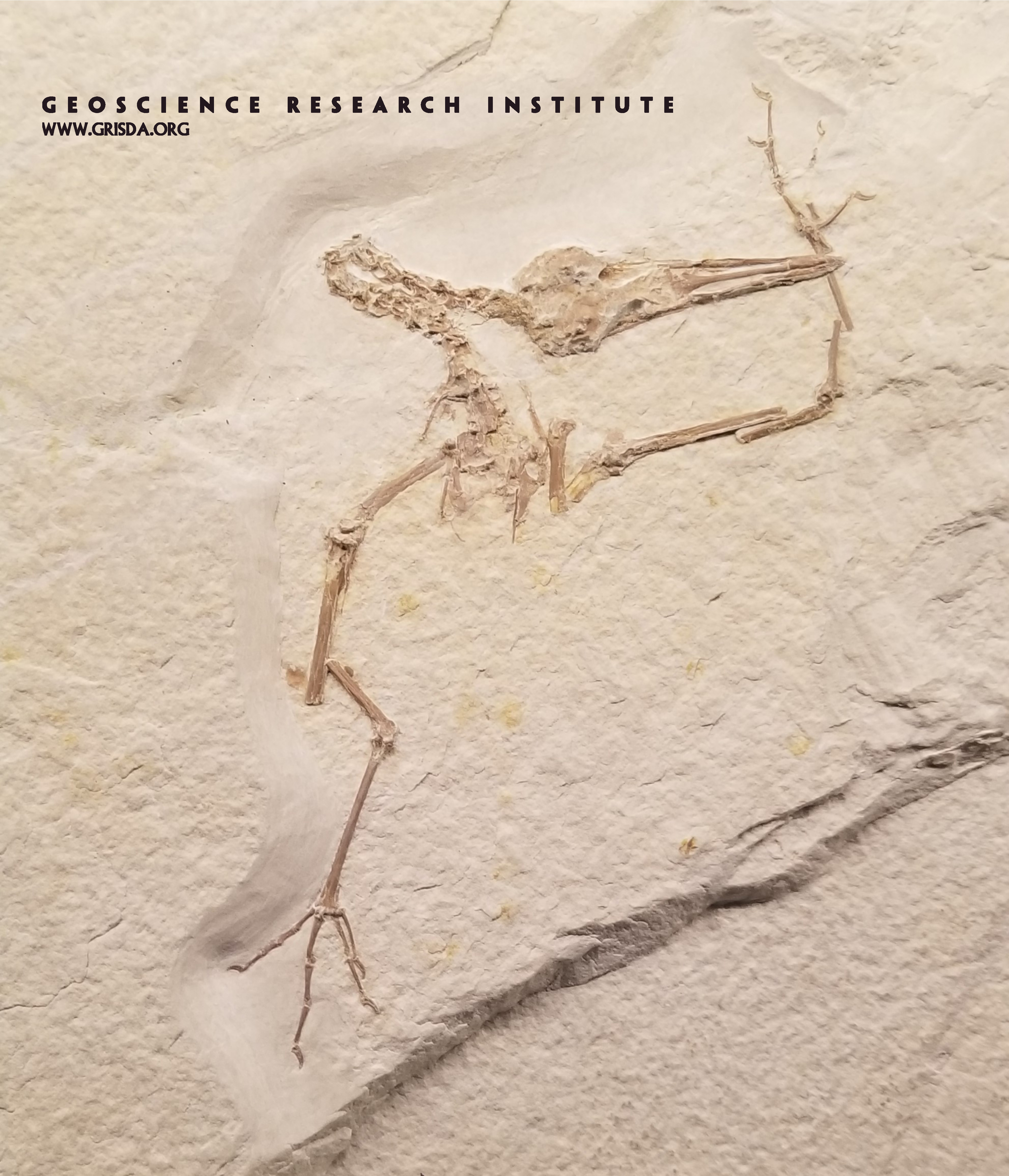
Birds have very delicate bones and are hard to find as articulated fossils. Here is a spectacular specimen from the Eocene of Fossil Lake Basin, Wyoming, on display at the Field Museum of Natural History, Chicago.
Wildebeests
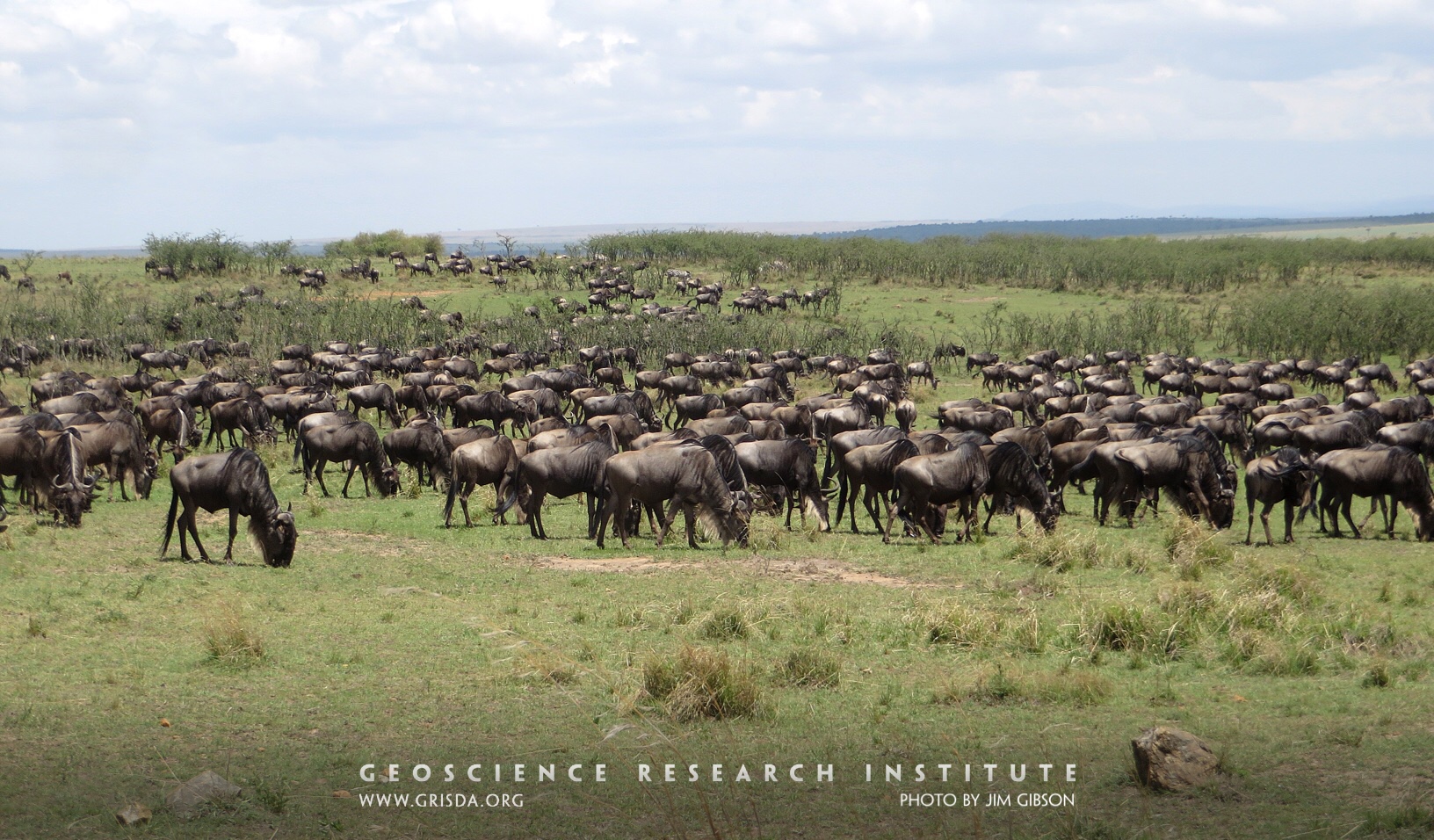
More than a million wildebeests, together with hundreds of thousands of zebras, migrate annually between Tanzania and Kenya, following the rains in order to find fresh grass to eat. Zebras eat the tougher, taller grass, leaving the shorter softer grass accessible to the wildebeests. By specializing in different grades of grass, the animals divide the resources, permitting greater species diversity. This division of resources extends to several species of antelopes, helping to maintain the species diversity for which Africa is famous. The capacity to specialize on different grasses appears to reflect the Creator’s intention that diverse species should coexist peacefully.
Mythen Klippen Overthrust
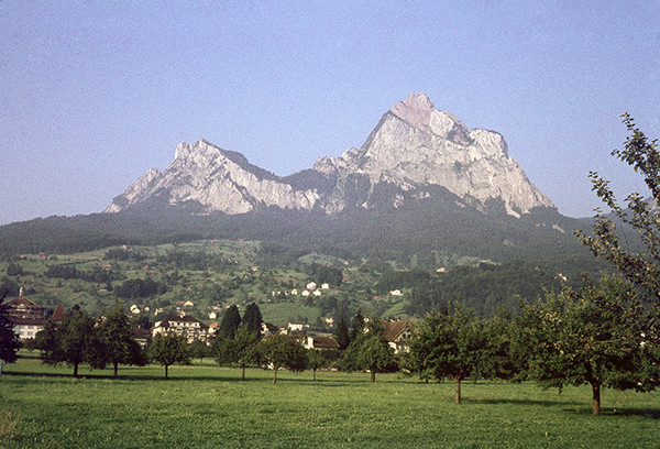
The Mythen is an isolated thrust outlier (Klippe) of Mesozoic rocks lying on top of Tertiary Eocene flysch, which in turn covers other Mesozoic formations. It is believed that the Mythen has been transported almost 150 km (90 miles) from the south.
Fossil Reef
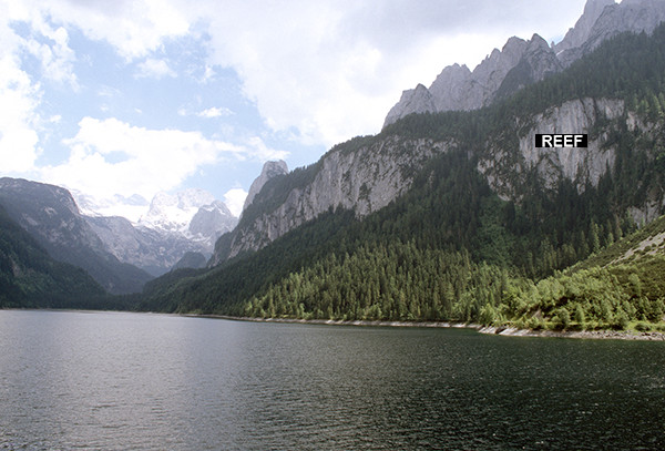
View of the massive reef (right) on the east side of Gosau Lake. The reef has been transported a long distance from the south during the formation of the Alps. On the southwest (right) side of the lake is a talus slope which has some typical fossils from the reef facies.
Collegiate Peaks
Rift Valley and part of Collegiate Peaks, Buena Vista --- The Rift Valley is formed by plate tectonic processes pulling the continent apart. Mt Princeton, seen in the right half of the picture, is formed from solidified granitic magma. The granite cooled, solidified, was uplifted and then overlying sediments were eroded off.
Sauropod trackways
Sauropod dinosaur footprints on the outskirts of the town of Torotoro. The footprints are very well preserved in sandstone rock.
North-Hueco-la-Zorra-from-South-Cerro-Blanco
View of Cerro Hueco la Zorra, which consists mostly of layers of sandstone and silstone rocks.
Flat pebbles
This picture shows three beds containing numerous intraclastic flat pebbles from upper Cambrian strata of the Notch Peak Formation, Utah. We find analogous flat-pebble conglomerates in lower Paleozoic strata from many different regions of the world, including China, North America, Australia, and Korea. In this and other similar cases, Paleozoic rocks record a global signal. Scale in cm.
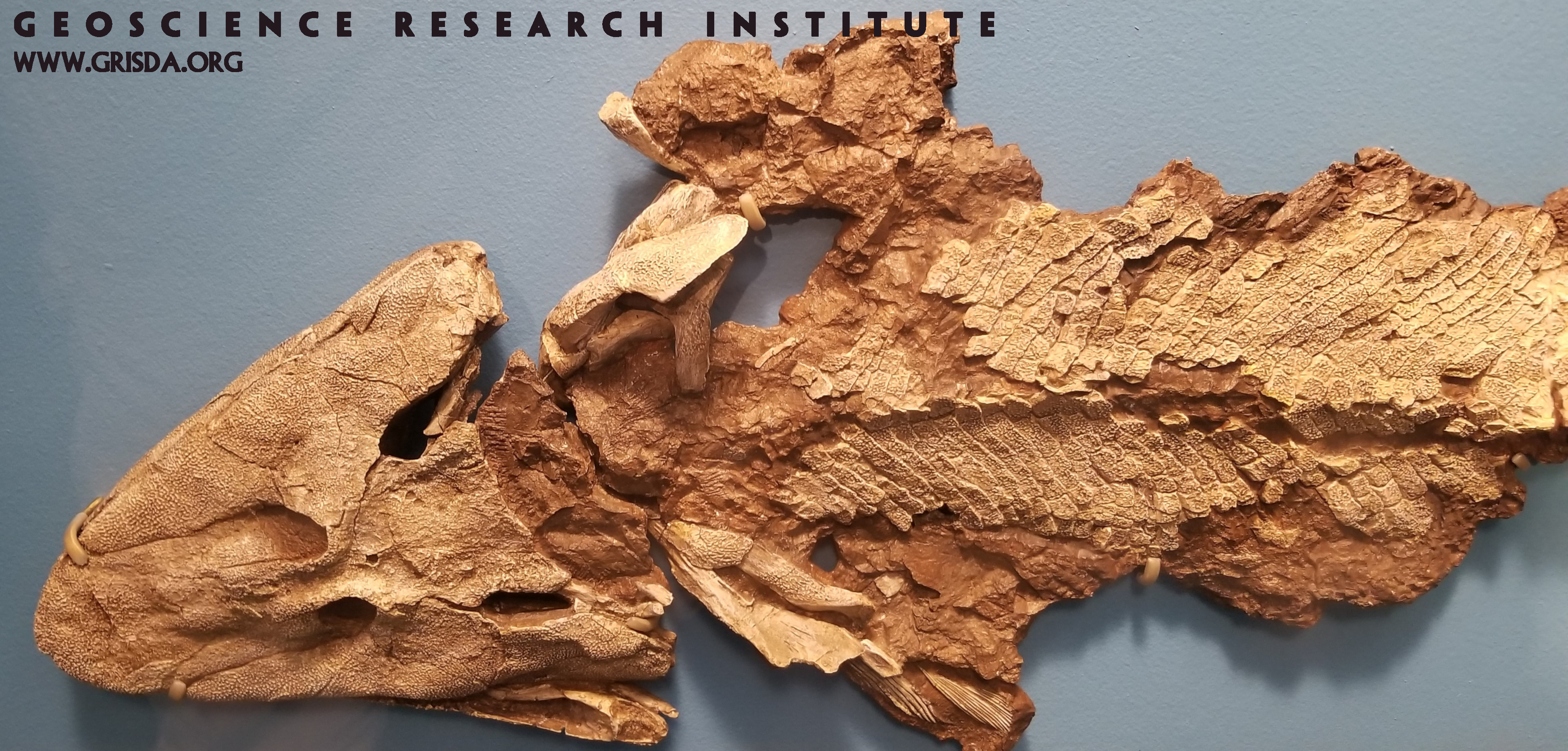
Bothriolepis canadensis
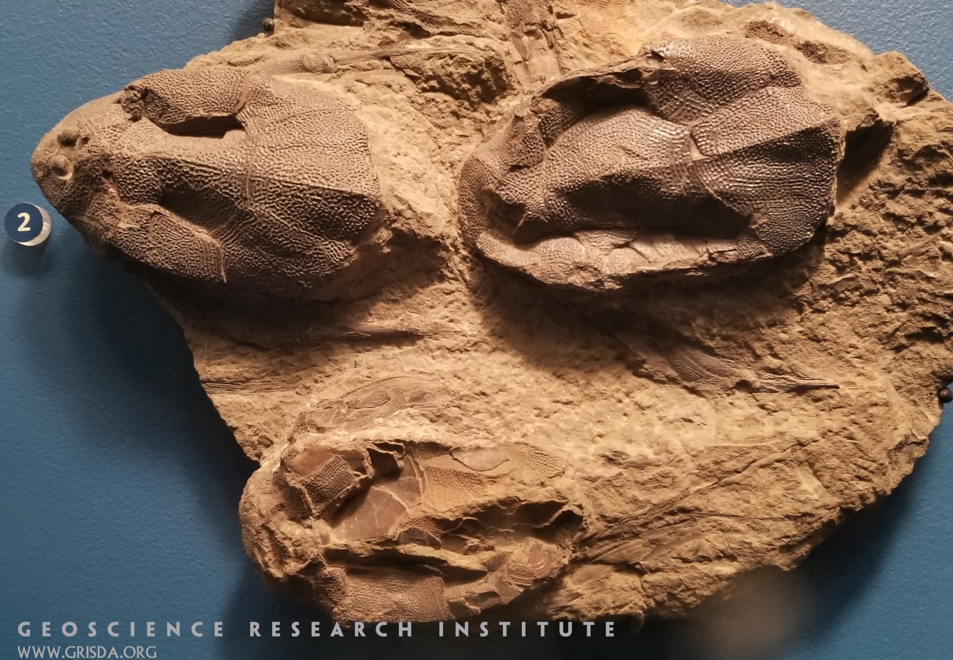
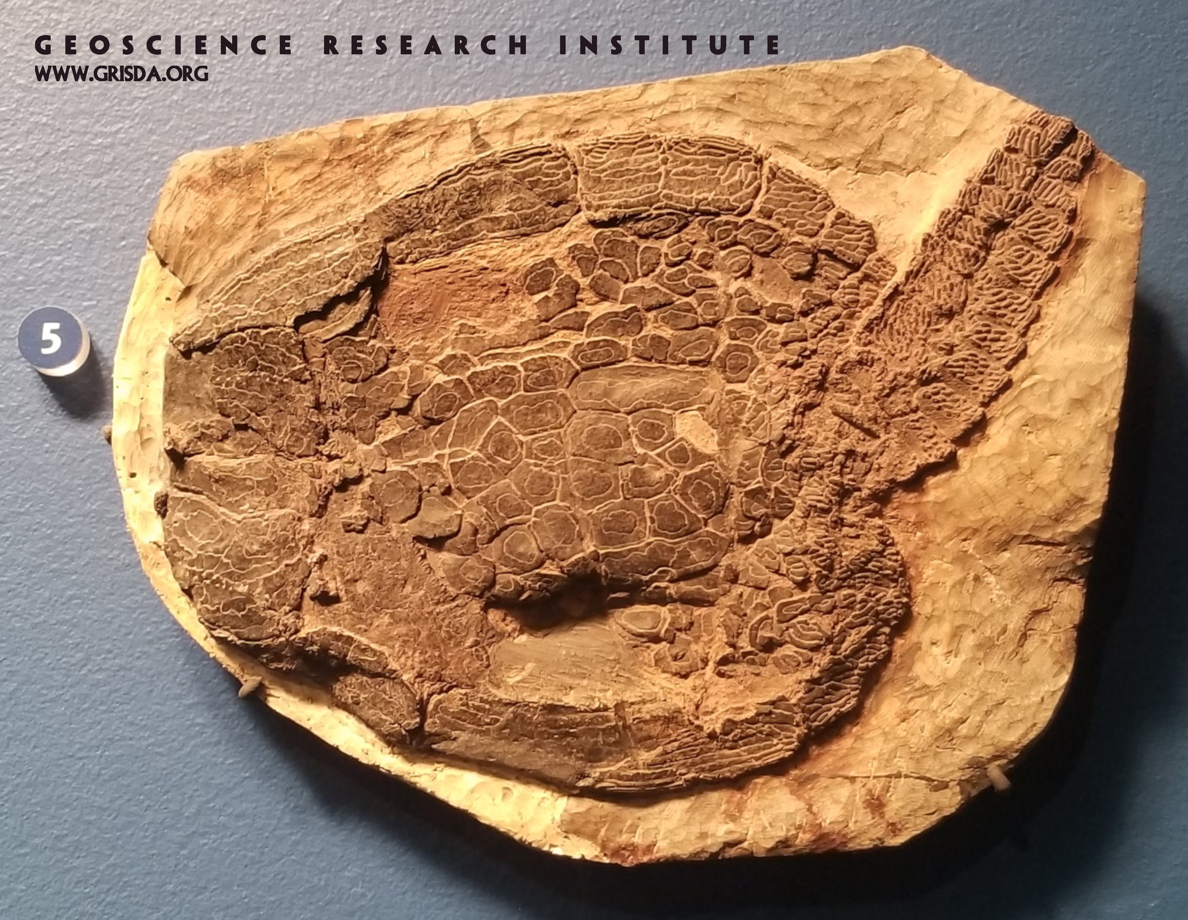
Three specimens of a Devonian armored fish, fossilized together. What is preserved are the armored head and the fins of the fish, still articulated. The fish must have died together, are found in close proximity, and are exceptionally well preserved. Slab (about 20 cm in size) on display at the Field Museum of Natural History, Chicago.
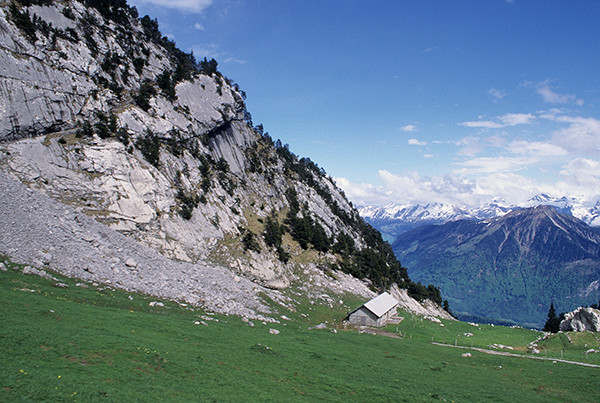
Slope of Mount Pilatus
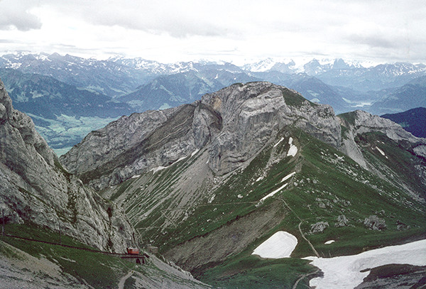
The steep sides of Mount Pilatus, south of Lucerne, are seen on the left. The rocks are mostly Cretaceous sediments.
Fossil Sponge
A fossil sponge from the reef region at the north end of Gosau Lake. The sponge is the darker round object (near the middle of the picture) having a small light center and a darker filled-in crack cutting across it.
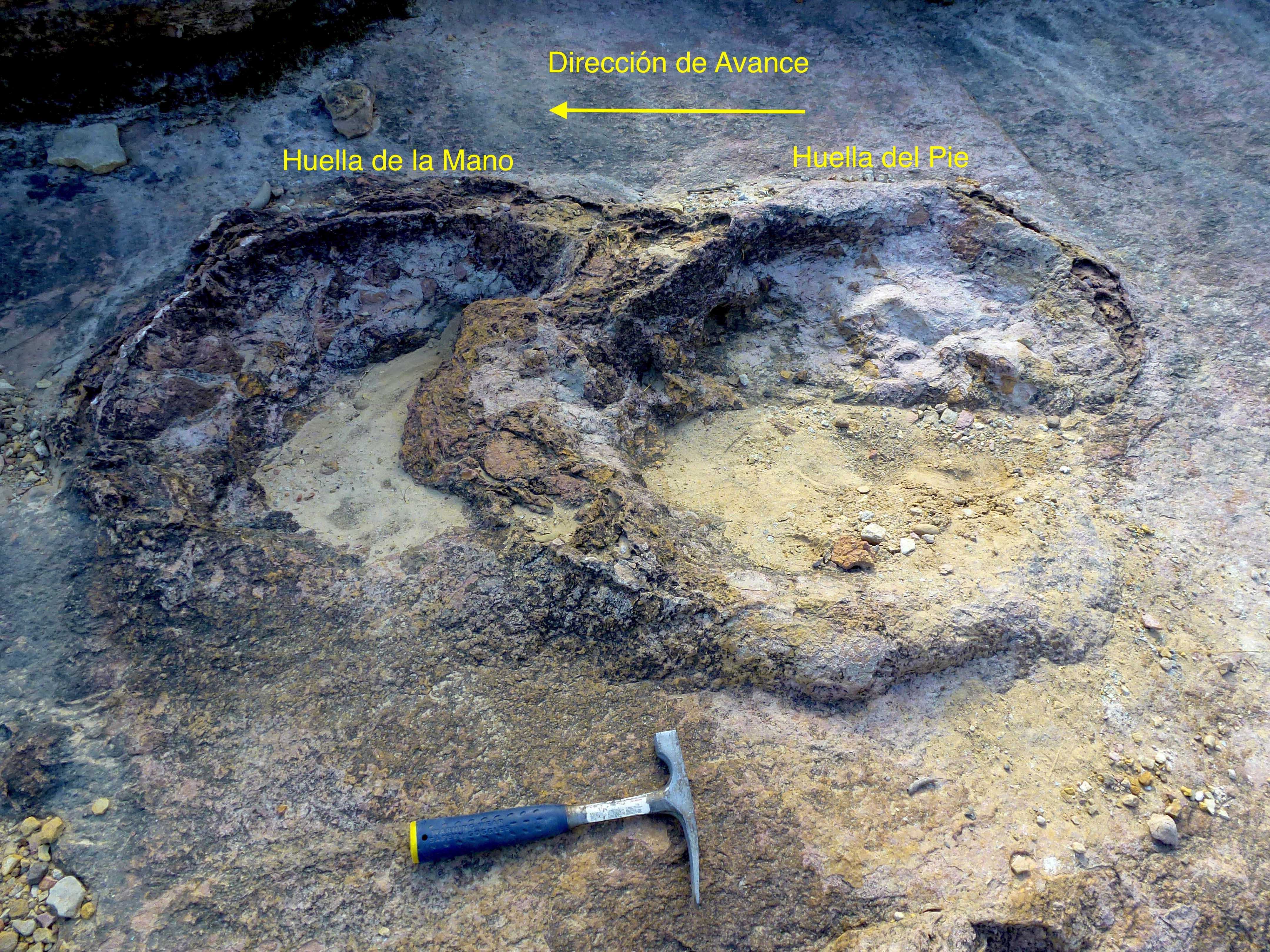
Sauropod footprints
Detail of two sauropod dinosaur footprints. Being quadrupedal, this dinosaur left four impressions, corresponding to two hands and two feet. In the photo, the left footprint corresponds to one hand (front leg), and the right to one foot (rear leg). When walking, the quadrupedal dinosaur first laid down the hand and then the foot, whose footprint partly overlapped with the footprint left by the hand.
Chelonia
Green Turtle (Chelonia mydas). Adults individuals measure up to 1.5 meters in length and weigh more than 230 kg. This is the only herbivorous species among sea turtles and feeds on seagrasses and algae. Due to this diet, its fat reserves are green, explaining the reason for its name.
Panorama-Zamaca
General view of the Zamaca area, south of the town of Ocucaje, Peru. This arid region is of great geological interest because it records several marine regressions and transgressions during which the layers that are now exposed in the desert were deposited.
Great Unconformity
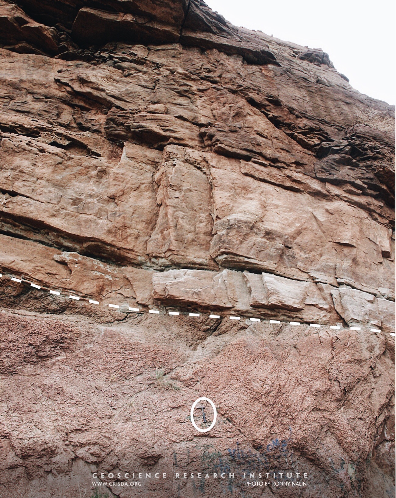
In many places around the world (and through most of the North American continent) Paleozoic rocks have a sharp discontinuity at their base. This widespread erosional surface, called “the Great Unconformity,” often separates layered sedimentary rocks from underlying metamorphic and igneous rocks (the so called “crystalline basement”). In this photo taken near Manitou Springs, CO, USA, the Great Unconformity is marked by the dashed line and overlain by the Cambrian Sawatch Quartzite. Hammer (encircled) for scale.
Cardipeltis bryanti
This is a specimen (several cm in size) of a fossil jawless fish, from the Devonian of Wyoming, on display at the Field Museum of Natural History, Chicago. Several groups of fish (like the ostracoderms, to which this fish belongs) appear suddenly in the rock record, without many intermediates.
Folded Sediments of Mount Pilatus
View to the west (left) near the top of Mount Pilatus, south of Lucerne. Note the very contorted layers. The mountain was overthrust about 50 km from the south (left of picture).
Salt and Clay
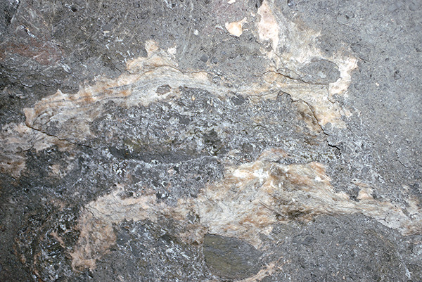
Close-up view of light-colored salt and darker surrounding clay and other minerals. The photo from the Bad Ischl salt mine near Hallstatt is about ½ m across.
Cactus finch
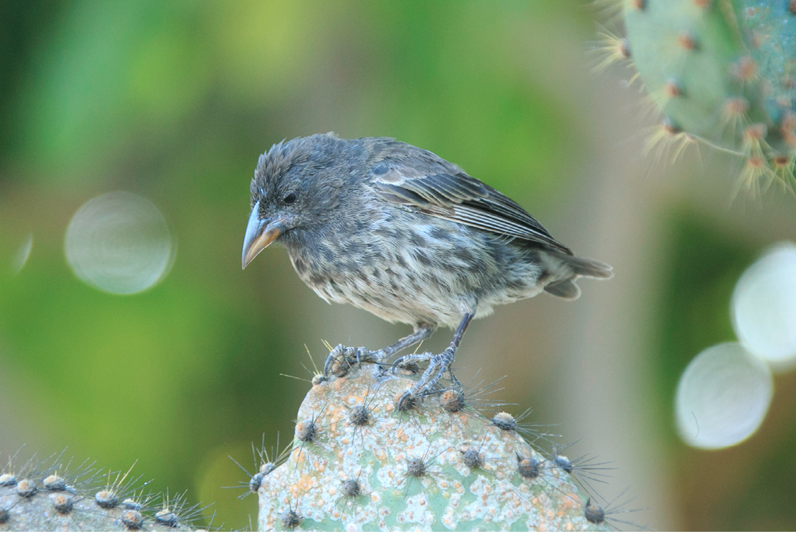
The Galapagos finches are several species of passerine birds that Charles Darwin collected for the first time during the second voyage of the Beagle. These birds are colored and weigh between 8 and 38 grams. The most important differences between different species are the size and shape of their peaks, which are related to different eating habits
Panorama-Cerro-Colorado
View of Cerro Colorado from the North, showing sandstone layers.
Confluence
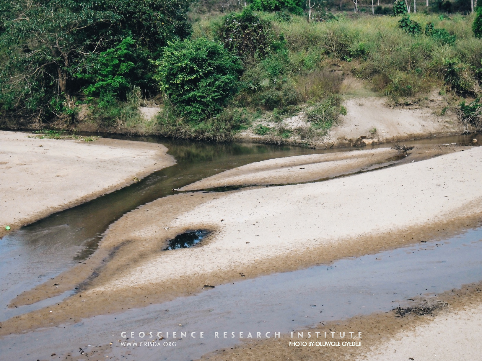
A confluence is the point at which two streams flowing from different directions unite. This photo shows a confluence of two streams, approximately equal in size and width, draining the basement complex in north-central Nigeria.
Cephalaspis
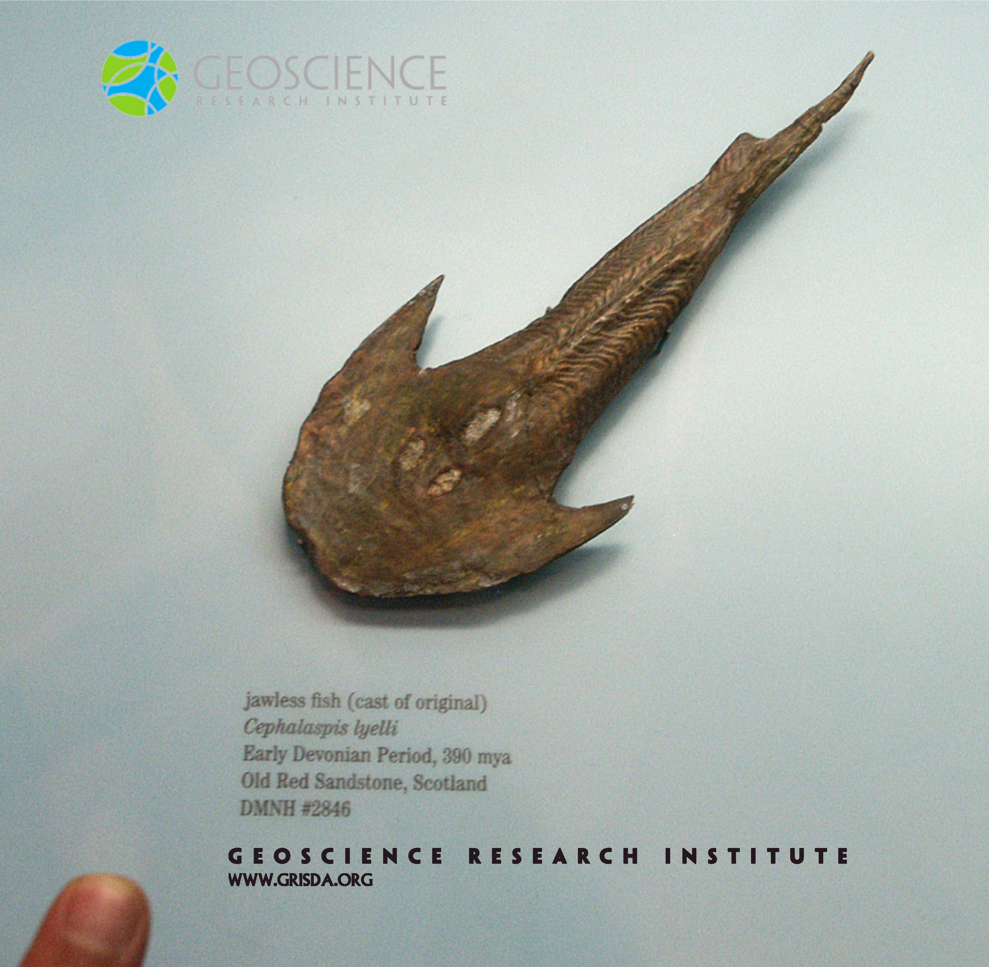
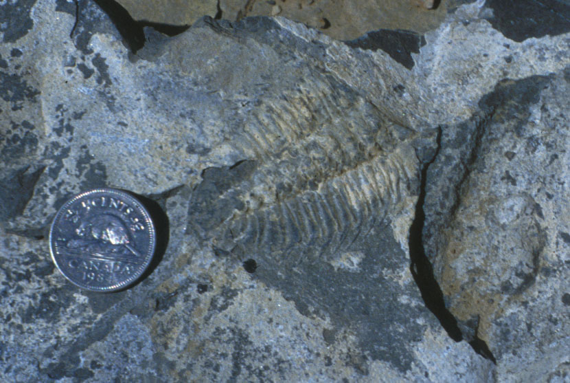
Entire groups of fish found as fossils in Devonian rock layers disappear from higher strata. Among them are osteostracans, like Cephalaspis, a jawless armored fish. Human fingernail for scale. Specimen on display at the Colorado Museum of Nature and Science.
Hydrochoerus hydrochaeris
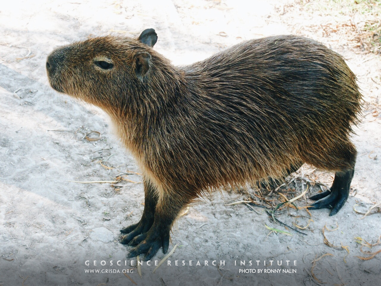
The capybara is the largest living rodent in the world. It is native to South America.
Wildflysch of Chantermerle near Bloney
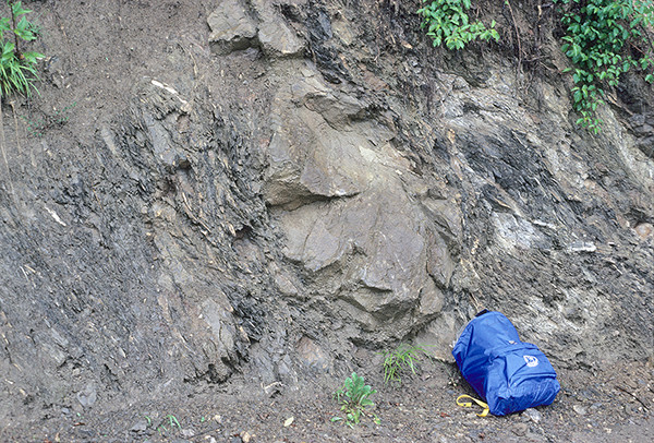
Wildflysch is a poorly sorted sedimentary rock resulting from a mass sediment flow. Note the backpack in the lower right corner for scale. Many inclusions can be seen, including a large one which fills the center of the picture.
Layers of Salt and Clay
Close-up view of lighter salt and darker clay layers from the purer salt deposits. Note the offset of layers due to movement of the deposit. Photo from the Bad Ischl salt mine is about ½ m across.
Mt Sopris
Mt. Sopris, Carbondale --- The granitic magma that solidified to form this mountain was intruded below sedimentary layers that have since been eroded away on top, but still remain tilted upwards along the edges.
Paleocene Maragua Bolivia
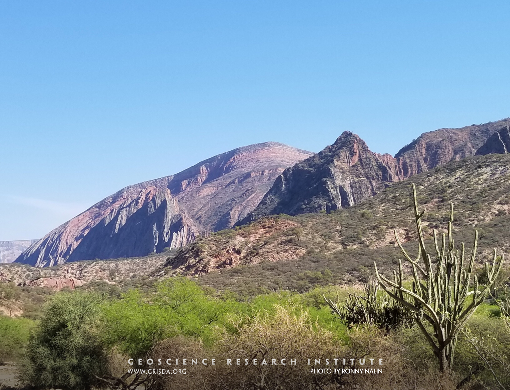
Succession of Upper Cretaceous and Cenozoic sediments in the Maragua syncline region, Bolivia
Scalesia
Forest of Scalesia. Scalesia is a genus of plants in the Asteraceae family that is endemic to the Galápagos Islands.
Gramadal-canyon
Gramadal canyon. The morphology of this canyon suggests that it formed in one or more rapid catastrophic discharges of water, which excavated the substrate.
Ravinement
The flat erosional surface separating gray clays (Argille Subapennine Fm., Pleistocene) from yellowish sands is called ravinement surface and was cut by waves in shallow water. Erosional surfaces in the rock record are essential for reconstruction of sea level and tectonic changes. They help unraveling the history of our planet but also illustrate the power of geologic processes. Photo taken near Canosa, Puglia, Italy.
Fossil cetaceans
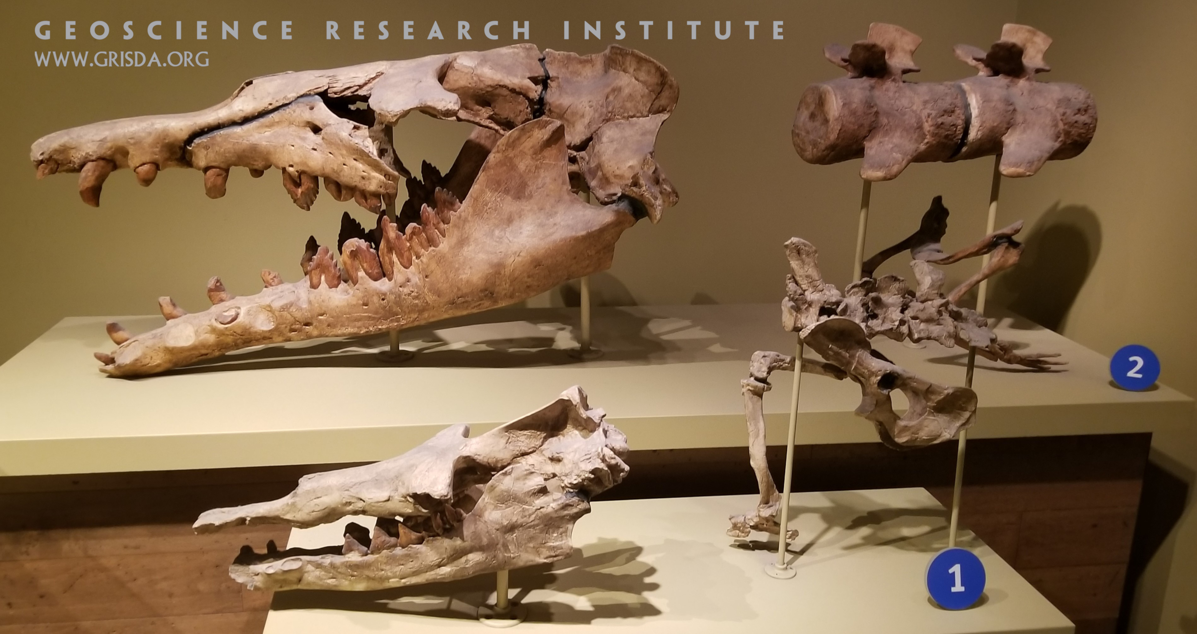
The fossils in this picture comprise the skull, pelvic bones, a few vertebrae, and hind limb bones of two organisms that have been presented as a part of an evolutionary sequence leading from terrestrial mammals to whales. Number 1 in the foreground is Rhodocetus, number 2 in the background is Basilosaurus. The specimens, on display at the Chicago Field Museum of Natural History, are meant to convey to the observer the concept of progressive adaptation to a fully aquatic behavior. However, inferences about the relation of past life forms should be introduced with awareness of the fragmentary nature of the fossil record.
Thomson’s gazelle
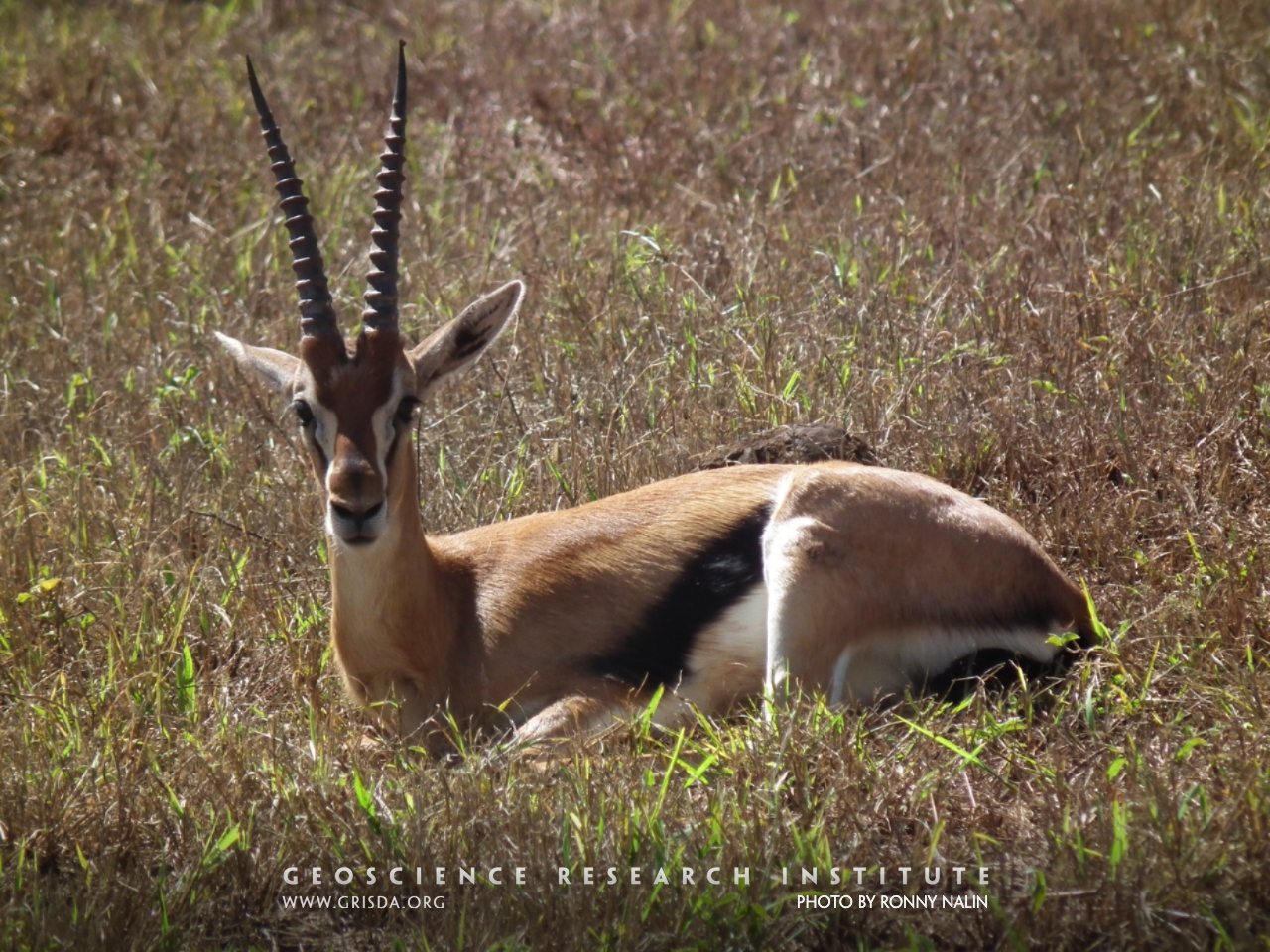
Thomson's gazelle is one of the fastest land animals. This individual was photographed on the campus of Maxwell Adventist Academy, in Nairobi, Kenya. PE teachers jokingly challenge their students to get one if they can. To date, no one has succeeded.
Turbidites near Bloney
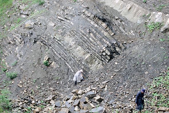
The Fayaux Quarry exposes many turbidites of the Gurnigel Nappe. Each light-colored layer is part of a turbidite. Note people for scale.
Grand Mesa Land O Lakes Viewpoint
Land o' Lakes viewpoint, Grand Mesa --- This mesa located at 10,000 feet elevation is one of the largest flat-topped mountains in the world covering 50 square miles. Hard Tertiary basalts resisted erosion to form the flat mesa.
Mangroves
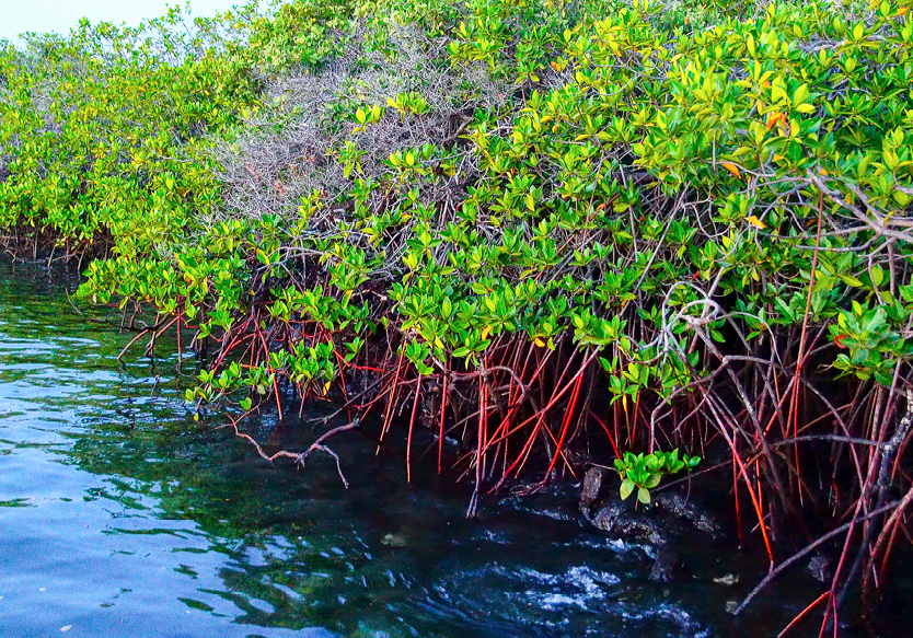
In the Galapagos Islands there are several areas with dense mangroves. Mangroves and beach bells disperse thanks to their seeds dragged by ocean currents.
Panorama-whale
Specimen of partially excavated fossil mysticete whale, in which excellent preservation and articulation is observed.
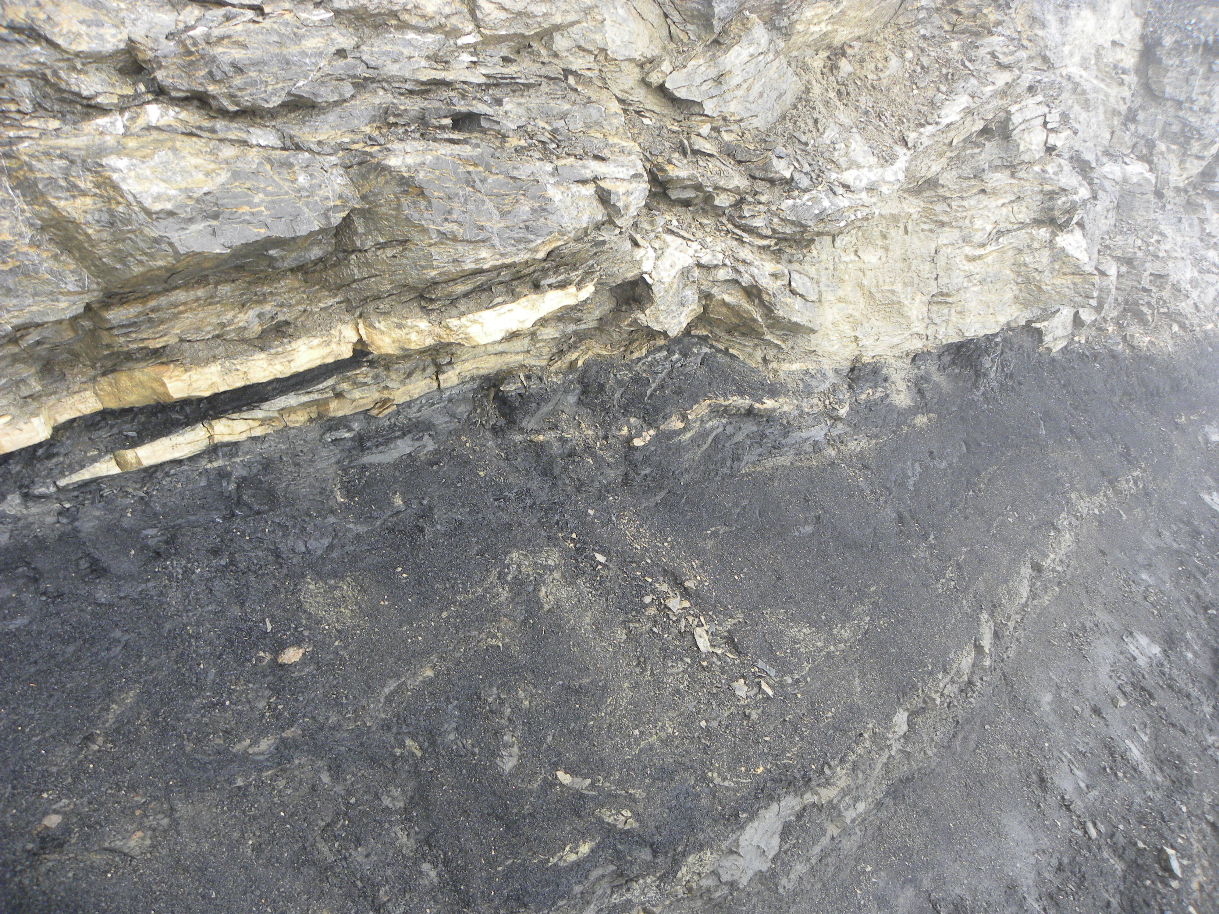
Coal mine
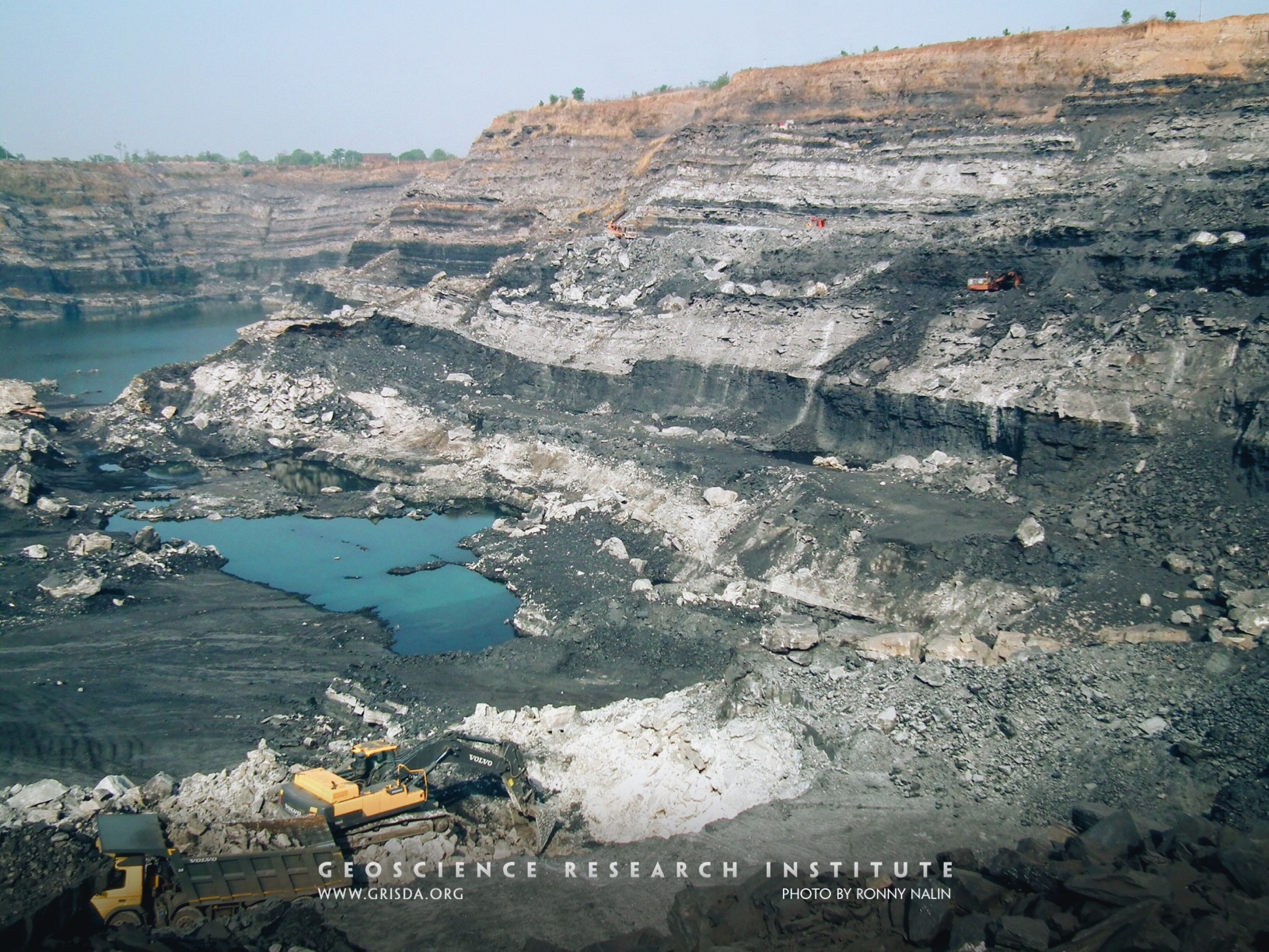
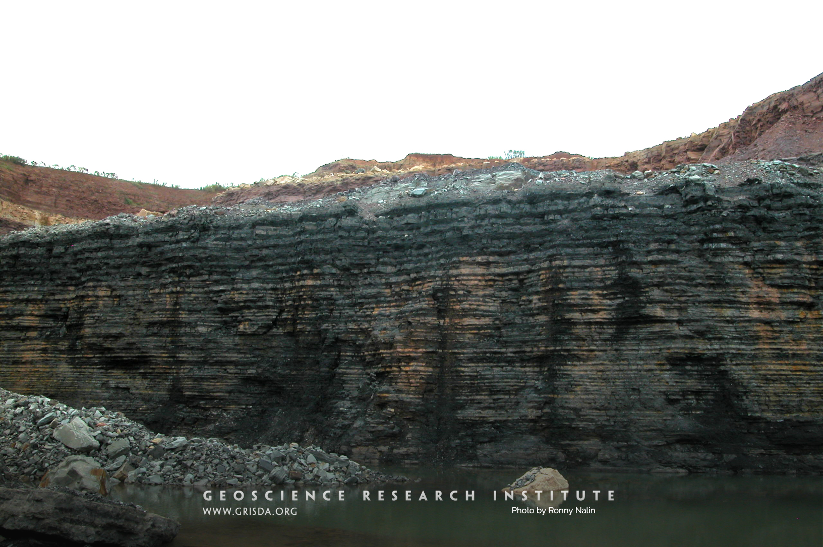
TOPA open-pit coal mine, Jharkhand, India. Laterally extensive coal seams represent a significant reserve of fossil fuels. No modern analogue can be offered as a counterpart to some of these ancient beds.
Dastilbe crandalli
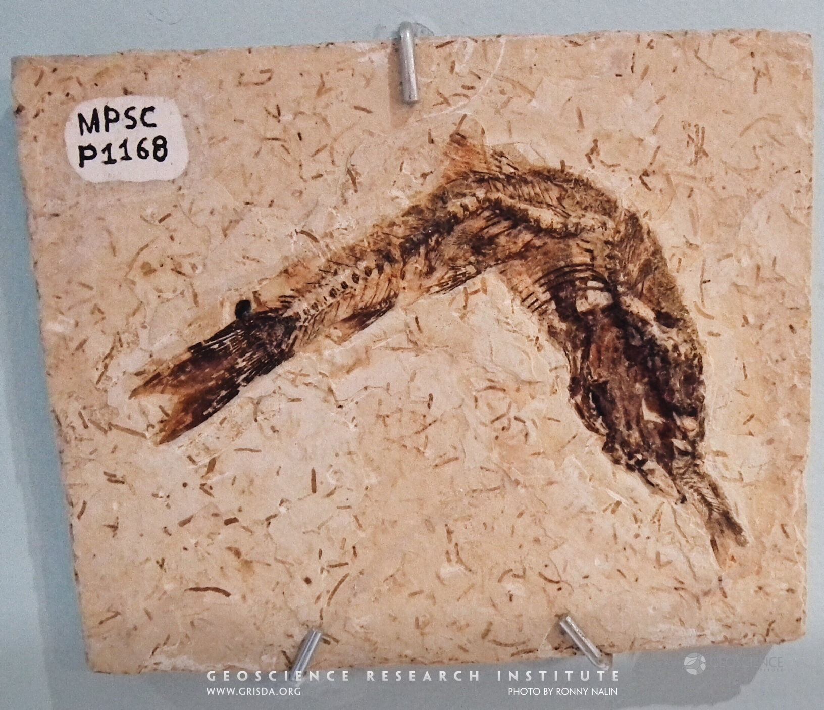
A fossilized example of predation. This Cretaceous fish from the Crato Formation of the Araripe Basin, Brazil, died while ingesting another fish. Specimen on display at the Paleontological Museum in Santana do Cariri, few cm in size.
Mantis shrimp
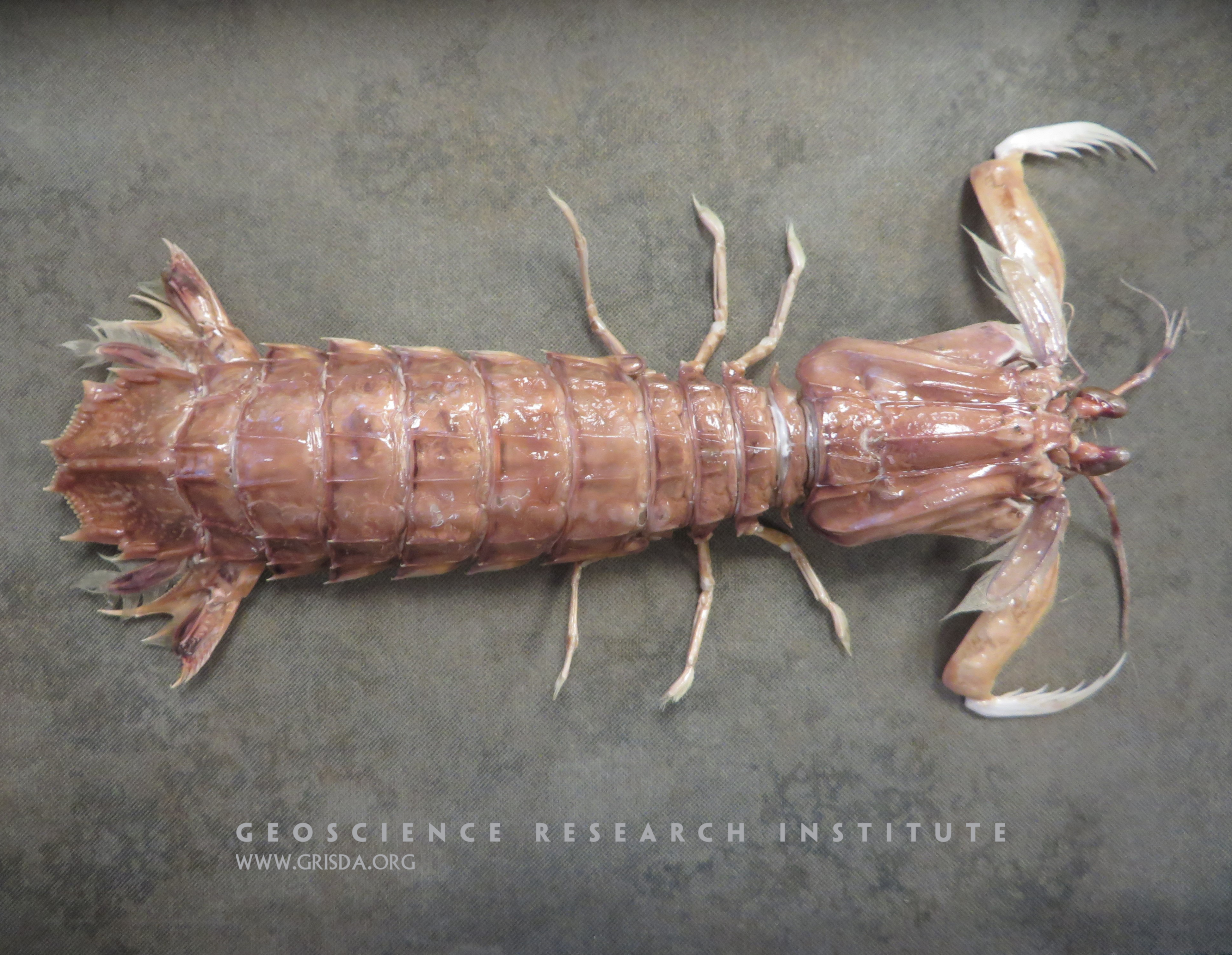
Mantis shrimp have eyes with a unique design. They have up to sixteen different types of color receptors in their eyes, compared to only three in humans. They can see in ultraviolet light, and can detect circularly polarized light. Such complexity points to intelligent design.
Turbidites near Le Sépey
Turbidites and debris flows of the Niesen Nappe above the town of Le Sépey. This is at an overturned section of the Niesen Nappe.
Glenwood Caverns Stalagtites
Glenwood Caverns in Glenwood Springs --- The caverns were formed by dissolution of the limestone, The stalagtites were then formed by water dripping from the ceilings of the caverns.
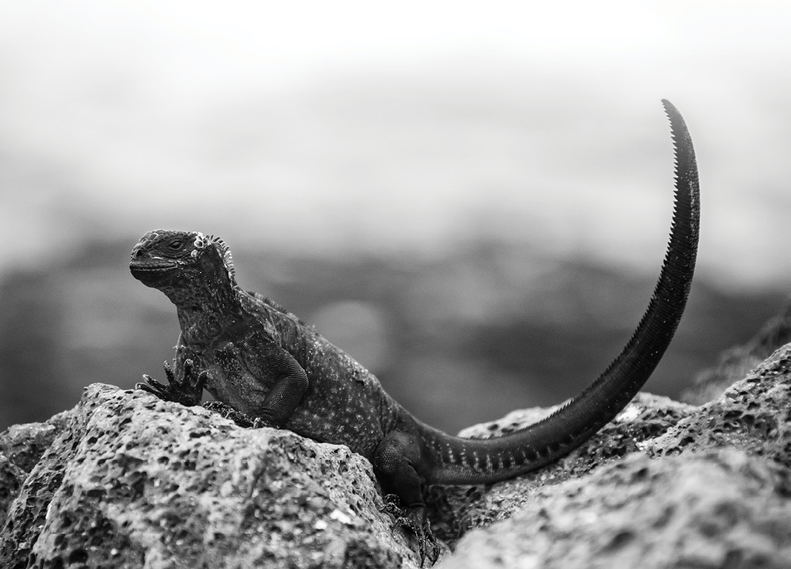
Amblyrhynchus cristatus
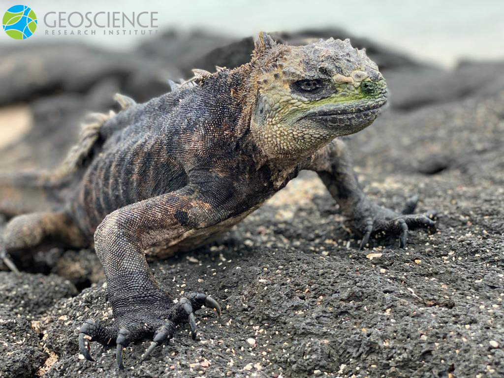
The marine iguana Amblyrhynchus cristatus, is a species endemic to the Galápagos Islands. These magnificent creatures did not make a great first impression on Charles Darwin, who referred to them as “disgusting, clumsy lizards.”
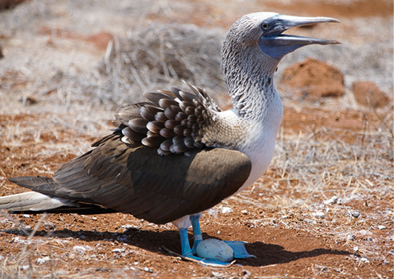
Blue-footed booby
The Galapagos Islands are habitat for numerous seabirds, which nest in large numbers on some islands and islets.
Tinajones
View looking south from Cerro Tinajones. The layers of sandstone and siltstone have been eroded, leaving small conical or elongated hills with a steep slope.
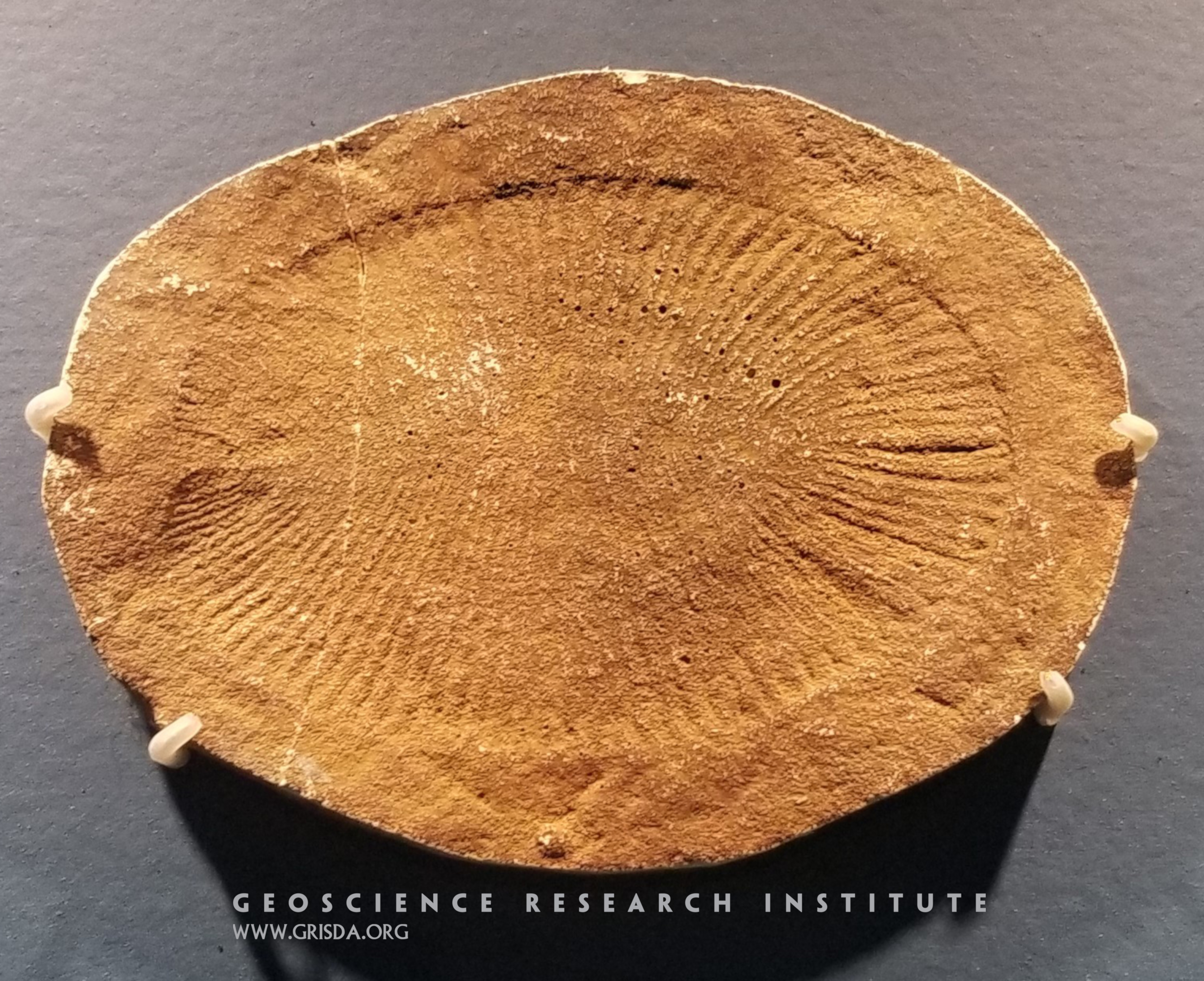
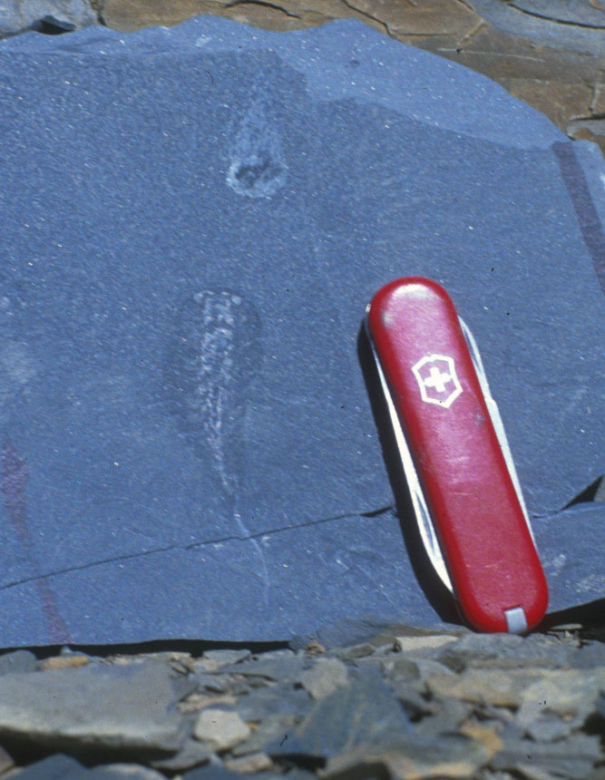
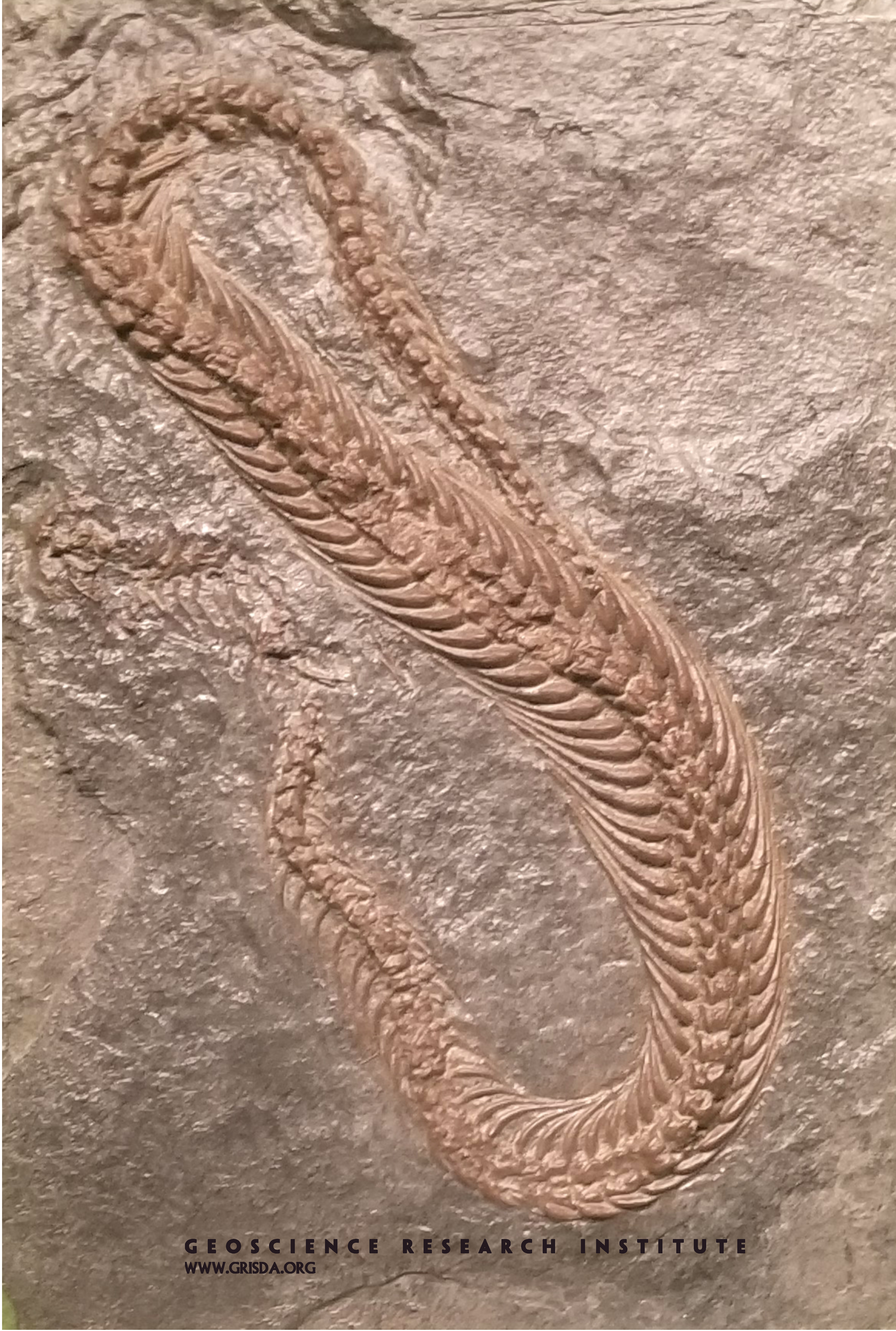
Dickinsonia
Dickinsonia is one of the macroscopic fossils found in the geologic layers just below the Cambrian. It is part of the so called "Ediacaran biota." There is no modern animal that has a similar body plan, so its mode of life remains a bit of a mystery. Specimen (several cm in size) on display at the Field Museum of Natural History, Chicago.
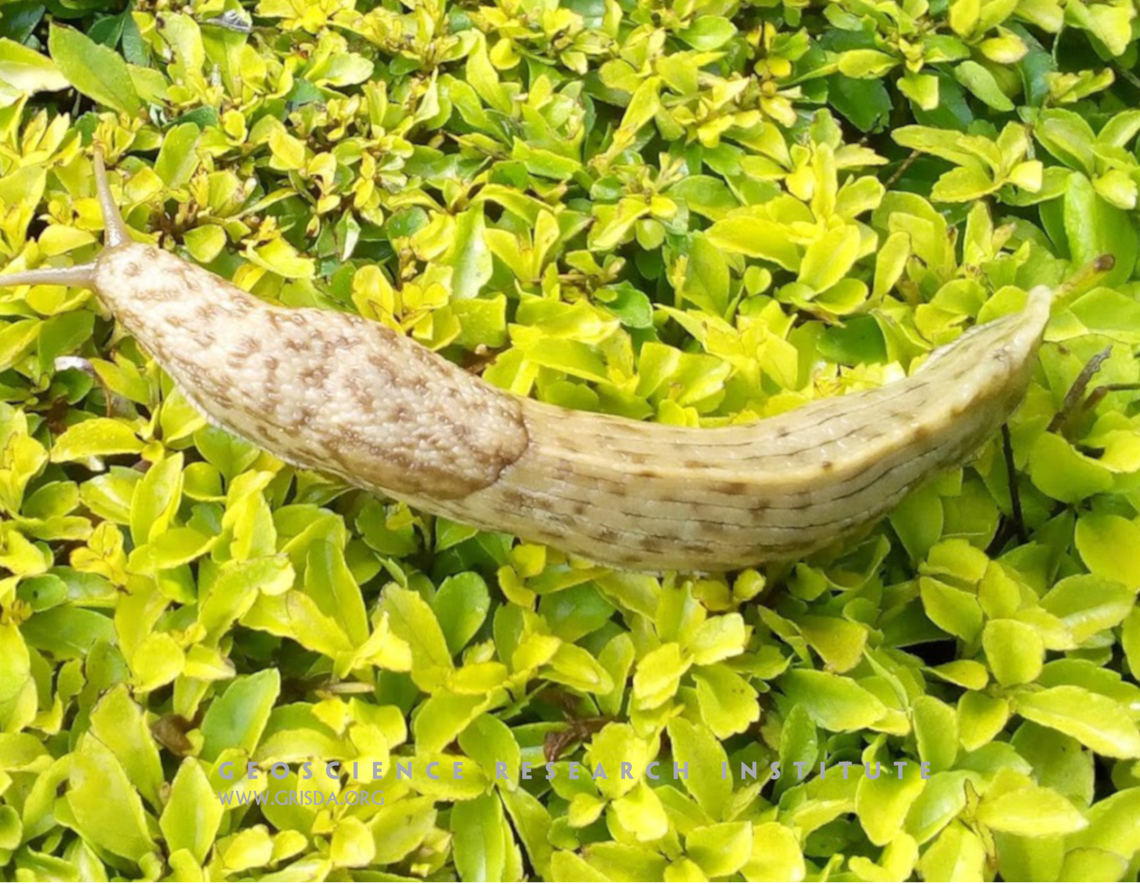
Terrestrial slug
A photo of a specimen of the terrestrial slug Polytoxon robustum, taken on the campus of the University of Eastern Africa, Kenya.
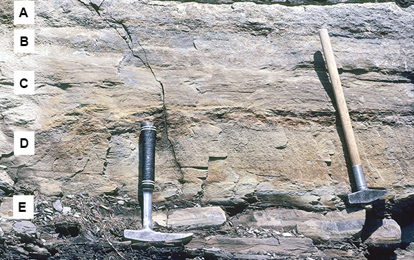
Close-up of Inverted Turbidite
View of a single thick turbidite at Le Sépey. The letters identify the various units of the Bouma sequence. Note that the order of the units is reversed, because at this locality the Niesen Nappe is overturned.
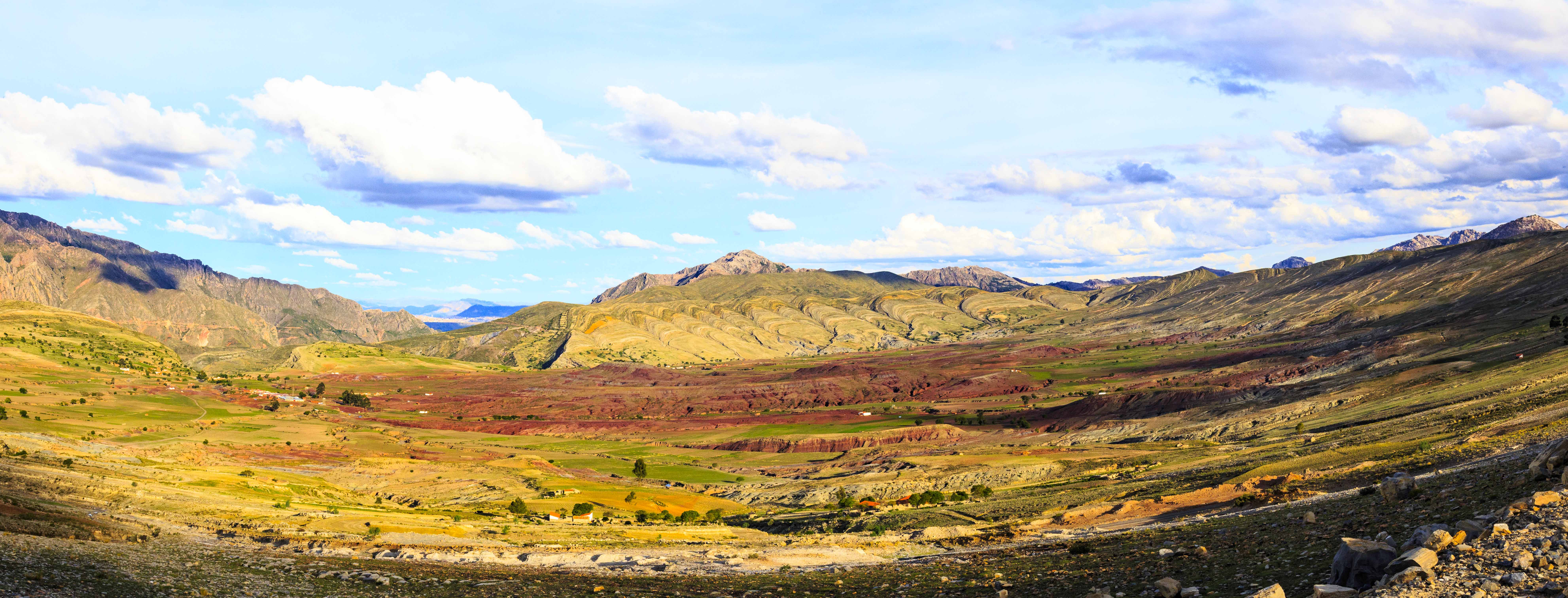
Maragua syncline
View of part of the Maragua syncline, known locally as “El Crater”. The pale colored layers correspond to Cretaceous sandstones and marine limestones. In the center, the red fill consists of layers of sandstone of continental origin that are more recent than those at the edges.
Amblyrhynchus
The Galapagos sea iguana ( Amblyrhynchus cristatus) is endemic to these islands and has the ability to feed underwater on algae.
Tinajones
View of one of the many hills in the Amara Valley where the layers of yellow and orange sandstone are well exposed. These layers contain fossils of invertebrates and cetaceans.
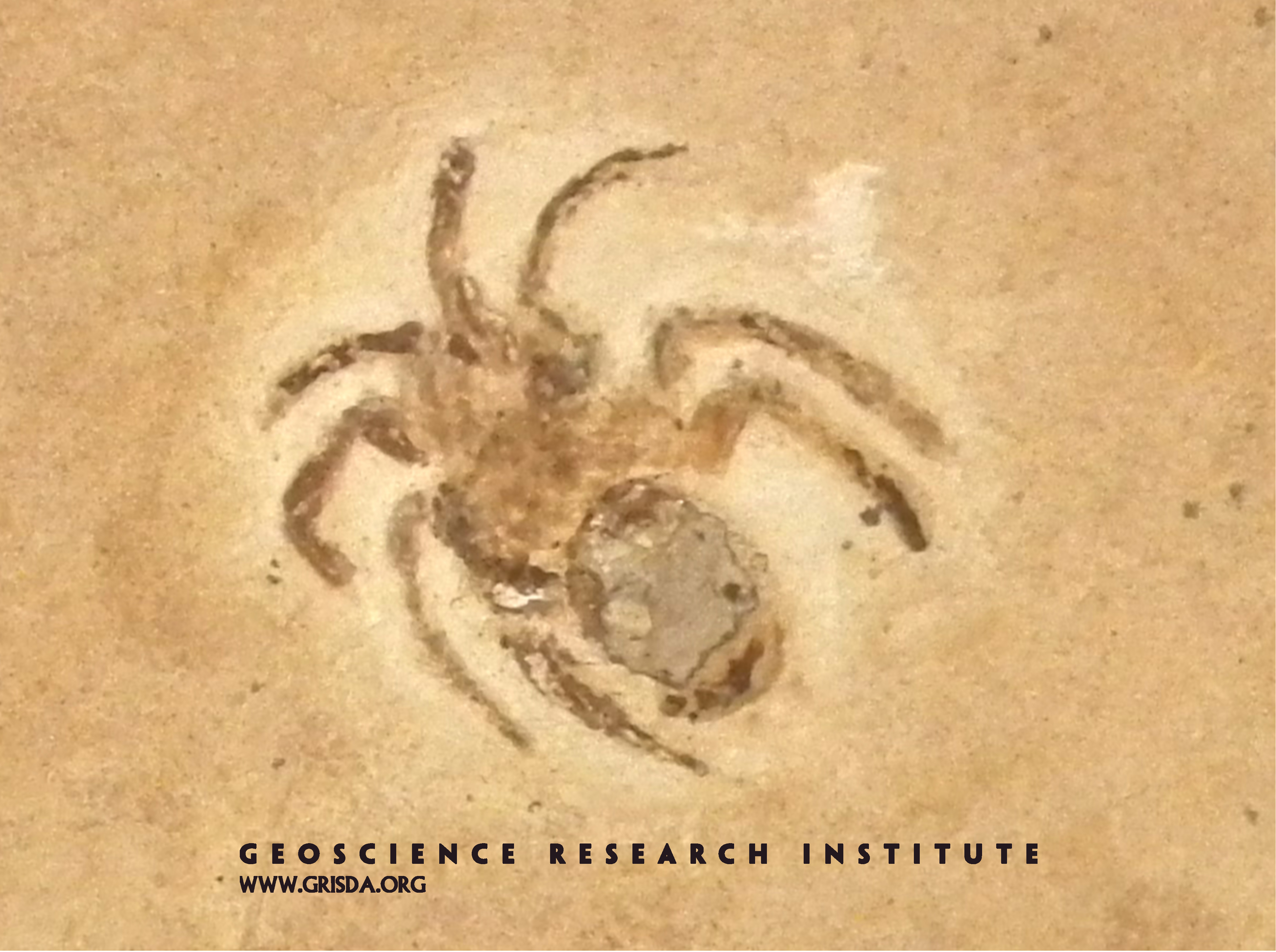
Dinodiplura ambulacra
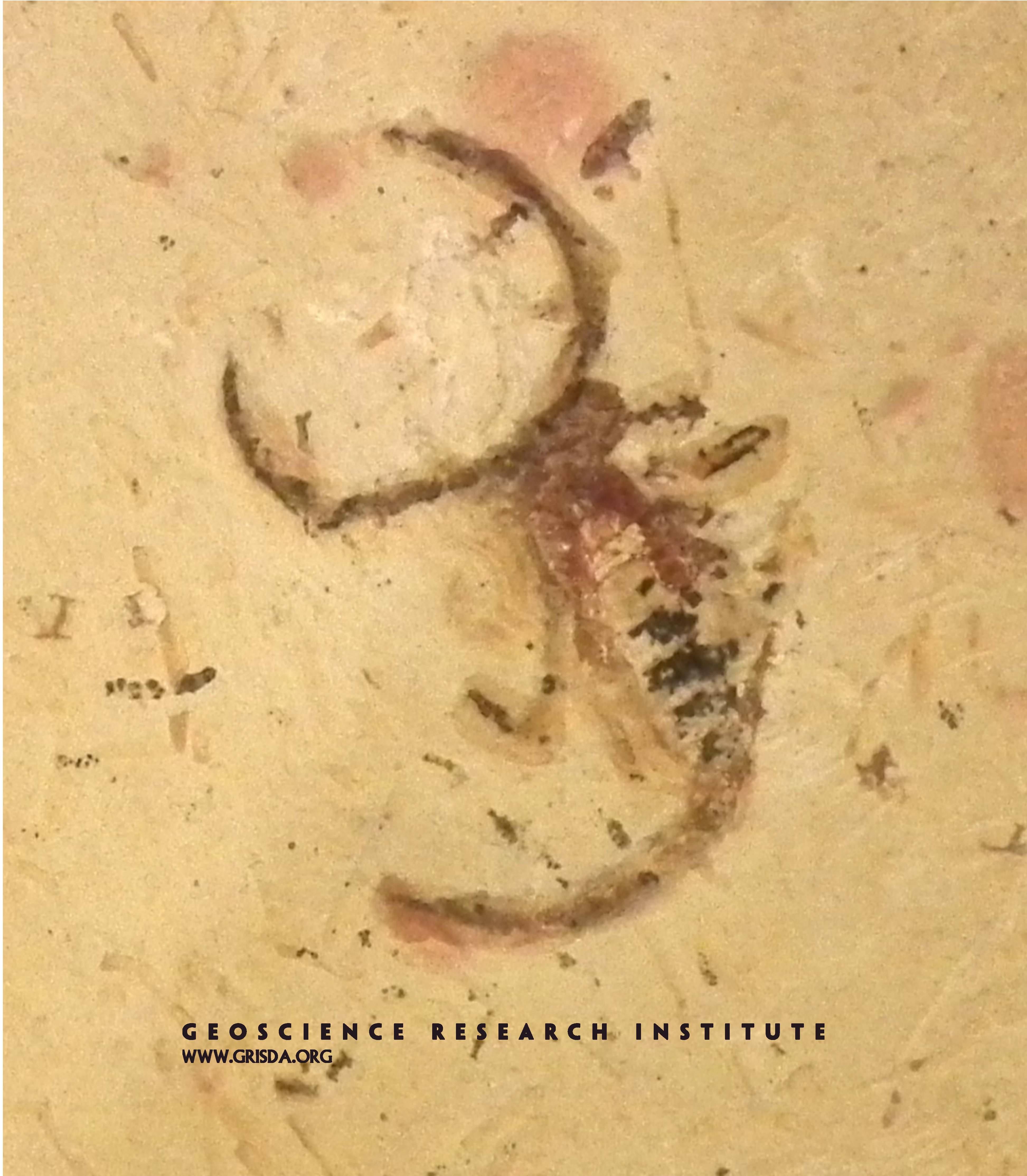
Exceptional preservation of organisms without hard skeletal parts, like this spider, requires special conditions for fossilization. Spiders appear abruptly in the fossil record. This is a Cretaceous specimen (few cm in size) of Dinodiplura ambulacra from the Crato Formation of Brazil, on display at the Paleontological Museum in Santana do Cariri.
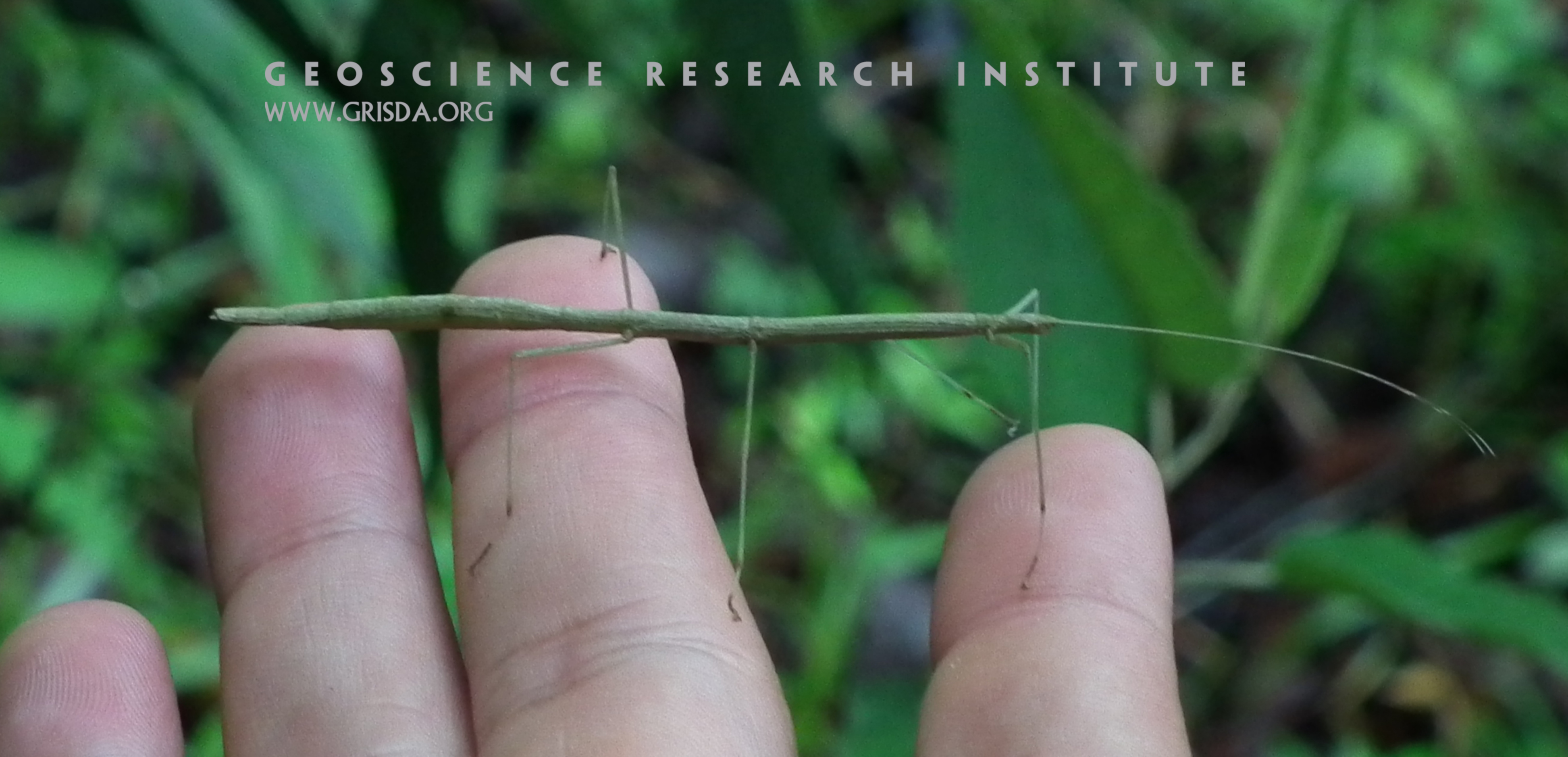
Phasmid
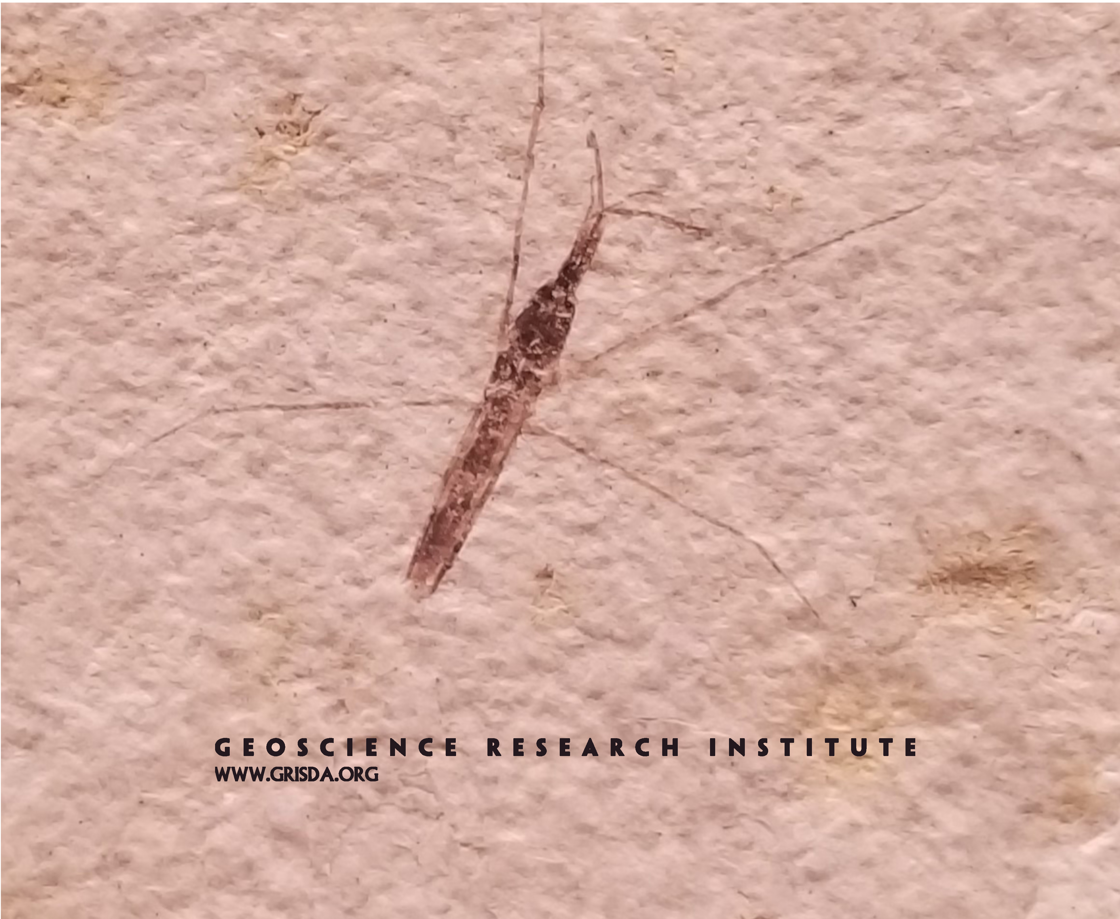
Stick insects (or "phasmids") belong to the Phasmatodea order, which includes the longest insect (up to almost 60 cm in size).
Col de la Croix
View to the east from Col de la Croix. Parts of four stacked nappes are visible from this point: Niesen, Bex, Diablerets and Wildhorn.
Trail Eto River
Harpers Corner, Dinosaur National Monument --- At the floor of these canyons of the Colorado Plateau run the Green and Yampa Rivers.
Pararistolochia goldieana
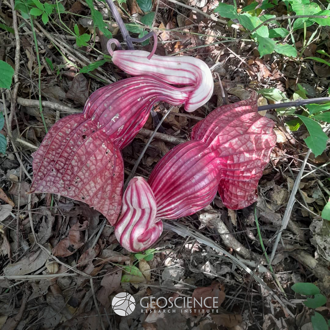
These large flowers (about 45 cm in size) are produced by the western African plant Pararistolochia goldieana. It is also known as "African corpse flower," because of its intense scent that attracts flies as pollinators. Pollination is an excellent example of interdependence between different organisms. Photo taken by Dr. Oluwole Oyedeji, about 25 km south of Ibadan, Nigeria.
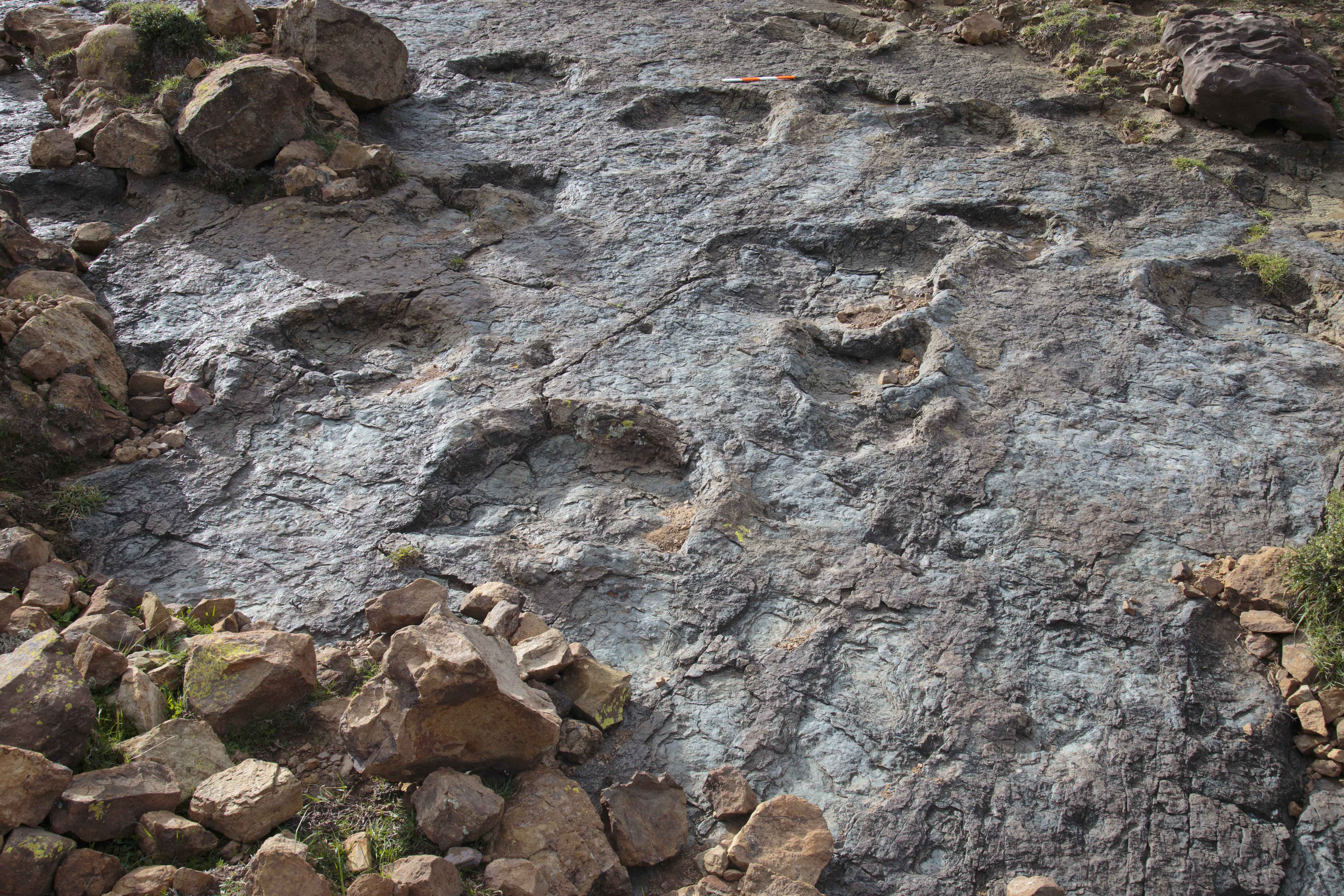
Parallel dinosaur trackways
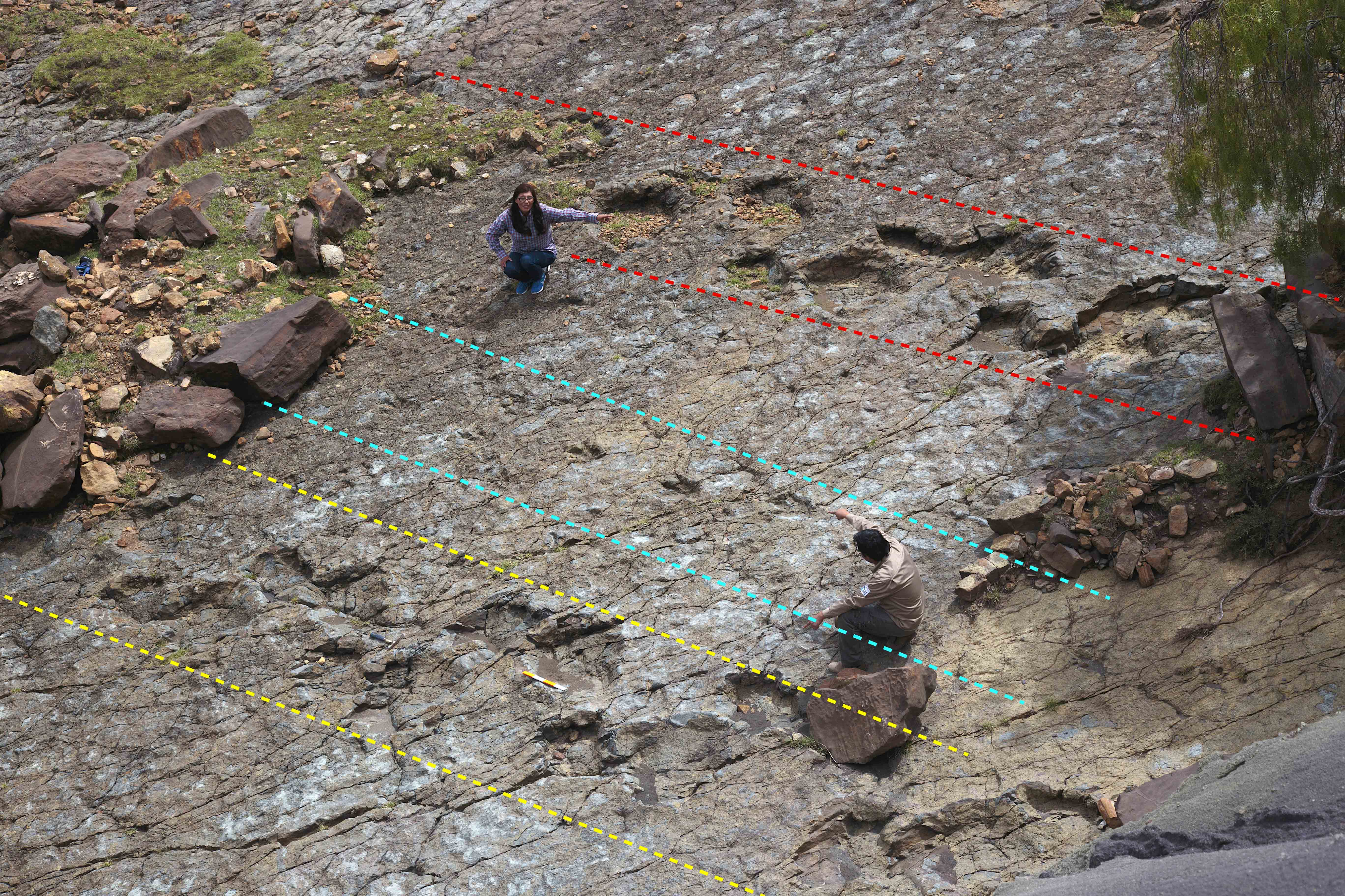
Three trackways of dinosaur footprints. The middle one was made by a bipedal dinosaur, and those on both sides by quadrupedal dinosaurs (sauropods). The rocky substrate consists of sandstones formed on a beach or coast at low tide. The substrate was originally wet and firm, but deformable. The direction of movement of the dinosaurs was to the left.
Mockingbird
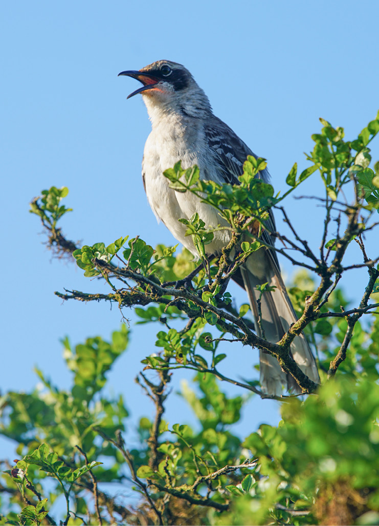
The Galápagos mockingbirds is an insectivorous bird, about 25 cm in size, with brown back, white belly, long tail, and straight, long and thin beak.
Whale-CBL-10
Mysticete fossil whale complete and well articulated. Bones show excellent preservation. Note the flipper bones in the lower central part of the photograph.
Dragonfly
It's not easy to become a fossil... and it's even more difficult if you don't have hard skeletal parts. That is why explaining the exceptional preservation of a dragonfly like this one, on display at the Chicago Field Museum of Natural History, is not a trivial matter. This specimen, from the Eocene of the Fossil Basin, Wyoming, is a few cm in size.
Glacial Erratic at Monthey
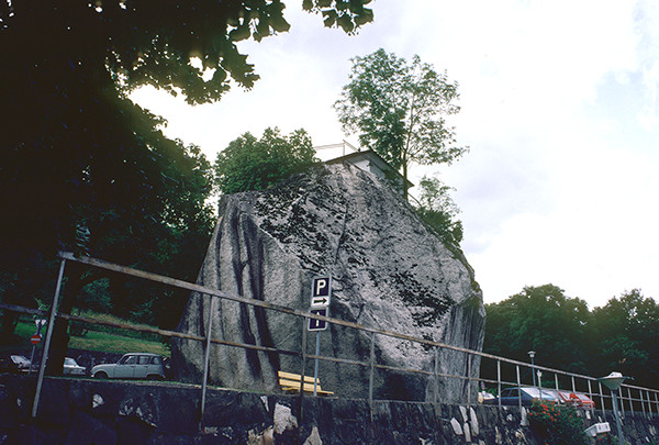
The house on the rock was built on an isolated massive boulder. The rock is composed of Mt. Blanc granite, which is not found near this region, and obviously had to be transported for many kilometers by action of glaciers.
Dinosaur-tracks
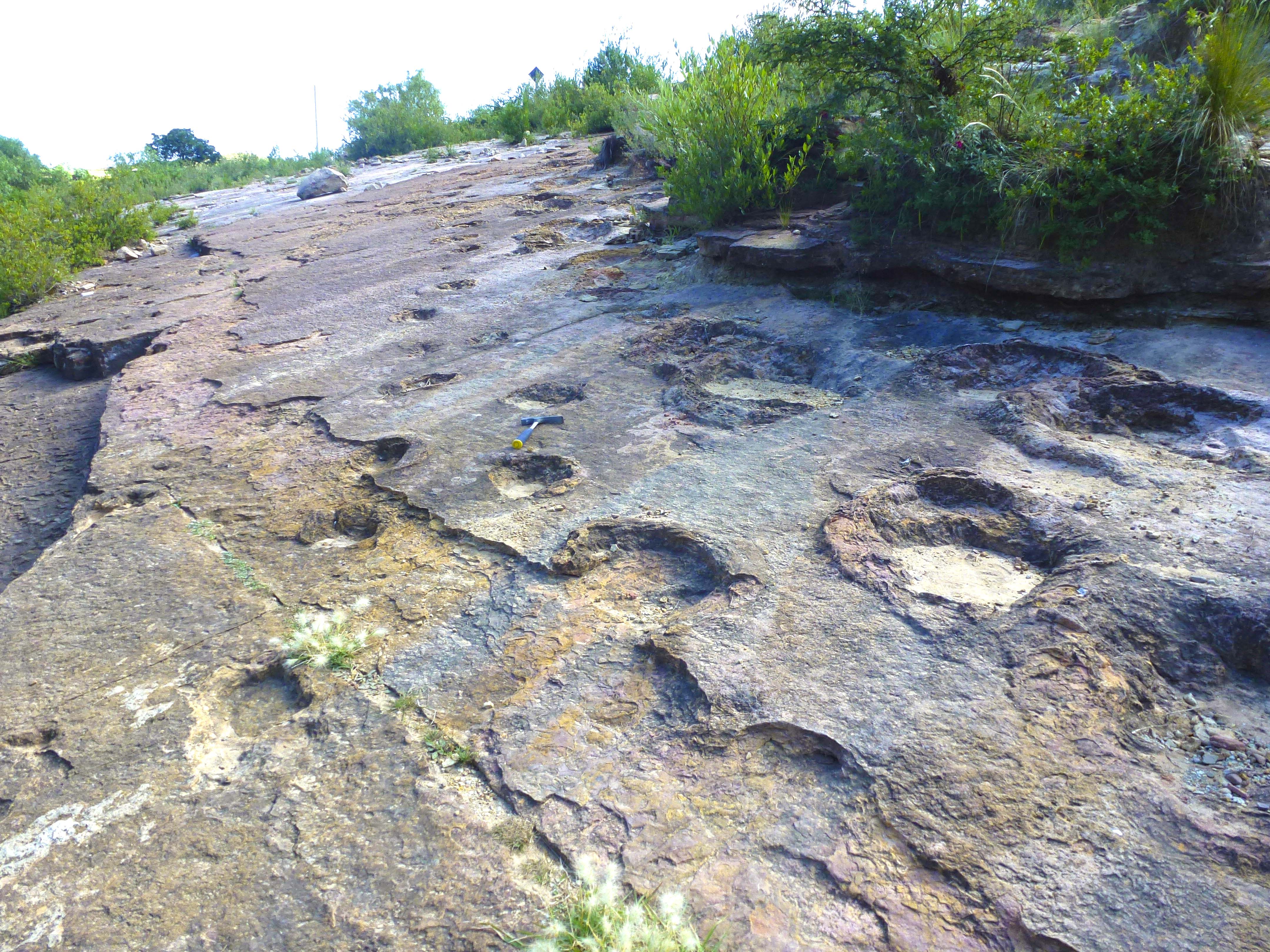
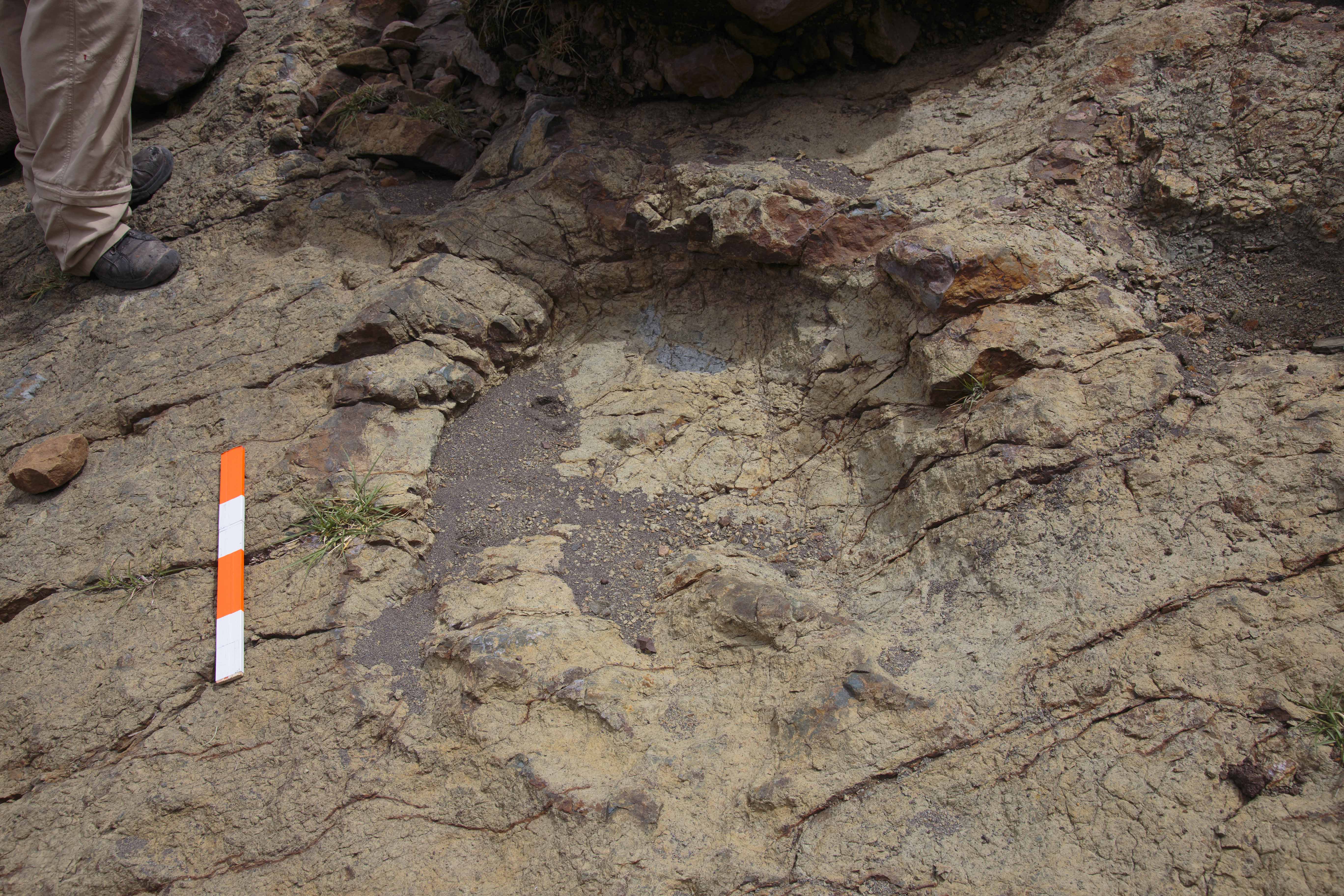
Various sauropod footprints exposed on the surface of a sandstone bed. Scale (red and white) is 40 cm long
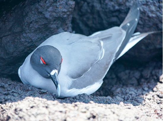
Gull
The bifurcated tail gull ( Creagrus furcatus) is completely nocturnal and thus avoids the attacks of the frigates, which fly during the day.
Pedogenesis
Pedogenesis is the process of soil formation. This photo shows a vertical section of a modern soil profile, with root traces and carbonate concretions. Scale in cm. Location: Muhanga District, Rwanda.
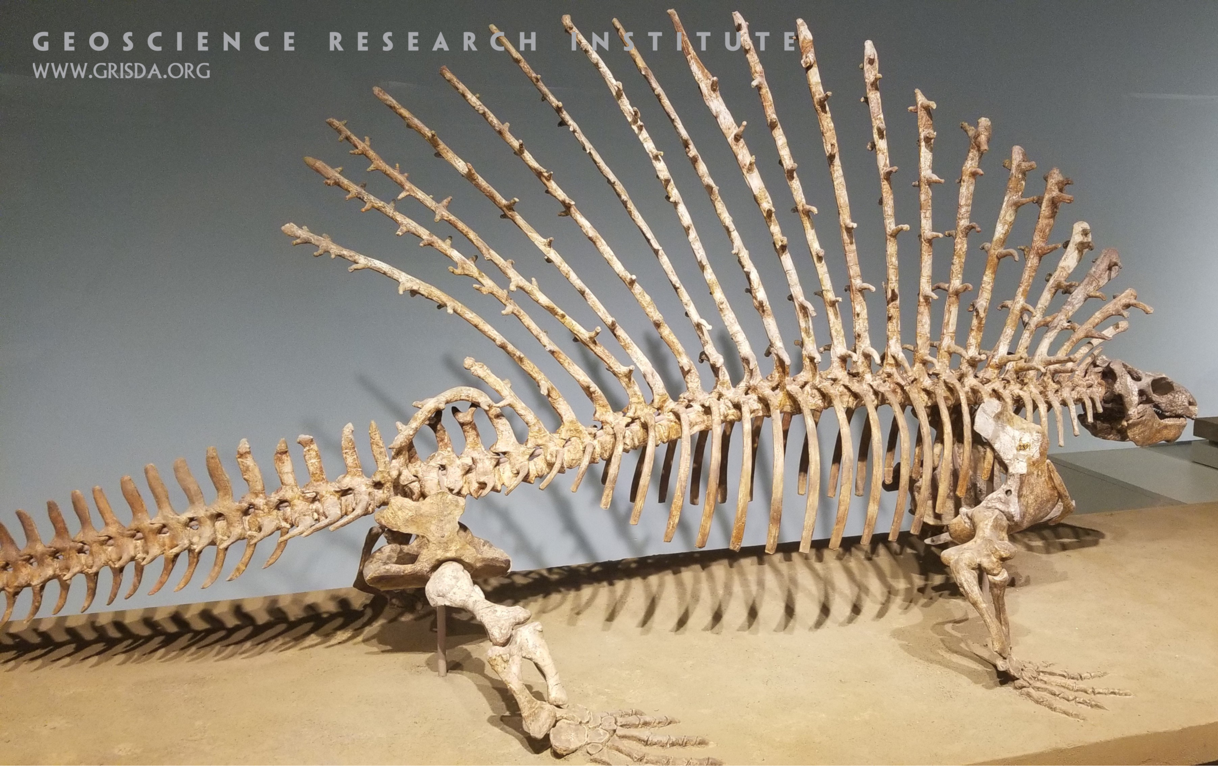
Edaphosaurus pogonias
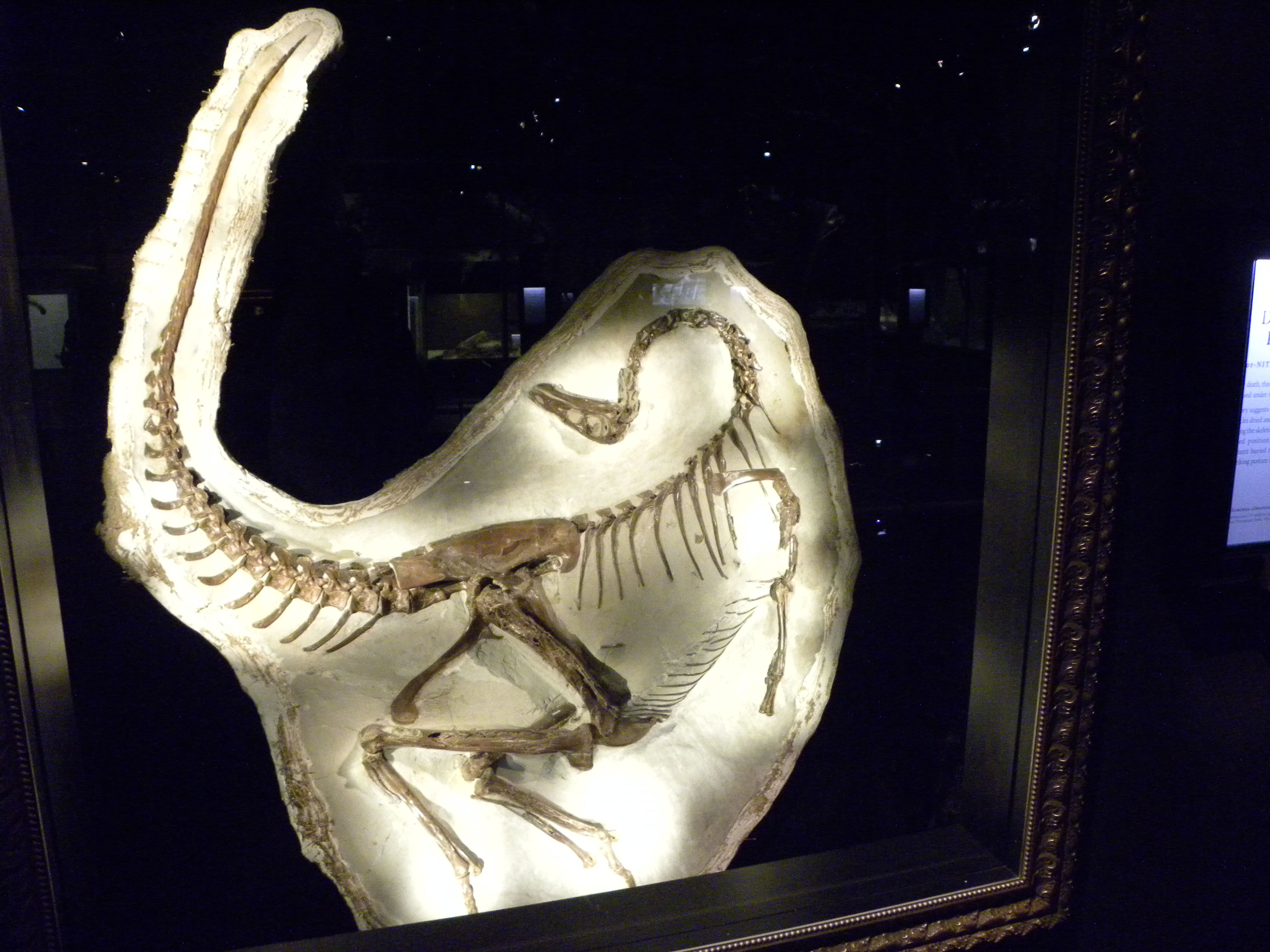
Edaphosaurs were large herbivores that had a peculiar "sail" on their back, supported by long neural spines with projecting tubercles. It is not clear what the function of this structure was, although a popular suggestion is thermoregulation. Specimen on display at the Field Museum of Natural History, Chicago.
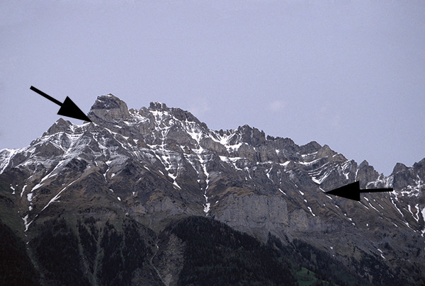
Overturned Morcles Nappe
View of the Dents de Morcles, near Mex. The arrow at the right indicates where the Morcles Nappe (above the arrow) slid over the more fixed layers below. Here the layers of the Morcles Nappe are reversed, due to recumbent folding from the south (right). The arrow at the left, which is within the Morcles Nappe, points to the lower margin of the thin, dark Gault (Upper Cretaceous) layer. Just below is a thick Nummulitic limestone layer (Eocene). Standard geologic interpretations would suggest some 45 million years between these two layers; yet the thin Gault shows little evidence of any erosion for 45 million years (remember the Morcles layers are overturned here).
RMNP
Rocky Mountain National Park --- The valley has been carved by glaciers between the viewpoint from Trail Ridge Road and the string of peaks in the distance along the Continental Divide. Longs Peak, the only 14,000 foot peak in the park, is the flat-topped mountain in the far distance.
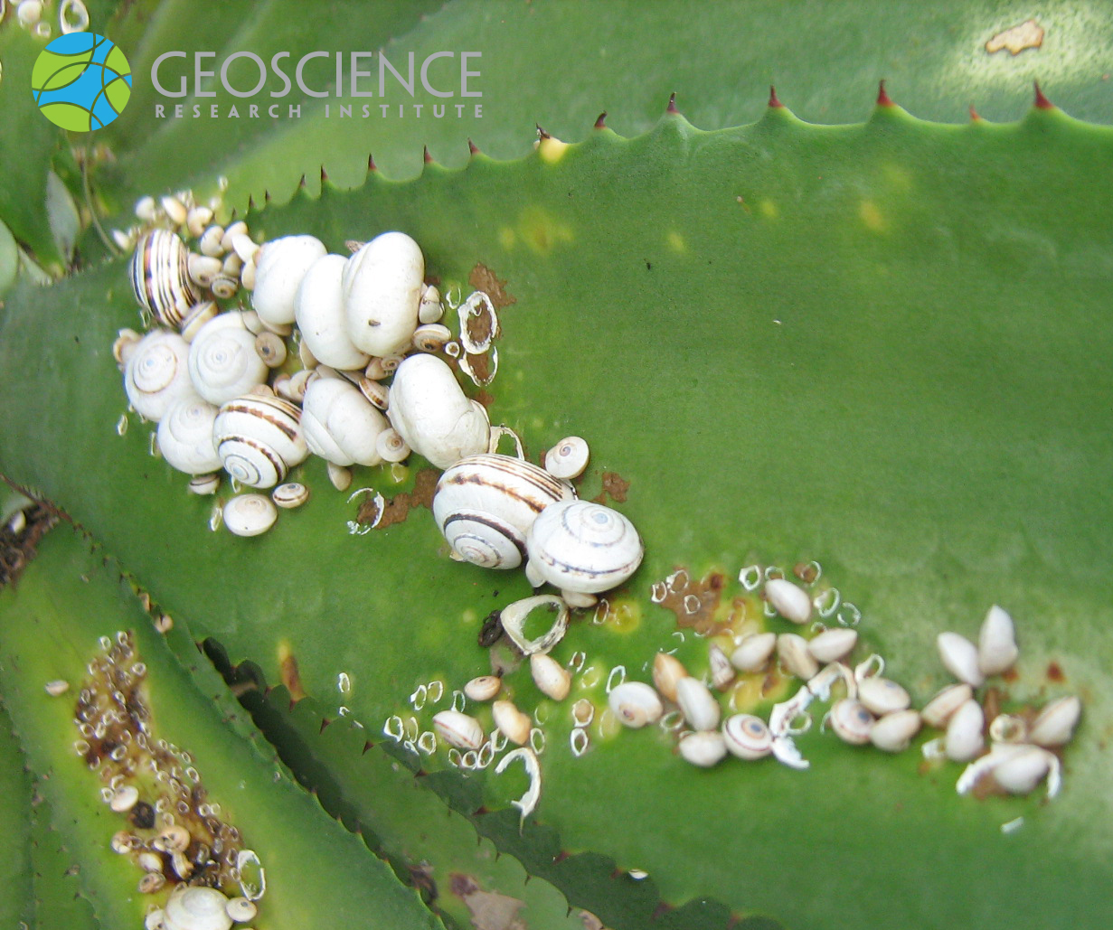
Aestivation
Land snails on agave plant. These terrestrial gastropods cope with hot and dry conditions during the day by entering a dormant state called "aestivation." A membrane of dried mucus provides attachment and insulation, and the light color of the shell helps to reflect sunlight. Photo taken by Dr. Oluwole Oyedeji, near Casablanca, Morocco.
Abelisaurus footprint
This footprint is the largest Abelisaurus footprint found to date. It is located near the Maragua syncline. The scale is 40 cm long.
Hills
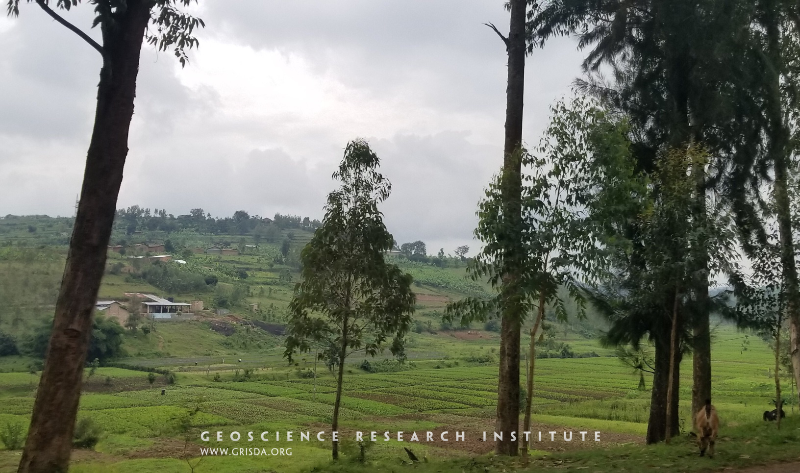
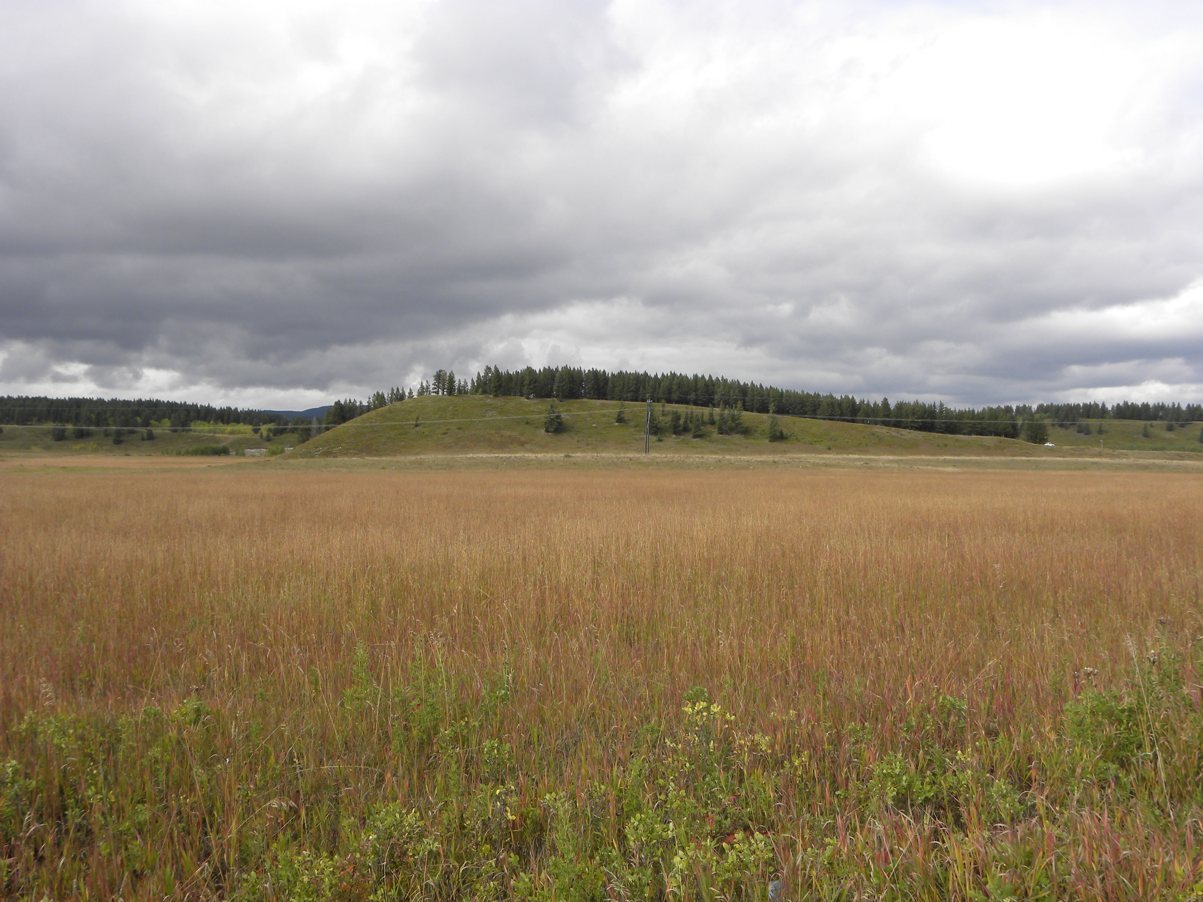
Rwanda is known as the country of a thousand hills. These hills are mostly made of Precambrian rocks. However, the valleys between these hills are filled with alluvial deposits that provide a fertile soil for cultivation. Photo taken in the Kigali district.
Archaeotherium
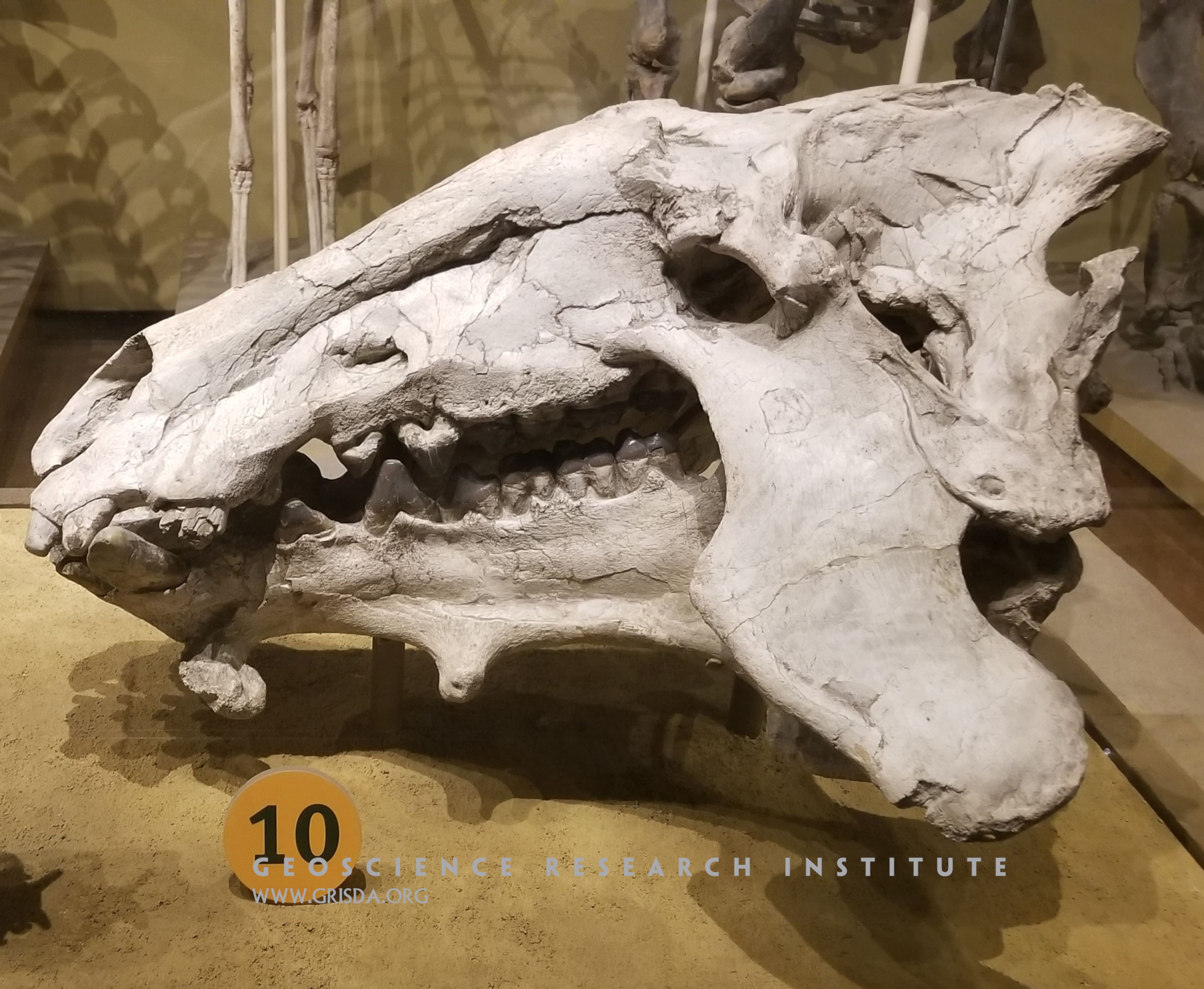
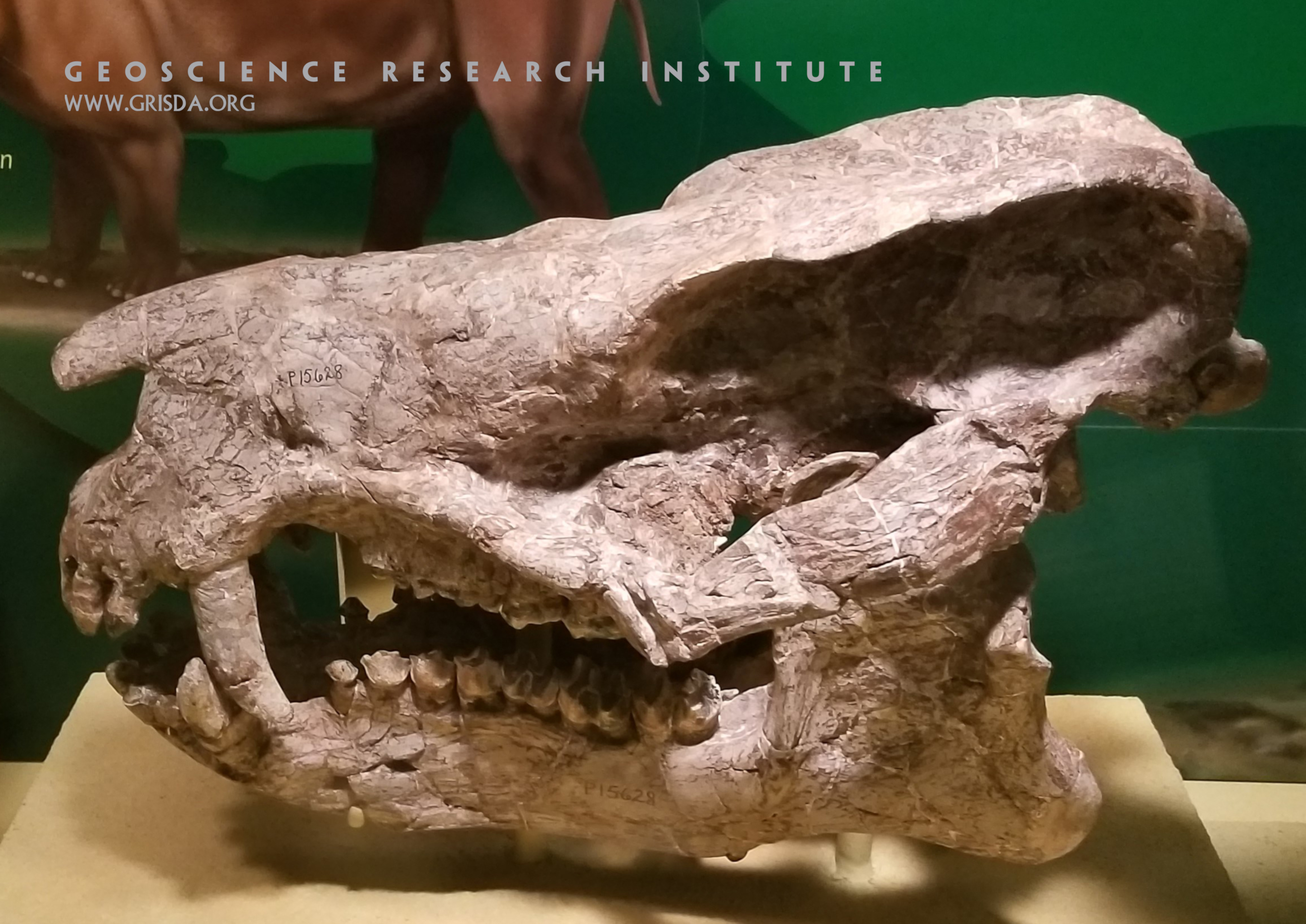
The skull in this picture belongs to an entelodont, a pig-like mammal that could reach the size of a cow. Specimen from the Oligocene of South Dakota, on display at Chicago Field Museum of Natural History.
Gornergrat Panorama
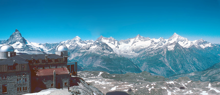
Panorama from Gornergrat looking towards the west. The peak on the left is the Matterhorn; the next peak is Dent Blanche. Both peaks are part of the Dent Blanche Nappe. The peak on the far right is Weisshorn.
Rainbow Curve Life Zones
Layers of Life, Rocky Mountain National Park --- An interpretive sign labels the ecosystems viewed at different elevations from this roadside stop: montaine, subalpine, and alpine. A total of eight different ecosystems can be found in Colorado, each with its own set of plants and animals.
Cal Orcko dino trackways
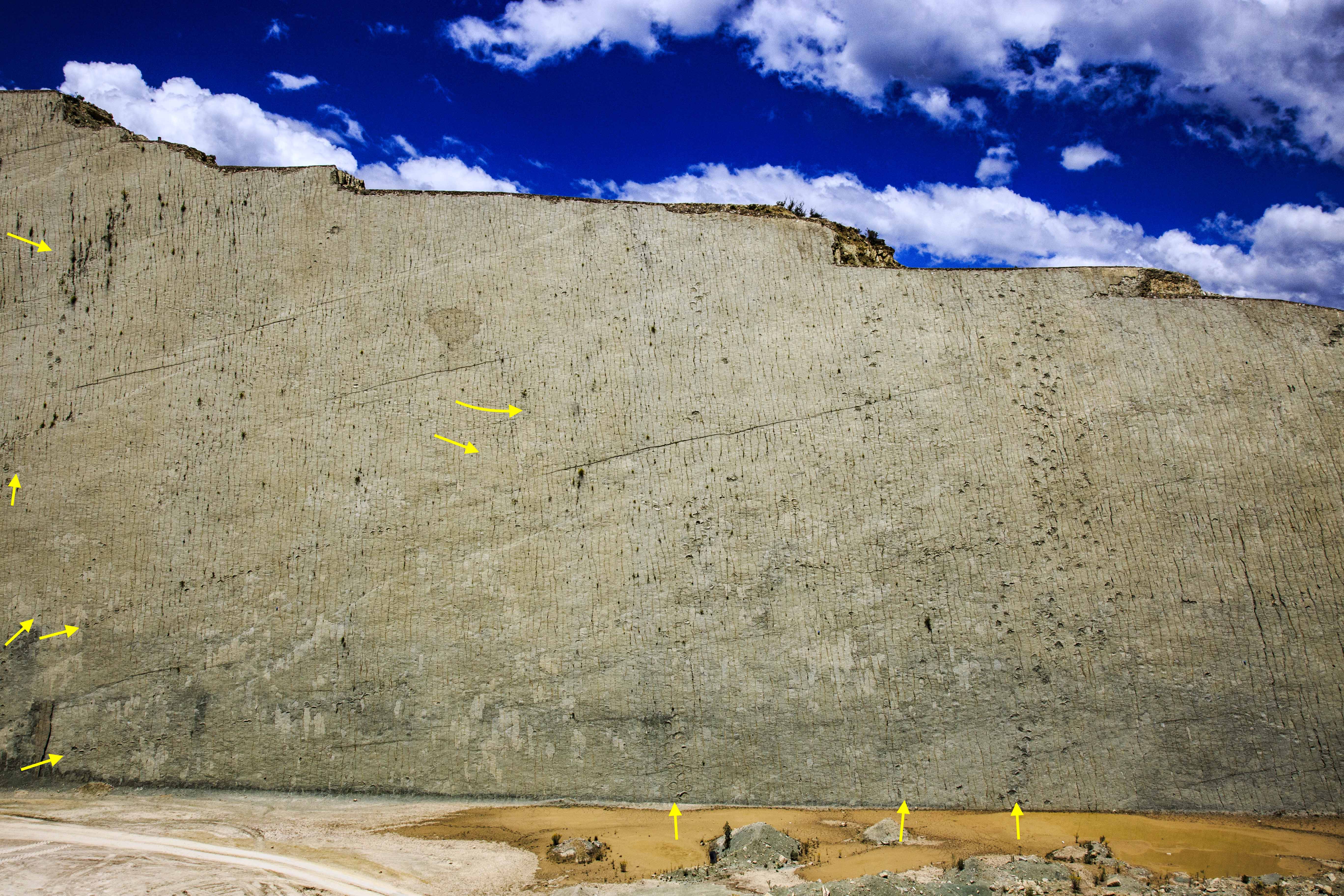
Site of dinosaur footprints of Cal Orcko, in Sucre, where more than twelve thousand prints have been found on numerous trackways in this wall of limestone and sandstone inclined at about 70 degrees, 1200 m long, and 80 m high. Researchers have found almost 300 ichno species on this exposure.
Frigate
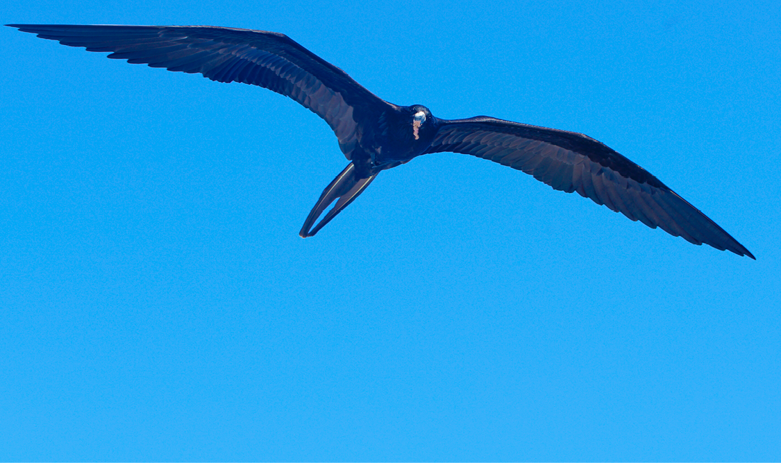
One of the most characteristic Galápagos seabird is the frigatebird, an elegant black bird with a wingspan of more than a meter, capable of performing the most incredible aerial maneuvers.
Faulting and deformation
Normal faulting of layers has resulted in lowering of the block to the right of the image. Note, however, the presence of an intensely deformed area along the fault zone, with evidence of plastic deformation. Cretaceous El Molino Formation, near Torotoro, Bolivia.
Homo erectus
A set of Homo erectus calvaria (skull caps) on display at the Chicago Field Museum of Natural History. The sudden appearance of Homo erectus in disparate geographic areas from Africa to east Asia contrasts with the traditional gradualistic model of human evolution.
Roche Mountonné at Gorner Glacier
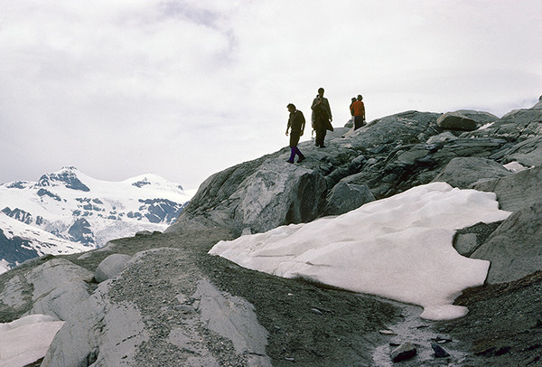
Smooth mounded rocks called roche moutonné (sheep rocks) formed by the action of the Gorner Glacier on the crystalline basement of the Monte Rosa Nappe. Note the striations on the rocks in the lower left corner.
Sierra Negra crater
Caldera of the Sierra Negra volcano, in the Isabela Island, 7 km wide and 10 km long
Volcano
A volcanic cone emerges from the clouds on a flight over the islands of Indonesia. The Java trench is one of the most tectonically and volcanically active regions of the earth.
Arariprhynus placidoi
Fossil of frogs are not particularly common, but the ones we find tend to be preserved in articulation. This is a specimen of a Cretaceous neobatrachian frog from the Crato Formation of the Araripe Basin, Brazil, on display at the Paleontological Museum in Santana do Cariri. Few cm in size.
Fossil Coral
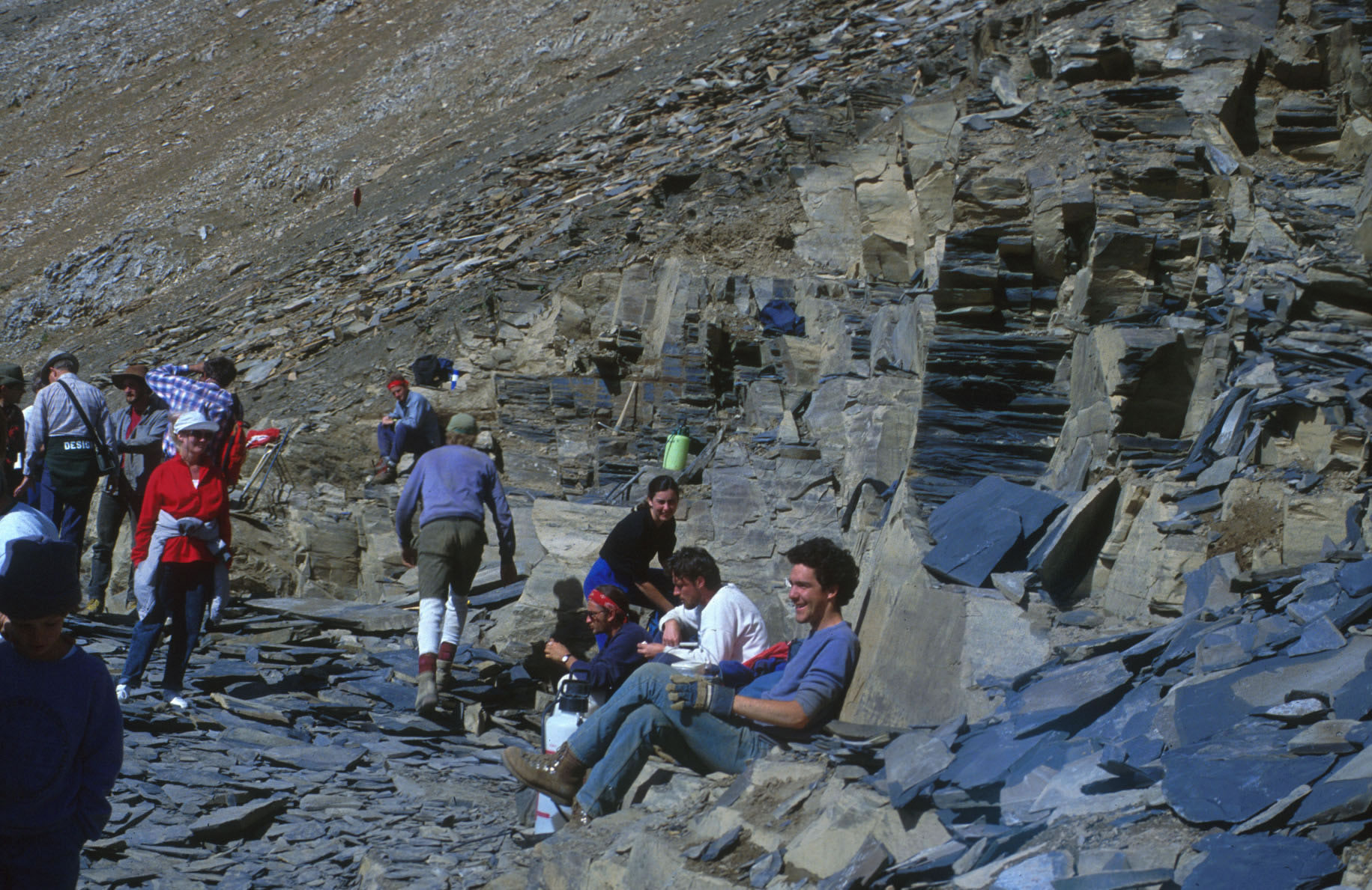
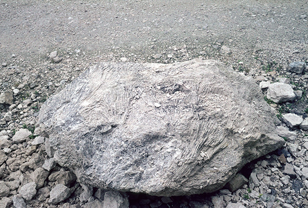
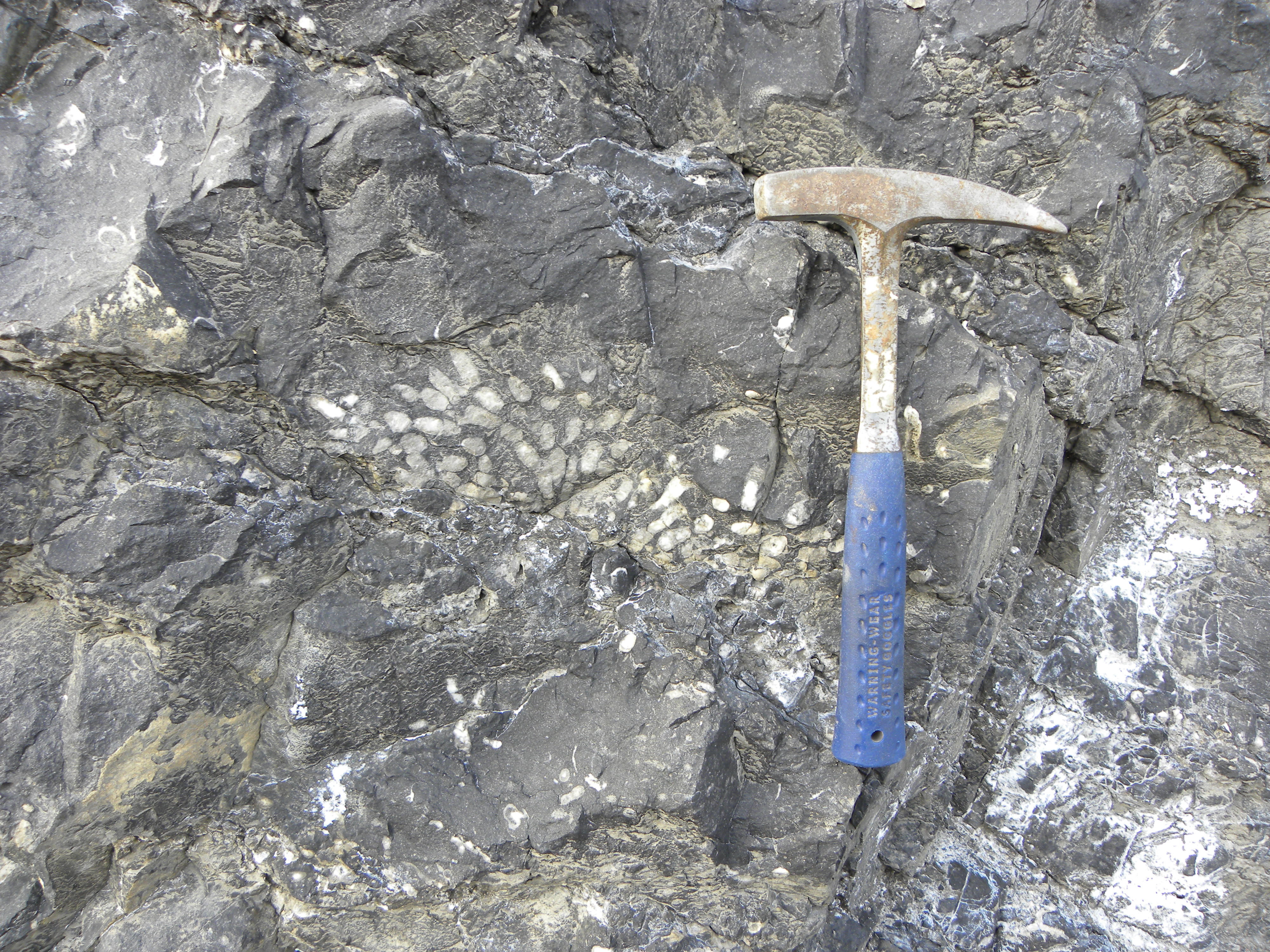
Close-up view of fossil coral from the Mares Quarry, near Saint-Germain-de-Joux, France (a few km west of the Swiss border). The block is about 1½ m long. Note the parallel arrangement of the numerous coral branches.
County Rd 301
SEDIMENTARY - CLASTIC: Conglomerate in a recent stream channel deposit, Colorado River Rd near McCoy --- Several features can be observed in the picture: Rounding of the boulders was probably caused by tumbling in a stream channel. Variation between sand layer and boulders indicates a variation in stream energy from low to high.
Penguin
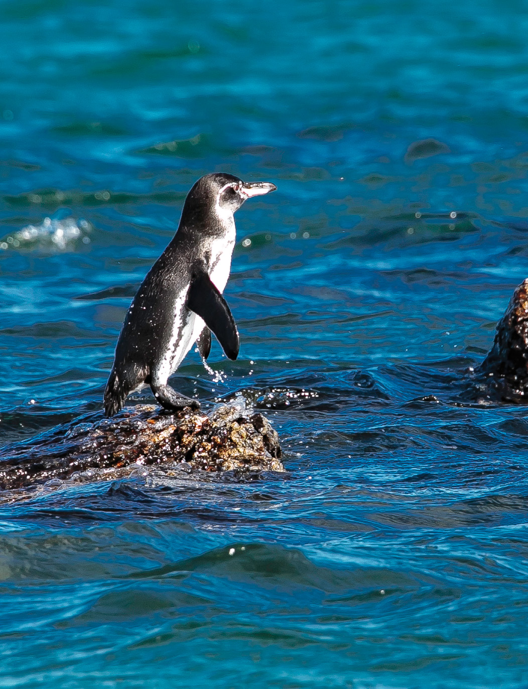
The Galapagos penguin (Spheniscus mendiculus) is the only penguin that lives in Ecuador. Although the species is endemic to the islands, the Galapagos penguins are morphologically similar to the Humboldt penguins, which breed in the coasts of Chile and Peru, and to the Magellanic penguins, typical of the southern tip of South America.
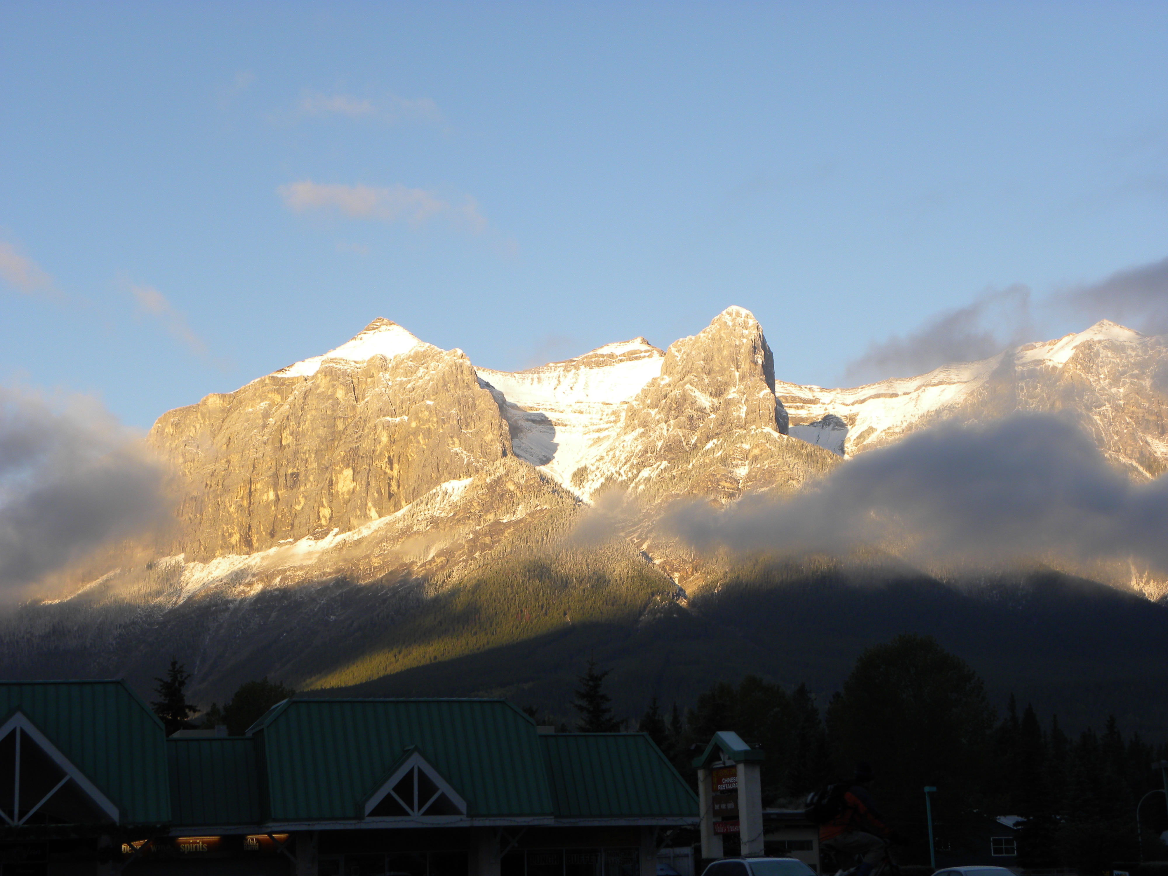
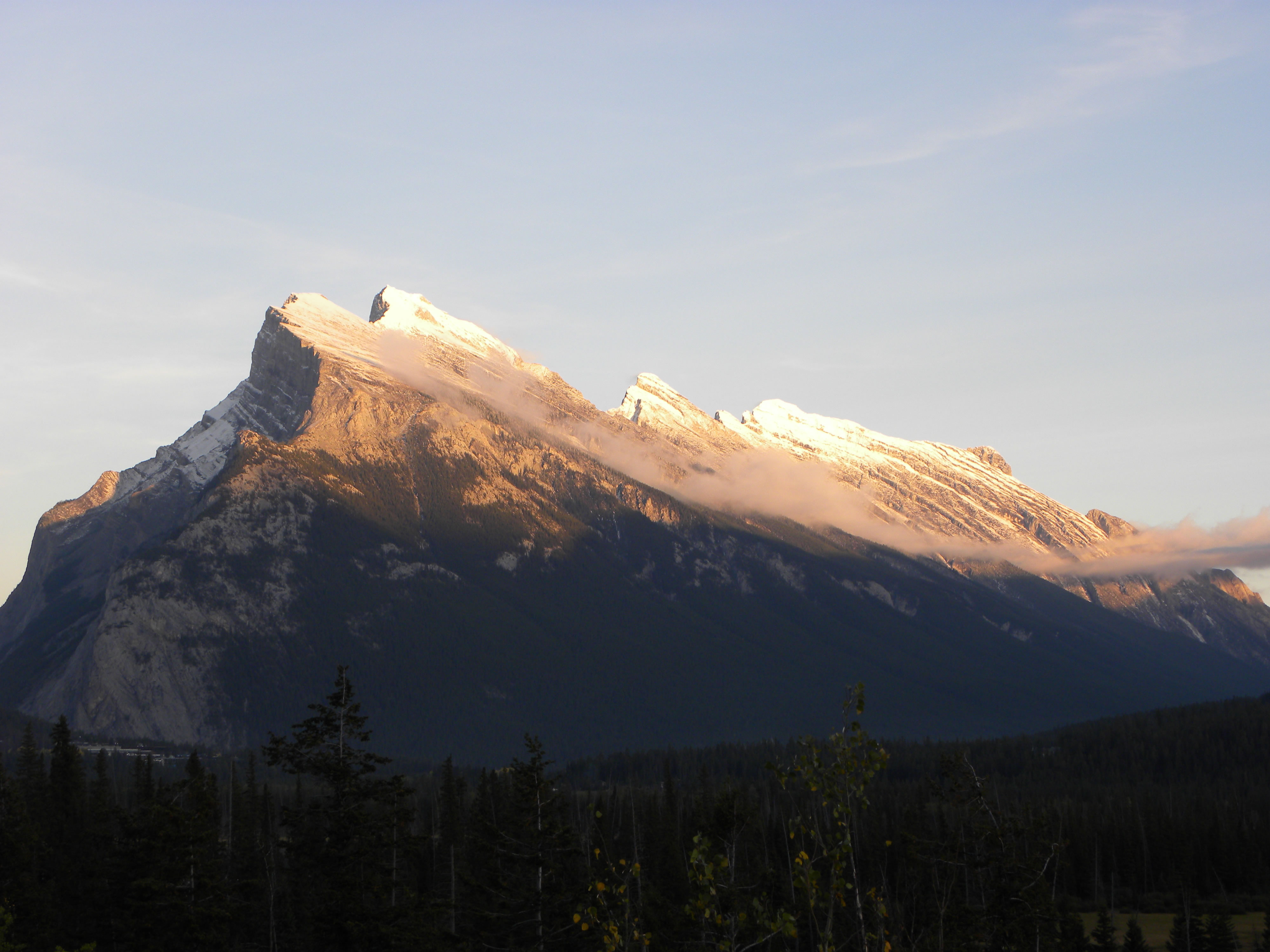
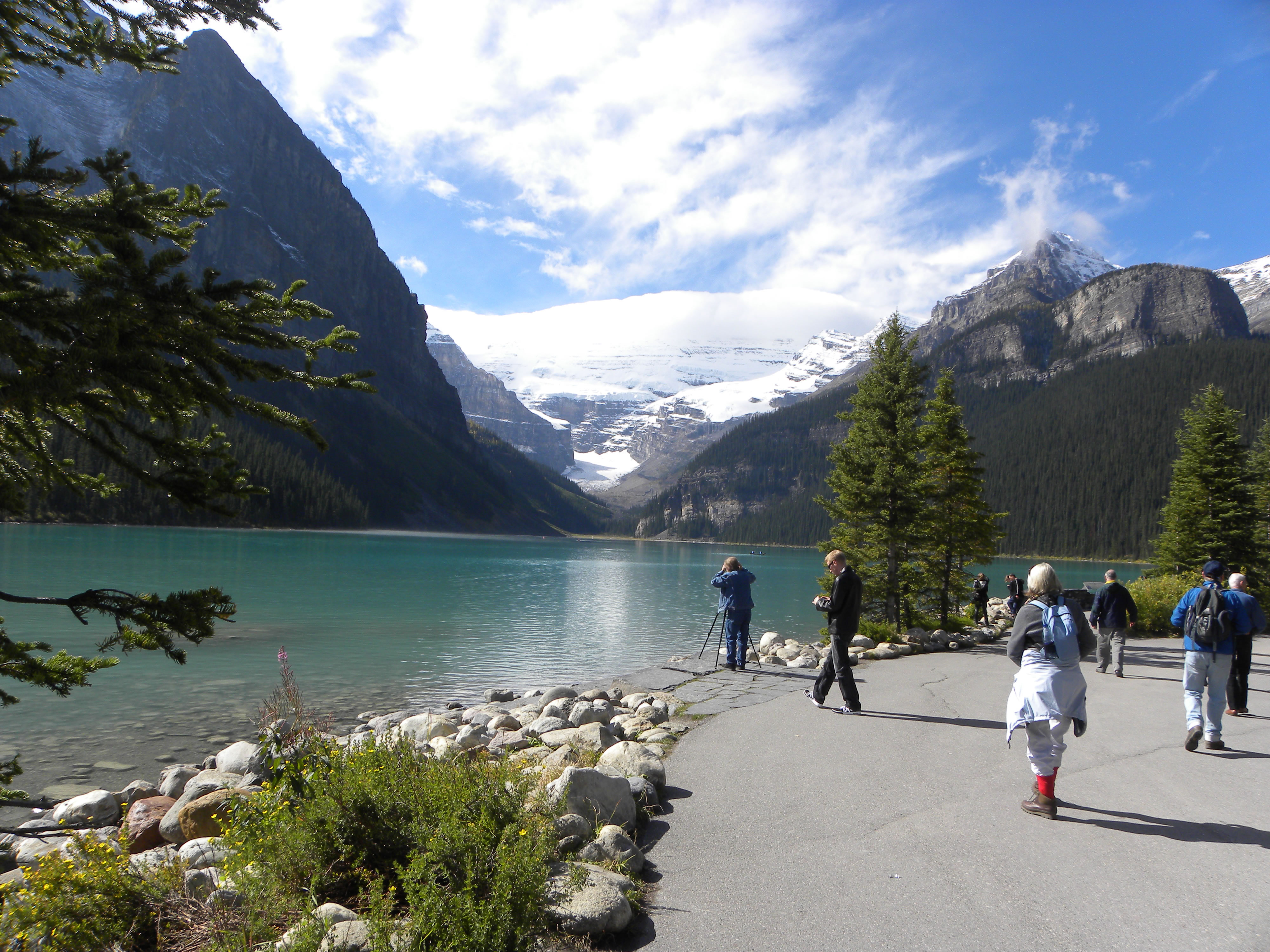
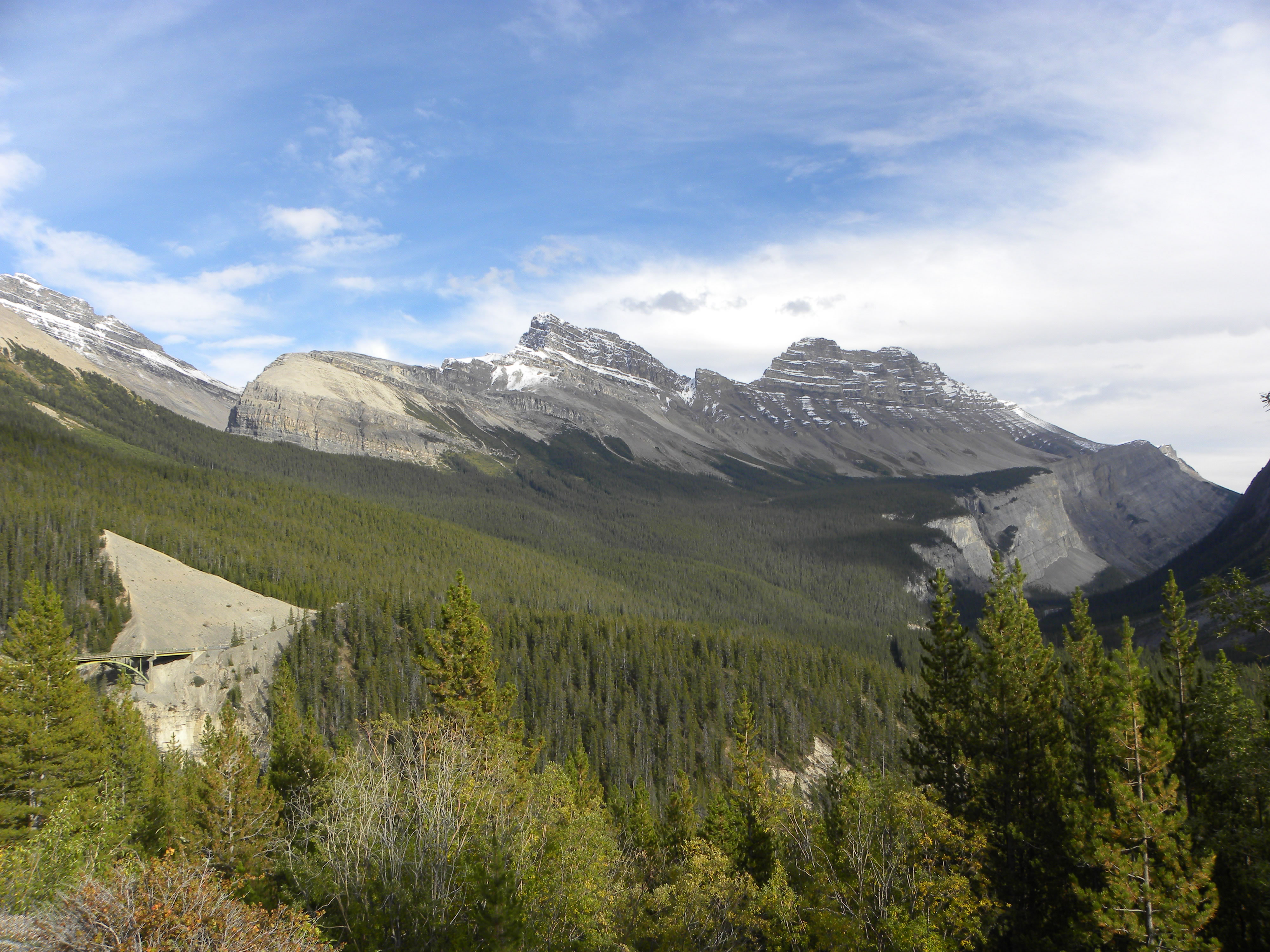
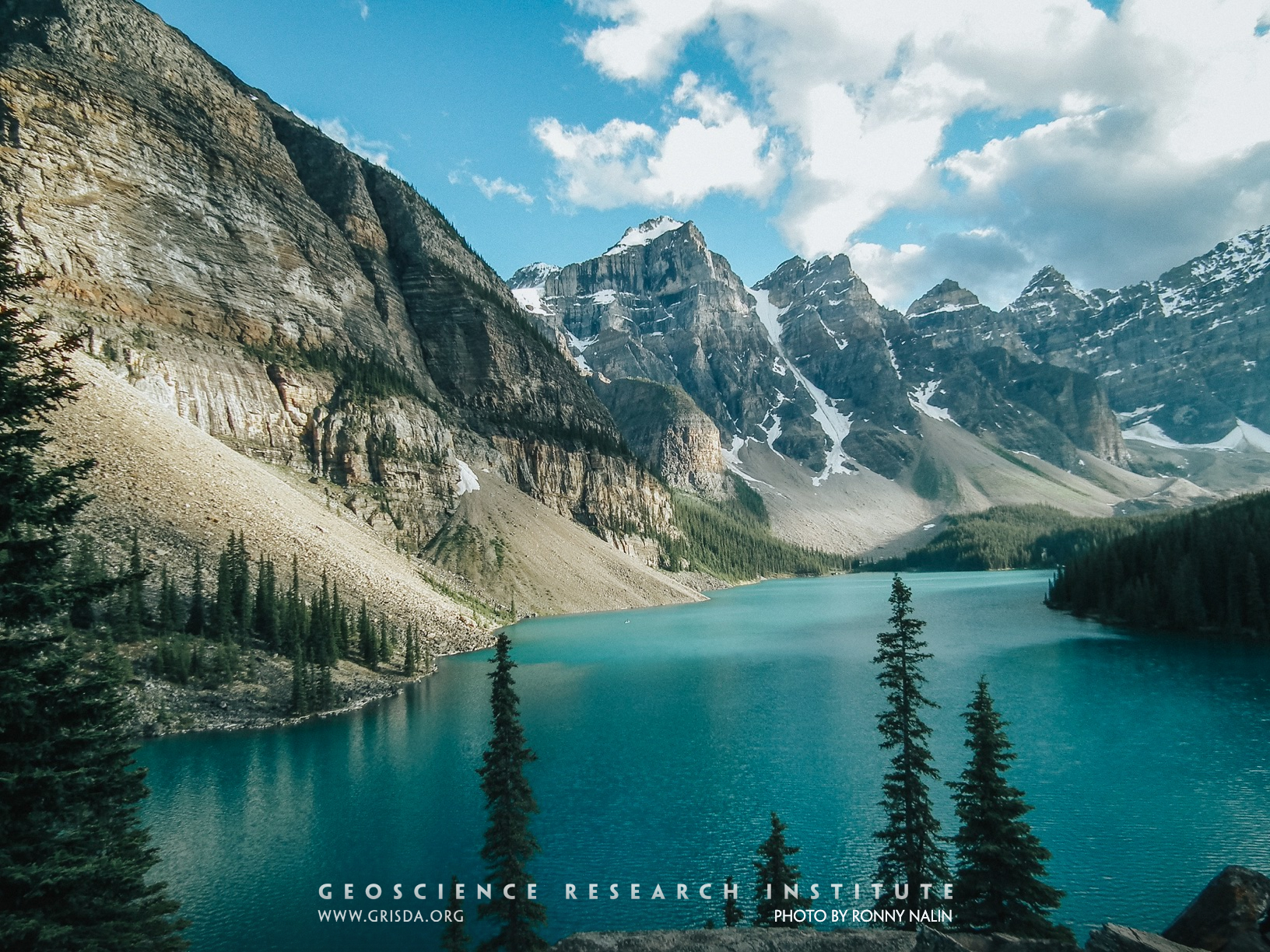
Moraine Lake
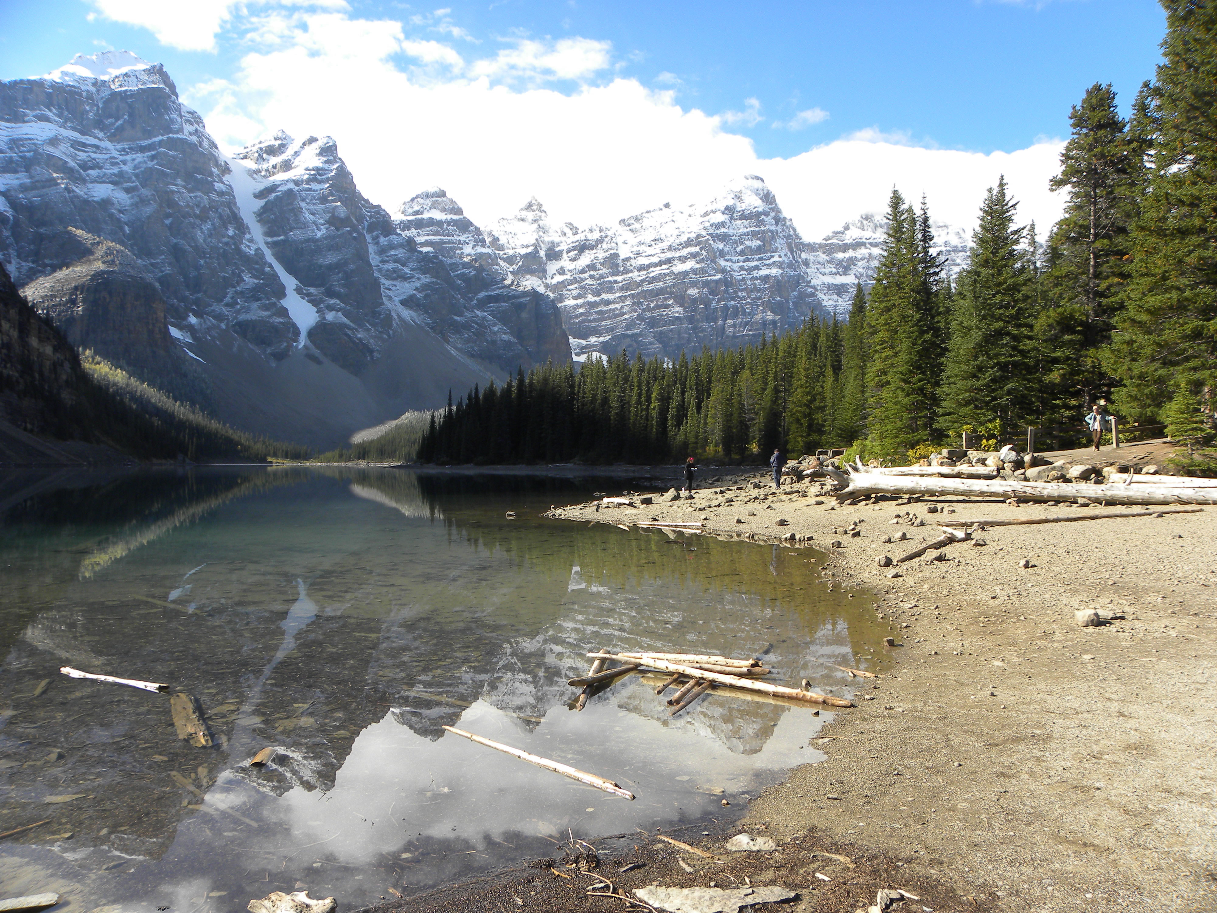
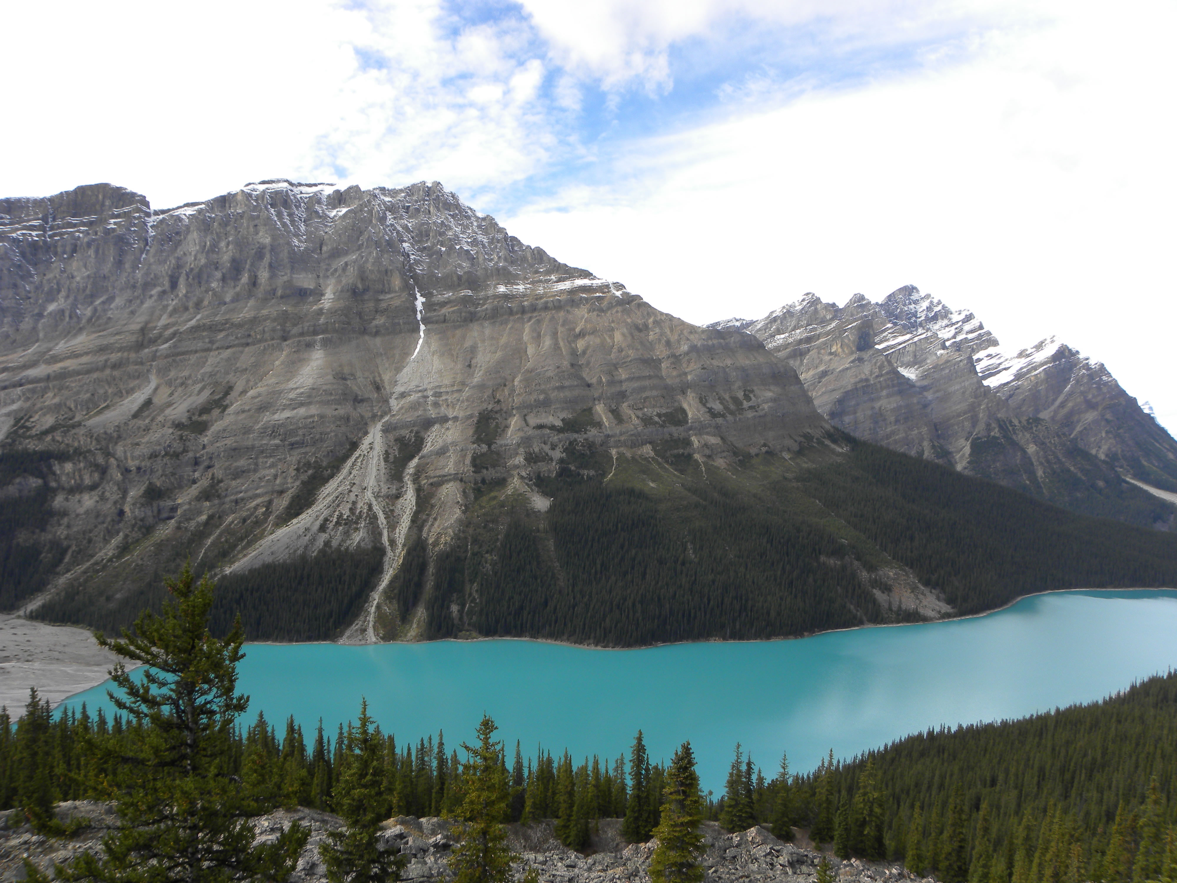
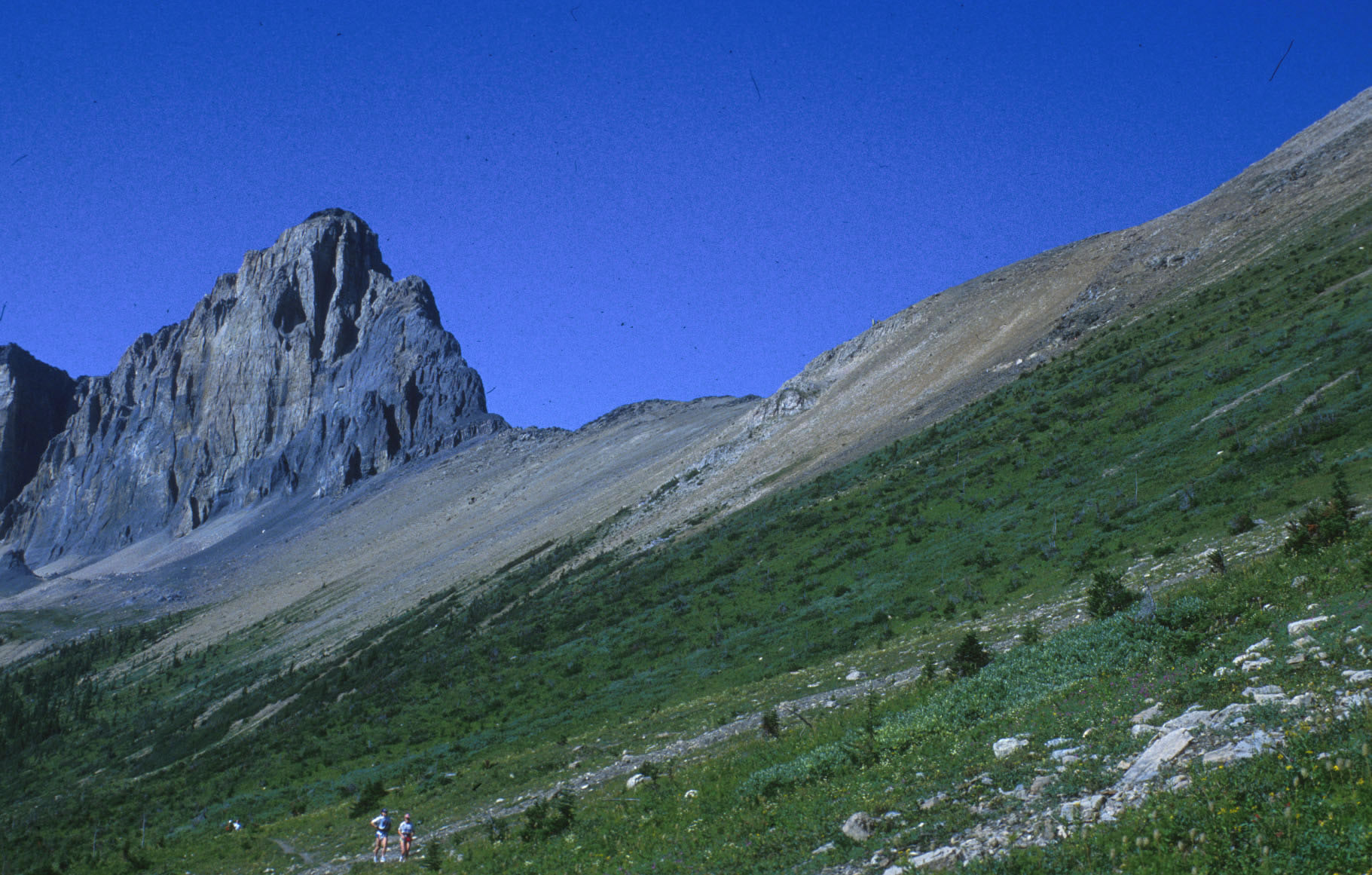
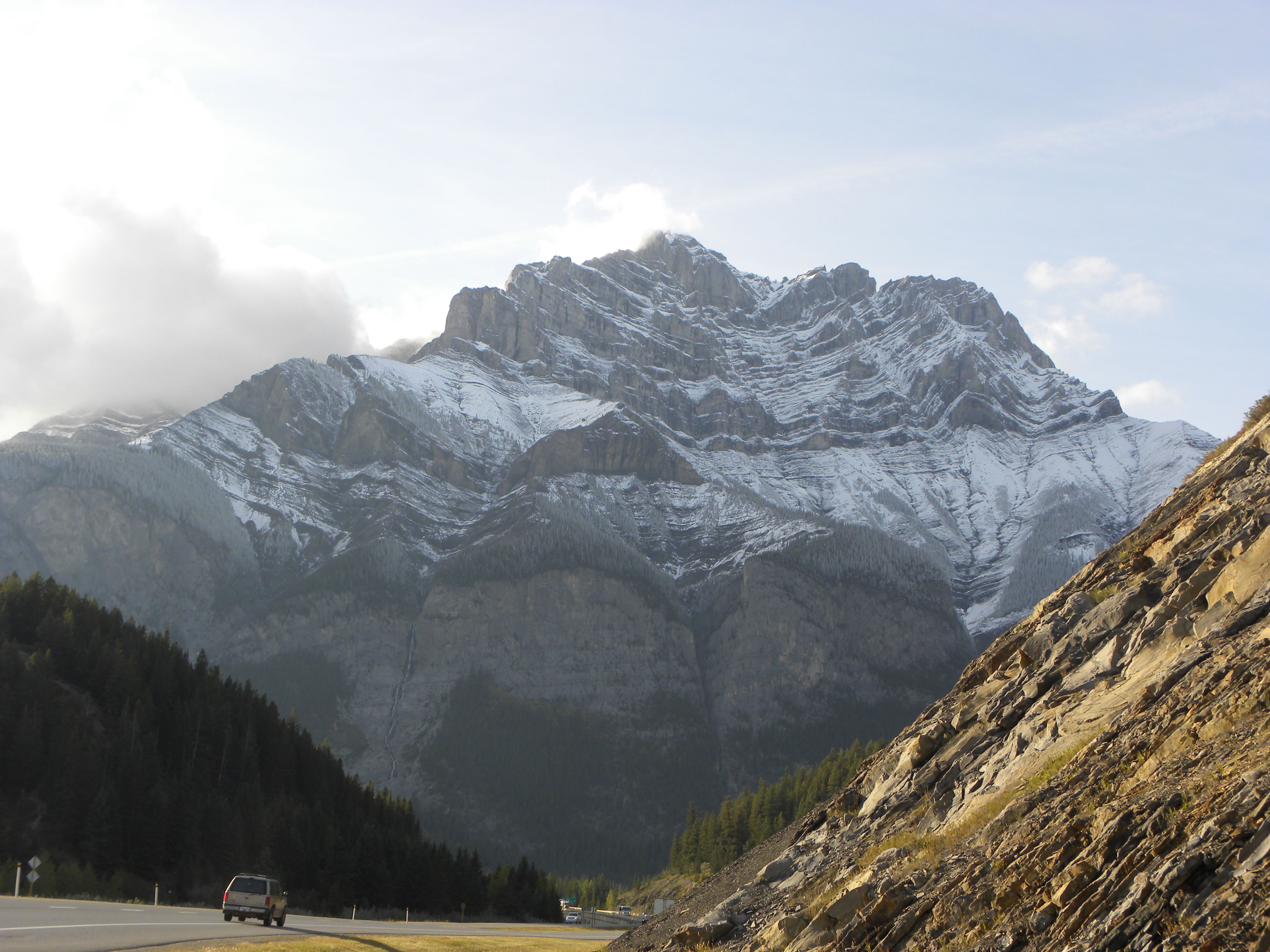
Talus cones, a glacial lake, and Cambrian quartzites: a perfect combo for a gorgeous landscape. Banff National Park, Canada.
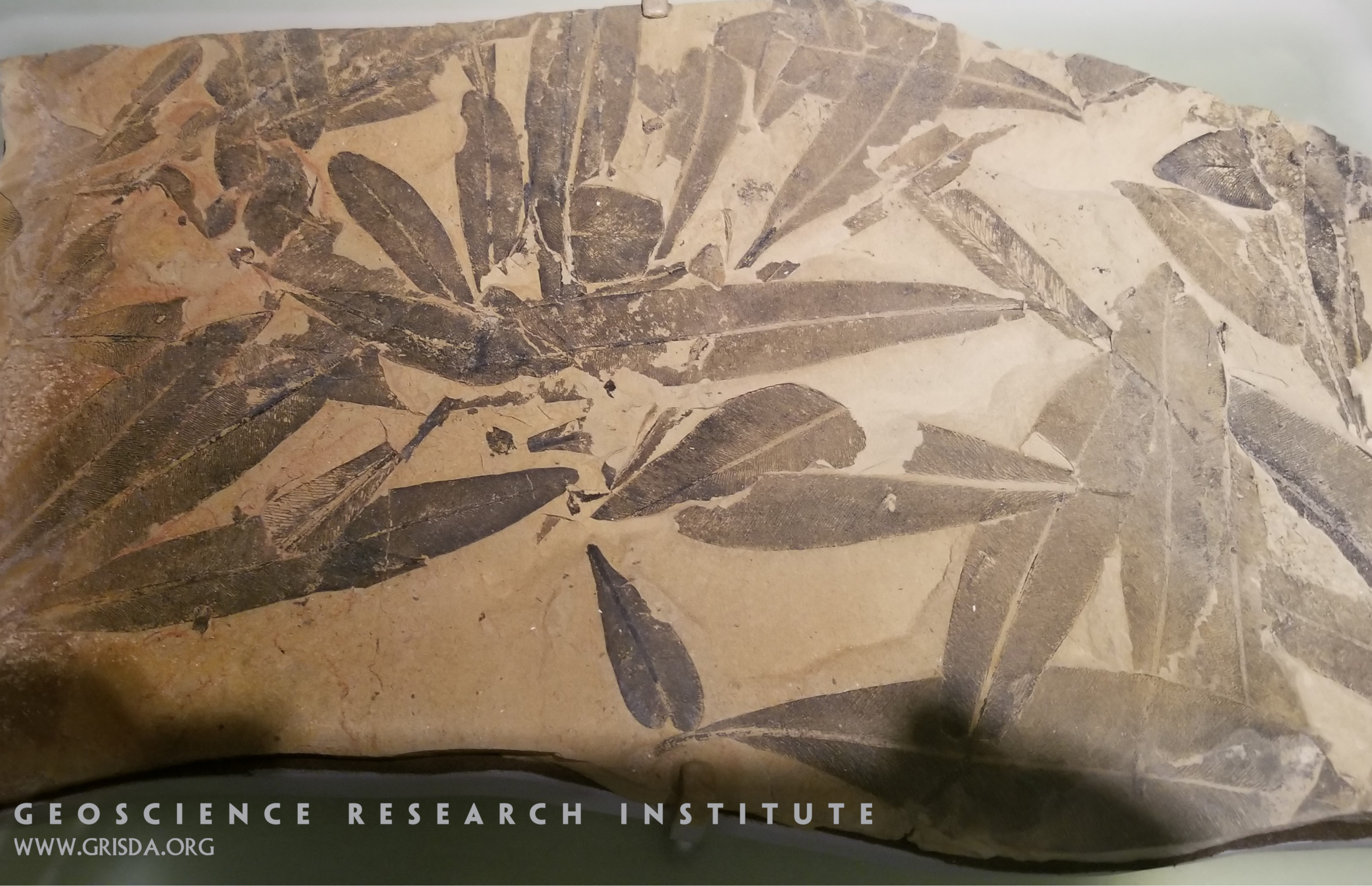
Glossopteris
The genus name Glossopteris comes from the shape of these leaves: it means "tongue-shaped feather." These leaves are a typical fossil of Permian strata from continents of the southern hemisphere and were important for the development of the theory of continental drift. Specimen on display at the Chicago Field Museum of Natural History.
RedRocksPark FountainCongl
SEDIMENTARY - CLASTIC: Conglomerate of the Fountain Formation, Red Rocks Park, west Denver --- These large boulders were rounded and transported by high-energy water action as the ancestral Rockies were eroded.
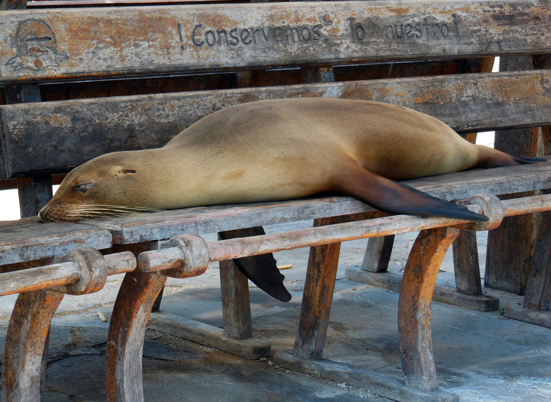
Sea lion
There are two species of otariids in the Galapagos Islands, both endemic. Galapagos fur seals (Arctocephalus galapagoensis) are found mainly on the western shores of the Isabela and Fernandina Islands, so they are more difficult to see, but the Galapagos sea lions (Zalophus wollebaeki) are very abundant.
Valleys
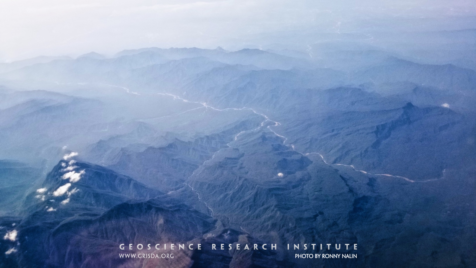
An example of transverse and longitudinal valleys from the Bolivian Andes, Parque Nacional Carrasco, reflecting structural control on geomorphology.
Glyptodon clavipes
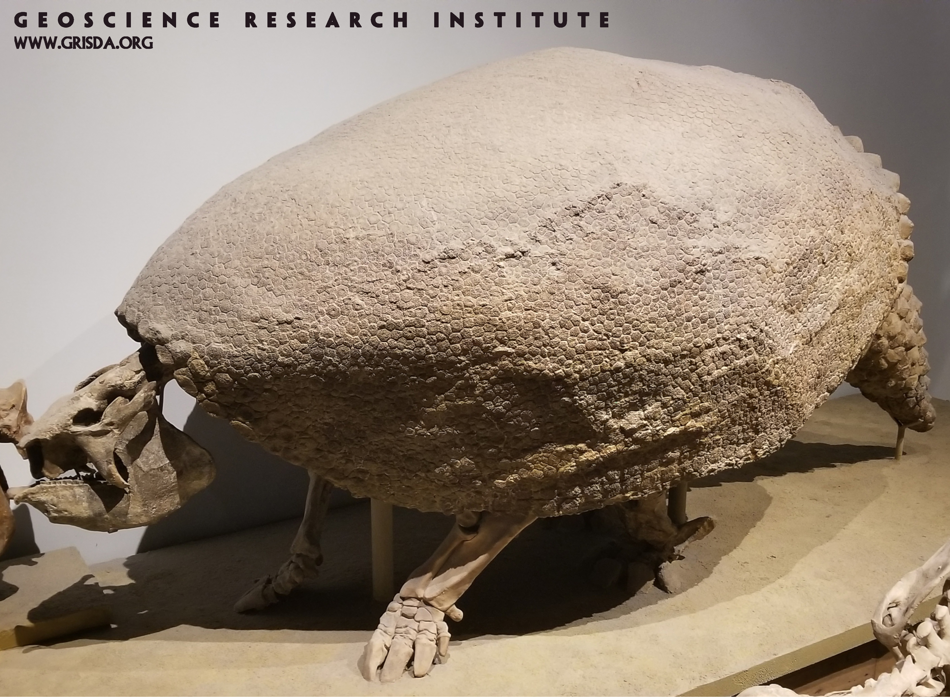
Glyptodonts are another impressive type of mammal lost to extinction and part of the Pleistocene megafauna. Specimen on display at the Chicago Field Museum of Natural History.
RedRocksPark FountainFm
SEDIMENTARY - CLASTIC: Sandstone of the Fountain Formation, Red Rocks Park, west Denver --- Vertical height of the picture is about 15 feet.
Microlophus albemarlensis
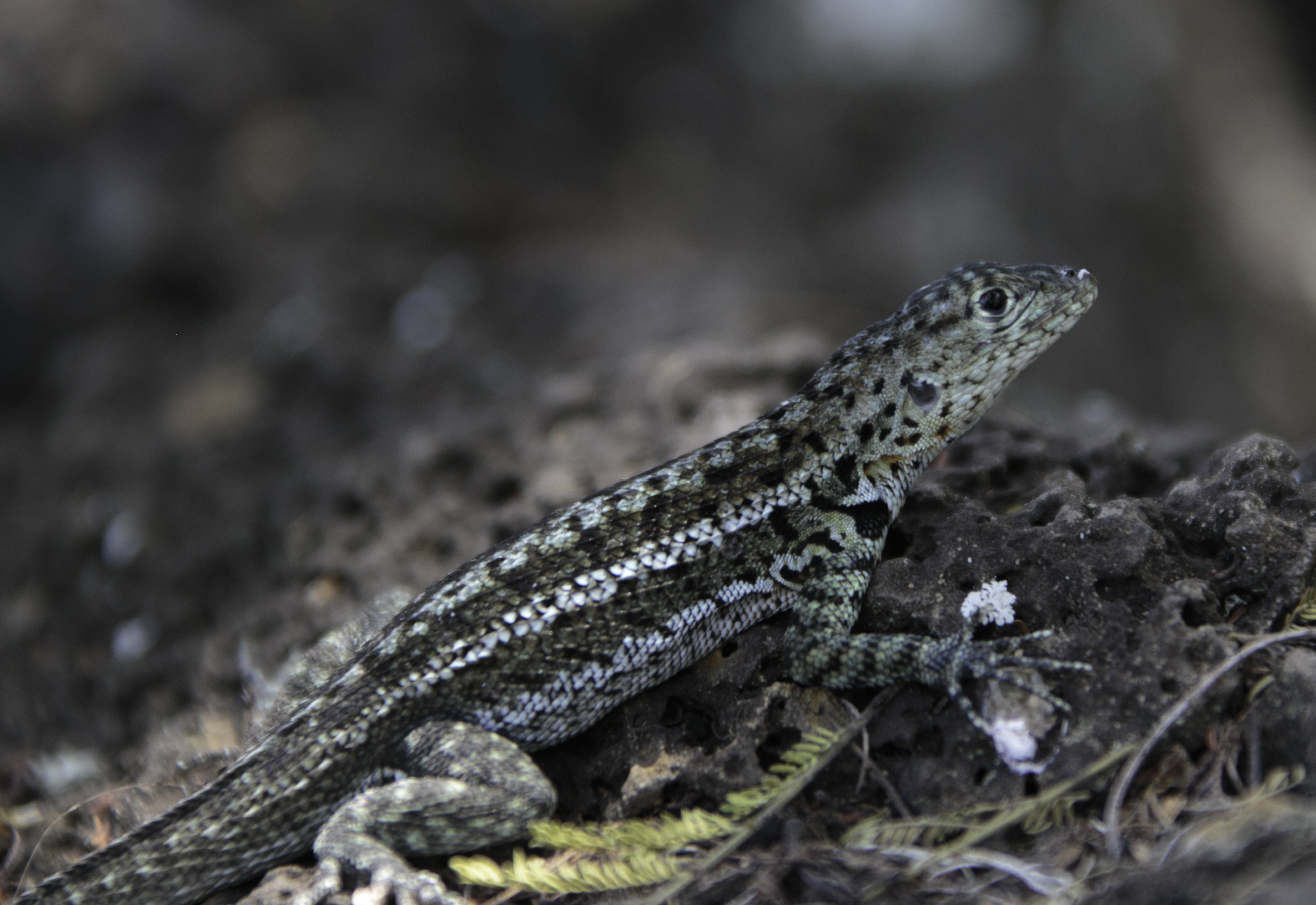
Galapagos lava lizard (Microlophus albemarlensis). These lizards are native to South America. There are about twenty recognized species, and six of them are endemic to the Galápagos Islands.
Monocline
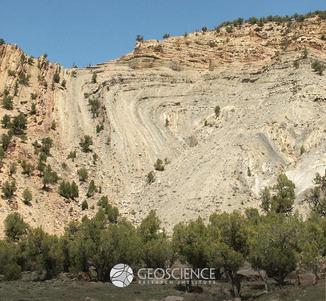
A monocline is a fold with a subhorizontal flank passing into a high angle flank. It is usually related to the activity of a tectonic lineament, like a thrust.
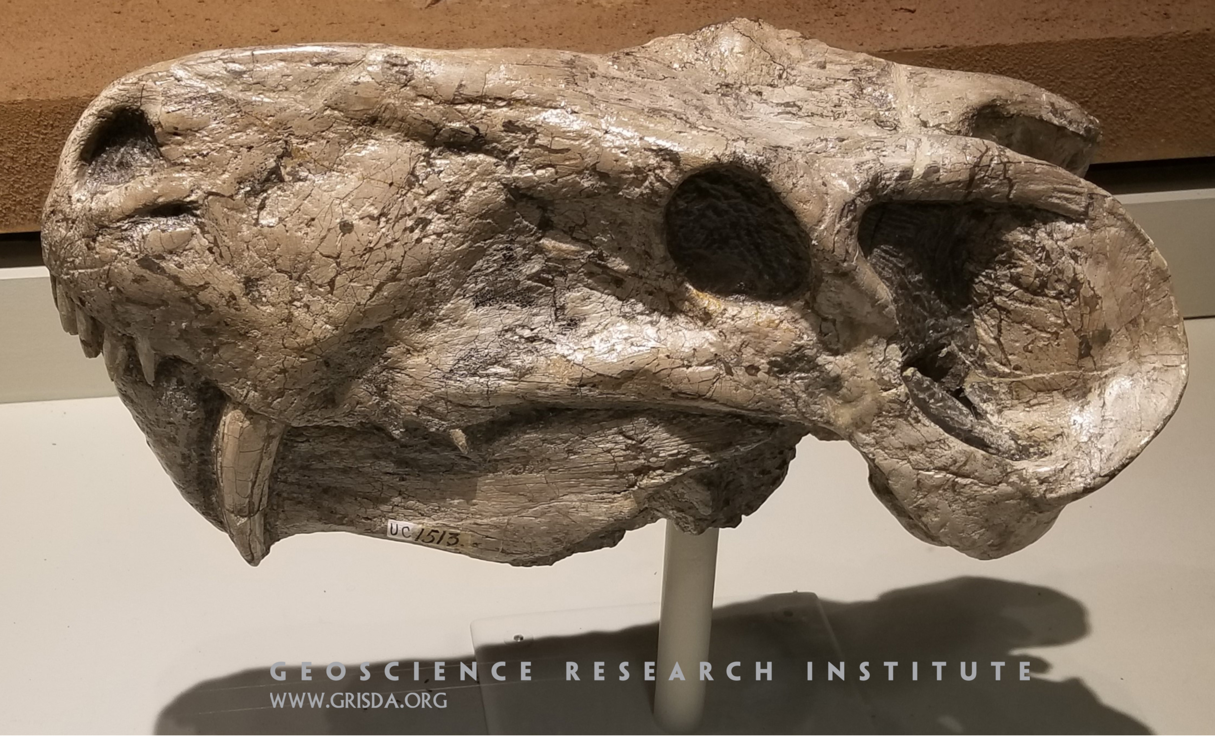
Lycaenops
The dentition of this Permian gorgonopsian from South Africa shows features, such as elongated canines, interpreted as indicative of a carnivorous mode of life. The skull (about 20 cm in size) is on display at the Field Museum of Natural History, Chicago.
Rt 139 GreenRiverFm
SEDIMENTARY - CLASTIC: Shale of the Green River Formation, Rt.139 near Douglas Pass --- Mud becomes hardened to form shale. Organic material gives the darker gray color to some of the layers; this oil shale is a mostly untapped energy resource.
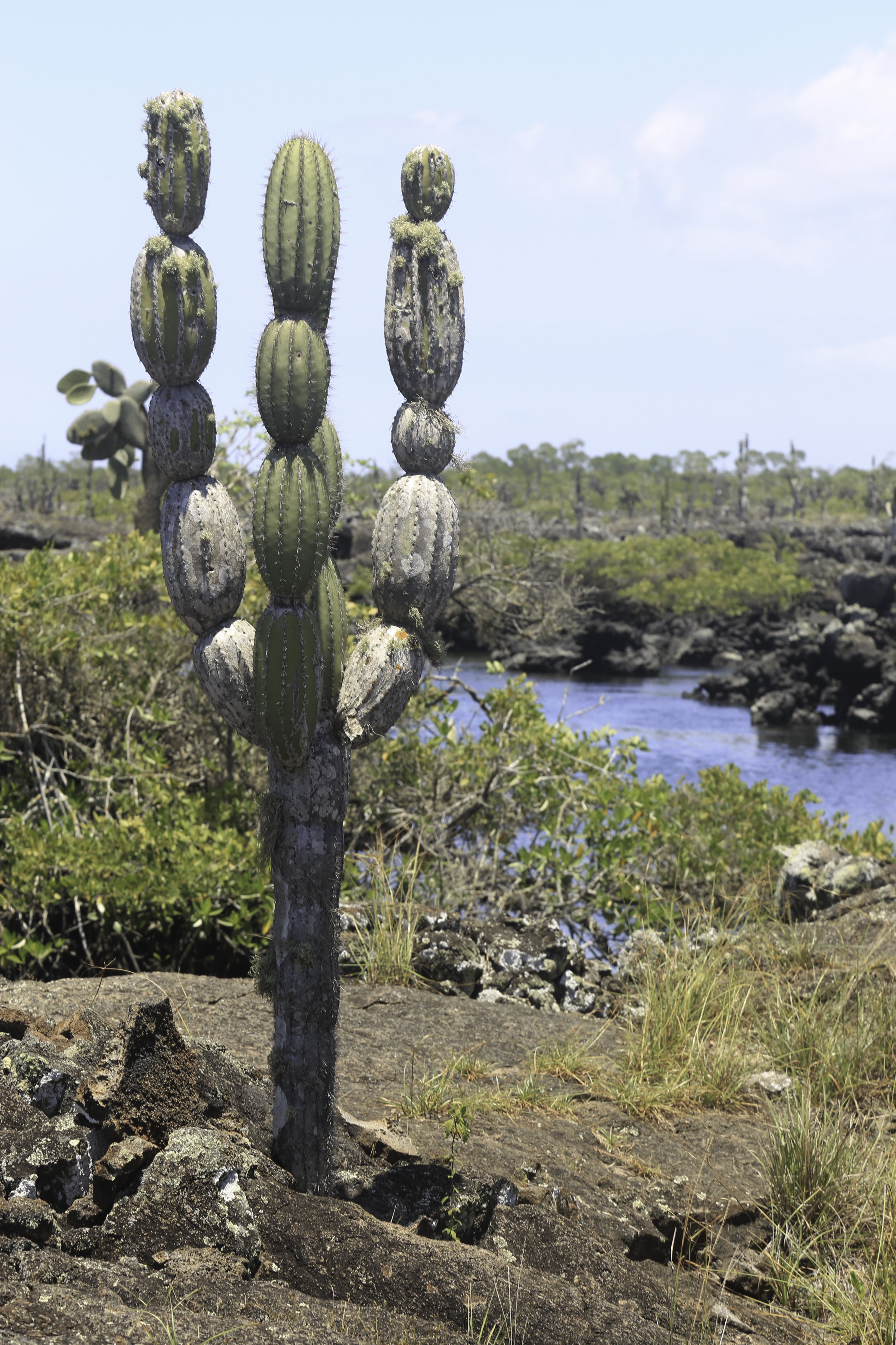
Candelabra-cactus
Candelabra Cactus. The flowers of this plant provide food for a species of Galapagos finches.
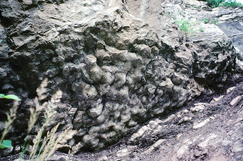
Load structures
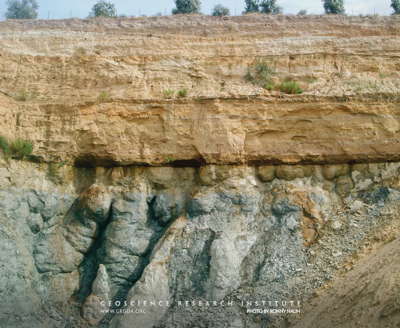
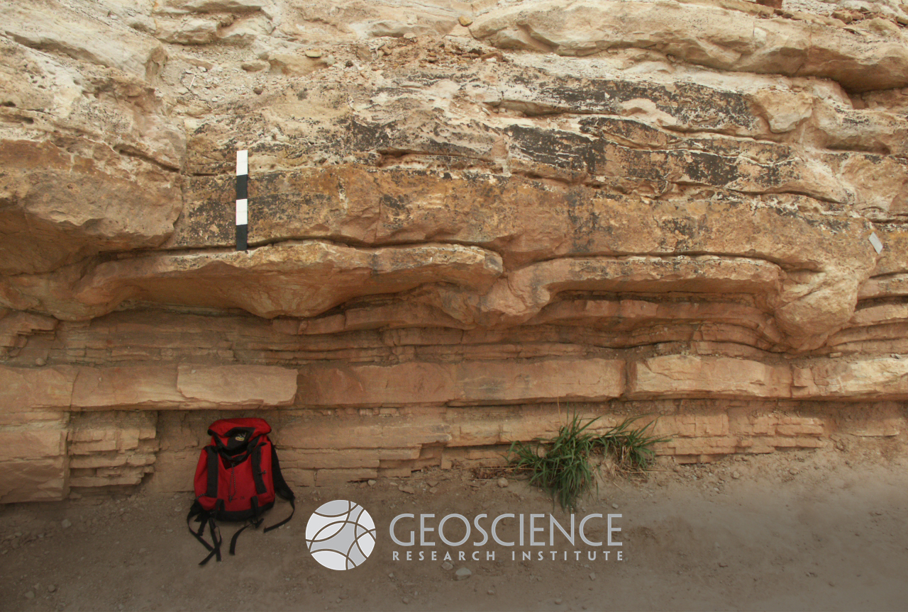
When sediment is still unconsolidated, it can deform under sudden solicitation (e.g., seismic shocks or load by additional sediment). Water expelled from intergranular pores can generate distinctive soft sediment deformation structures, known as ball-and-pillow structures or load structures, typically found at the contact between sandstone and mudstone beds.
Opuntia
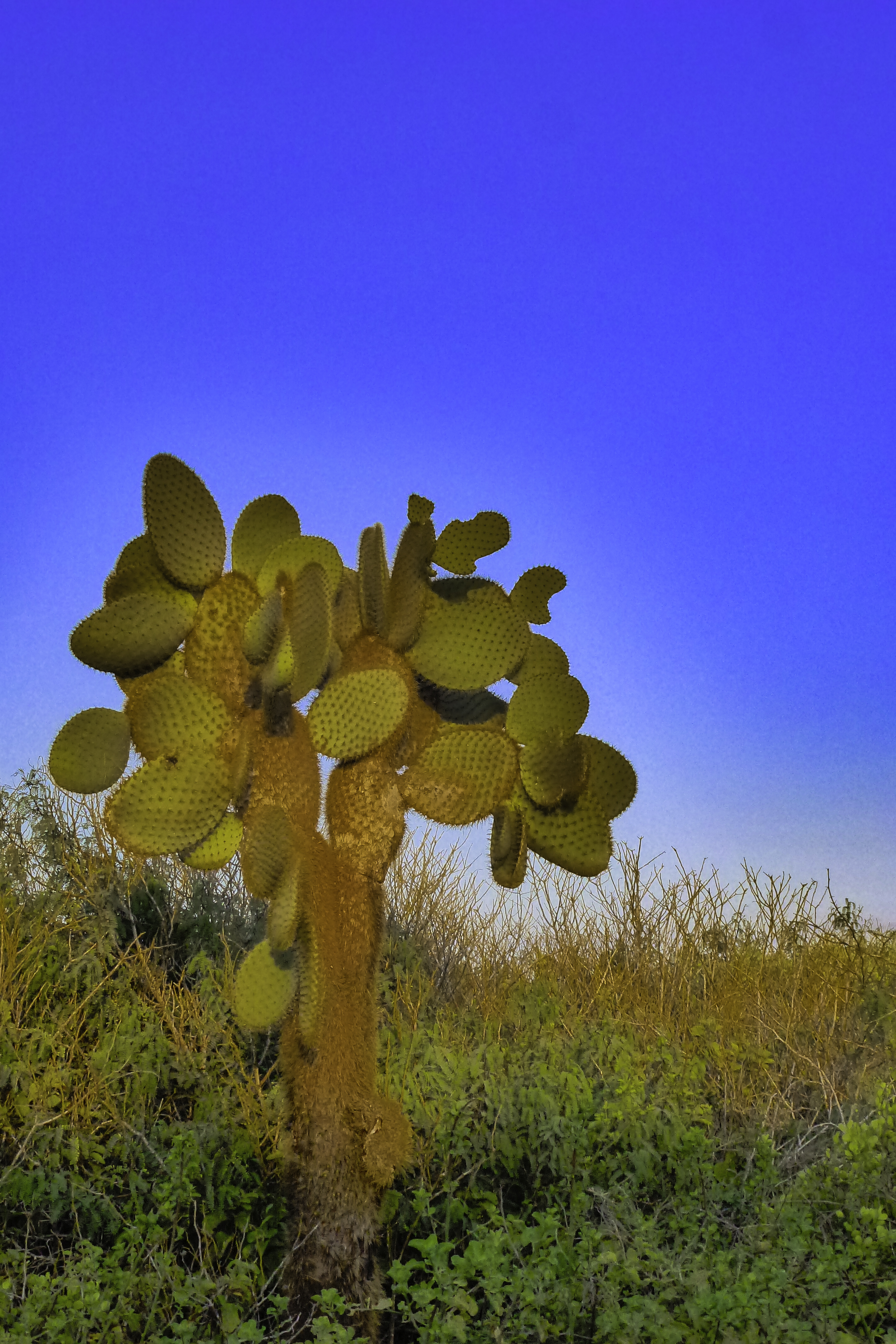
Opuntia Cactus: Opuntia is a genus that includes 200 species of cacti, all with broad, flat leaves. Of those species, only six grow in the Galapagos: Opuntia echios, Opuntia galapageia, Opuntia helleri, Opuntia insularis, Opuntia saxicola, Opuntia megasperma.
Channel
In sedimentology, a channel is a lensoidal architectural element with a concave erosional base.
Rt82 GypsumFolding
SEDIMENTARY - CHEMICAL: Pennsylvanian Eagle Valley evaporites, Rt.82 south of Glenwood Springs --- Gypsum is assumed to have formed in a hot, arid climate by evaporation of sea water in a closed basin causing the precipitation of calcium sulfate. After burial, this soft rock easily flows forming the chevron fold seen in this picture.
Lava
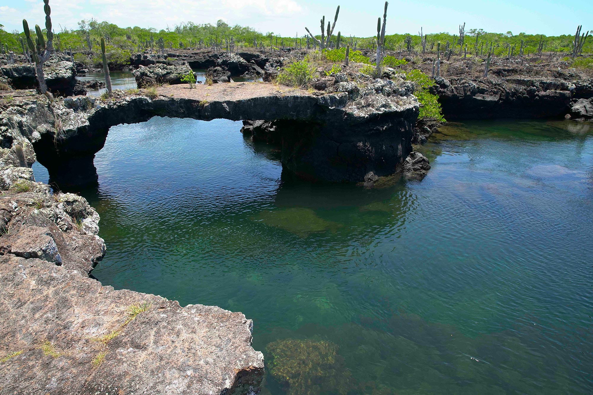
Lava tunnel on Isabela Island. As lava flows, it can form lava tunnels up to several kilometers long. The surface of the lava cools rapidly and forms a crust that protects the lava that continues to flow beneath. If the lava under the hardened crust eventually drains out, it can leave a hollow tunnel behind.
Epsilon cross-stratification
As meandering rivers move on a floodplain they can generate distinctive cross-stratified deposits related to lateral migration of point bars. The cross-set at the center of the photo is several meters thick.
Cannibalism
Cannibalism exhibited by the fish Dastilbe crandalli, Cretaceous Crato Fm., Brazil. Specimen on display at the Paleontological Museum in Santana do Cariri. Larger fish is about 10 cm in size. Unique environmental conditions are required for such spectacular preservation of fossil fish. This form of cannibalism is also interpreted as indicative of stressful environmental conditions.
Rt34
IGNEOUS - INTRUSIVE: Potassium feldspar, Big Thompson Canyon --- The potassium in this mineral is often used in K-Ar (potassium-argon) radiometric dating.
Volcanic cone
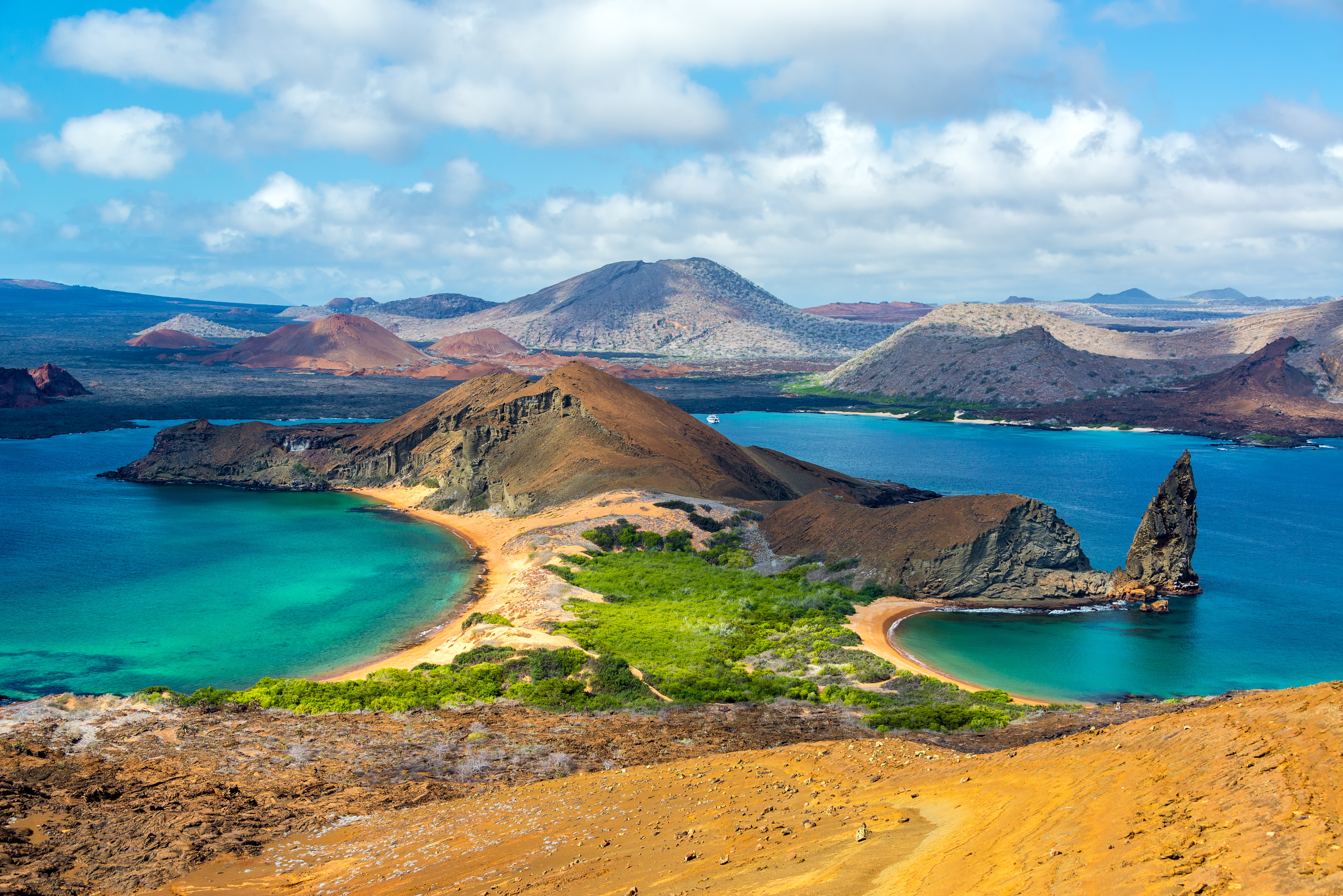
View of Bartolomé Island, where a parasitic cone is observed on the right side of the photograph. Notice the reddish colors from weathering of the volcanic rocks.
Current ripples
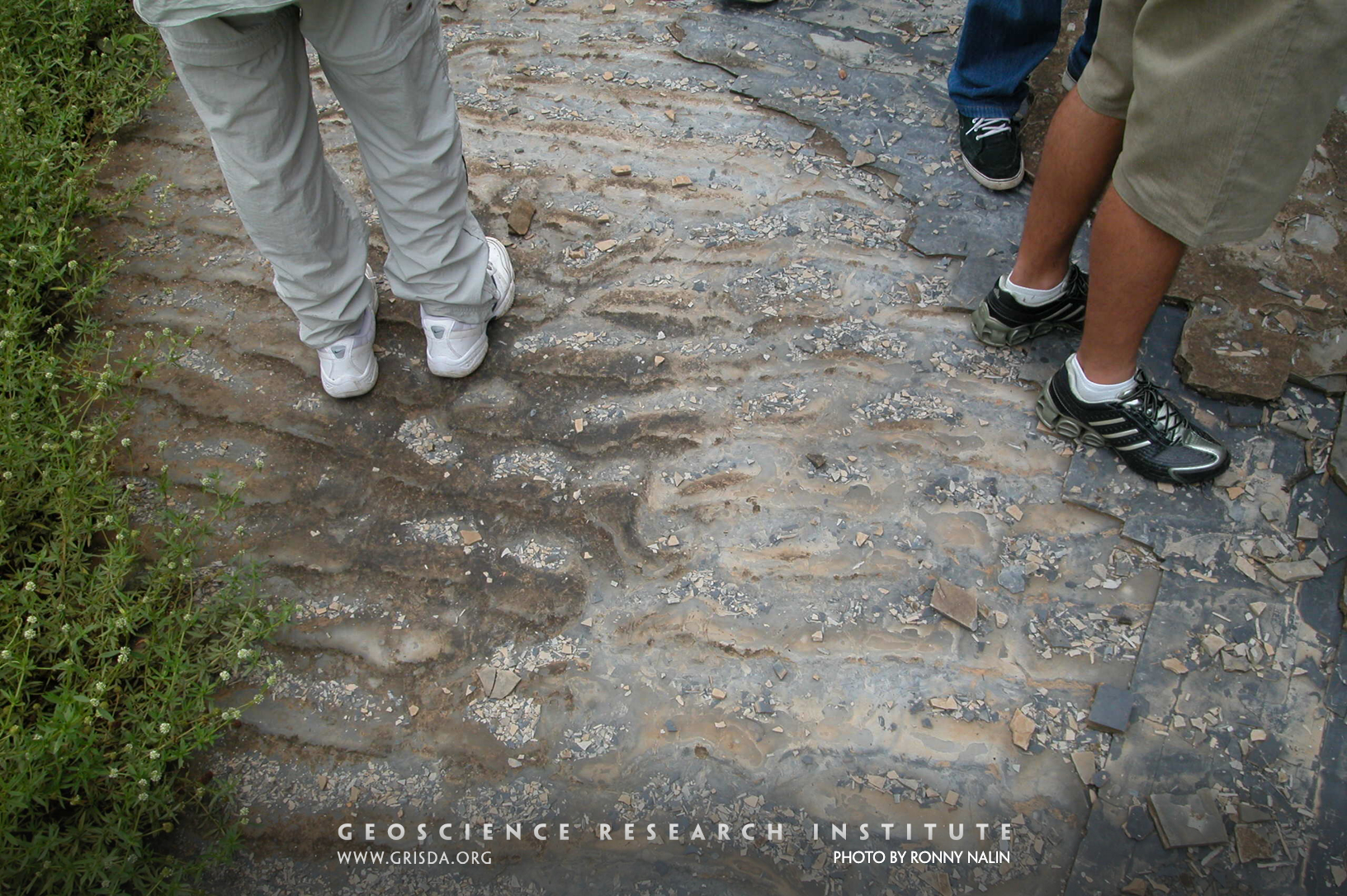
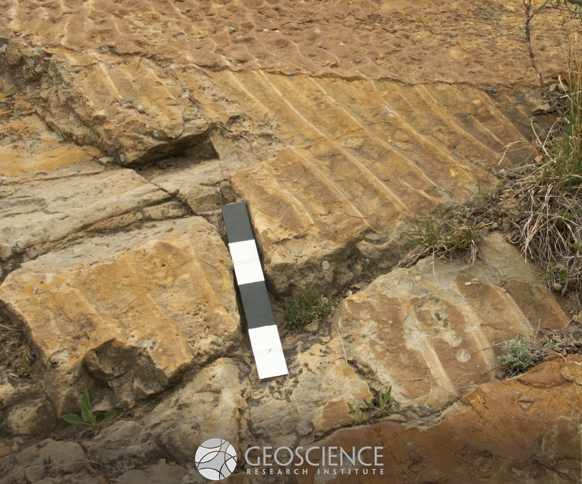
Walking on water? Not really, but these ripples, now petrified, formed under shallow water and are exposed on the floor of a quarry at the Varvito Park, Ito, Brazil. They are part of exposures of Permian sandstone from the Itararé Group. The ripple crests are mostly linear and the profile of the ripple is asymmetric, allowing to reconstruct the direction of flow (towards the viewer).
Dinosaur trackways
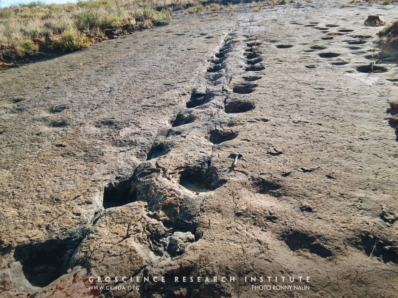
Dinosaur trackways, the main one thought to have been left by an ankylosaurid (hammer for scale). Cretaceous El Molino Fm., Torotoro, Bolivia. Well developed fossil trackways imply a special set of conditions, with sediment wet enough for footprints to remain impressed followed by prompt induration and burial.
Basalt Cliffs
IGNEOUS - EXTRUSIVE: Basalt cliffs, Grand Mesa --- Tertiary basalt flowed down a valley and hardened. Later erosion formed these cliffs where the hard basalt caps the mesa. Grand Mesa is an inverted valley -- what was low has now become high.
Asymmetric ripples
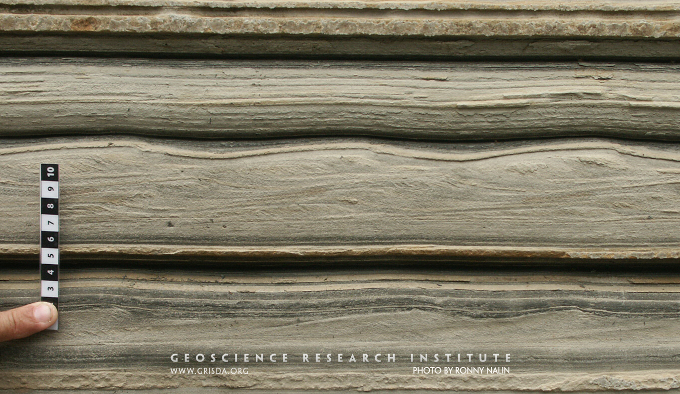
Current ripples are small asymmetric bedforms generated by movement of fine-grained sediment under unidirectional currents. The presence of climbing ripple lamination indicates rapid deposition from a sediment-laden flow. Upward transition from planar lamination to current ripple lamination is indicative of flow deceleration. Sequence of sedimentary structures (cf. Bouma sequence), grain size decrease, and cyclical repetition of bedding points to deposition from turbidity currents. Photo taken at the Varvito Park, Ito, Brazil, with exposures of Permian strata from the Itararé Group. Scale in cm.
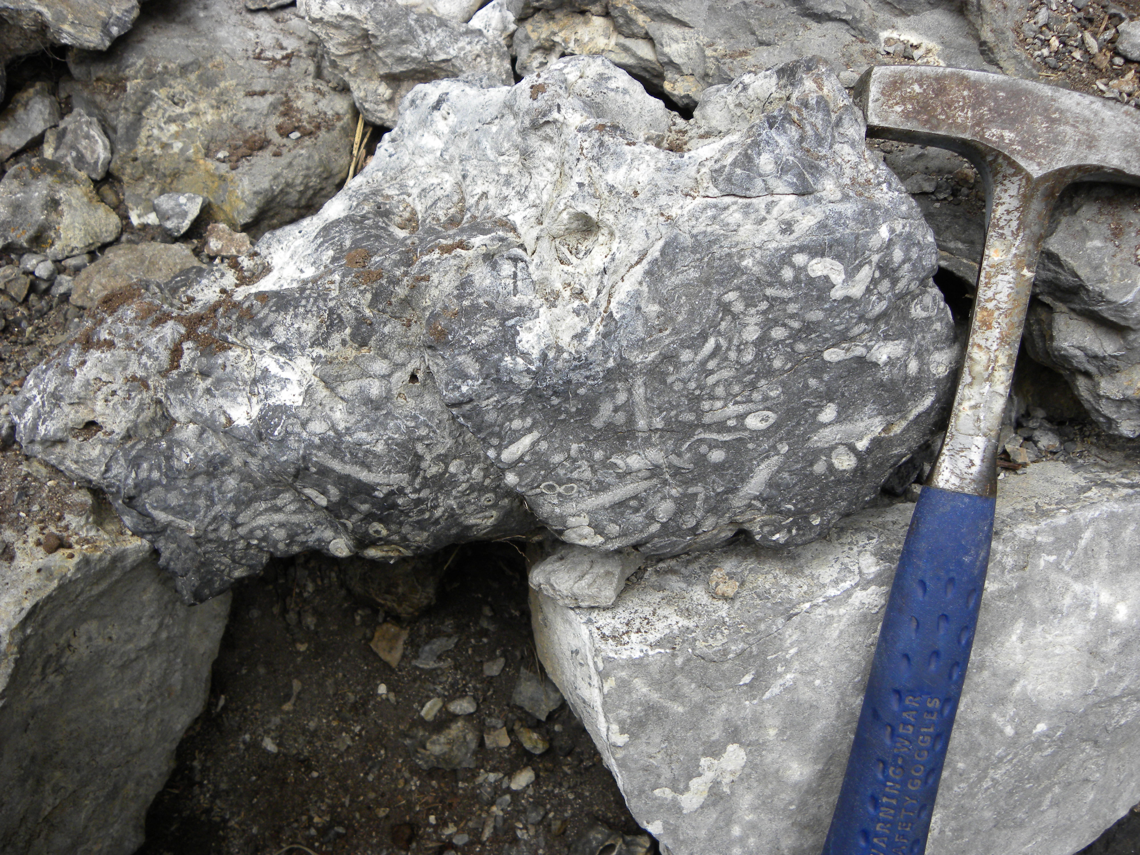
Shellbed
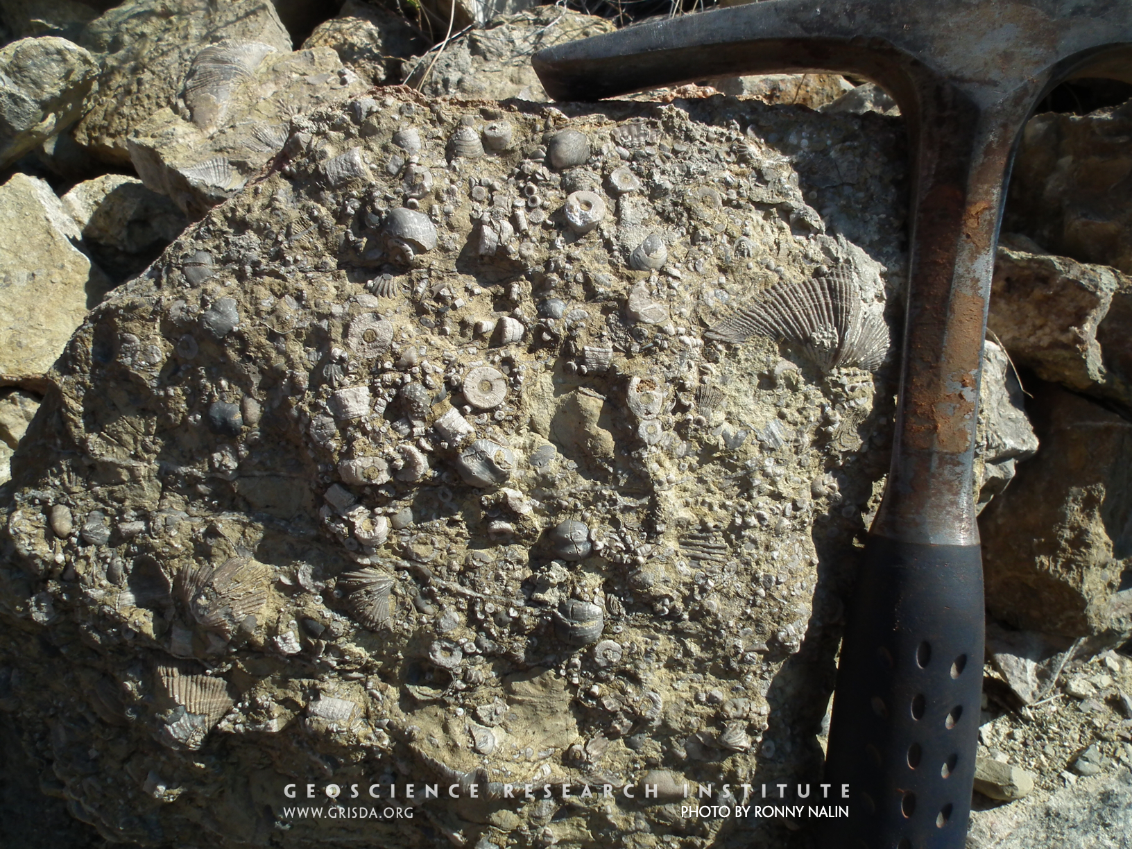
Accumulations of skeletal fragments of marine invertebrates are common in the geologic record and are important for reconstruction of depositional processes. This is a Permian example from the Copacabana Fm. of Bolivia, dominated by brachiopods (including Neospirifer condor) and crinoids.
Rt 34
IGNEOUS - EXTRUSIVE: Volcanic tuff layers, Rt.34 near Grand Lake --- This volcanic ash was deposited in the Tertiary.
Climbing ripples
When a fluid laden with sediment rapidly drops some of its load as it is flowing, a sedimentary structure named "climbing ripple lamination" can form. It is characterized by superimposed ripple crests (or ripple cross-sets) migrating in the direction of flow. Photo taken at the Varvito Park, Ito, Brazil, with exposures of Permian strata from the Itararé Group. Scale in cm.
Bioturbation
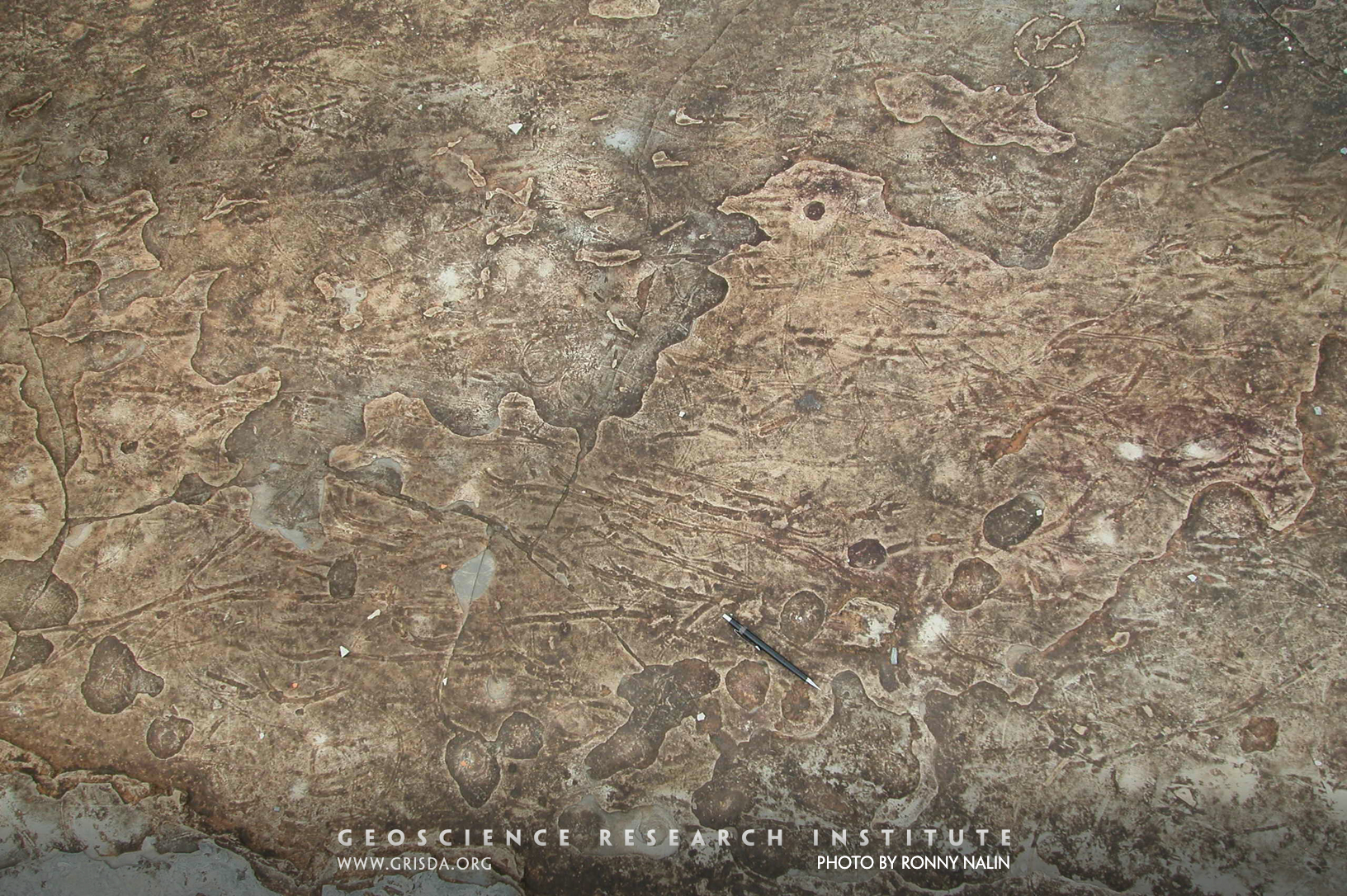
The distinctive linear patterns observed on the surface of this sandstone bed are trace fossils produced by crustaceans as they were moving in the originally loose sediment. The technical term for this type of biogenic structures is bioturbation. Photo taken on a sandstone slab at the Varvito Park, Ito, Brazil, with exposures of Permian strata from the Itararé Group.
White Ranch Andalusite
METAMORPHIC: Andalusite crystals, White Ranch Park, northwest of Golden --- These large metamorphic crystals (some a foot long) formed deep in the earth under high pressures and temperatures.
Dropstone
Dropstones are outsized rock clasts much larger than the average grain size of the surrounding sediment. Rather than being laterally transported by a flow, they show evidence (in the form of displacement of underlying lamination) of vertical sinking onto the substrate. The dropstone in the picture has a diameter of about 20 cm and is included in turbiditic deposits (Permian Itararé Group, Itu, Brazil).
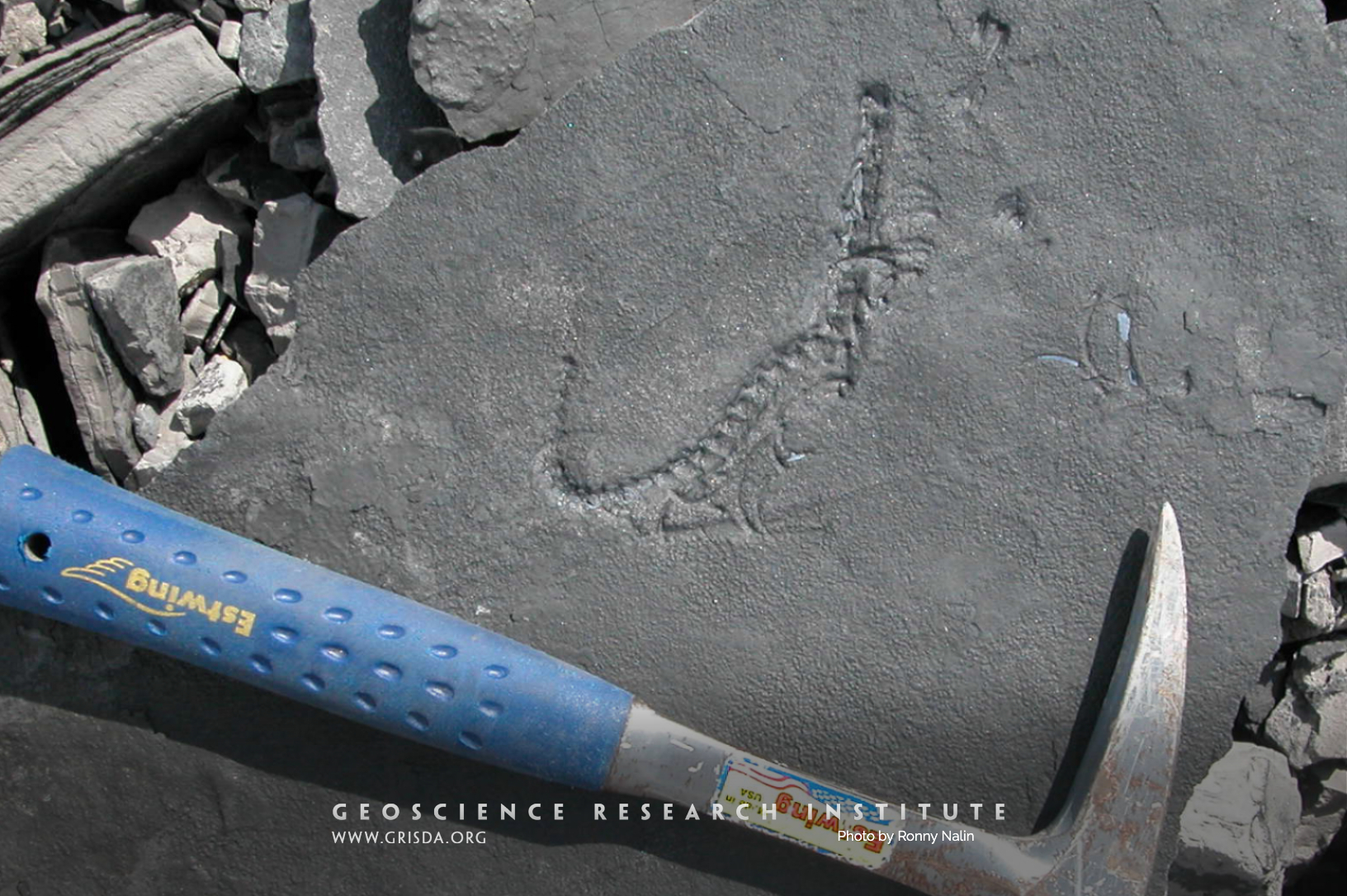
Mesosaurus
Mesosaurus is an extinct, small-sized, Permian marine reptile. It is very important for the history of geology because its disjunct distribution (eastern South America and western Africa) was used to argue in favor of continental drift (an early version of plate tectonics). These impressions of a vertebral column and a few ribs were photographed at the Cruziero Quarry, where strata of the Irati Formation of the Paraná Basin of Brazil are exposed.
Rt 34
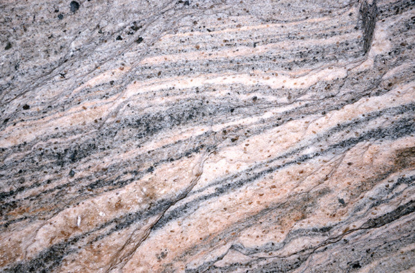
METAMORPHIC: Gneiss, Big Thompson Canyon --- In this high-grade metamorphic rock, the lighter colored layers melted and recrystallized between the darker colored layers.
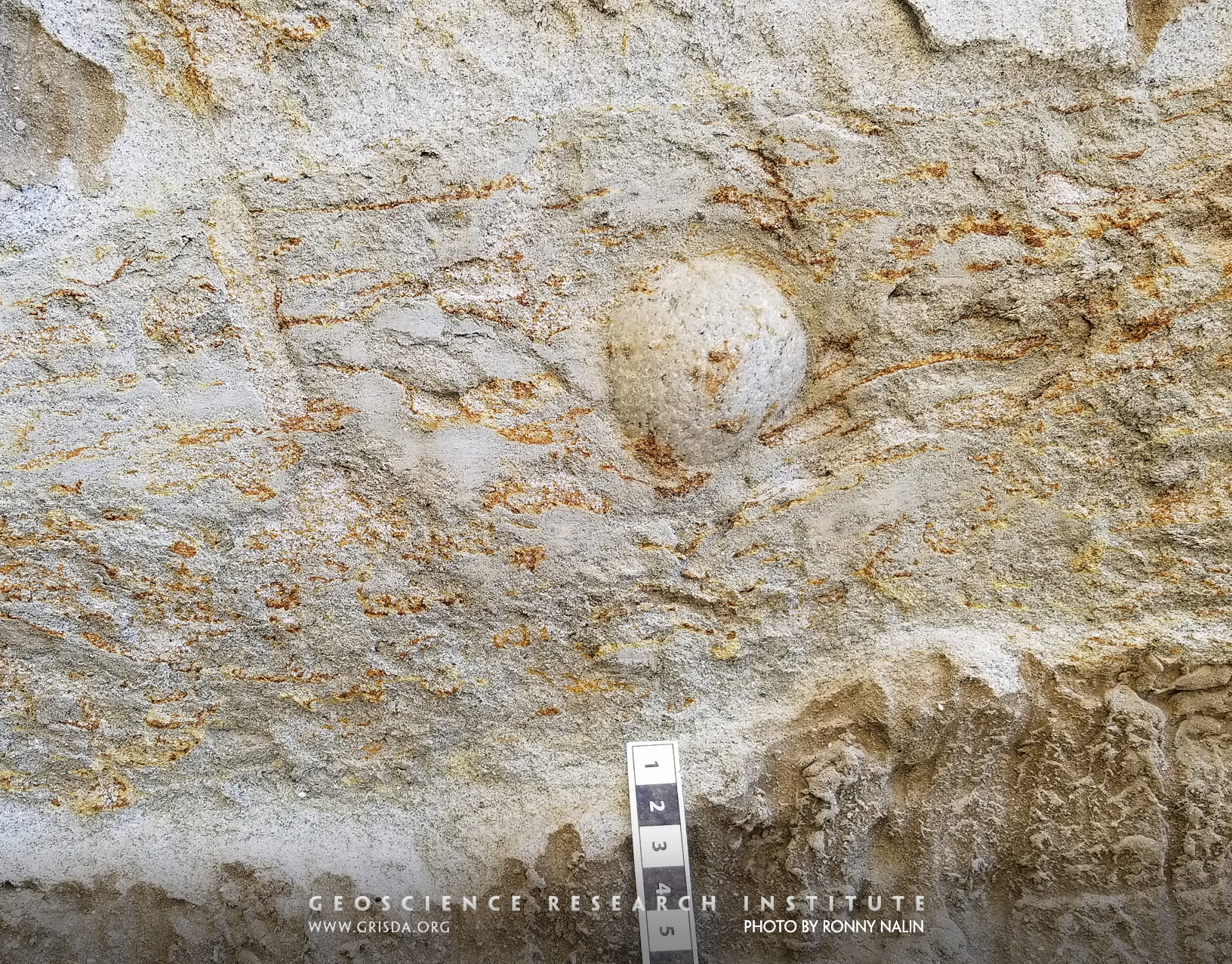
Outsized clast
Outsized clasts are isolated rock fragments encased in much finer sediment and their mode of transport and deposition is therefore puzzling. One way to explain their occurrence is the "dropstone" model (vertical sinking from floating rafts or icebergs). However, gravity flows can also carry outsized clasts in sand-laden waters. This picture shows a well-rounded granitic outsized pebble encased in bioturbated sandy turbidites of a submarine channel complex of the Mio-Pliocene Capistrano Formation (San Clemente State Beach, California). Scale in cm.
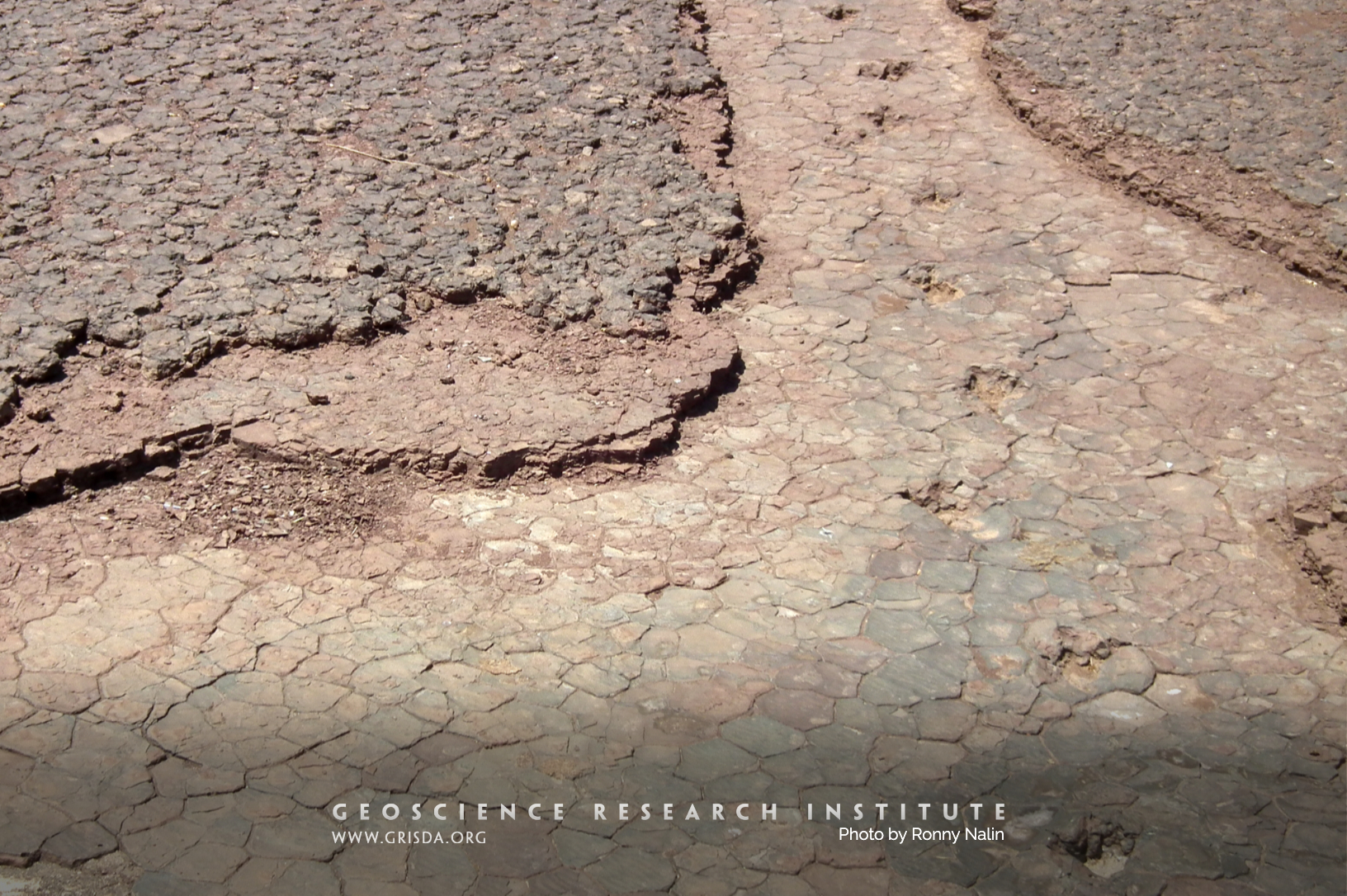
Carnosaur trackway
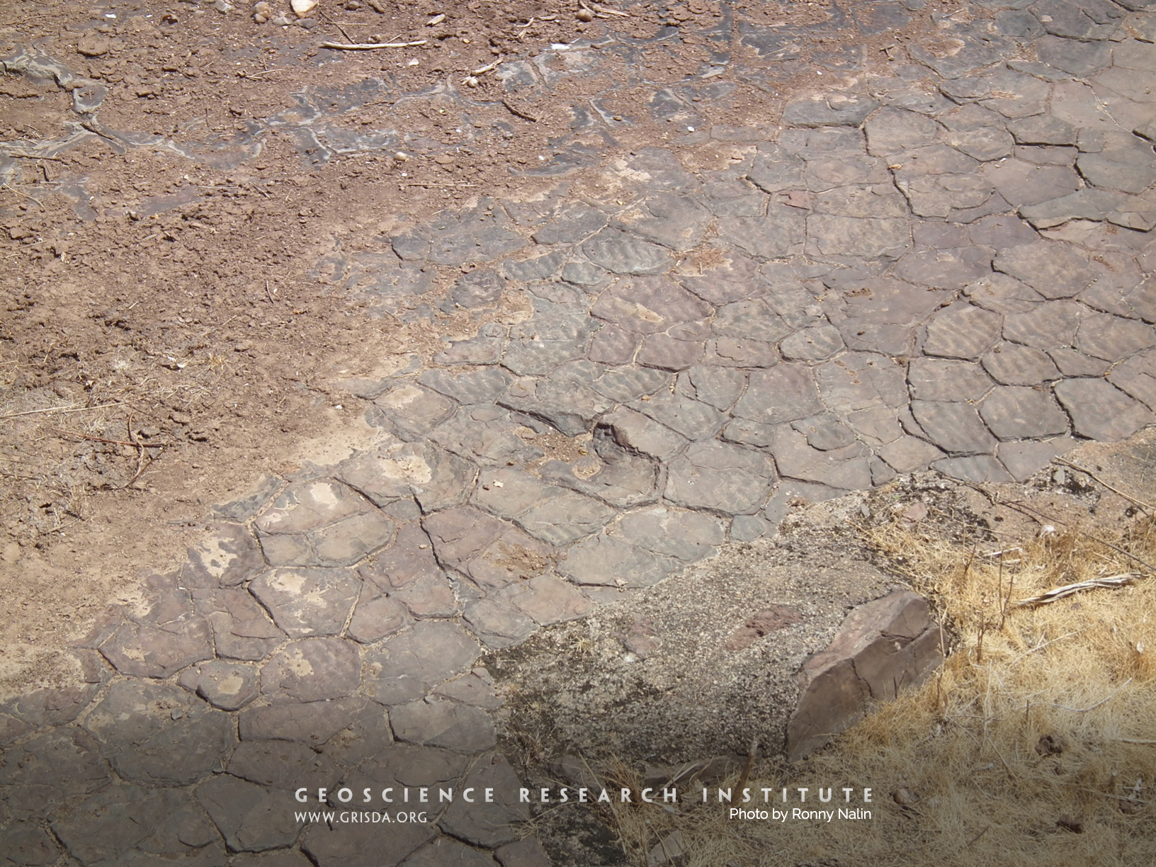
Walking on mudcracks. A dinosaur left this track in muddy sediment that shrank, forming polygons upon desiccation. Trackway exposed in Cretaceous layers from the Sousa Basin of Brazil, at the Vales Dos Dinossauros geosite.
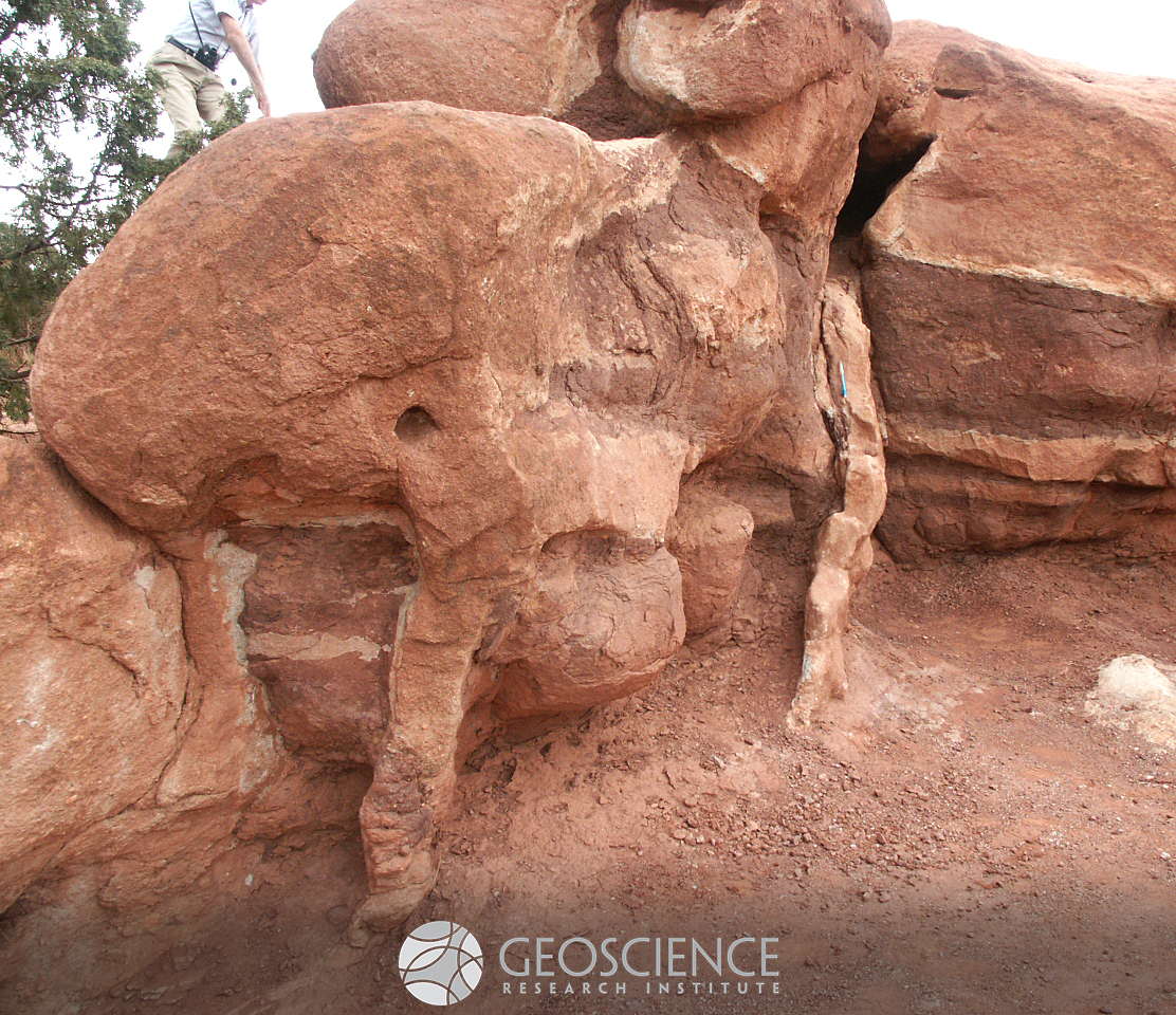
Garden Of Gods Red Lyons
UPLIFTED: Garden of the Gods, Colorado Springs --- Layers of Lyons Formation sandstone were tilted vertically when the Rocky Mountains were uplifted.
Bedrock abrasion
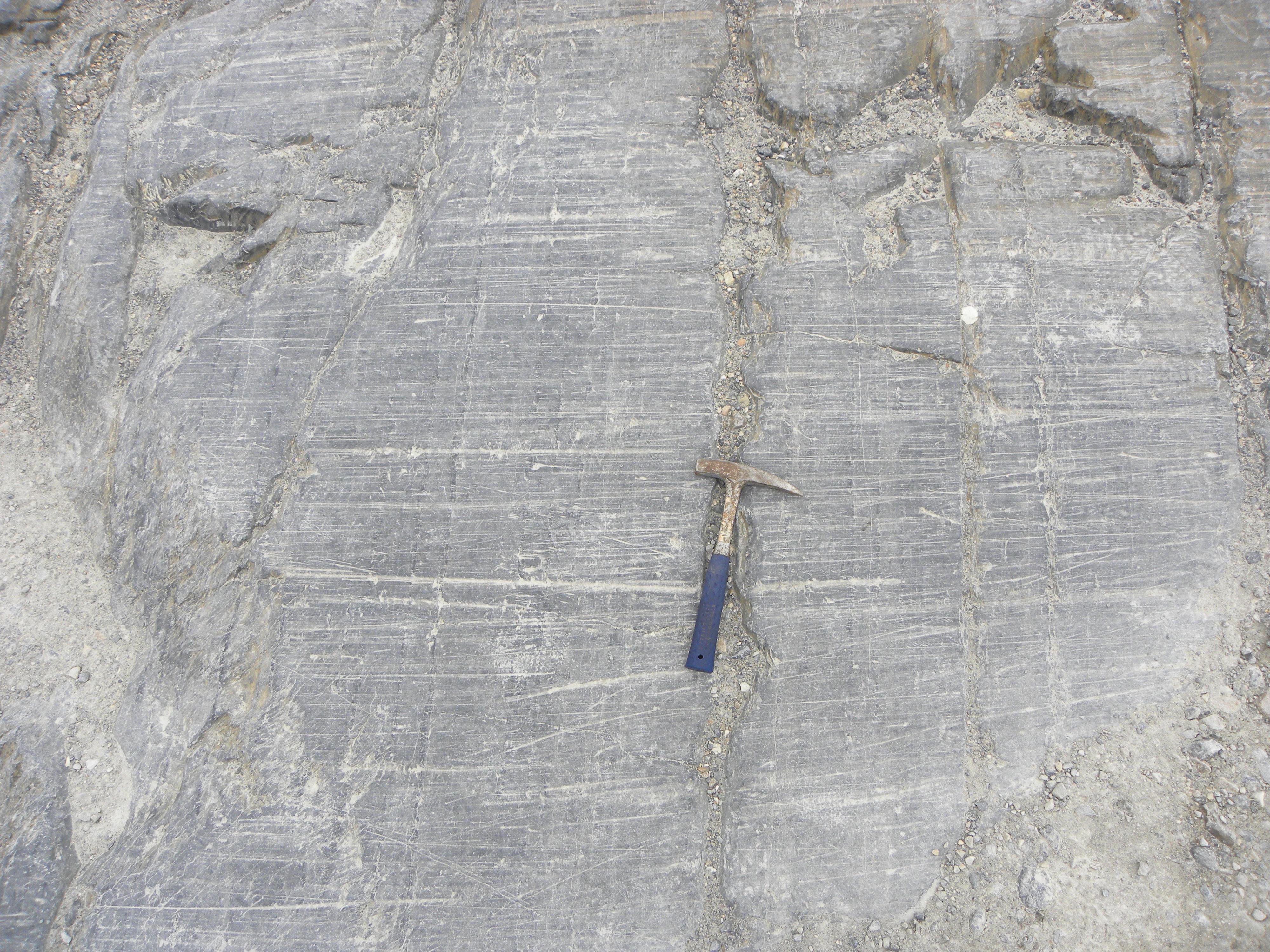
Glaciers can levigate the bedrock over which they flow, smoothing irregularities into a glaciogenic landform called "roche moutonnée." This example from the rock record (Paranà Basin, Brazil) is interpreted as evidence for Permian glacial activity. The bedrock is granitic and it is overlain by patches of diamictite (reddish deposit). Several sedimentary processes can generate bedrock abrasion and a glaciogenic origin for features in the rock record should be presented with caution and based on a combination of multiple lines of evidence.
Mud cracks and ripples
On the surface of this Cretaceous mudstone bed from the Sousa Basin of Brazil, one can see both polygonal cracks (indicative of subaerial exposure) and wave ripples (indicative of a thin cover of water).
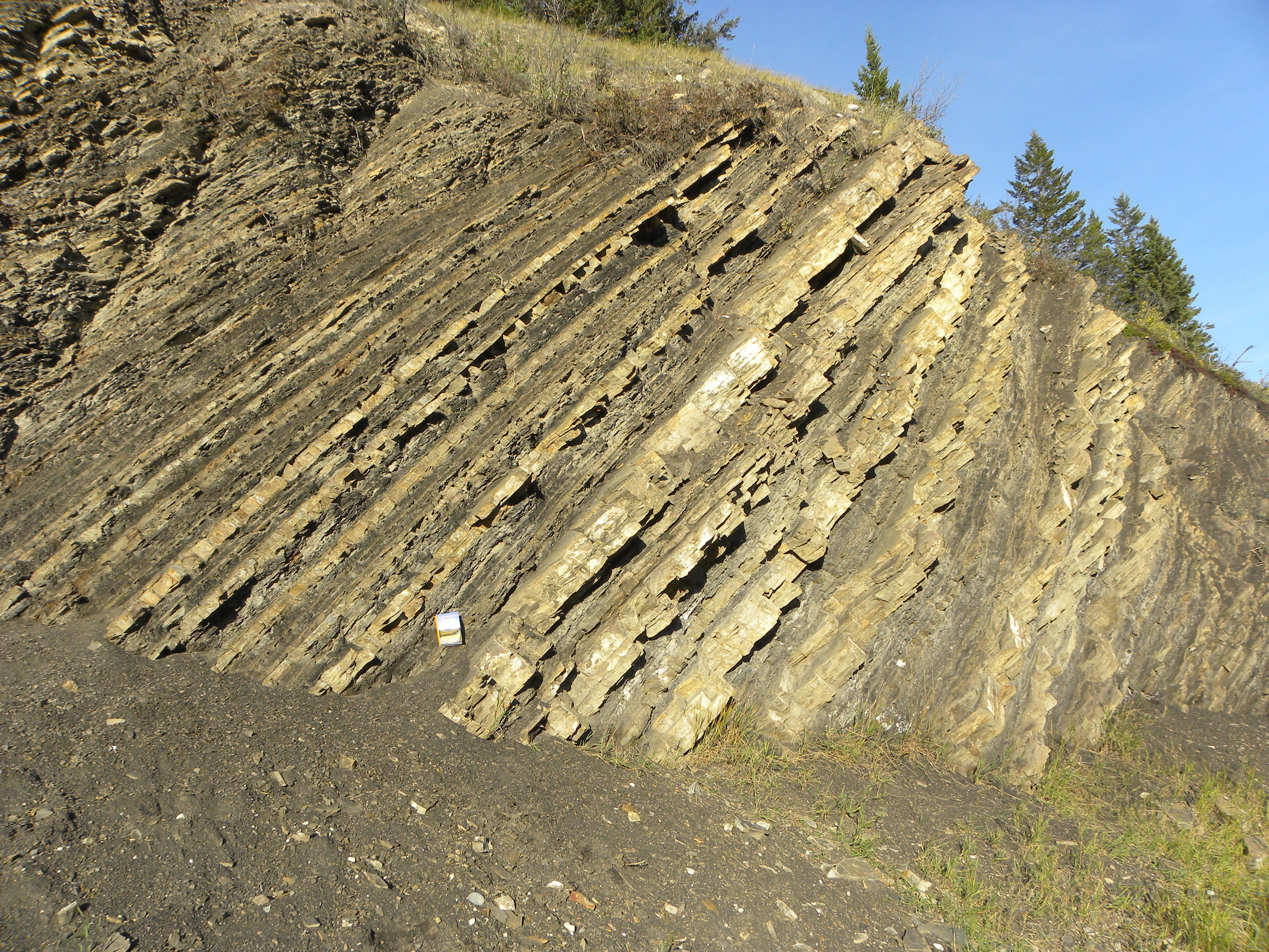
I70RoadCut
UPLIFTED: Interstate-70 roadcut, west Denver --- A thick sequence of rock layers tilted upwards as the Rocky Mountains were uplifted.
Diamictite
Diamicton is the term used to describe a poorly sorted, matrix-supported, clastic deposit with particles of a wide range of sizes. There are many processes that can generate diamicton, but this type of deposit is often associated with the action of glaciers. This photo shows a Permian example of lithified diamicton (diamictite), from the Paranà Basin, Brazil, found above a striated bedrock surface and traditionally interpreted as glaciogenic.
Brachyphyllum obesum
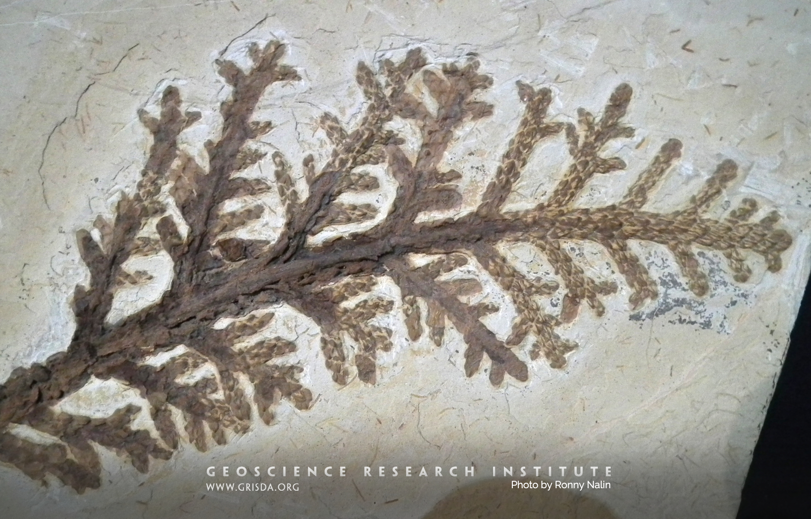
Fossil branches and leaves of an araucarian tree from the Cretaceous of the Crato Basin, Brazil. On display at the Paleontological Museum of Santana do Cariri
Rt 131 Turbidites
UPLIFTED: Turbiditic deposit near McCoy --- Deposition is by underwater mudflows. Vertical layers are due to later uplift of hardened rock.
Cyclical bedding
Cyclical bedding with alternating beds of black shale and dolomite. Permian Irati Fm., Brazil. A thickening-upwards of the beds is distinguishable. High-frequency cycliclity is one of the many patterns can be found in the sedimentary record. Vertical face is about 3 meters high.
Fossil feather
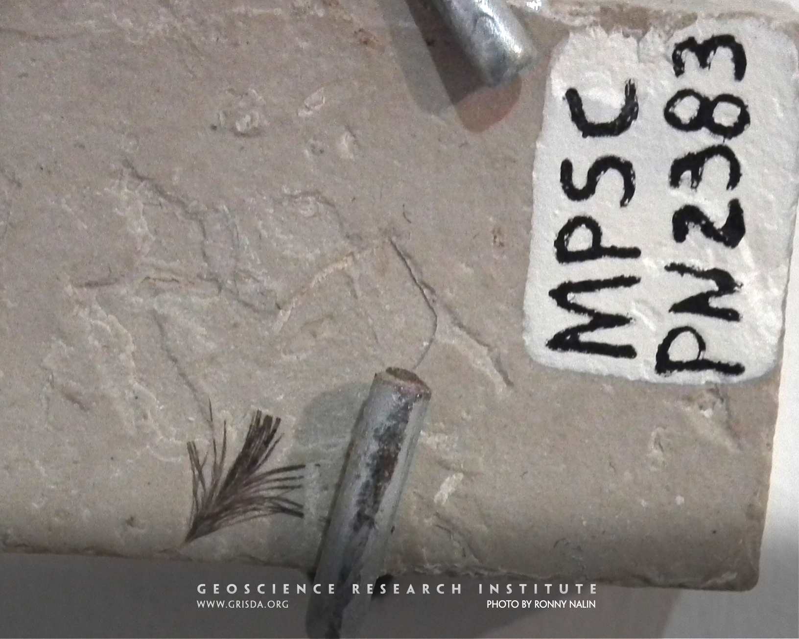
Fossil feather from the Crato Formation, Cretaceous, Brazil. It is possible that this feather belonged to an individual of the bird species Cratoavis cearensis. Specimen on display at the Paleontological Museum of Santana do Cariri
HangingLakeTrailHeadL
PARACONFORMITY: Hanging Lake area, Glenwood Canyon --- An unconformity occurs between the lower Ordovician Manitou Formation and the upper Devonian Chaffee Group. [The Manitou Fm extends left horizontally from the lone tree on the sloping skyline ridge in the middle of the picture. The formation is about twice as thick as the tree is high. The Chaffee Group is about the same thickness and is the next higher layer with many tree growing along the top of it on the skyline.] The 25 million year-long Silurian period is missing between them, although no evidence is found here for major erosion in the lower layer.
Pterosaur
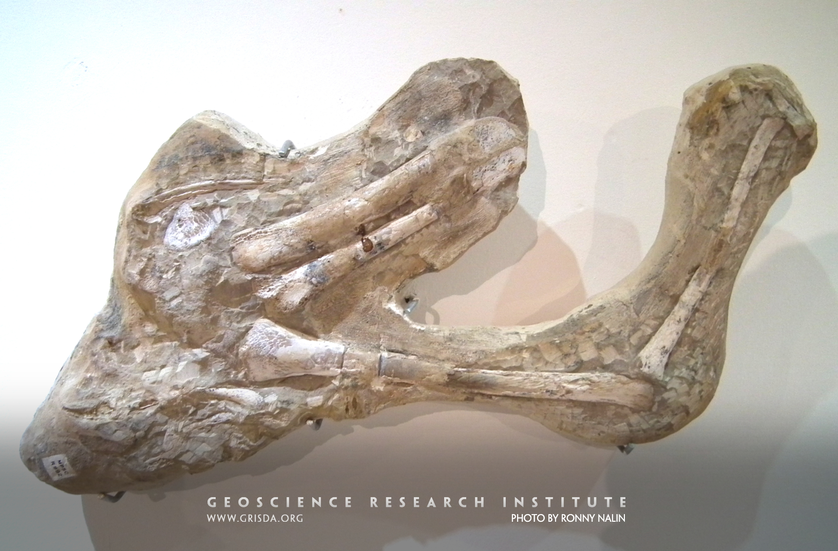
3D preservation of pterosaur bones, in articulation, is extremely rare and requires special conditions for fossilization. This example comes from a concretion within the Cretaceous Romualdo Formation, Brazil. On display at the Paleontological Museum in Santana Do Cariri
Siltation
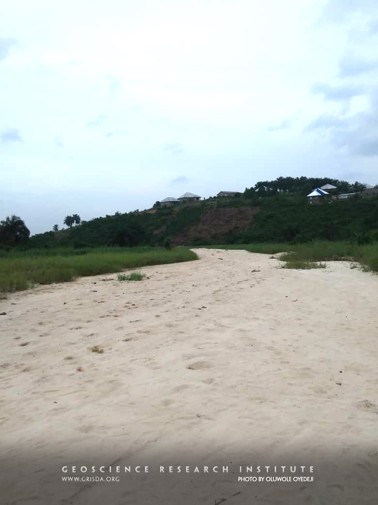
After a flooding event, when waters are carrying much suspended sediment, the bed of a river can suffer siltation, becoming extensively covered by relatively fine-grained particles. This picture shows an example of this process from southern Nigeria.
Trail06WtoRiver
PARACONFORMITY: Whirlpool Canyon, Dinosaur N.M. --- The Mississippian Madison Limestone forms the cliff about a third of the way up the canyon walls to the right of the Green River. Below it is the Cambrian Lodore Formation. In between the Ordovician, Silurian, and Devonian Periods are missing. The resulting unconformity is barely discernible although it represents a break of possibly 155 million years.
Nevados de Chillan
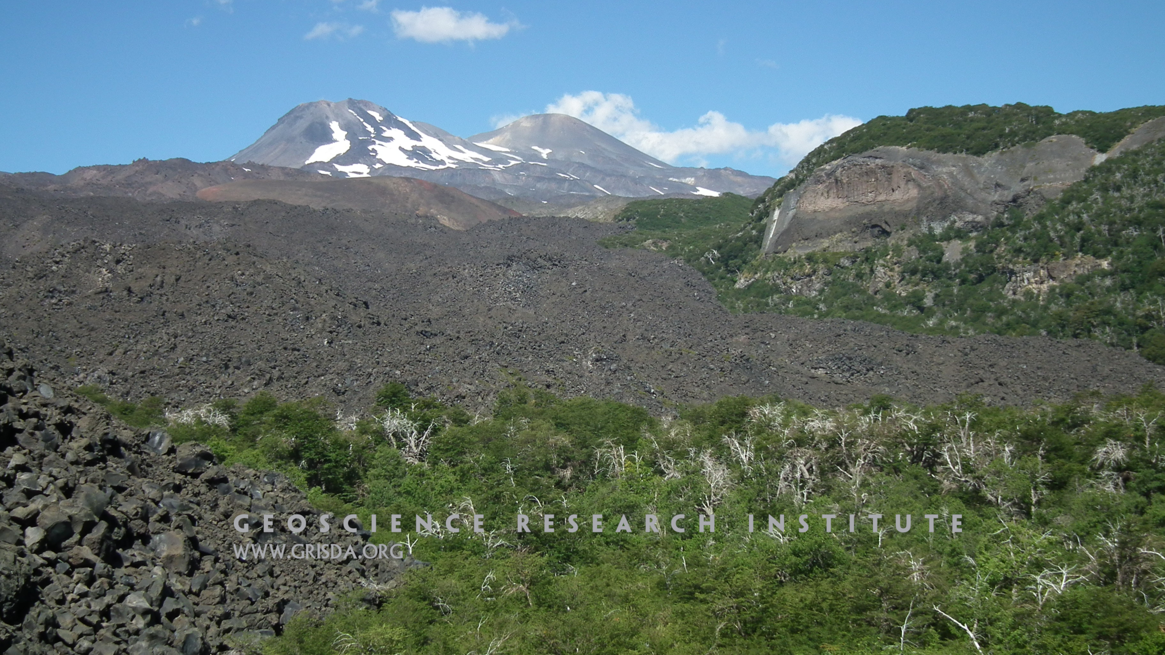
Basaltic rubble at the front of a lava flow with the stratovolcanoes of the Nevados de Chillan, Chile, in the background.
Araripemys barretoi
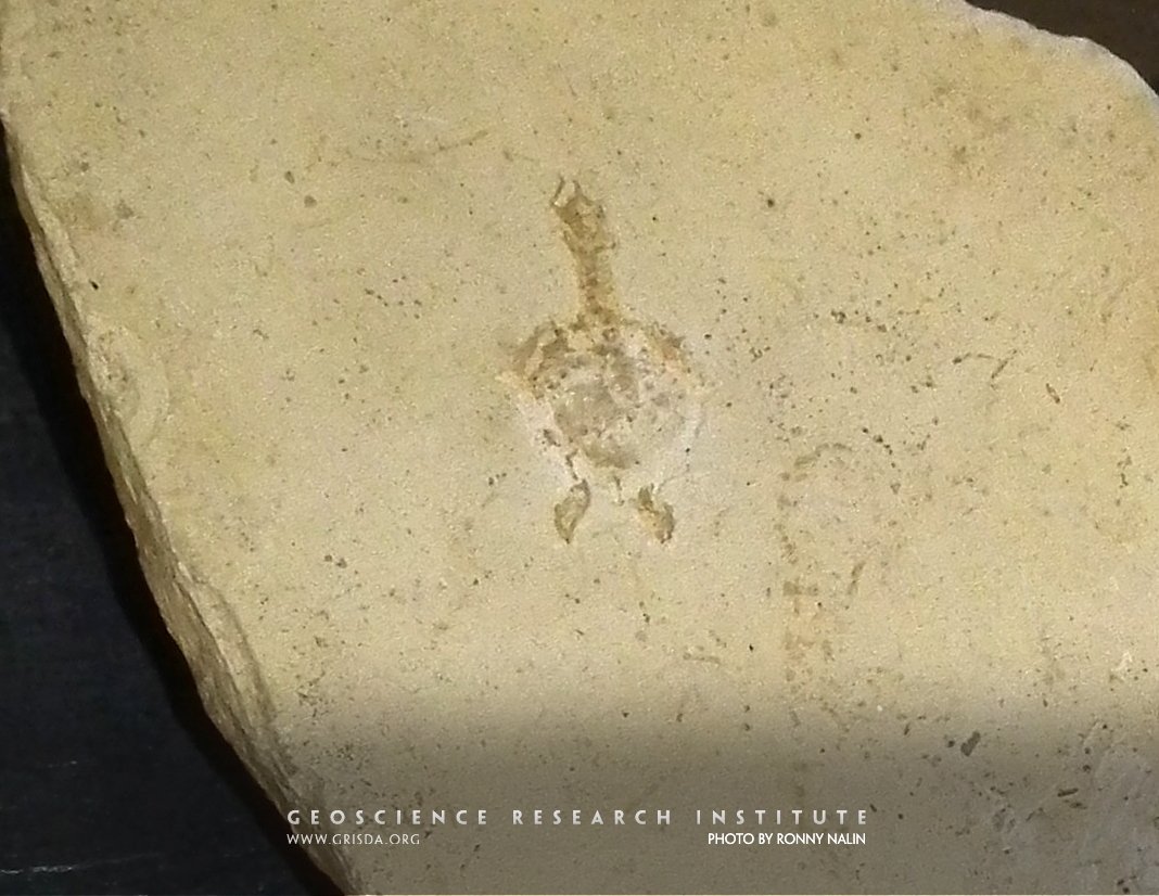
Fossilized hatchling of a Cretaceous pleurodiran turtle from the Araripe Basin, Brazil. Specimen on display at the Paleontological Museum in Santana do Cariri, few cm in size.
AngularUnconformity
ANGULAR UNCONFORMITY: Along Interstate-70, New Castle --- Rock layers were deposited, hardened, uplifted at an angle, eroded flat, and then more rock was deposited on top.
Pallasite
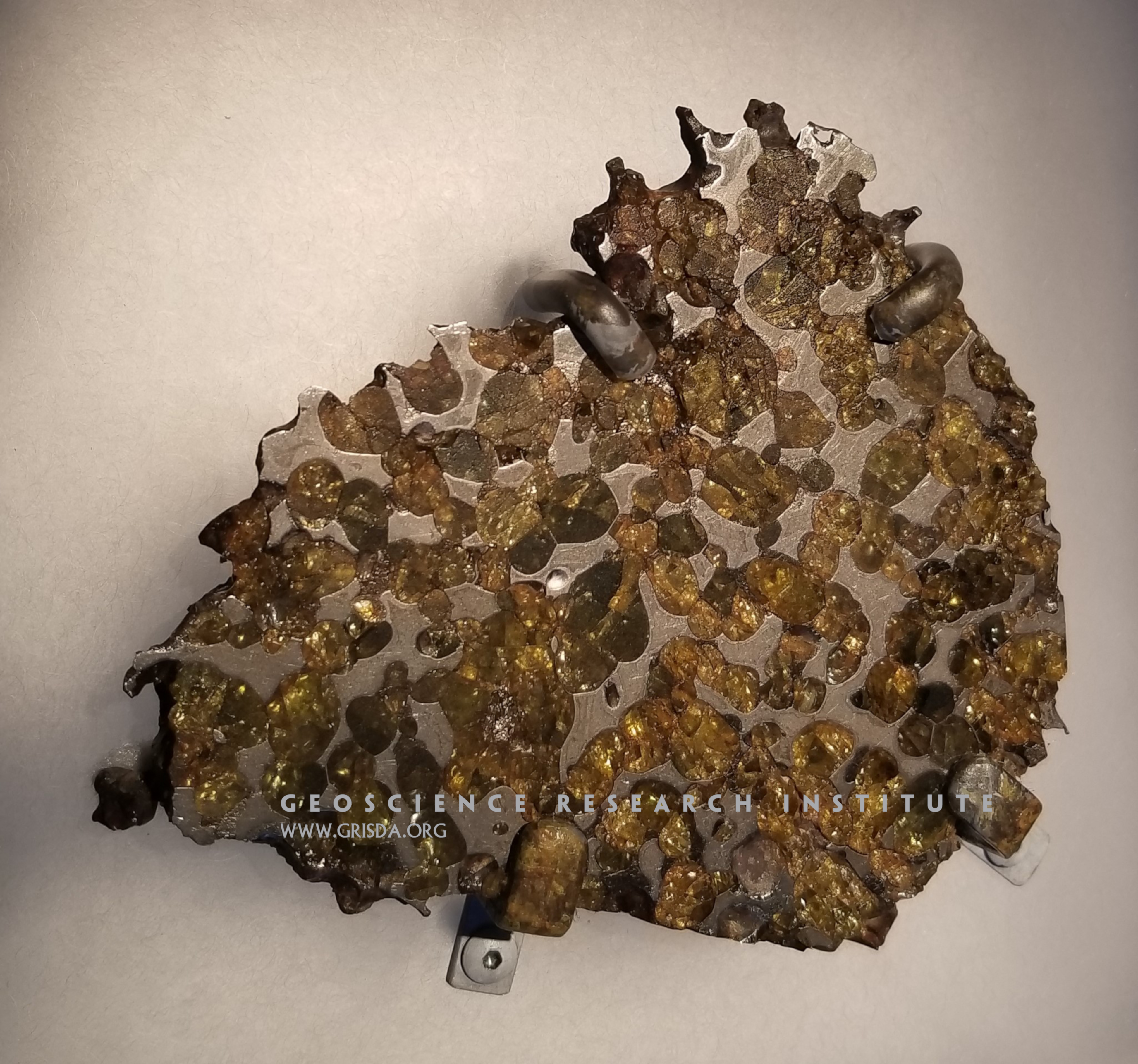
Meteorites are fragments of solid material coming from space, found on earth after surviving passage through the atmosphere. There are two general categories of meteorites: stony meteorites and iron meteorites. However, stony-iron meteorites also exist. For example, the meteorite in this image shows olivine (a silicate mineral) embedded in an iron-nickel matrix. This type of meteorite (known as pallasite) was found in the Thiel Mountains of Antarctica. Specimen on display at the Chicago Field Museum of Natural History.
Hyracotherium
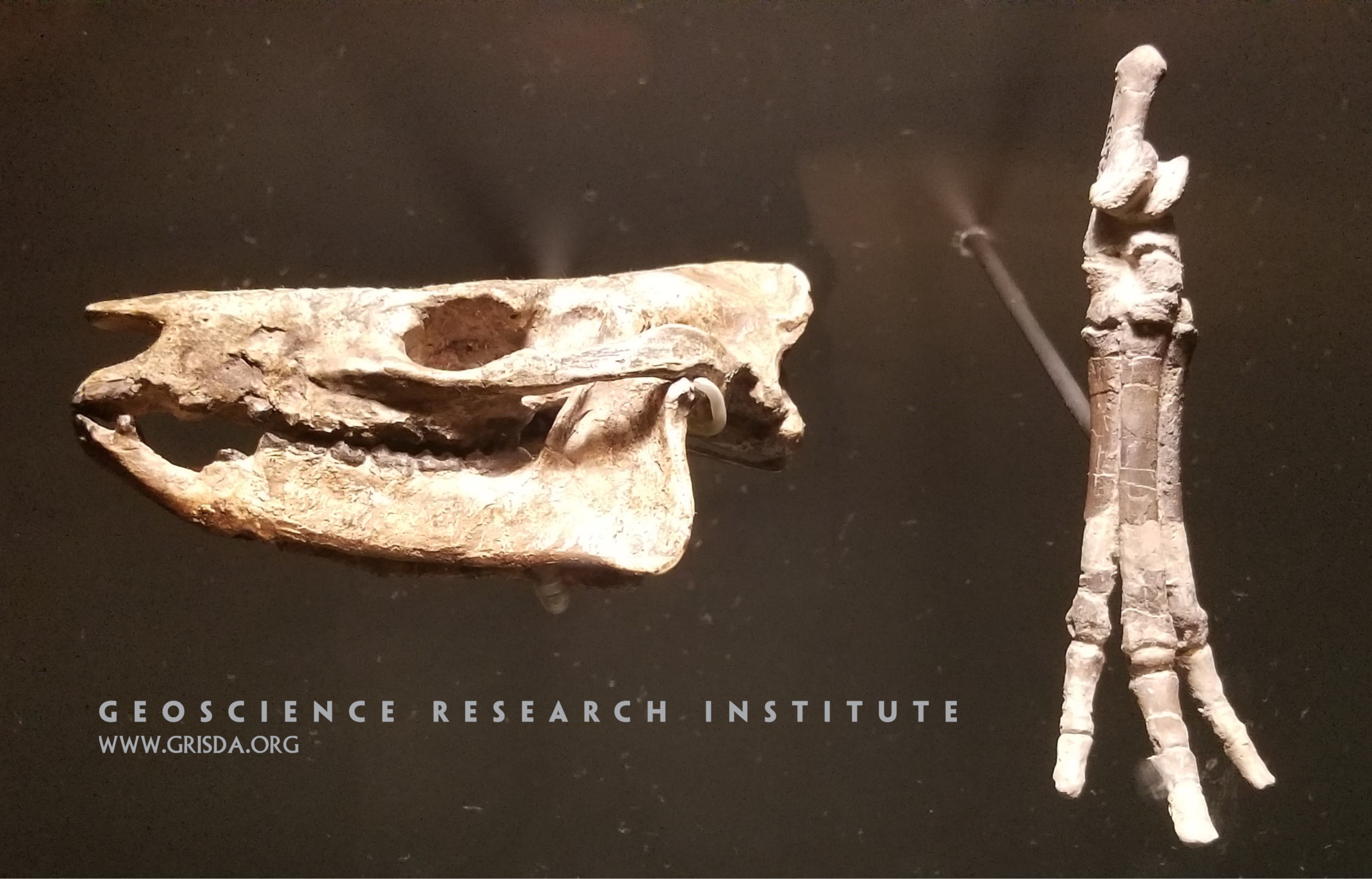
Skull and foot of Hyracotherium, a small horse with 3 hooves on its hind feet. Specimens from the Paleocene of Colorado, on display at the Field Museum of Natural History, Chicago.
El Peñón de Guatapé
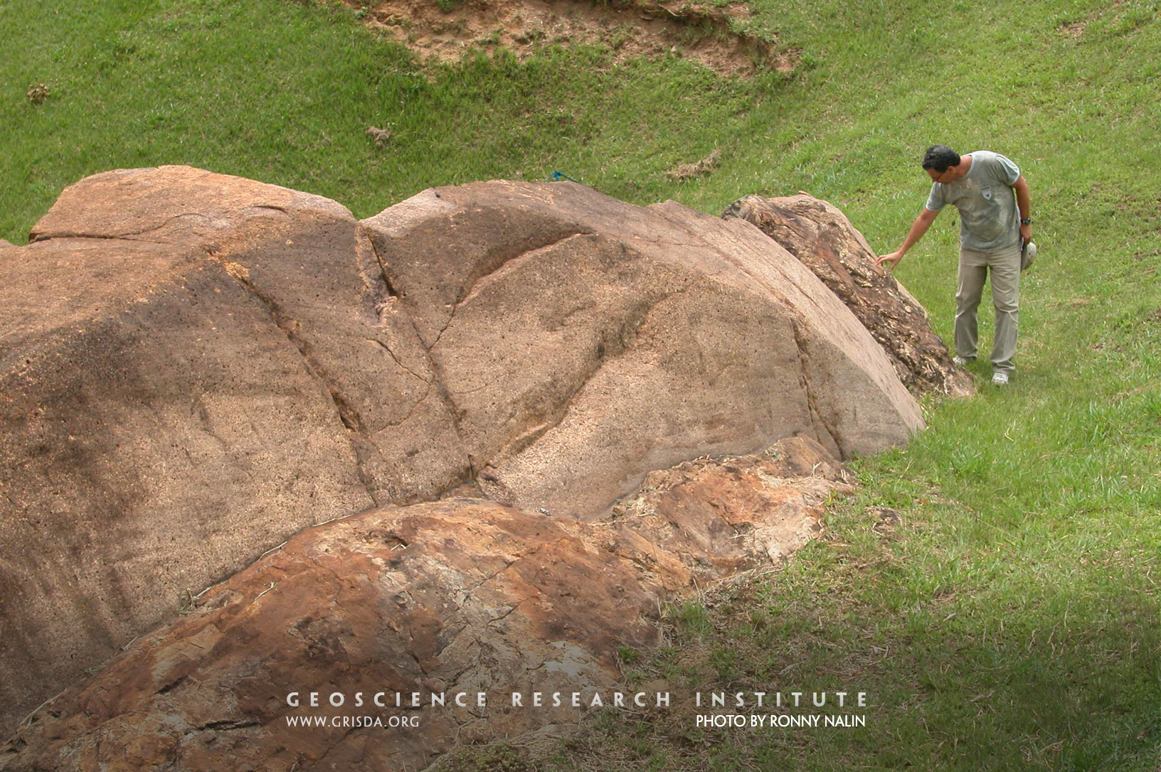
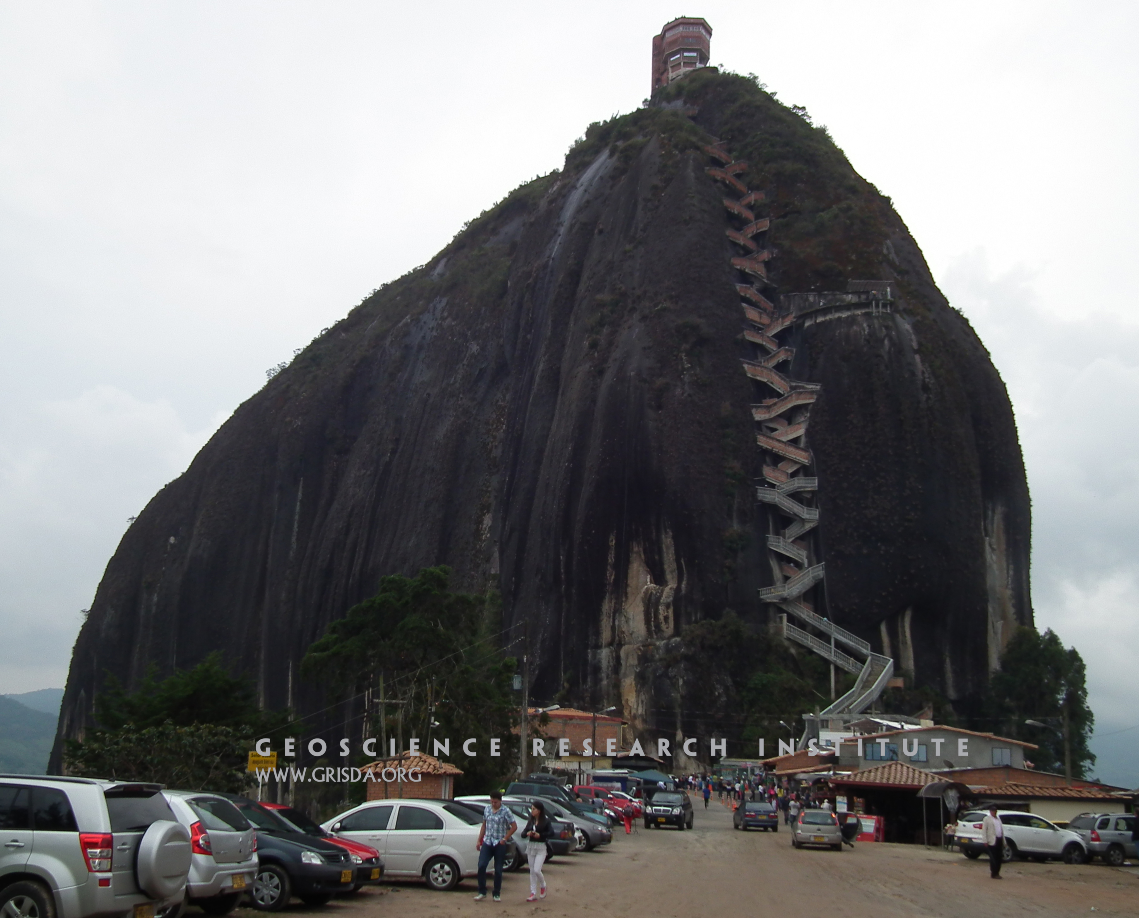
El Peñón de Guatapé is a granitic monolith that rises about 200 m above the surrounding landscape, in the Antioquia region of NW Colombia. These isolated landforms are also known as "inselbergs" and are typical of granitic rocks in tropical regions.
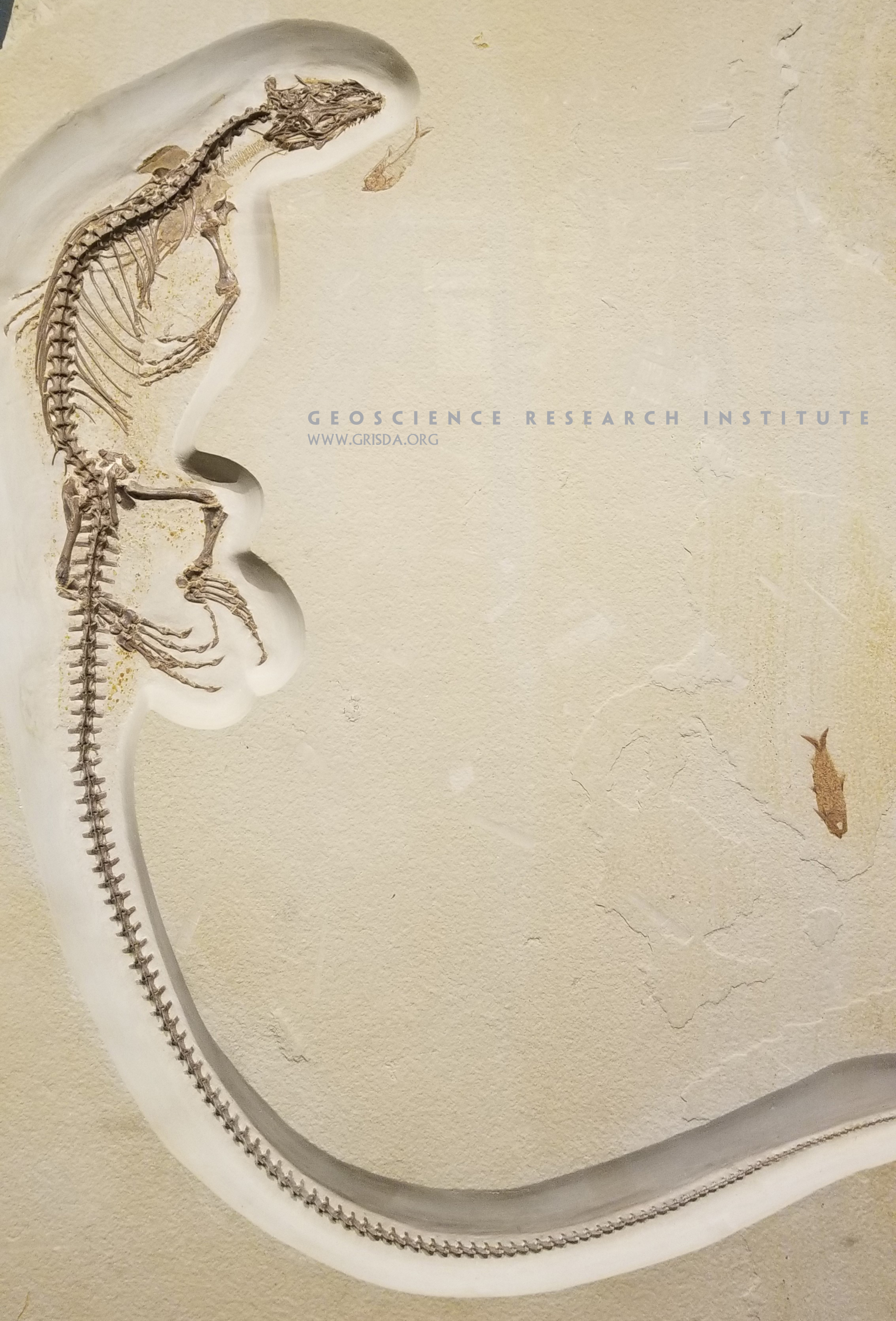
Lizard and fish
This iguanid lizard, on display at the Field Museum of Natural History, Chicago, is perfectly preserved in full articulation. Minimal decay after death is necessary for this type of fossilization. Specimen from the Eocene of Fossil Lake Basin, Wyoming. Note the close association with some fossil fish also perfectly preserved.
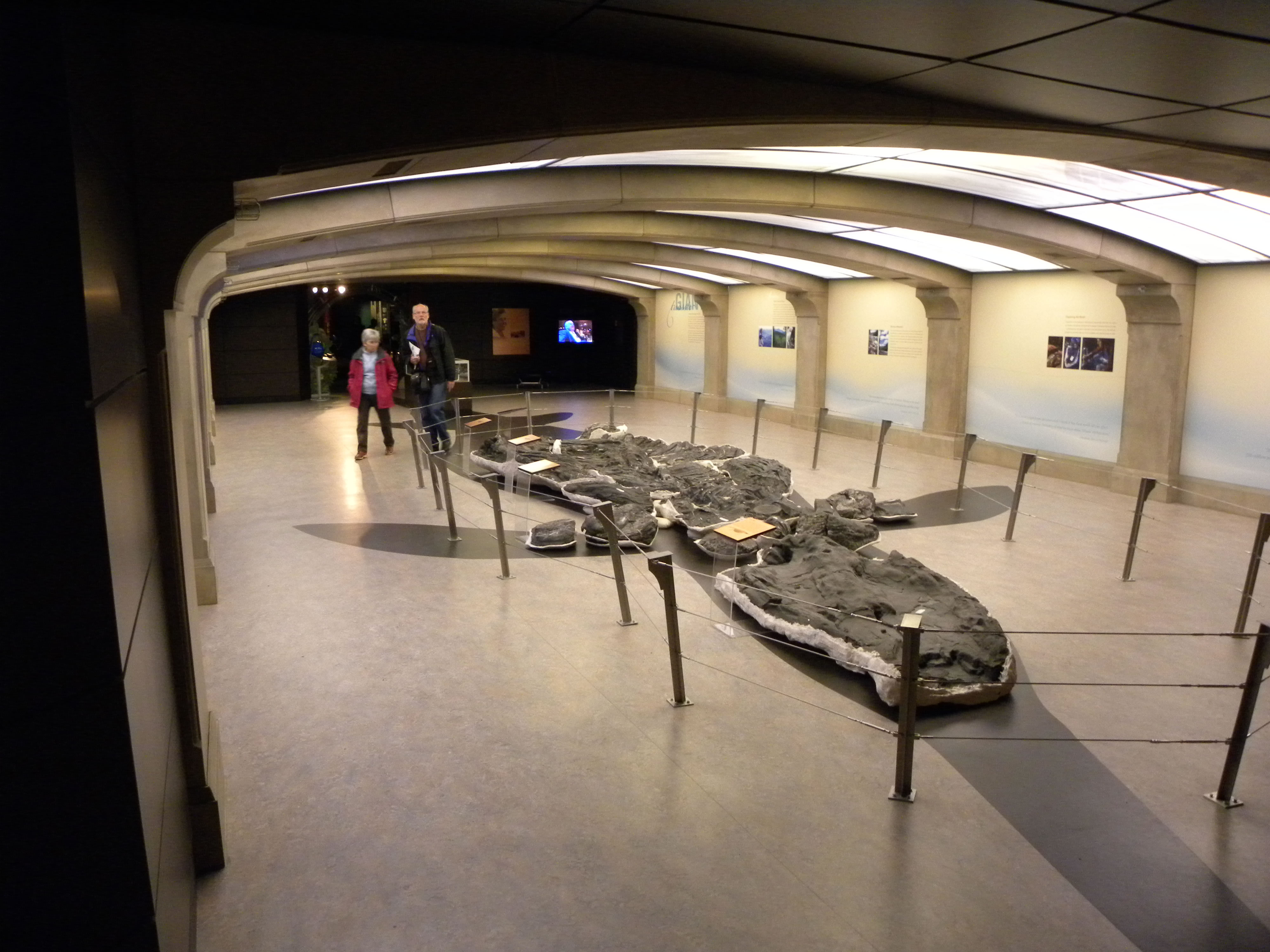
Tyrrell Museum
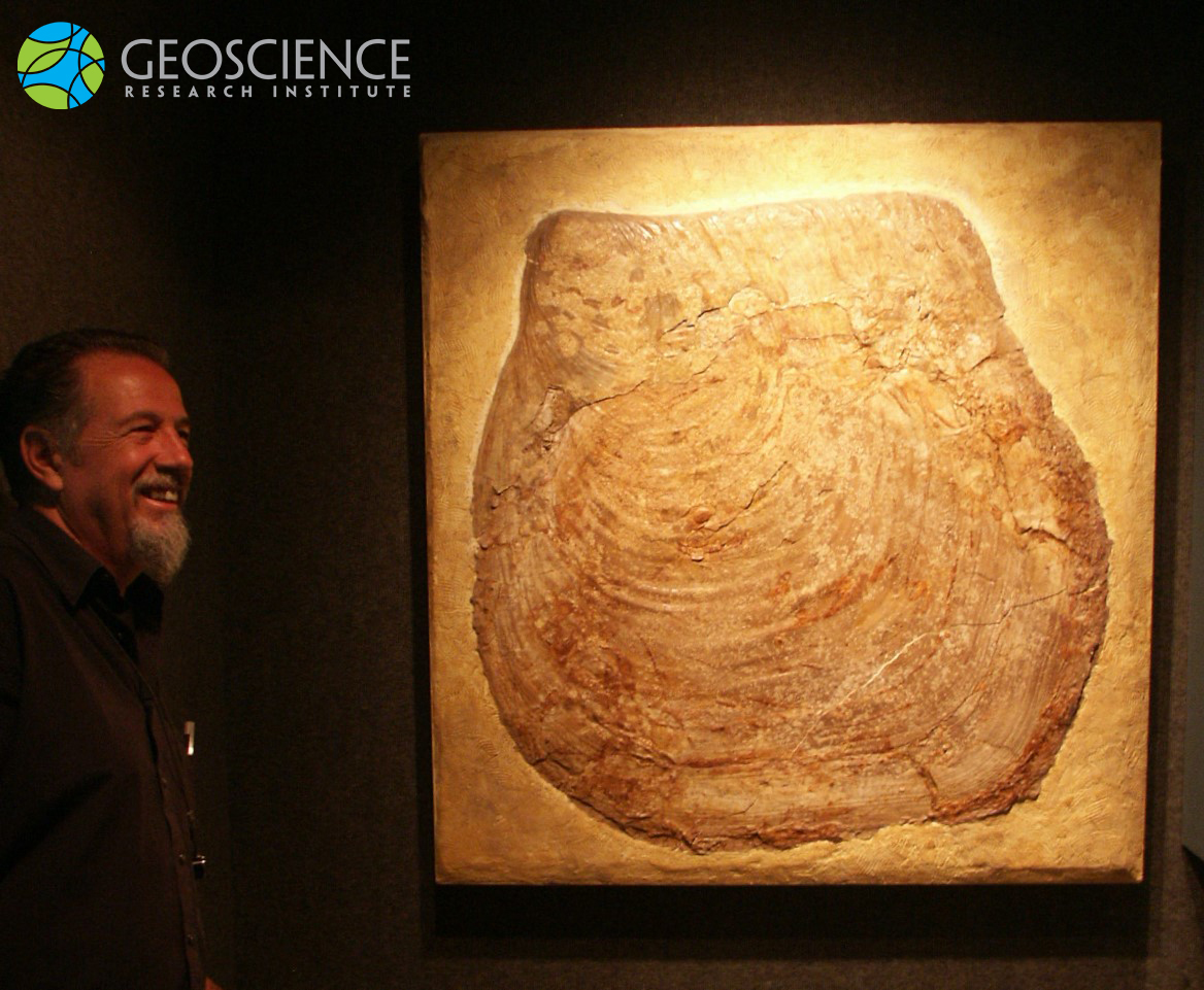
Tyrrell Museum, Shonisaurus sikanniensis the world’s largest-known marine reptile (21 m long)
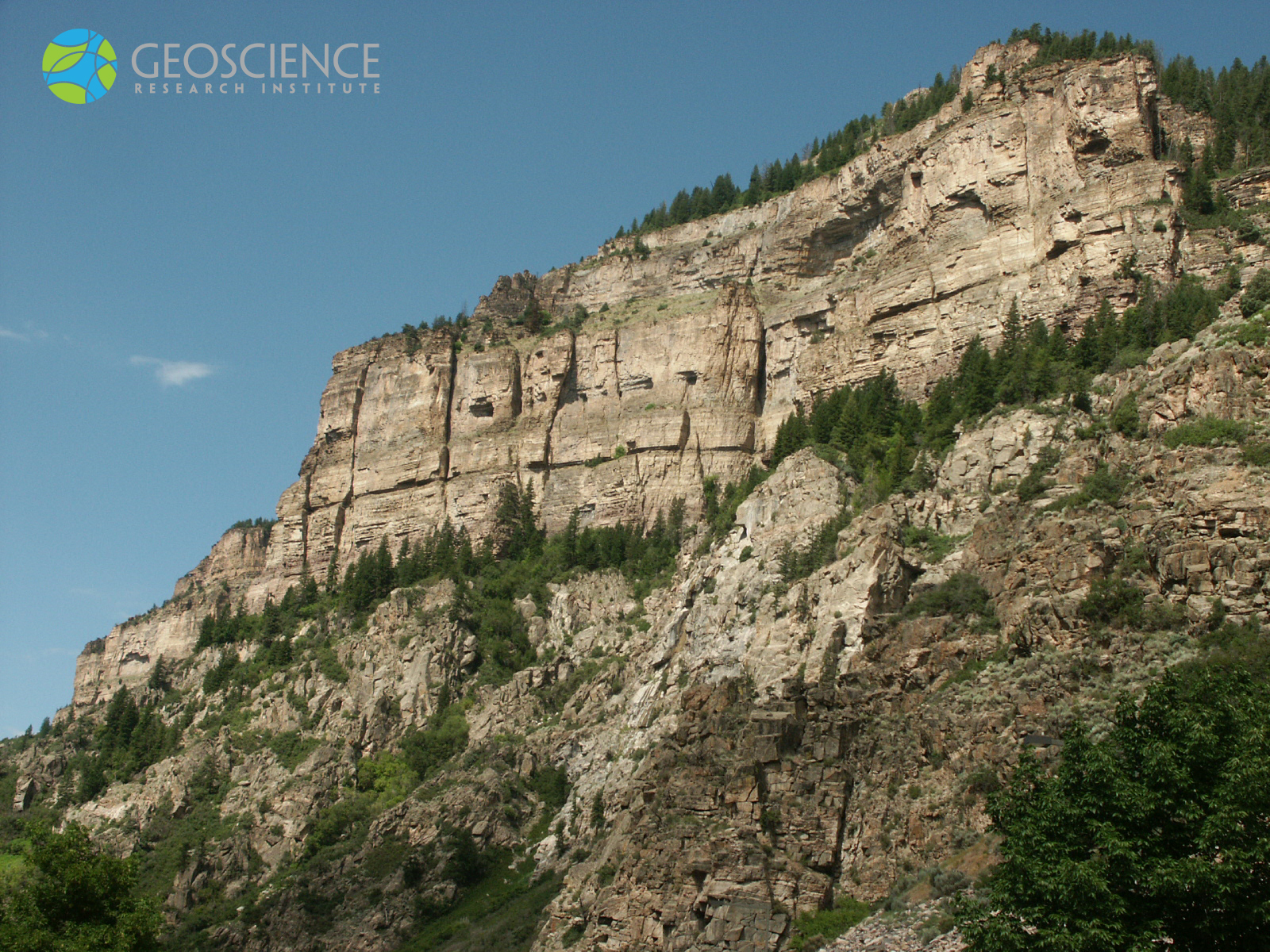
Great Unconformity_2
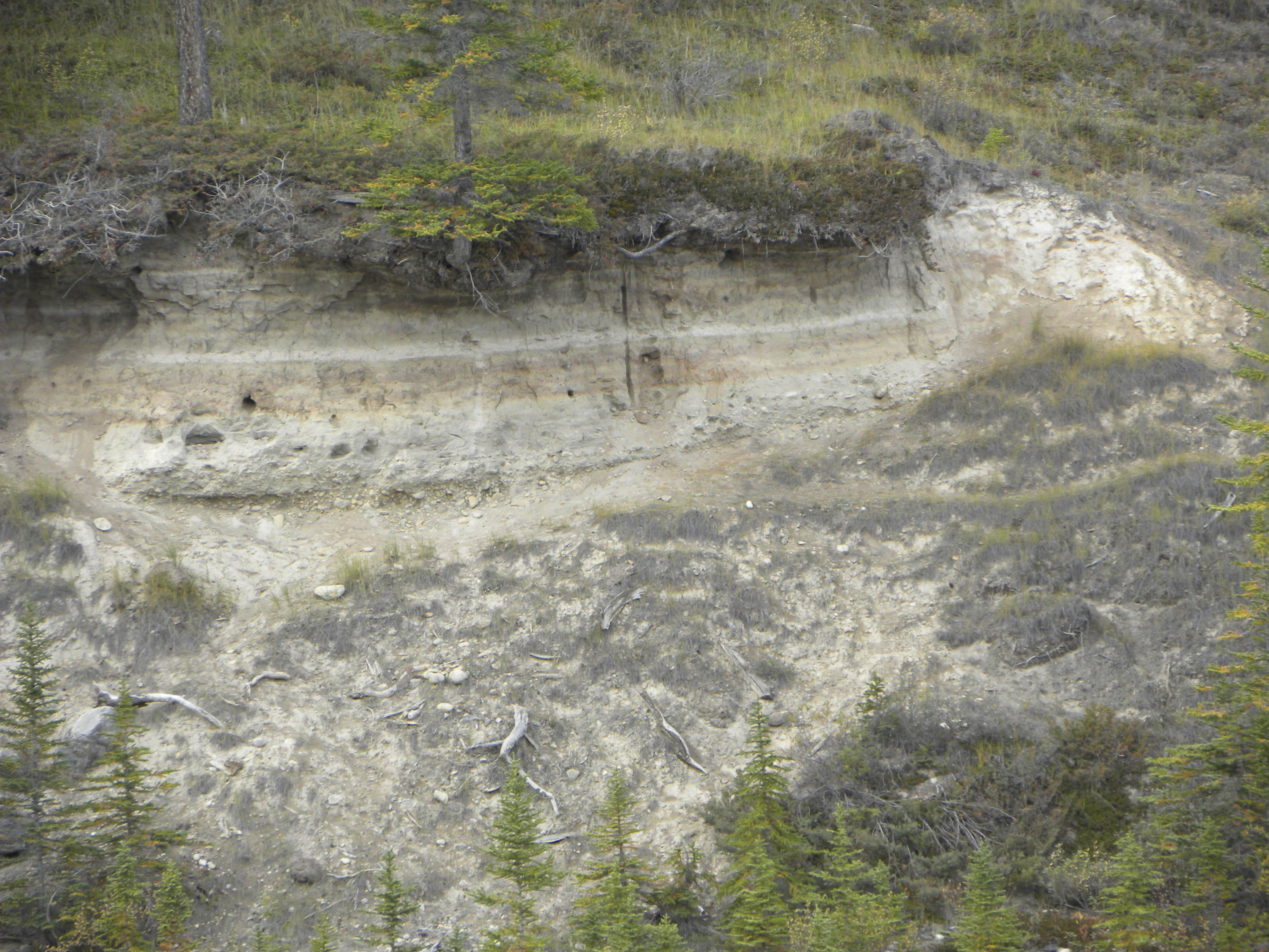
View of the contact between Precambrian basement and the Cambrian Sawatch Quartzite (marked by the tree line, mid-way through the picture), in the vicinity of Glenwood Canyon, CO, US. This important contact, an erosional discontinuity called "the Great Unconformity," is found over large sections of the North American continent.
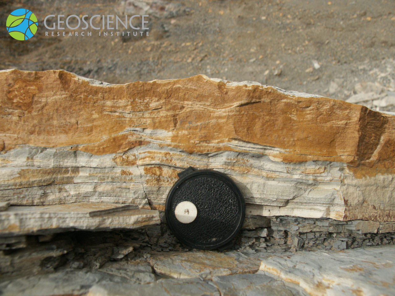
Ripple cross-lamination
Cross-sectional view of a calcareous mudstone to fine-sandstone bed, showing planar lamination passing upward to ripple-cross lamination. The symmetric shape of the ripples, the presence of foreset laminae dipping in opposite directions, and some lamina draping suggest that the cross-lamination was likely generated by wave-ripples. The sequence from planar lamination to ripple cross-lamination can be indicative of decreasing velocity of bottom currents (or changes in sediment grainsize and supply rate). Diameter of lens cap is 6 cm. Photo taken at the I-70 roadcut, near Morrison, Colorado (Cretaceous Dakota Group).
Sandstone
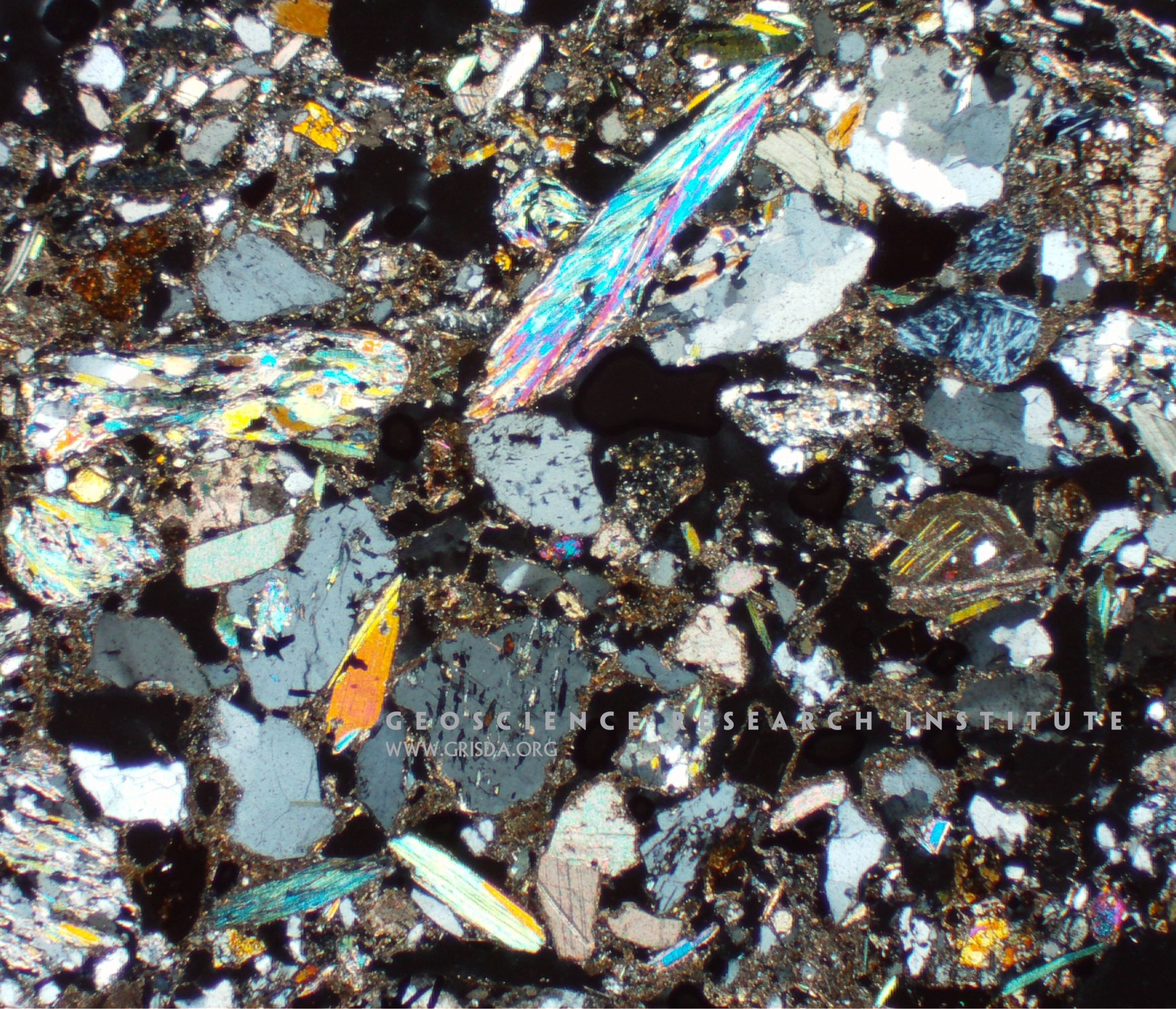
Thin section microphotograph (in cross-polarized light) of a poorly sorted sandstone from Pliocene strata of the Sorbas Basin, Spain, containing lithic fragments of metamorphic rocks and gypsum clasts. The high birefringence colors of muscovite contrast with the gray colors of quartz. Field of view is several cm wide.
Telmatrechus
An example of exceptional preservation of a fossilized water strider (Telmatrechus parallelus). Slab, a few cm in size, on display at the Chicago Field Museum of Natural History, from the Eocene of Fossil Lake, Wyoming.
MaroonFmDike
Clastic dike in the Maroon Fm at Vail Pass along Interstate-70 --- The Maroon Fm on the west side of the Ancestral Rockies corresponds to the Fountain Fm on the east side. Both were deposited from the outwash of the erosion of the ancestral Rockies. The sand in the diagonal cross-cutting dike had not yet been turned to rock when it was intruded into a crack in the horizontal sandstone layers.
Wave ripples
Wave ripples in surface view (scale is 40 cm long). The crests are straight and regularly spaced. However, the overlying thin layer (top of the picture) shows a more disorganized pattern, partly reflecting the underlying crest orientation but probably indicating changing wave conditions. The preservation of these bedforms (that typically form in shallow water) can help to reconstruct the environment of deposition of sedimentary layers. Outcrop of the Cretaceous Dakota Sandstone, exposed along Dinosaur Ridge, Golden, Colorado.
Aspidiophyllum obtusum
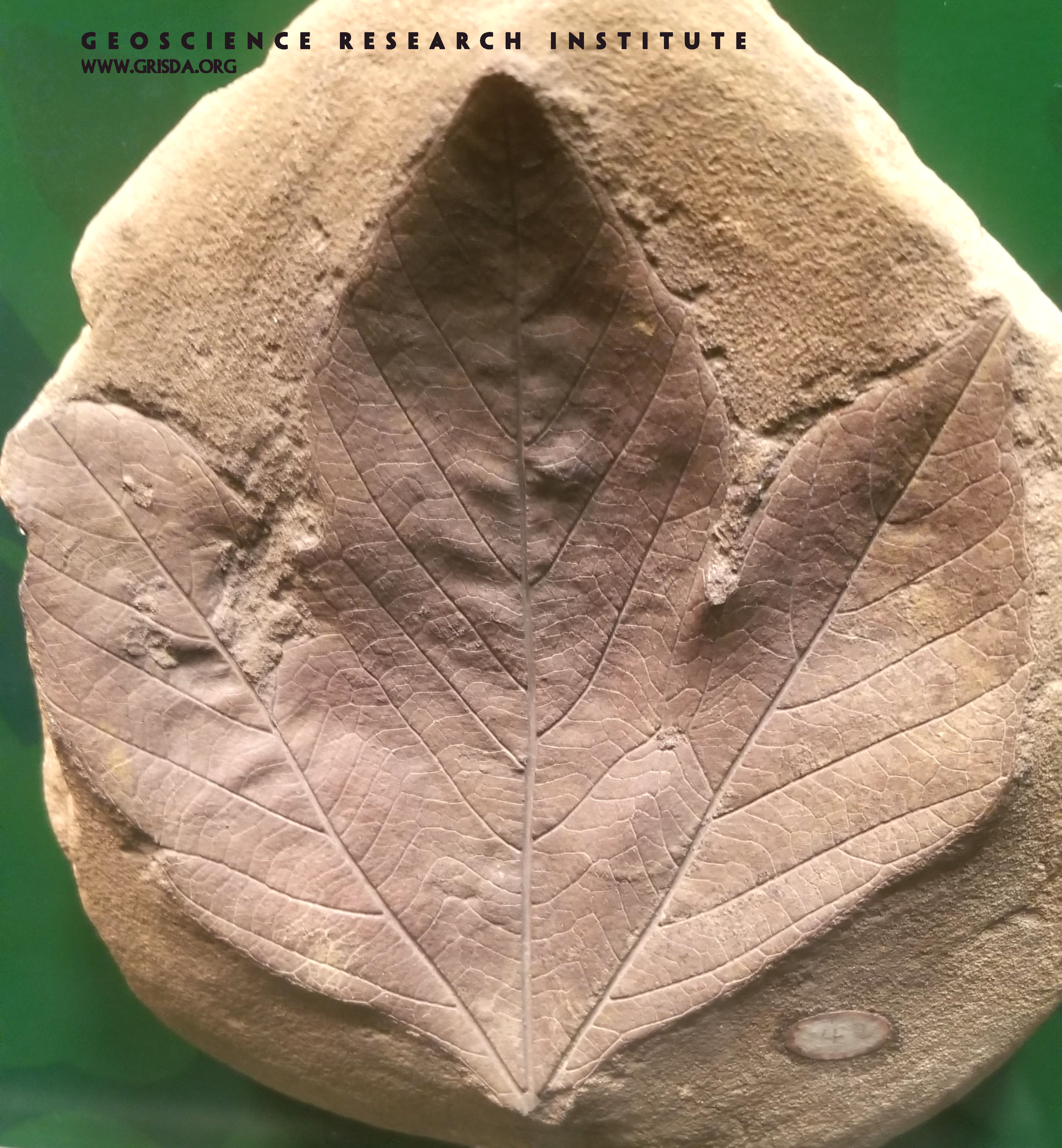
Flowering plants appear abruptly in the fossil record in Mesozoic strata. Here is an example of an exquisitely preserved sycamore-like leaf from the Cretaceous of Kansas. Specimen (several cm in size) on display at the Field Museum of Natural History, Chicago.
Trail14ClastInLimestone
Reworked clasts in the Morgan Fm, Harpers Corner, Dinosaur N.M. --- Quartzite (metamorphosed sandstone) from the Precambrian Uinta Mountain Group was eroded, rounded during transport, and deposited in what is now the Morgan Limestone.
Raindrop impressions?
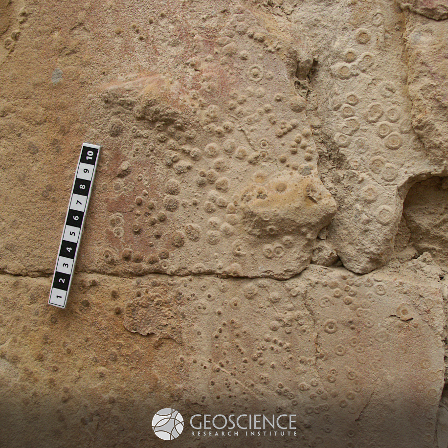
These circular impressions, exposed on the underside surface of a layer of fine sandstone, have been interpreted as raindrop impressions. Sedimentologists have cautioned that similar impressions can form in muddy substrates by the ascent of bubbles through the sediment, or by interaction with air bubbles trapped in the overlying fluid. Scale in cm. Outcrop of the Maastrichtian Laramie Fm., exposed along the Triceratops trail Golden, CO, US.
Lystrosaurus
This incomplete but articulated skeleton is a specimen of Lystrosaurus, an extinct terrestrial vertebrate (synapsid) the remains of which are found in several distant locations in the southern hemisphere, including Antarctica. The widespread distribution of Lystrosaurus was used by early proponents of the continental drift theory to suggest the existence of a once unified supercontinent, Pangea. Hence, its iconic status in geology and paleontology. Specimen on display at the Chicago Field Museum of Natural History.
FossilTraceRaindropsClose
Surface features interpreted as raindrop impressions, Parfet Prehistoric Preserve, Golden (west Denver).
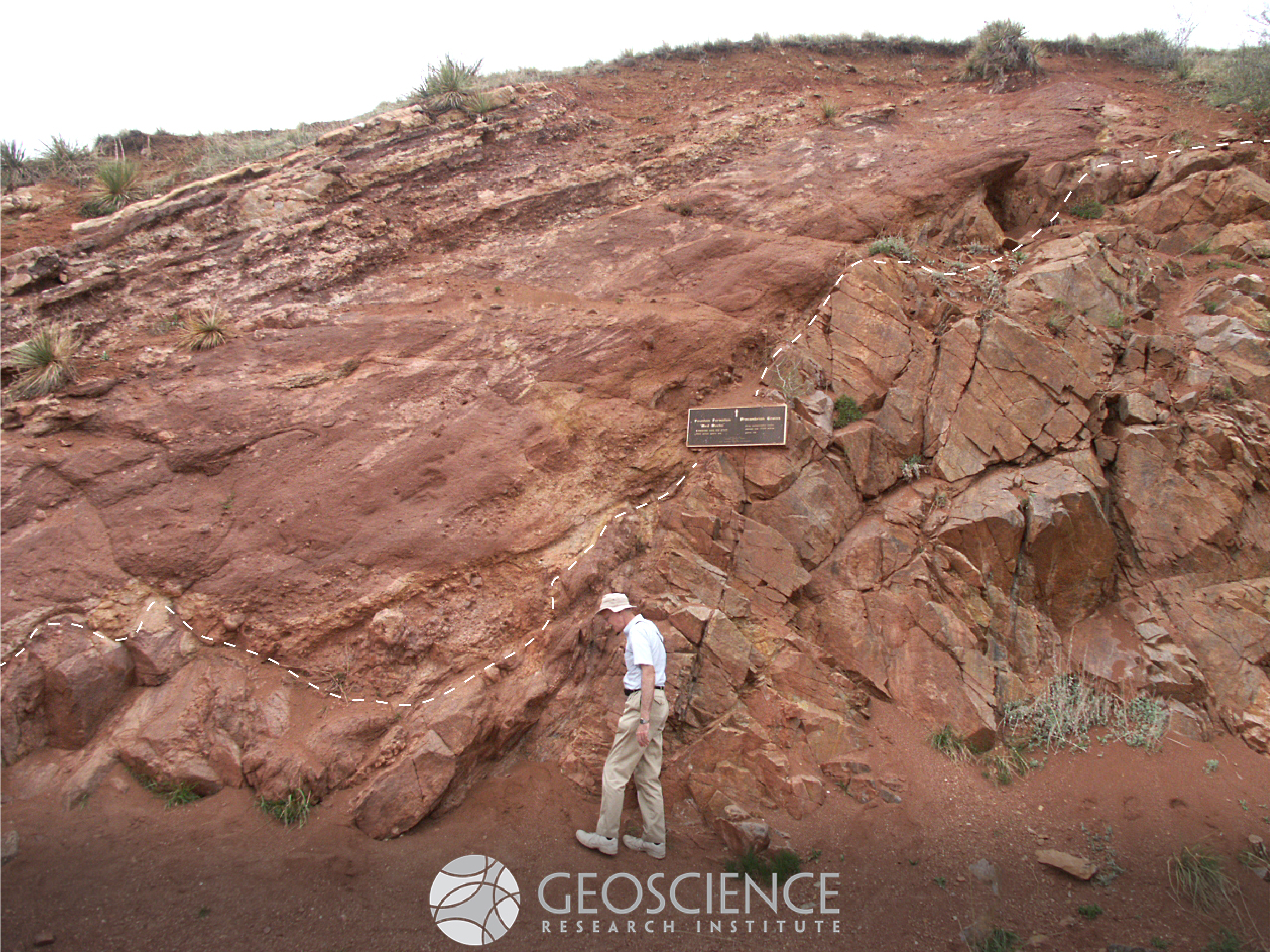
Nonconformity
A "nonconformity" is a type of discontinuity surface where sedimentary rocks lie above crystalline rocks. The dashed line in the picture marks a nonconformity between the Mesoproterozoic Pikes Peak Granite (bottom/right) and the Pennsylvanian conglomerates of the Fountain Formation (top/left), near Denver, CO. The contact in this outcrop (near Red Rocks Amphitheater) is marked by a plaque.
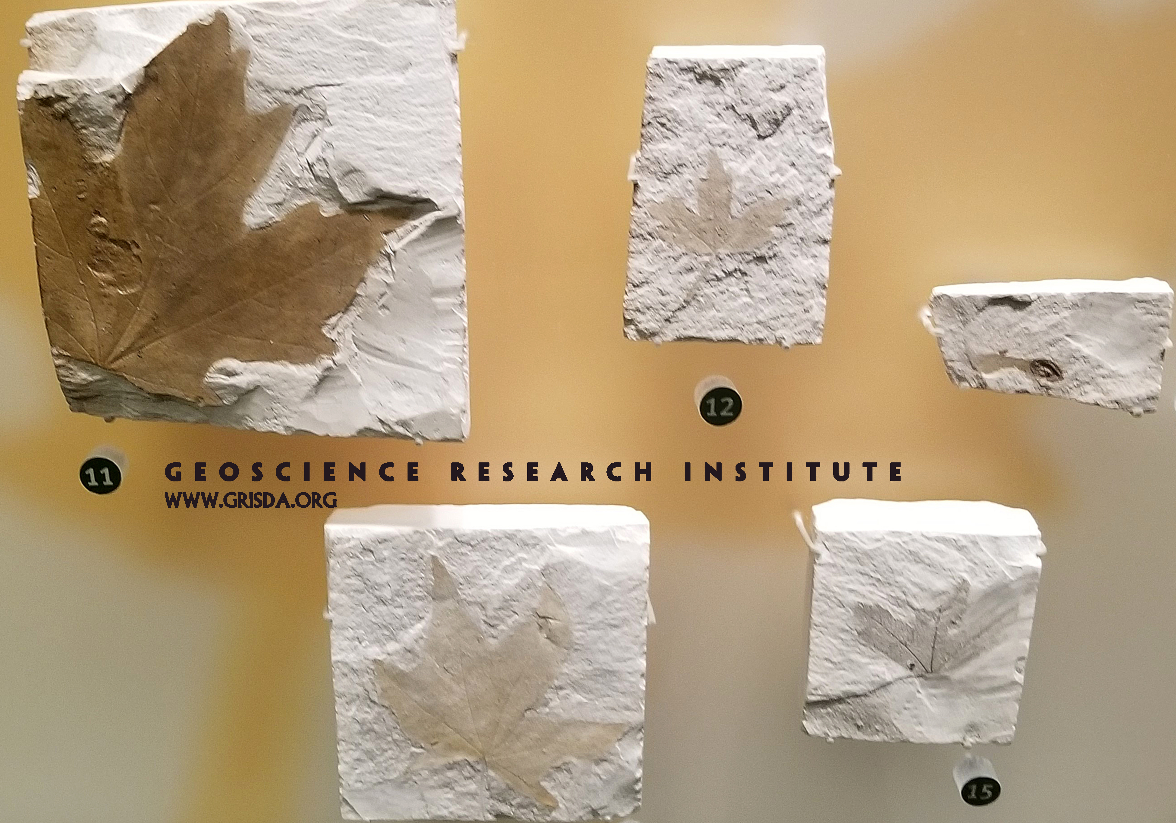
Acer
Stasis and plants: specimens of fossil maple leaves and fruit from the Miocene of Oregon. On display at the Field Museum of Natural History, Chicago
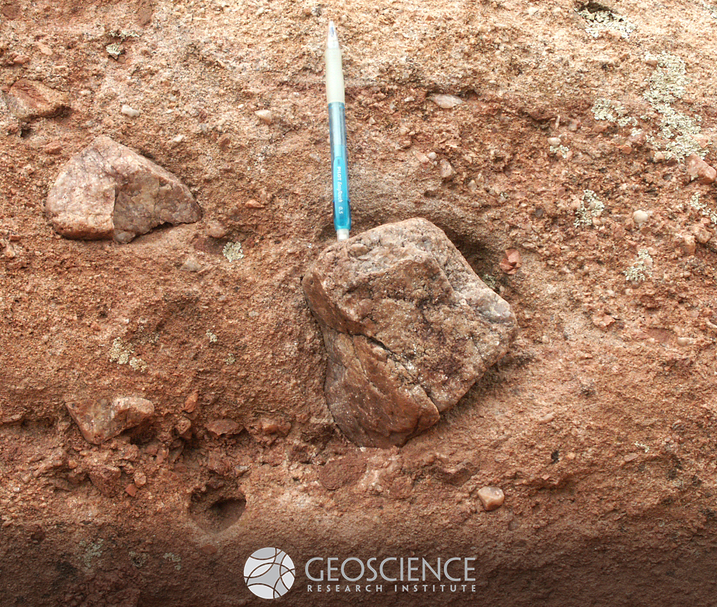
Principle of inclusion
One of the basic principles of stratigraphy is the "principle of inclusion." The principle states that if fragments of a rock unit are found included in a second rock unit, the second unit is younger than the first. In this picture, fragments of the Mesoproterozoic Pikes Peak granite (like the clast on which the pencil is resting) are included in a conglomerate layer of the Pennsylvanian Fountain Formation, CO. We infer that the granite must have existed as a solid rock body that was broken and eroded before and during the deposition of the conglomerate layer. Therefore, this principle helps establishing a relative sequence of events. The principle was already understood by Nicolas Steno, the father of stratigraphy. In his "Prodromus," published in 1669, he writes: "these same bodies had already become hard at the time when the matter of the earth and rock containing them was still fluid. And not only did the earth and rock not produce the bodies contained in them, but they did not even exist as such when those bodies were produced in them” (pp. 15-16).
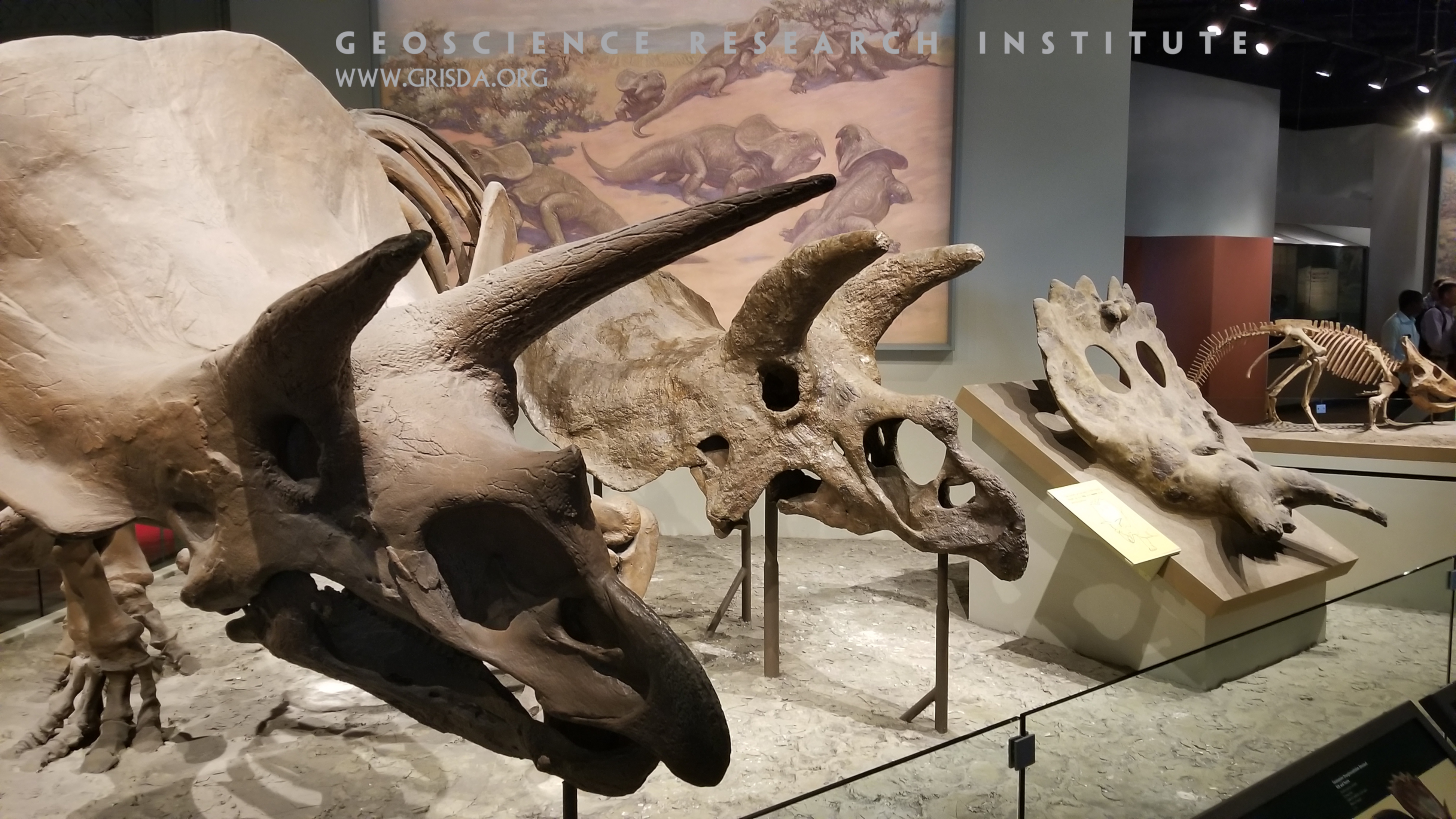
Marginocephalians
Marginocephalians are a group of herbivorous dinosaurs found in Cretaceous layers and characterized by a bony frill at the back of their skull. This photo shows specimens of 4 different species within this group, on display at the Field Museum of Natural History, Chicago.
CountyRd301
Cross-bedding, Co. Rd. 301 near McCoy --- About one third of the way up the picture are beds at an angle to the main layers.
Clastic dykes
Clastic dykes are sedimentary features consisting of seams of sediment truncating the surrounding host rock or deposit. These dykes can form through different processes. For example, fluidized sand can be injected through fractures, cutting through underlying and overlying deposits. Alternatively, pre-existing open cracks can be passively infilled by accumulation of a different kind of sediment. This picture shows three sub-vertical sandstone dykes, with parallel orientation, cutting through sub-horizontal mudstone and sandstone layers of the Pennsylvanian Fountain Formation, at the Balanced Rock site of Garden of the Gods Park, CO. Although different interpretations have been presented to explain the dykes in this outcrop (e.g., infill after thermal contraction of unconsolidated deposits in a cold environment), fieldwork by GRI scientists suggests that they should be interpreted as injection features, possibly related to seismic activation of small normal faults. Pencil for scale (resting vertically on right dyke).
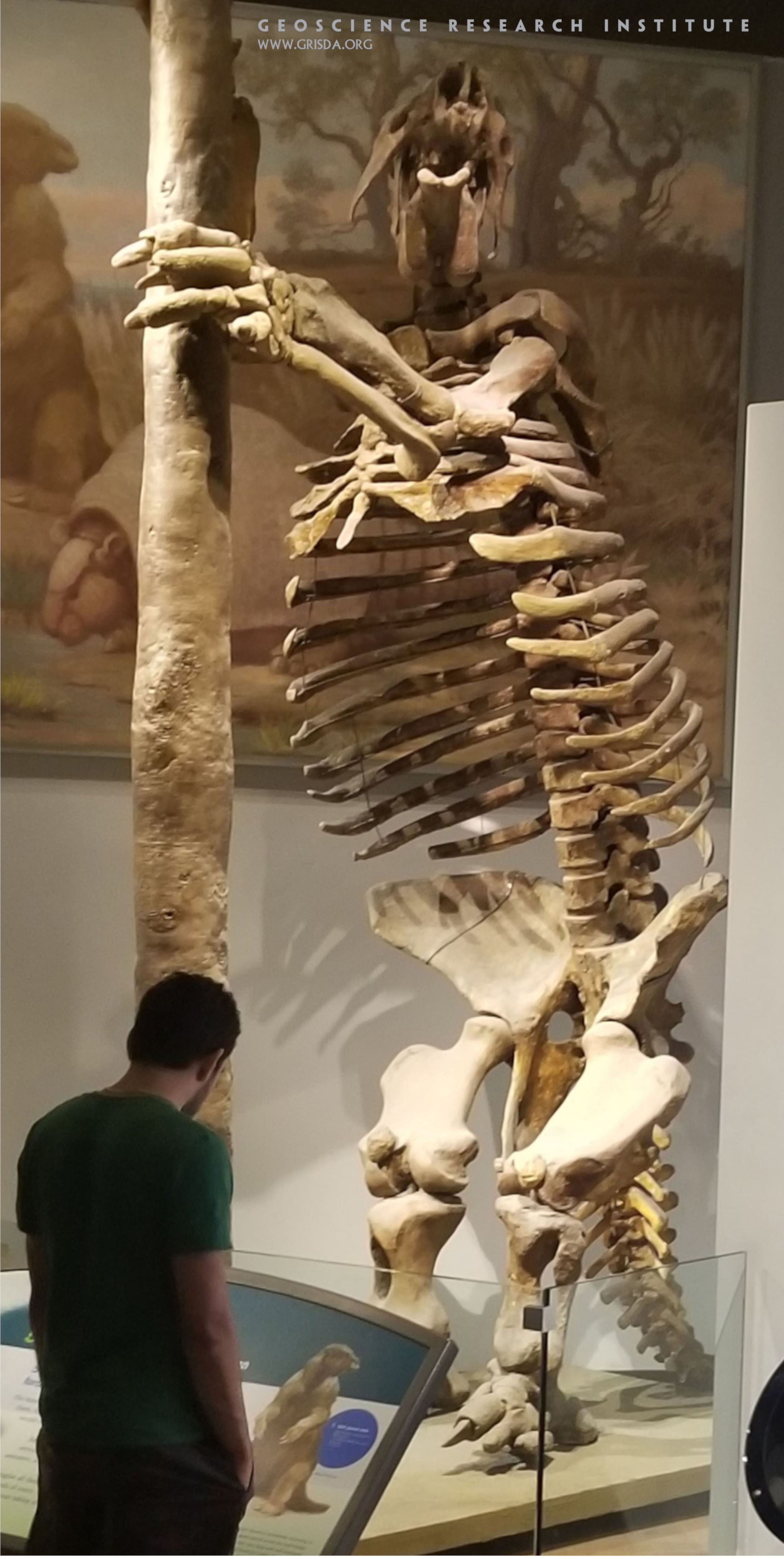
Megatherium
Megatherium is one of the largest land mammals known to have existed and is part of the Pleistocene megafauna. This ground sloth was endemic to South America. Specimen on display at the Chicago Museum of Natural History
Rt13
Badlands, Wasatch Formation, Rt.13 north of Rifle --- The sandstone has been eroded into badlands and teepee-shaped mounds.
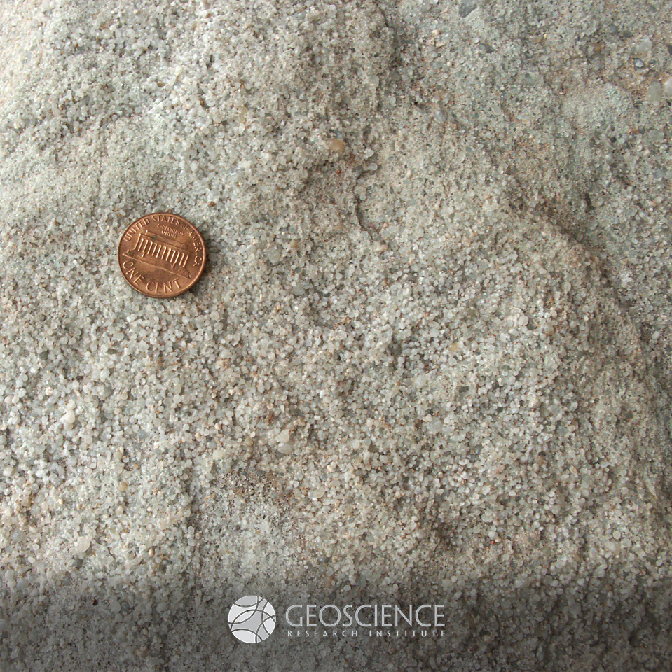
Cambrian quartzite
This sandstone, made up mostly of quartz grains, is an example of Cambrian quartzite. This type of deposit is very widespread in North America (and in other areas of the world), where it blankets the "Great Unconformity," the erosional surface marking the contact between crystalline basement and overlying sedimentary rocks. Sawatch Formation, vicinity of Colorado Springs, CO, USA
Fish and frond
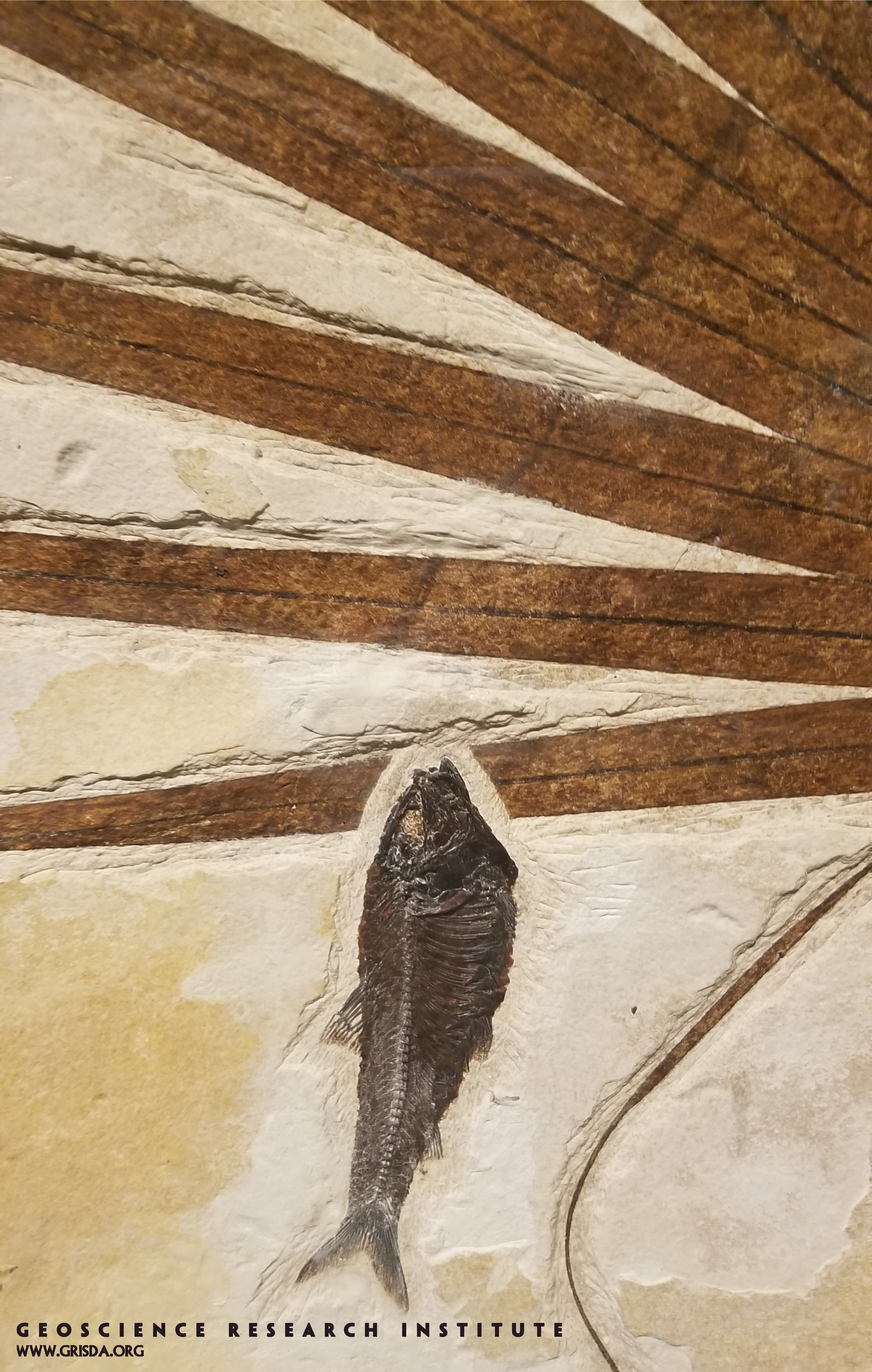
A perfectly preserved fish resting by a perfectly preserved palm frond...This slab on display at the Field Museum of Natural History, Chicago, comes from Fossil Lake Basin, Wyoming, a locality that has yielded exquisite specimens of a variety of organisms. Special conditions are required for this kind of uncommon preservation.
ManyParksCurveStreamMeanders
WATER: Stream meanders, Horseshoe Park, Rocky Mountain National Park --- Water descending rapidly down a canyon forms a straight path, but when it arrives in an almost level valley it meanders as shown in this picture. The lower Mississippi River shows similar meanders.
vesicles
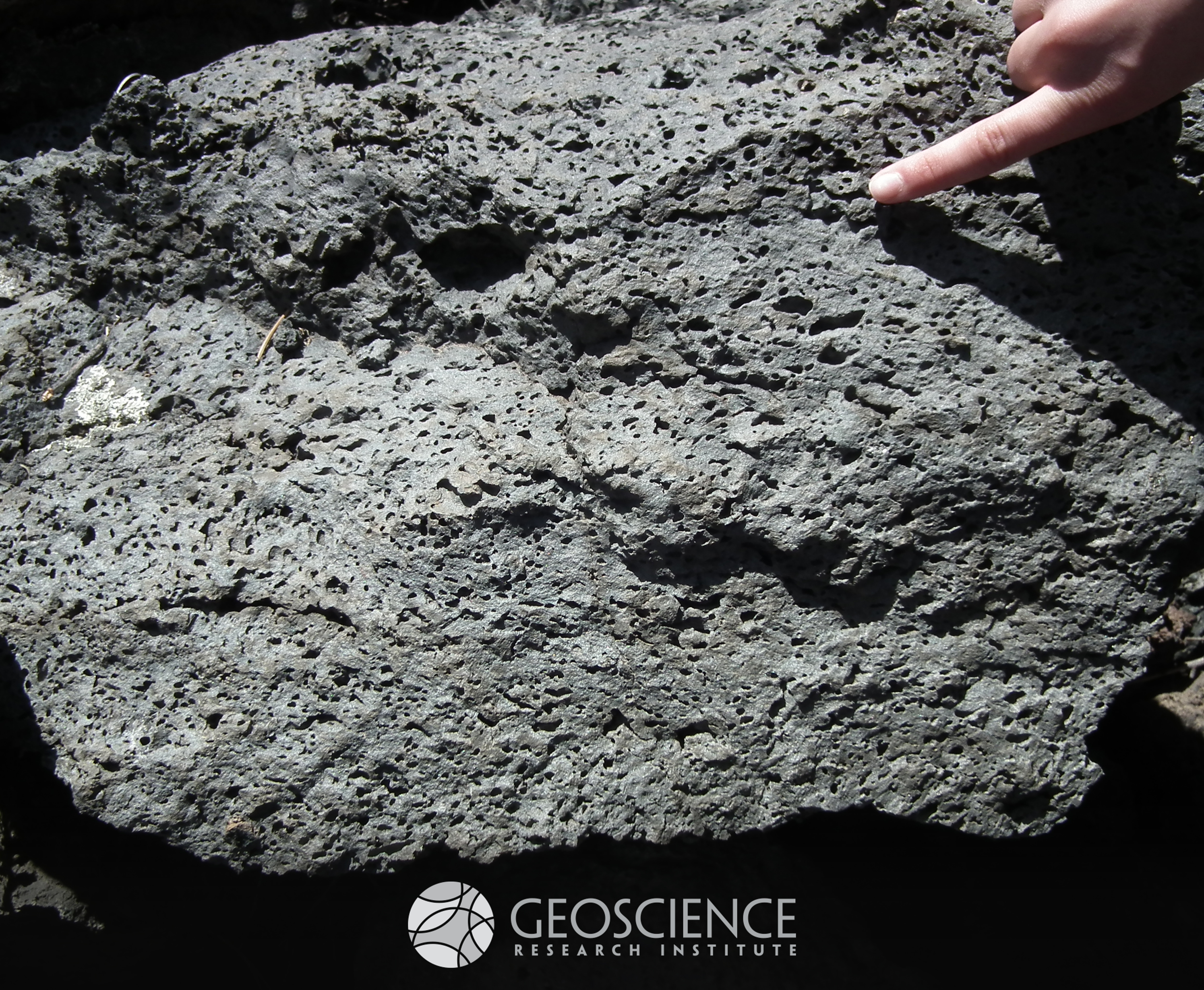
Elongate vesicles in basalt from the Bonito Lava Flow, west of Sunset Crater, AZ. Gas bubbles trapped in the lava originated these cavities, with the stretching related to a preferential direction of flow. This example of volcanic activity is about 1,000 years old, and is part of a larger Volcanic Field (San Francisco Volcanic Zone, AZ, USA).
Coryphodon
Pantodonts are an extinct type of large mammals, somehow reminiscent of hippos. Skull (from Paleocene of Colorado, US) on display at the Field Museum of Natural History, Chicago.
Trail11SteamboatRock
Entrenched meander, Steamboat Rock at Harpers Corner, Dinosaur N.M.
Recumbent anticline
Anticlinal folding in Pennsylvanian strata of the Belden Fm. (Sweetwater Creek, near Dotsero, CO). Monoclinal to recumbent folds (similar to this one) can be caused by displacement connected with the termination of a thrust fault buried at depth. Some have interpreted this particular fold in this way, linking it with thrust activity during the Laramide orogeny. Note that the lithology of the Belden Fm., which consists of bedded shales, limestone, and evaporites, favors ductile deformation. Layers that tend to resist plastic deformation under stress are termed "competent," and a contrast between competent (e.g., sandstone, chert) and less competent (e.g., shale, gypsum) beds can produce spectacular folding.
Eocene prawn and herring
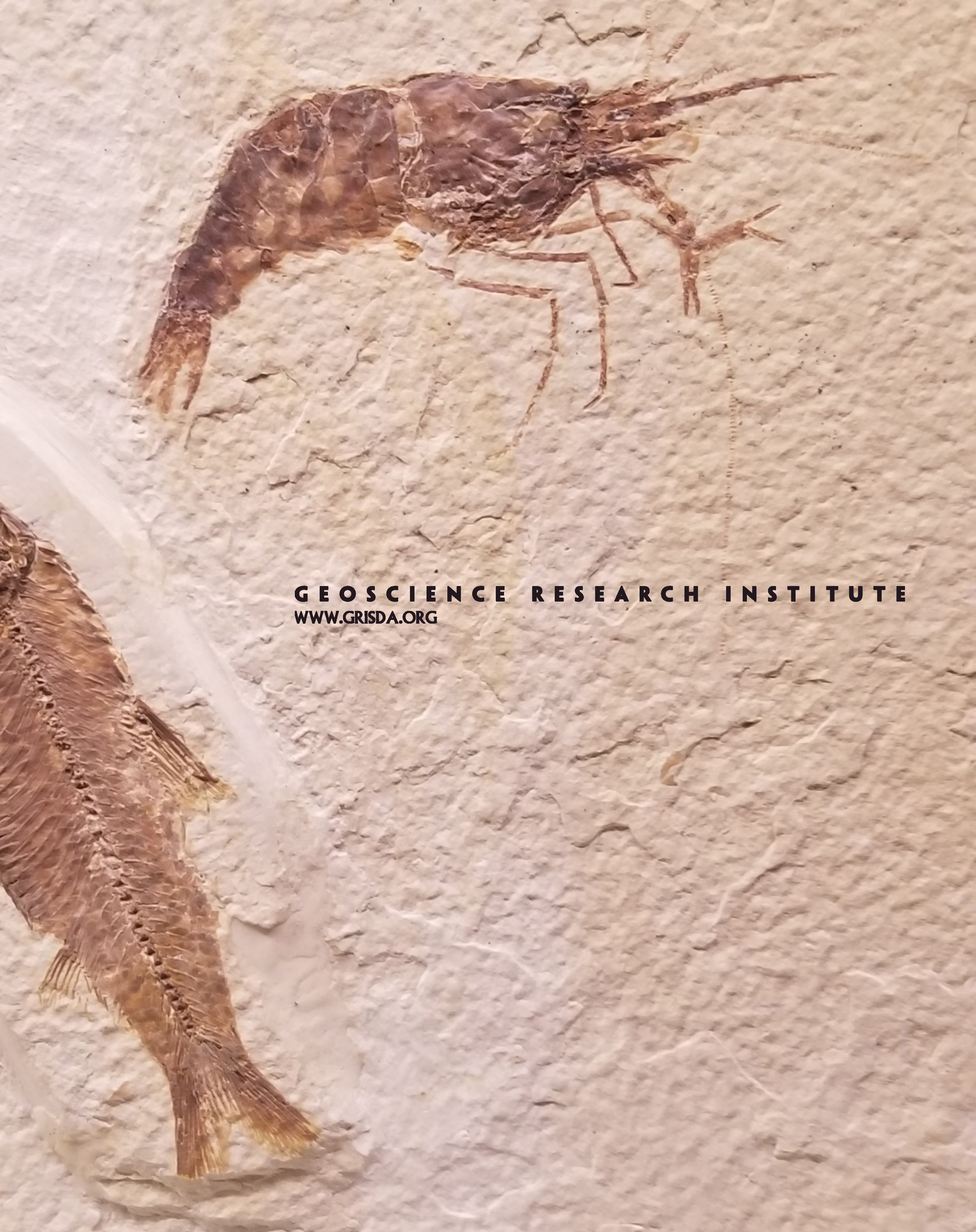
What do these two fossils share? They died together, they are spectacularly preserved, and they were buried rapidly. These specimens of a prawn (Bechleja rostrata) and a herring (Knightia eocaena) are from Eocene deposits of the Fossil Lake, Wyoming, on display at the Chicago Field Museum of Nature and History.
Glenwood_Cny
WATER: Dissolution caves in the Mississippian Leadville limestone, Glenwood Canyon, Interstate-70 --- As acidic water dissolved the limestone, caves formed as seen here and sinkholes formed at the upper surface. In the standard interpretation, the ancient sinkhole land surface at the top of this formation formed a karst topography similar to what is seen in some places in Florida today.
Psylophyton forbesii
Trimerophytes were leafless vascular plants, with branches departing from the stem in a spiral pattern. This specimen containing multiple stems (several cm in size) is from the Devonian of Quebec, on display at the Field Museum of Natural History, Chicago.
Rt139 MesaVerdeFm
Honeycomb weathering, Mesa Verde Fm, Rt.139 north of Grand Junction --- Freezing and thawing of wet sandstone cliffs loosens the sand grains that are then blown away by the wind.
Araripescorpius ligabuei
The body plan of fossil scorpions is not much different from modern ones: an example of morphological stasis. This is a Cretaceous example from the Crato Formation of Brazil. Specimen on display at the Paleontological Museum in Santana do Cariri, few cm in size.
ForestCanyon LongsPeak
Glacially U-shaped valley and Longs Peak, Rocky Mountain National Park.
Hyperpycnite
You may have heard of turbidites. This type of deposit forms from pulse-like flows, where sediment travels rapidly down a slope because of a gravity contrast with the surrounding fluid. Turbidites typically show an upward decrease in gain size and a vertical succession of structures (massive/planar laminated/ripple cross-laminated) indicative of decreasing energy of the flow. There are, however, some deposits that differ from turbidites by showing a symmetric internal organization, with increasing and then decreasing grainsize, and with structures pointing to increasing and then decreasing energy of the flow. Hyperpycnites are such kind of deposit, forming when a river, laden with sediment during its flooding stage, flows into a basin. The flow typically waxes, reaches peak strength, and then wanes. Therefore, the resulting hyperpycnite reflects the waxing and waning cycle in its internal structure. This picture shows a nice hyperpycnite from the Pennsylvanian Minturn Formation, near McCoy (CO, USA). The bed displays reverse grading in its bottom part and a gradual upward transition from ripple laminated, to planar laminated, to massive (waxing phase). The upper part of the bed shows normal grading and hints of ripple-cross lamination (waning phase).
Fossilization styles
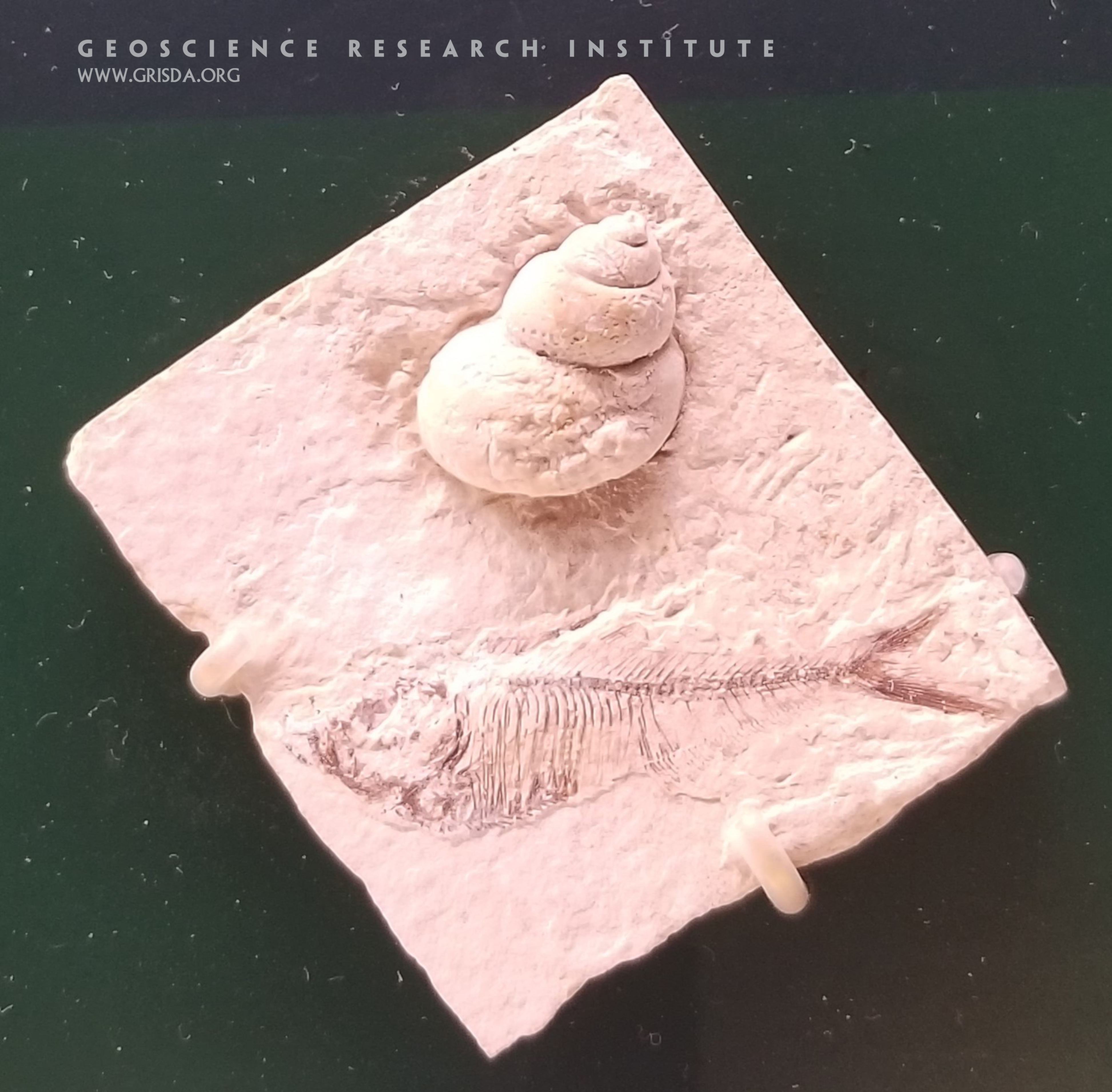
Two types of fossils preserved in close proximity. The herring-like fish, Dyplomystus dentatus, consists of actual bone remains. The gastropod is an internal mold made of sediment, with the original shell being dissolved. Slab is about 10 cm in size, on display at the Chicago Field Museum of Natural History. From Eocene deposits, Fossil Lake, Wyoming.
ManyParksCurveAtMorainePark
GLACIATION: Moraine Park from Many Parks Curve, Rocky Mountain National Park --- Glaciers moving to the left in the picture along what are now light green meadows pushed boulders to each side into elongated hilly moraines now covered by darker colored trees.
Fossil snake
Snakes appear in the fossil record in Mesozoic layers. Here is a cast of a fully articulated specimen from the Cretaceous of Bosnia-Herzegovina, on display at the Field Museum of Natural History, Chicago.
MoraineParkRoucheMoutonee
Moraine Park from Many Parks Curve, Rocky Mountain National Park --- Glaciers moving to the left in the picture along what are now light green meadows pushed boulders to each side into elongated hilly moraines now covered by darker colored trees.
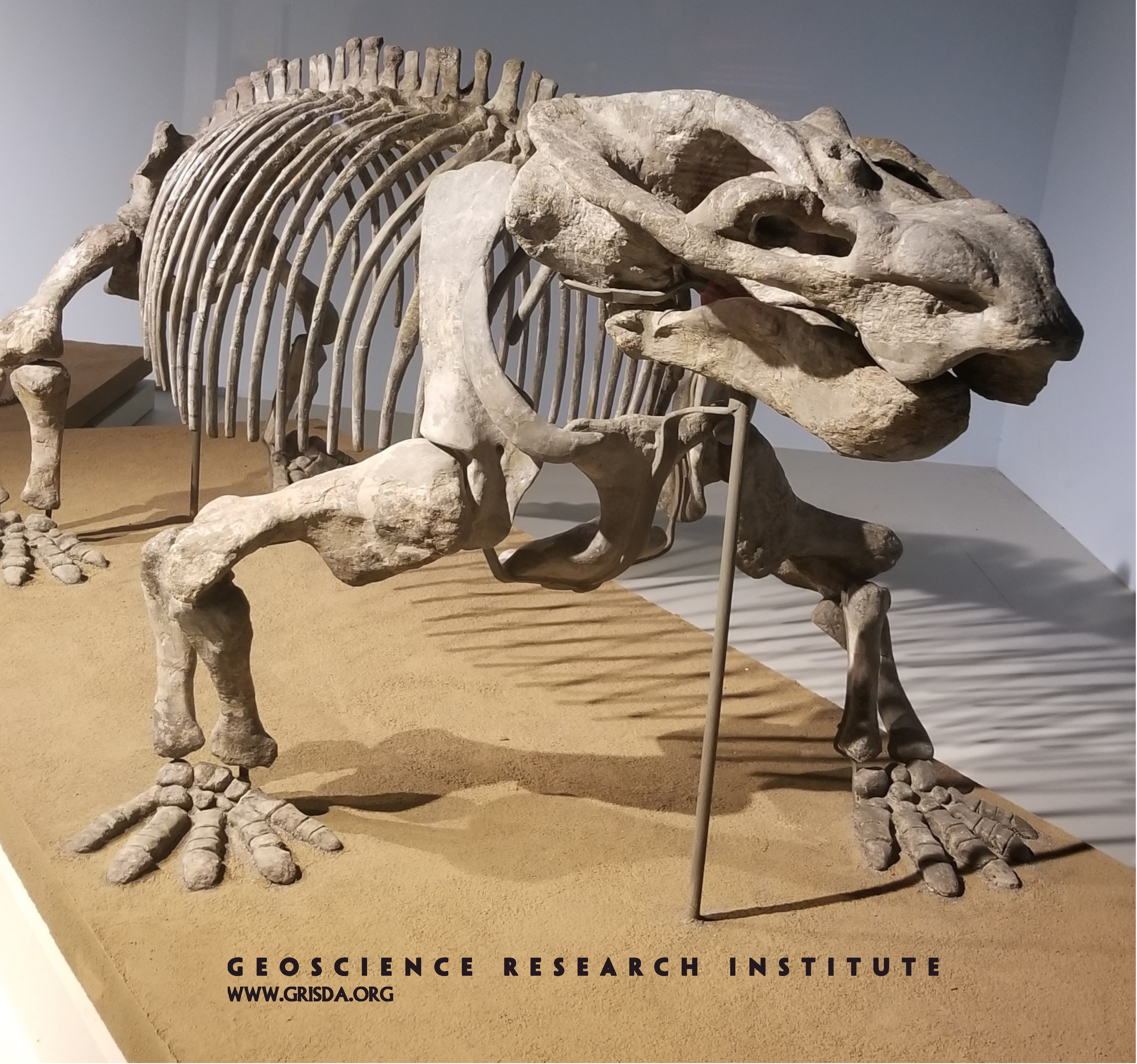
Aulacephalodon peavoti
Reconstruction of the skeleton of a dicynodont synapsid, from the Permian of South Africa, on display at the Field Museum of Natural History, Chicago. These large animals with big barrel-shaped trunks are thought to have been herbivores.
GrandMesaLandOLakesViewpointStriations
Glacial striations, Land o' Lakes view on Grand Mesa --- The horizontal scratch marks in this picture were formed as rocks embedded in the bottom of glaciers moved across this bedrock.
Tiktaalik roseae
A cast of a famous specimen (about 50 cm in size) of the lobe-finned fish Tiktaalik roseae, from the Devonian of Canada, on display at the Field Museum of Natural History, Chicago. Tiktaalik is often presented as a "missing link" in tetrapod evolution. However, as it often happens, the picture of "sequential transitions" is much more complicated when looked at in detail, with mosaic distribution of characters between various forms.
Lithic tools
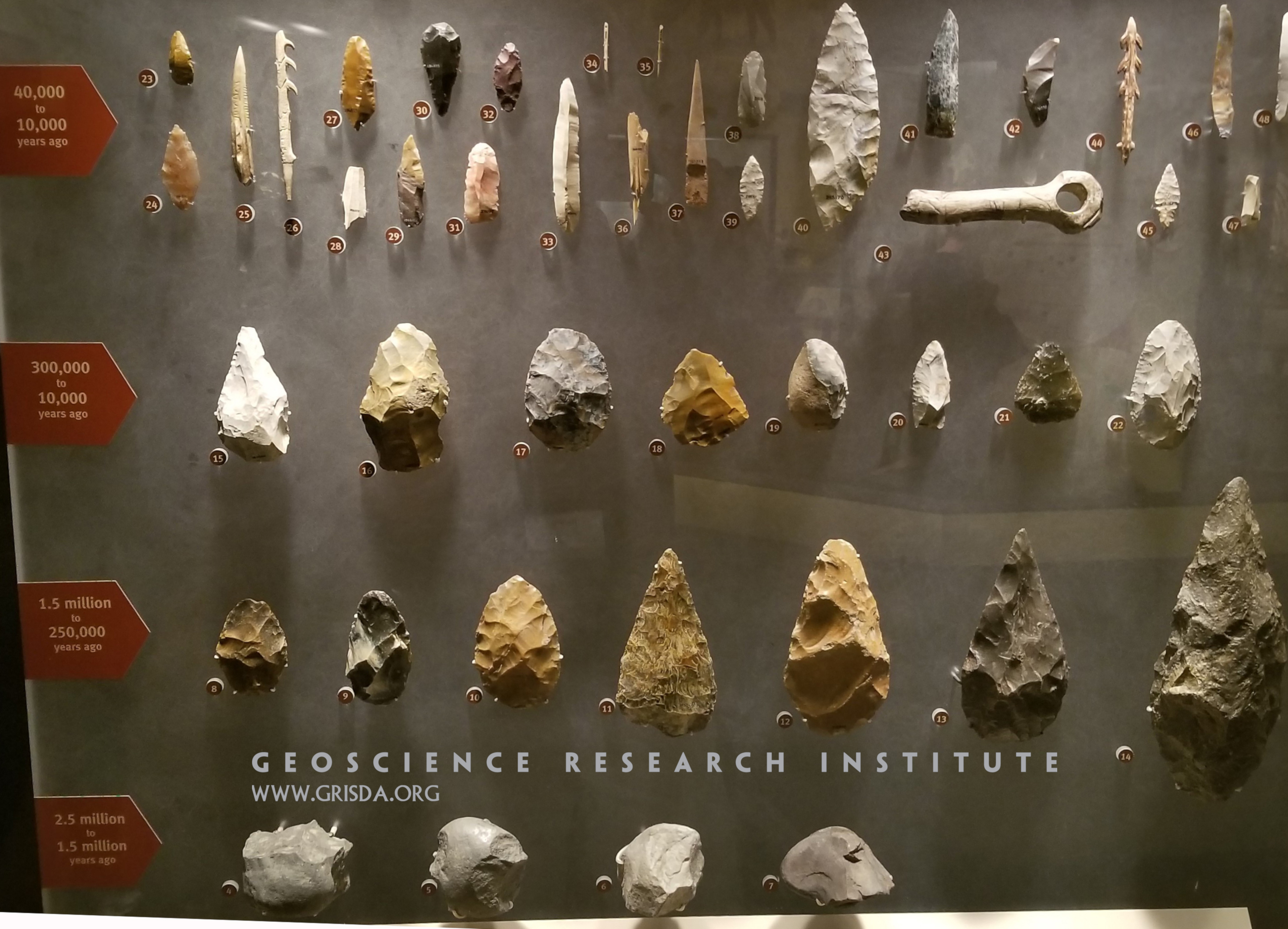
A panel on display at the Chicago Field Museum of Natural History, meant to illustrate how the appearance of more complex tool kits signals the emergence of more sophisticated tool-making abilities. However, this general stratigraphic order of appearance is not as clear cut, and tools representing different lithic industries can be found in correlative layers or even in inverted order.
T. rex foot
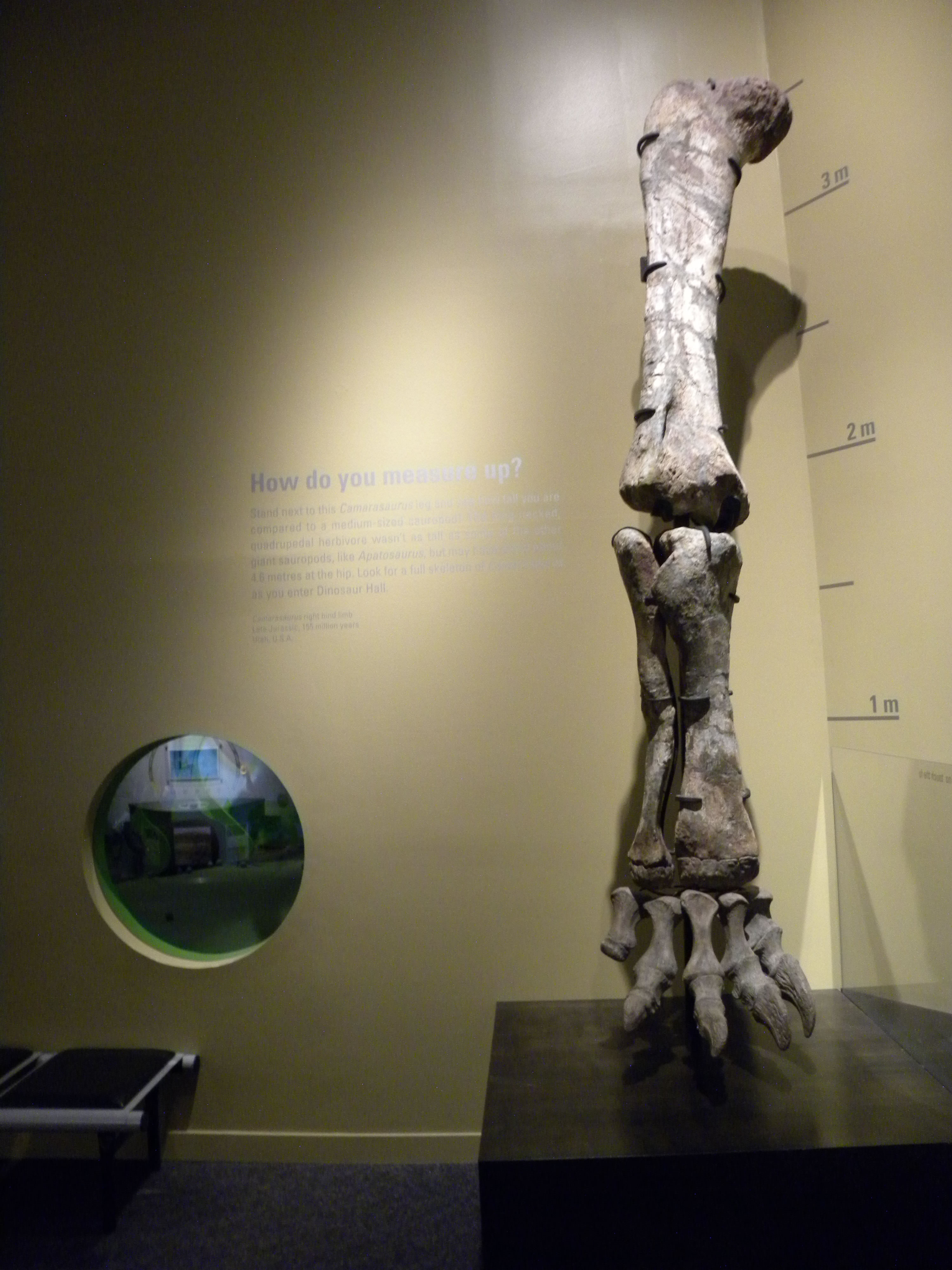
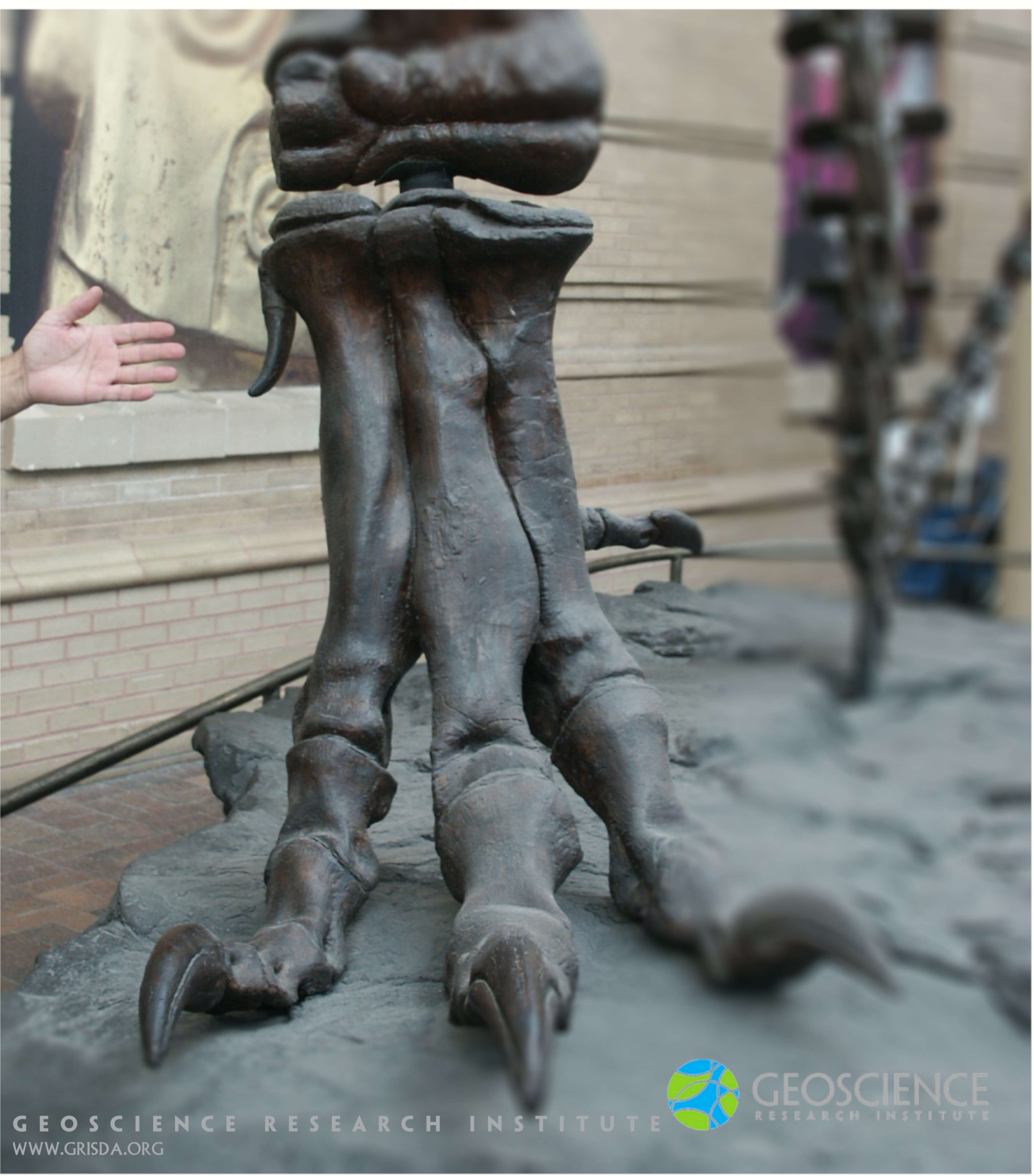
Compare the foot of this big land vertebrate with the hand of a human... Pretty massive animal, right? Can you guess the species? Well, a T. rex dinosaur, of course! This specimen welcomes you in the foyer of the Denver Museum of Nature and Science, CO, US.
Mass mortality
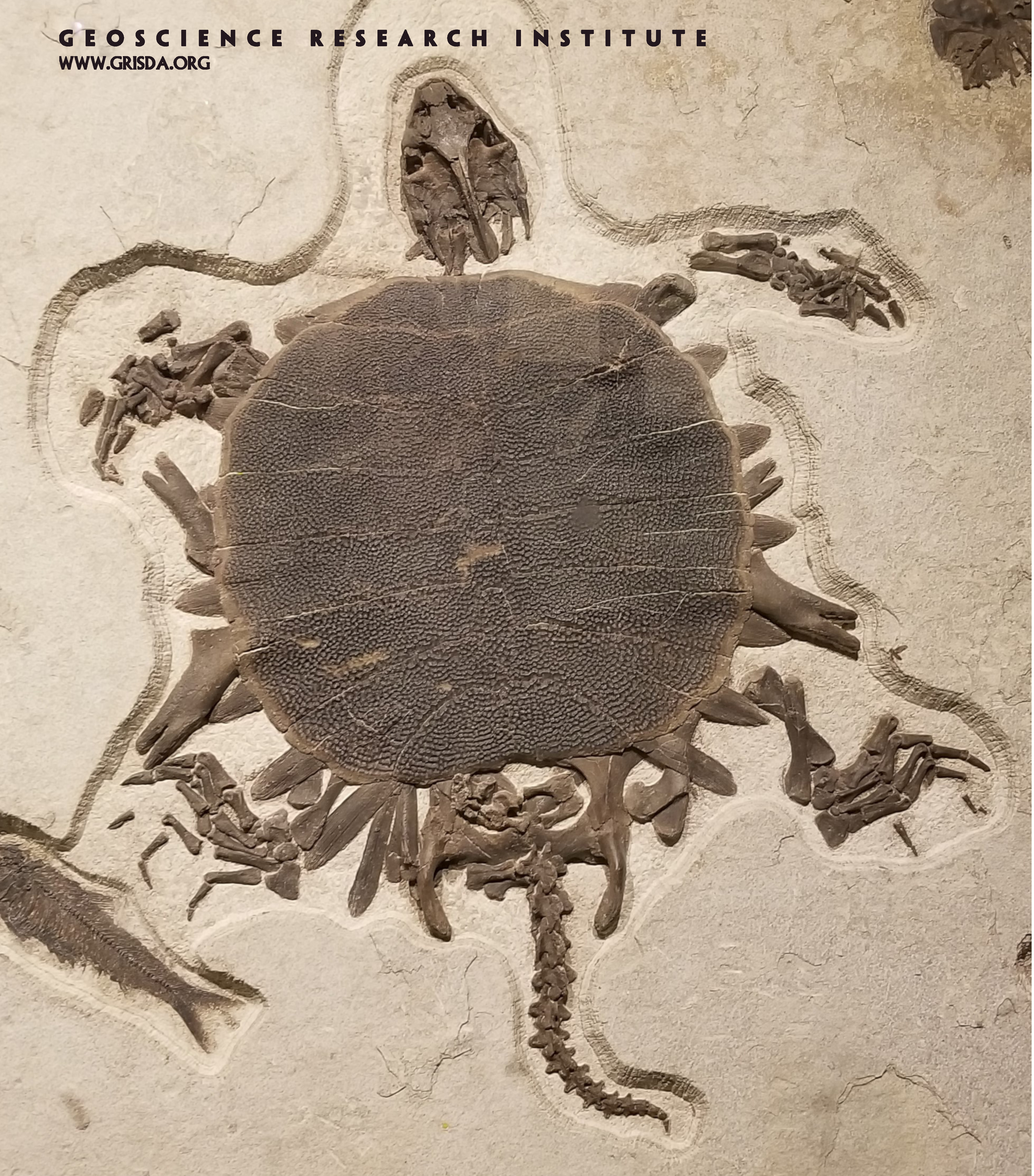
5 different organisms (a soft-shelled turtle, 3 species of fish, and an insect) are preserved in close proximity on this slab from the Eocene Fossil Lake Basin, Wyoming (on display at the Field Museum of Natural History, Chicago).
SweetwaterRdBigFold
TECTONIC FOLDING: Large fold in gypsum layers, Sweetwater Canyon --- Folding is the result of enormous tectonic forces.
Taniwhasaurus
Replica of the skeleton of a Cretaceous large marine reptile, Taniwhasaurus antarcticus, on display at the Chicago Field Museum of Natural History. Remains of this reptile are found in locations both within the southern and northern hemisphere, illustrating an example of widespread distribution of a fossil type.
Ursus spelaeus
This large-sized extinct bear was a representative of the so-called Pleistocene megafauna. Specimen mounted and on display at the Chicago Field Museum of Natural History.
Trail142Fault & river & arch
TECTONIC FAULTING: Mitten Park Fault, Harpers Corner, Dinosaur National Monument --- Spectacular vertical fault with adjacent folding of sedimentary layers in the lower left corner of the picture.
Wasp
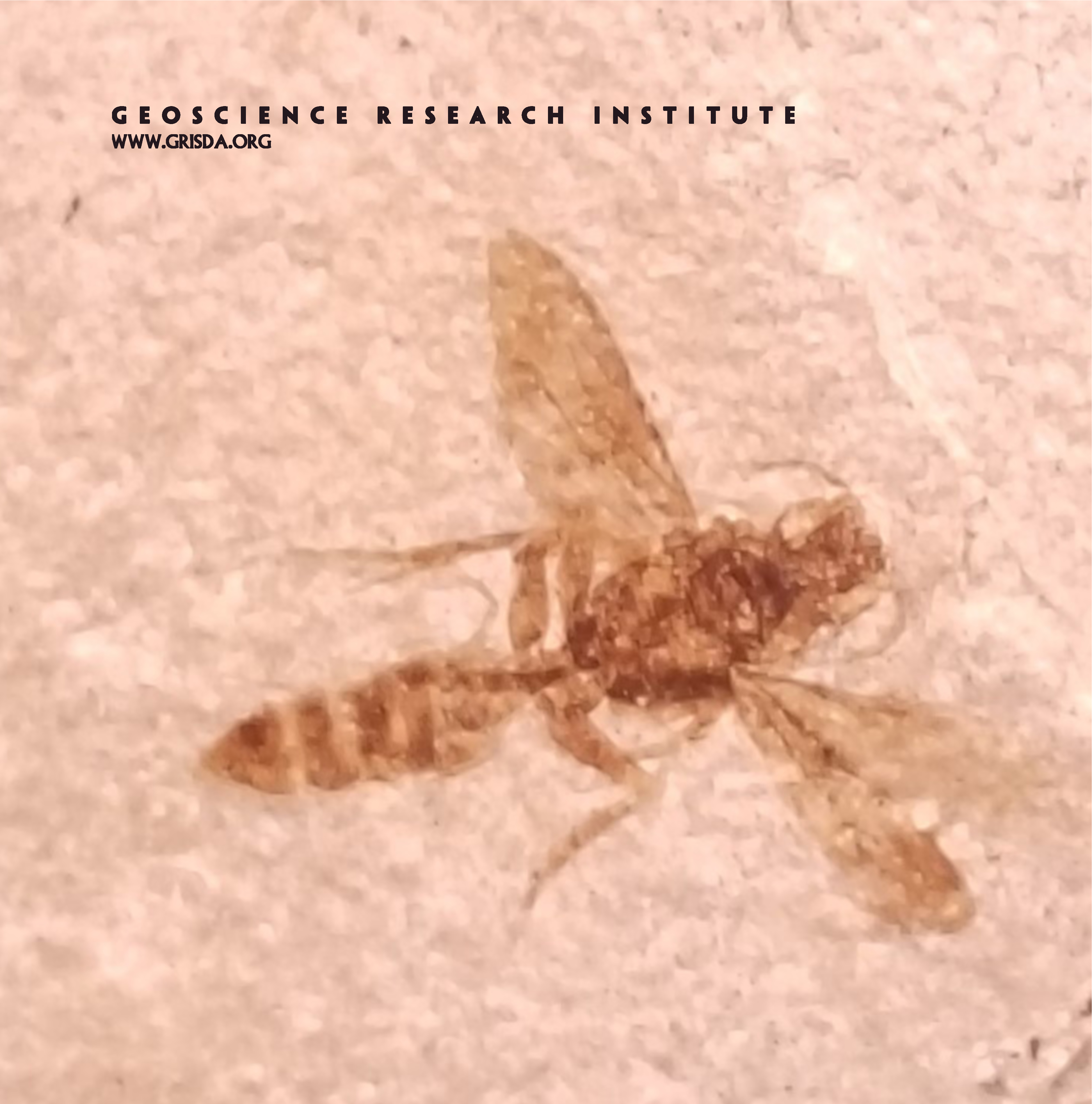
This specimen of a fossil wasp comes from Eocene strata of the Fossil Lake (Wyoming) and its body plan is quite similar to modern representatives of this type of organism. On display at the Field Museum of Natural History, Chicago.
I70 ThrustFault
TECTONIC FAULTING: Thrust fault along Interstate-70, Silverthorne --- Younger rocks on the very bottom of this picture have been thrust under older rocks. The fault line ascends slowly from the lower right edge of the picture to beyond the center where some folding of the layers at the fault contact can be seen.
Platyceramus platinus
Dinosaurs are not the only group of organisms to disappear above Cretaceous strata. Inoceramids, a family of large bivalves, are also extinct and not found in Cenozoic layers. Remains of fish have been found preserved within some specimens of this giant clam, leading to the suggestion of possible commensalism or symbiosis. Specimen on display at the Colorado Museum of Nature and Science.
Rt40 WolfordMtnThrustFault
TECTONIC FAULTING: Thrust fault at Wolford Mountain east of Rt.40 north of Kremmling --- Trees take root in the older Precambrian rocks outcropping over the top half of the mountain, but do not grow in the younger Cretaceous Pierre shale outcropping over the lower half.
Underprints
“Brontosaur bulges." Mid-way through the picture we can observe four bulges in a sandstone layer, depressing downward the underlying layers. These have been interpreted as a dinosaur trackway viewed in cross-section. A large sauropod left these “underprints" by deforming soft sediment while walking. Very specific conditions (e.g, sediment cohesiveness, rate of sedimentation, exposure vs submergence) are necessary for the preservation of footprints in the rock record. Scale bar is 40 cm long. Photo taken at Dinosaur Ridge, Golden, Colorado.
Dinosaur Ridge Trackway
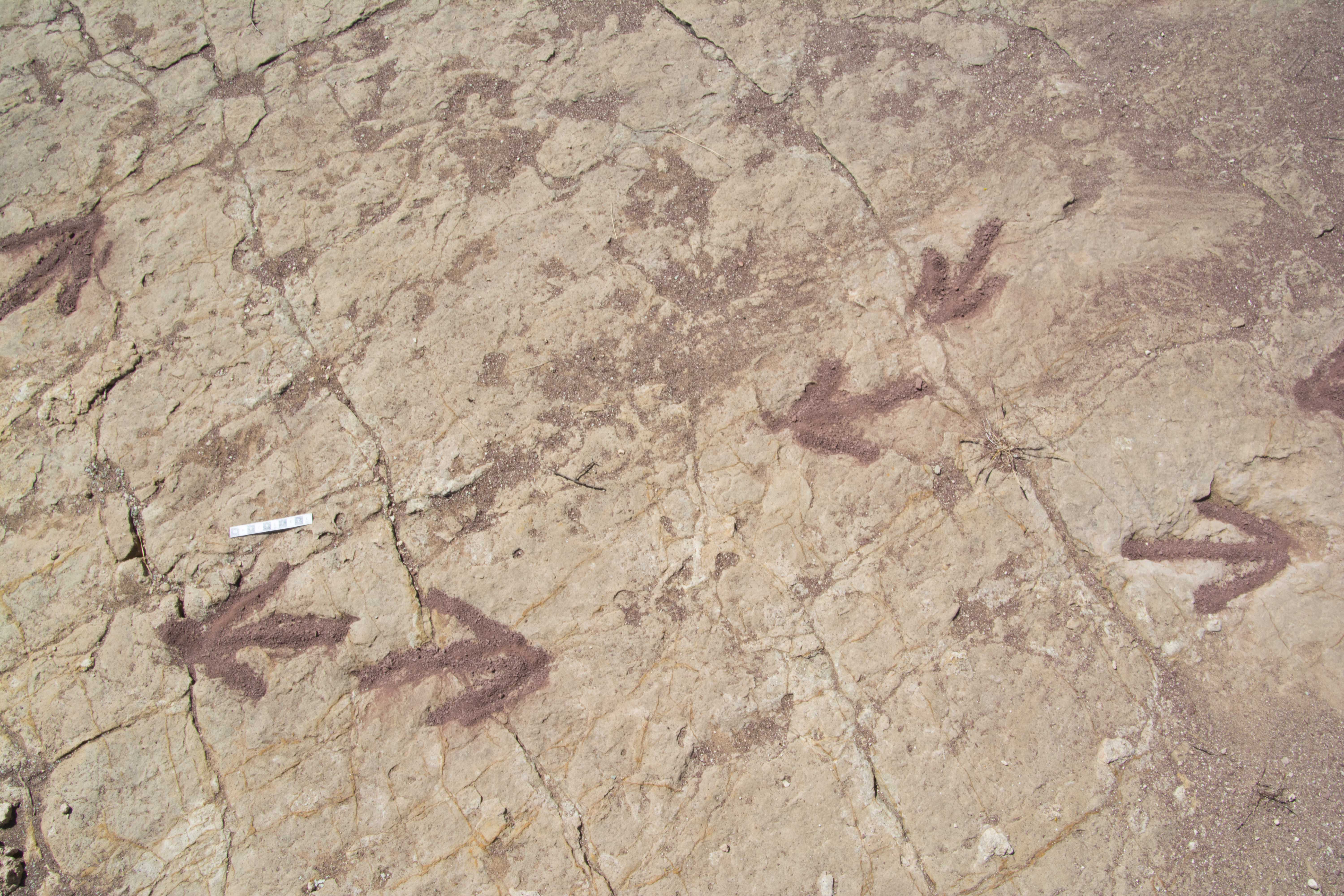
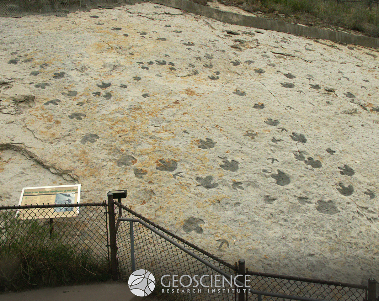
The Dinosaur Ridge Tracksite, in Golden, CO, preserves two main types of dinosaur footprints. Both are tridactyl (with three toes). They have been colored in with charcoal to enhance their visibility. The tracks with a wider aspect and thick toes were made by ornithopod dinosaurs. They were left by animals of different sizes (possibly adults and juveniles). The narrow-toed tracks were made by theropods. See if you can recognize the different tracks. This outcrop exposes the surface of a sandstone bed in the Lower Cretaceous South Platte Formation of the Dakota Group.
Palm fronds
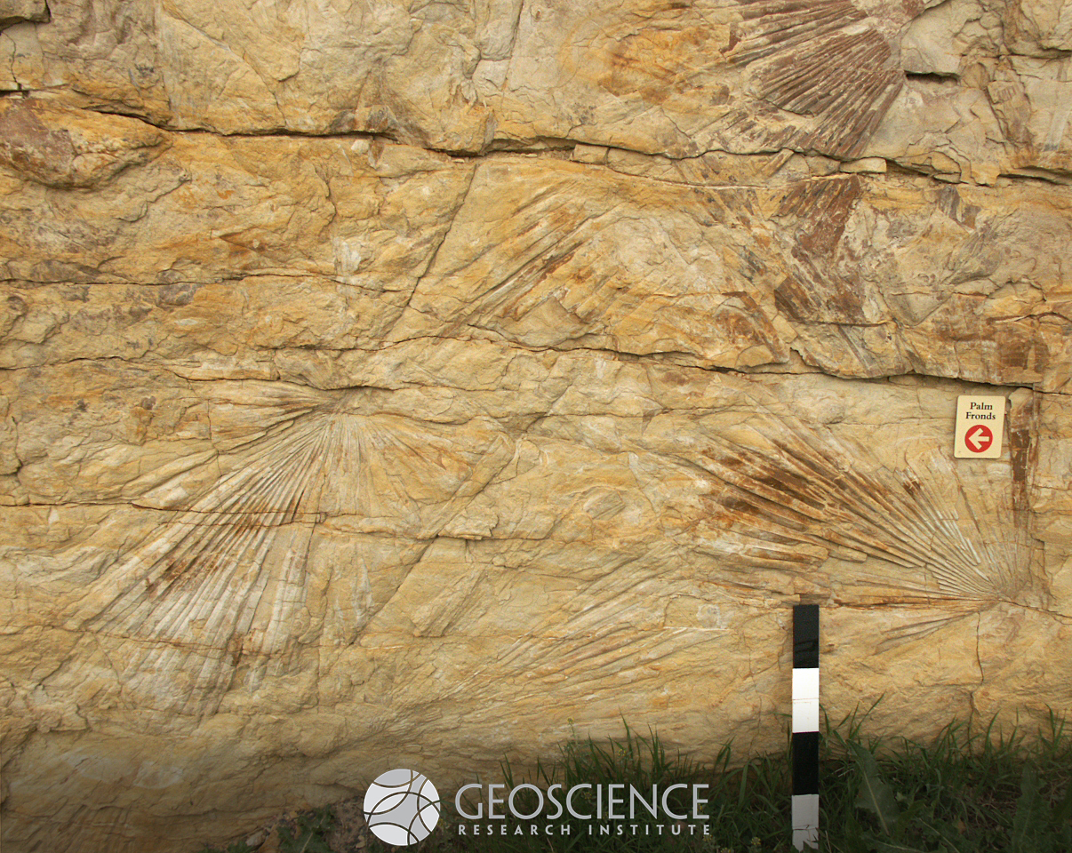
Fossil impressions of palm fronds exposed on a verticalized bedding surface of fine sandstone in the Maastrichtian Laramie Formation, near Golden CO. The integrity of individual fronds implies that minimal decomposition took place prior to burial. Scale bar is 40 cm long.
Coccoliths
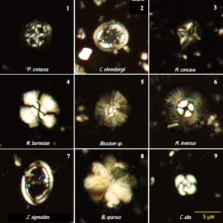
Calcareous nannofossils (coccoliths) are among the tiniest fossils preserved in the sedimentary record, measuring around 5 to 10 microns. The image (plate) shows petrographic microscope photos of some of the most characteristic coccoliths of the Cretaceous/Paleogene (K/Pg) boundary. This boundary is associated with one of the most studied mass extinctions in the geological record, which has been correlated to a major catastrophic event. Photos 1 to 4 show nannofossils of the Upper Cretaceous (Maastrichtian) that are thought to have gone extinct at the K-Pg catastrophic event. Photos 5 to 7 are of Cretaceous survivors that show continuous distribution into the Paleogene (Danian). These last species are considered adapted to cold water and eutrophic environments (r-selected taxa). Photos 8 and 9 show Paleogene taxa, not present below the boundary. (Photos by E. Belia)
BurningMtn
ENERGY SOURCES: Burning Mountain, New Castle --- Burning coal seam heats up the ground so there is a horizontal bare streak across the hill that is too warm for vegetation to grow.
Sequoia affinis
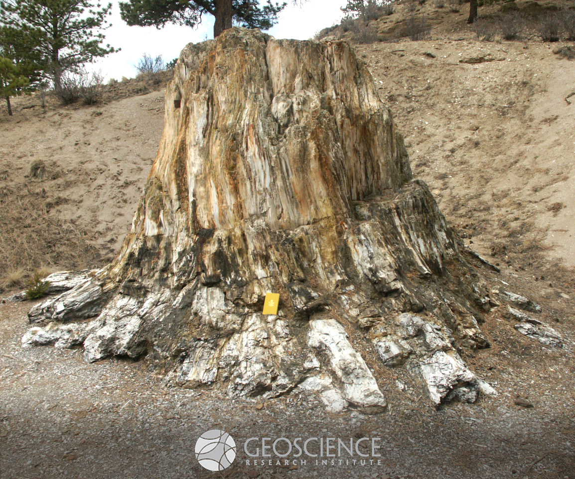
Large fossilized redwood stump preserved in Eocene deposits at Florissant Fossil Beds National Monument (CO). Volcanic activity was essential for rapid burial and petrification of this stump. Vertical side of notebook (for scale) is 19 cm long.
Rt139 MesaVerdeFmBurntOrganics
ENERGY SOURCES: Mesa Verde Formation, Rt.139 south of Rangely --- Coal seams in this formation ignite and burn, baking to a bright red nearby shale and sandstone layers.
IdahoSpgsPhoenixVein
MINERAL RESOURCES: Phoenix gold mine, Idaho Springs --- A mineral vein colored blue-green by copper compounds.
DrumsRNDisplays
CATASTROPHE - EARTHQUAKE: National Earthquake Information Center, Golden (west Denver) --- United States Geological Survey center for real-time compilation of the world's earthquakes.
RainbowCurveLawnLakeFloodOutwash
CATASTROPHE - FLOODING: Lawn Lake flood outwash from Rainbow Curve, Rocky Mountain National Park.
Rt139 Landslide
CATASTROPHE - LANDSLIDE: Douglas Pass on Rt.139 north of Grand Junction --- The hummocky ground in the foreground including the lake slid down from the cliff area to the right.
DinoRdgTracks
Dinosaur trackways, west Denver --- Dinosaur Ridge with trackways in the Dakota sandstone.
Plesiosaur
Plesiosaur skeleton, Denver Museum of Nature and Science --- A marine lizard with a small head, long neck, and powerful paddles for limbs.
MesozoicSeasAmmonites
Ammonite fossils, Denver Museum of Nature and Science --- Fossils of shells related to the still-living chambered nautilus.
073_050604_23Trail14CrinoidsNBrachiopod_903
Crinoid stems, Harpers Corner, Dinosaur National Monument.
DinoRdgTraceFossils
Burrows, Dinosaur Ridge, west Denver --- These tubes are assumed to be traces of animals that formed burrows on the surface of underwater sediment.
FlorissantCommercialQuarryFossils
Leaf fossils, Florissant National Monument --- Rapid burial resulted in exquisite preservation of details in these and other fossils, such as insects.
FossilTracePalmFront
Fossil palm frond, Parfet Prehistoric Preserve, Golden (west Denver)
RedRocksParkLykinsStroms
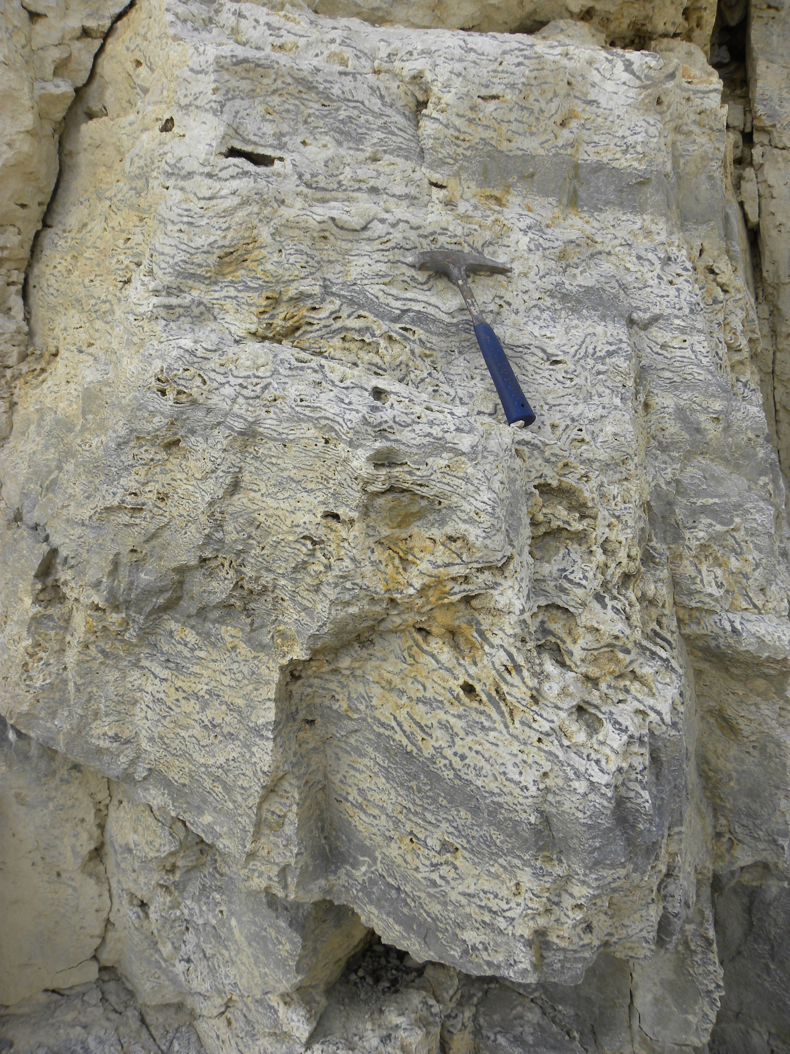
Stromatolite layers, Lykins Formation, Red Rocks Park, west Denver
