©Copyright 2018 GEOSCIENCE RESEARCH INSTITUTE
11060 Campus Street • Loma Linda, California 92350 • 909-558-4548
All Galleries
All Images


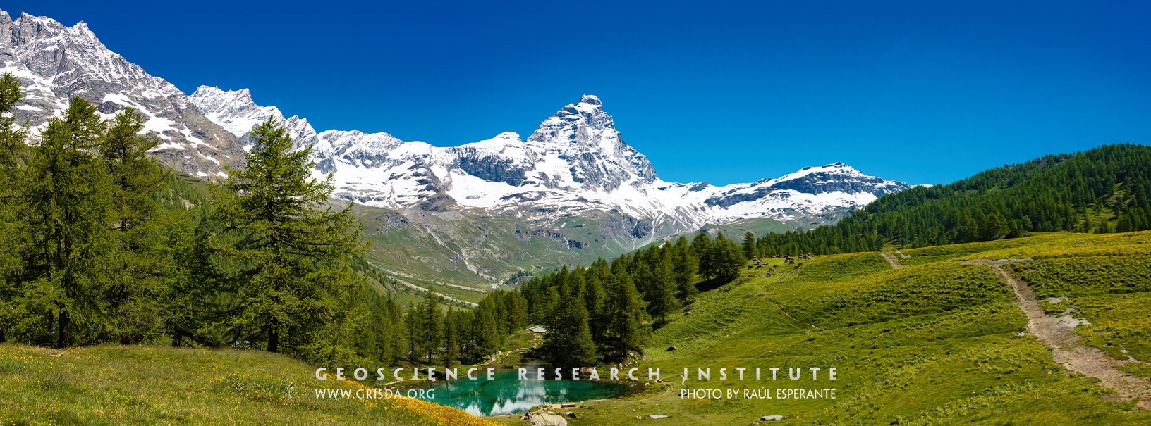
Cervino (Matterhorn)
The snowy peak of the Cervino. The Alps are a majestic mountain chain that records a history of continental collision and mountain rising. Glaciers and rivers have sculpted many valleys and contributed to the beauty of this natural landscape. Photo taken from Blue Lake, Cervinia-Breuil, Aosta, Italy.
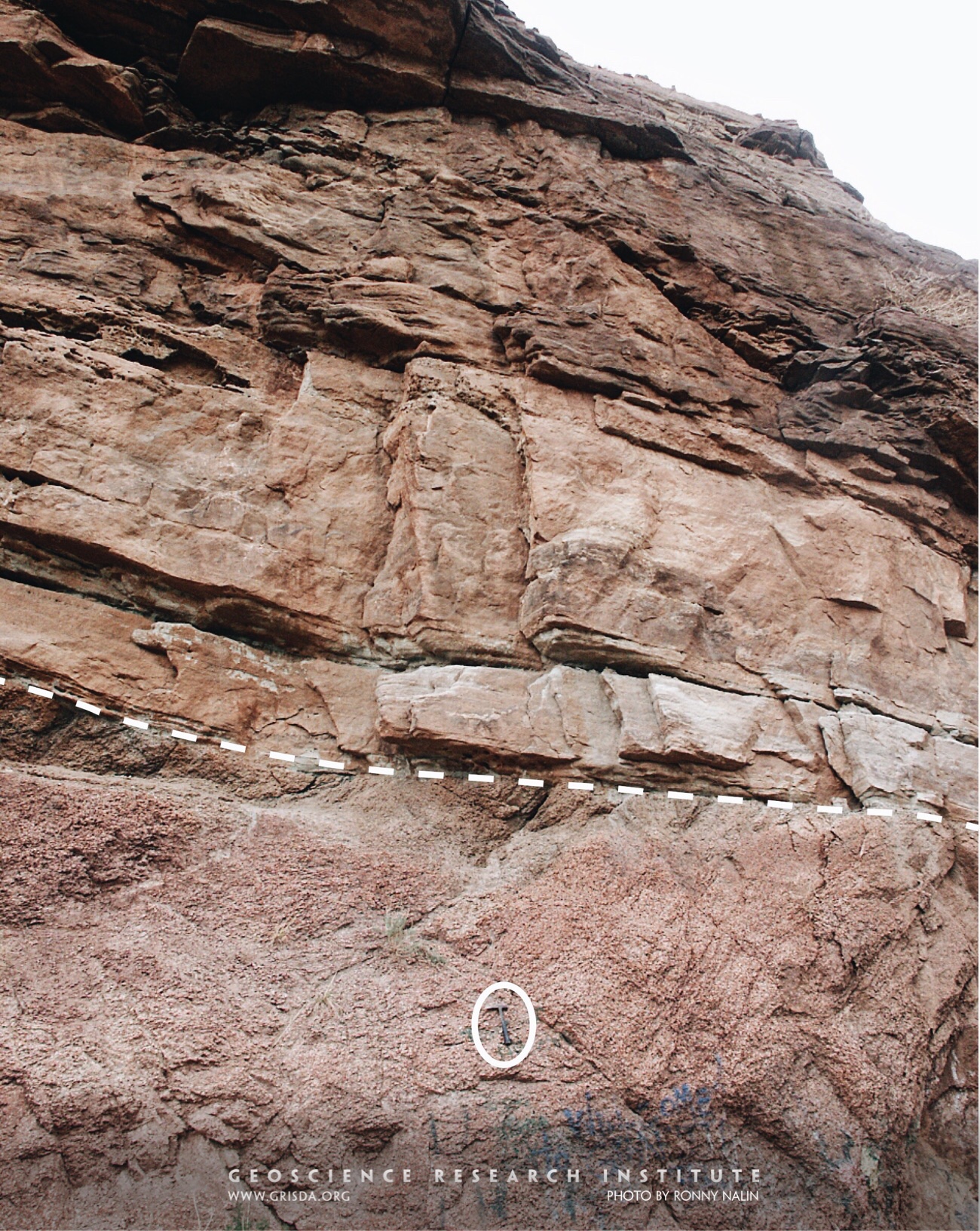
Great Unconformity
In many places around the world (and through most of the North American continent) Paleozoic rocks have a sharp discontinuity at their base. This widespread erosional surface, called “the Great Unconformity,” often separates layered sedimentary rocks from underlying metamorphic and igneous rocks (the so called “crystalline basement”). In this photo taken near Manitou Springs, CO, USA, the Great Unconformity is marked by the dashed line and overlain by the Cambrian Sawatch Quartzite. Hammer (encircled) for scale.
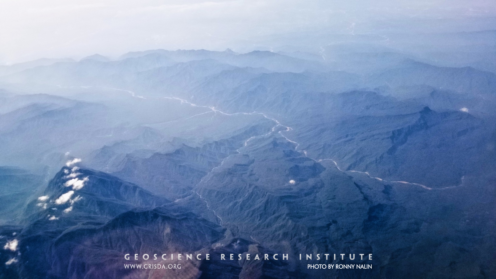
Gramadal-canyon
Gramadal canyon. The morphology of this canyon suggests that it formed in one or more rapid catastrophic discharges of water, which excavated the substrate.
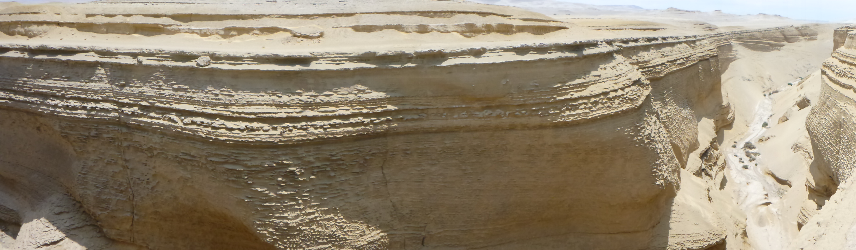
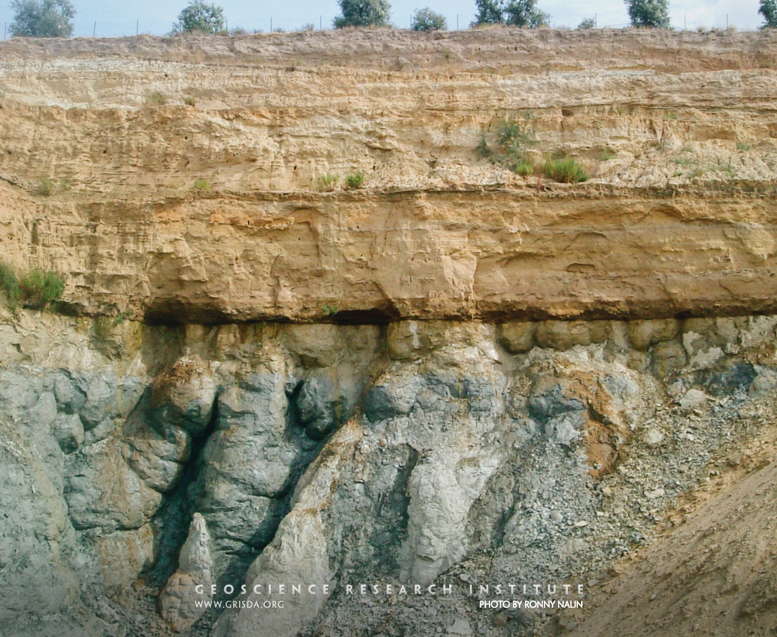
Ravinement
The flat erosional surface separating gray clays (Argille Subapennine Fm., Pleistocene) from yellowish sands is called ravinement surface and was cut by waves in shallow water. Erosional surfaces in the rock record are essential for reconstruction of sea level and tectonic changes. They help unraveling the history of our planet but also illustrate the power of geologic processes. Photo taken near Canosa, Puglia, Italy.
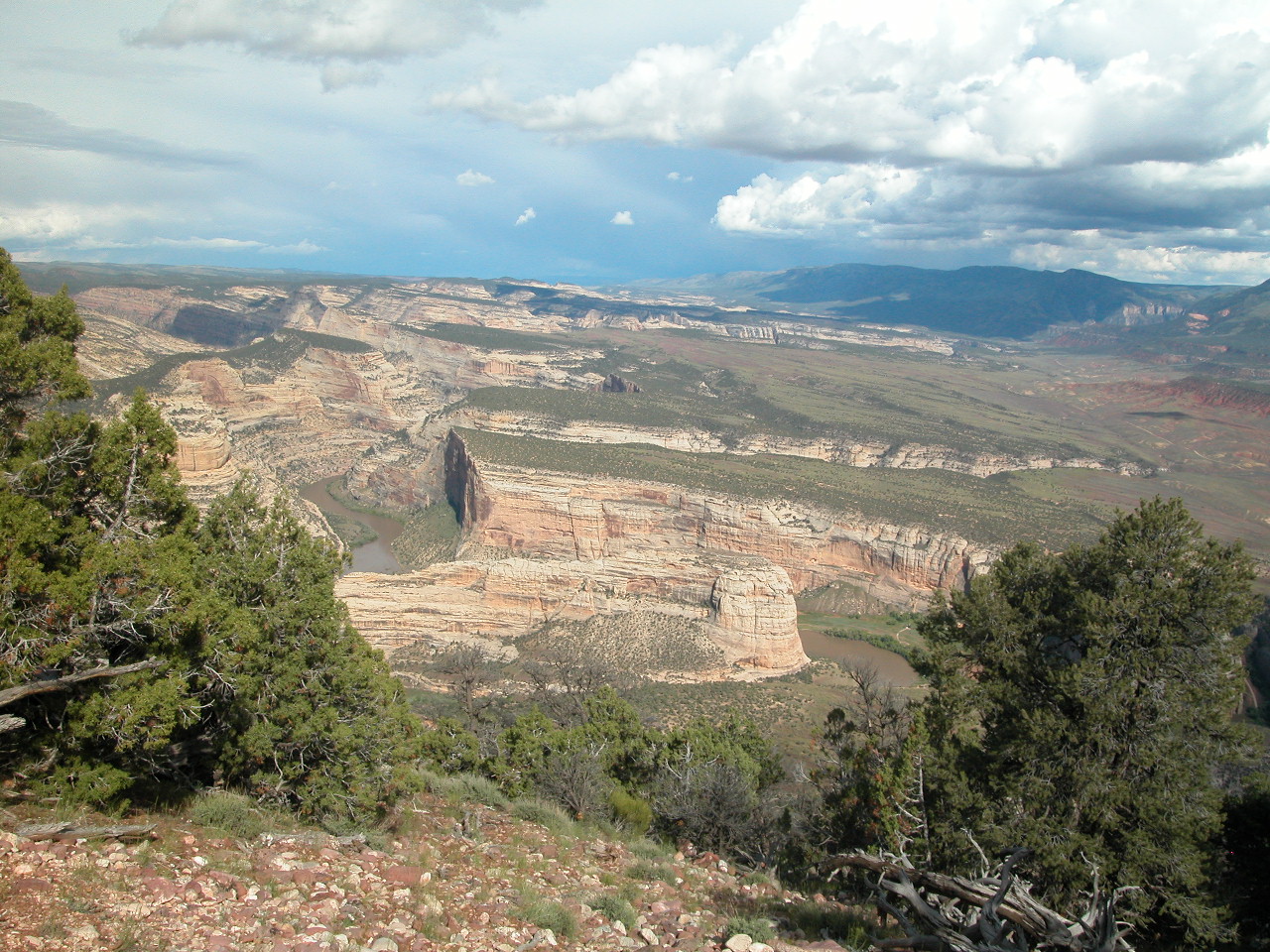
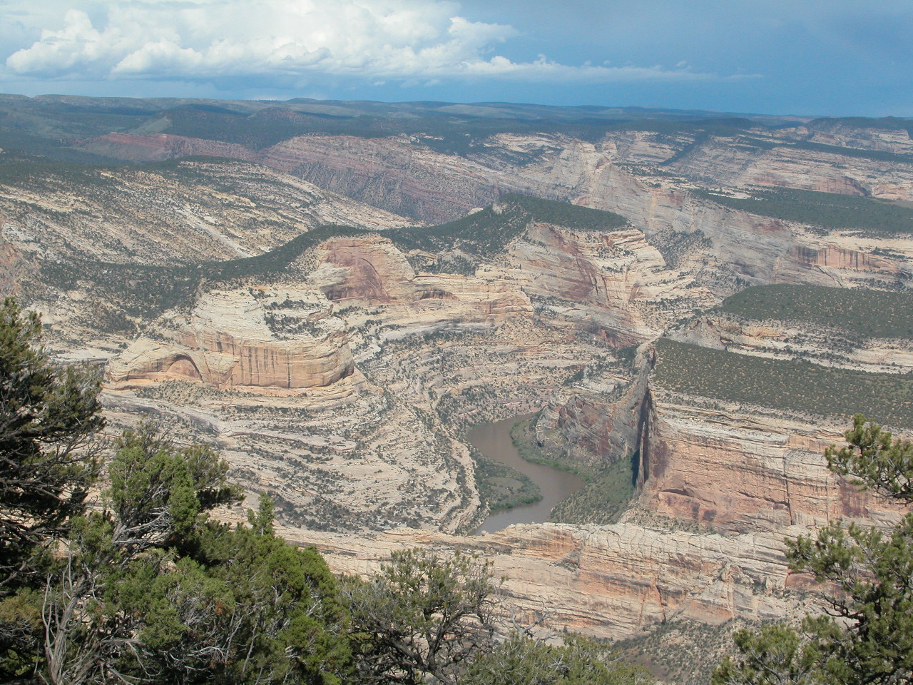
Trail Eto River
Harpers Corner, Dinosaur National Monument --- At the floor of these canyons of the Colorado Plateau run the Green and Yampa Rivers.
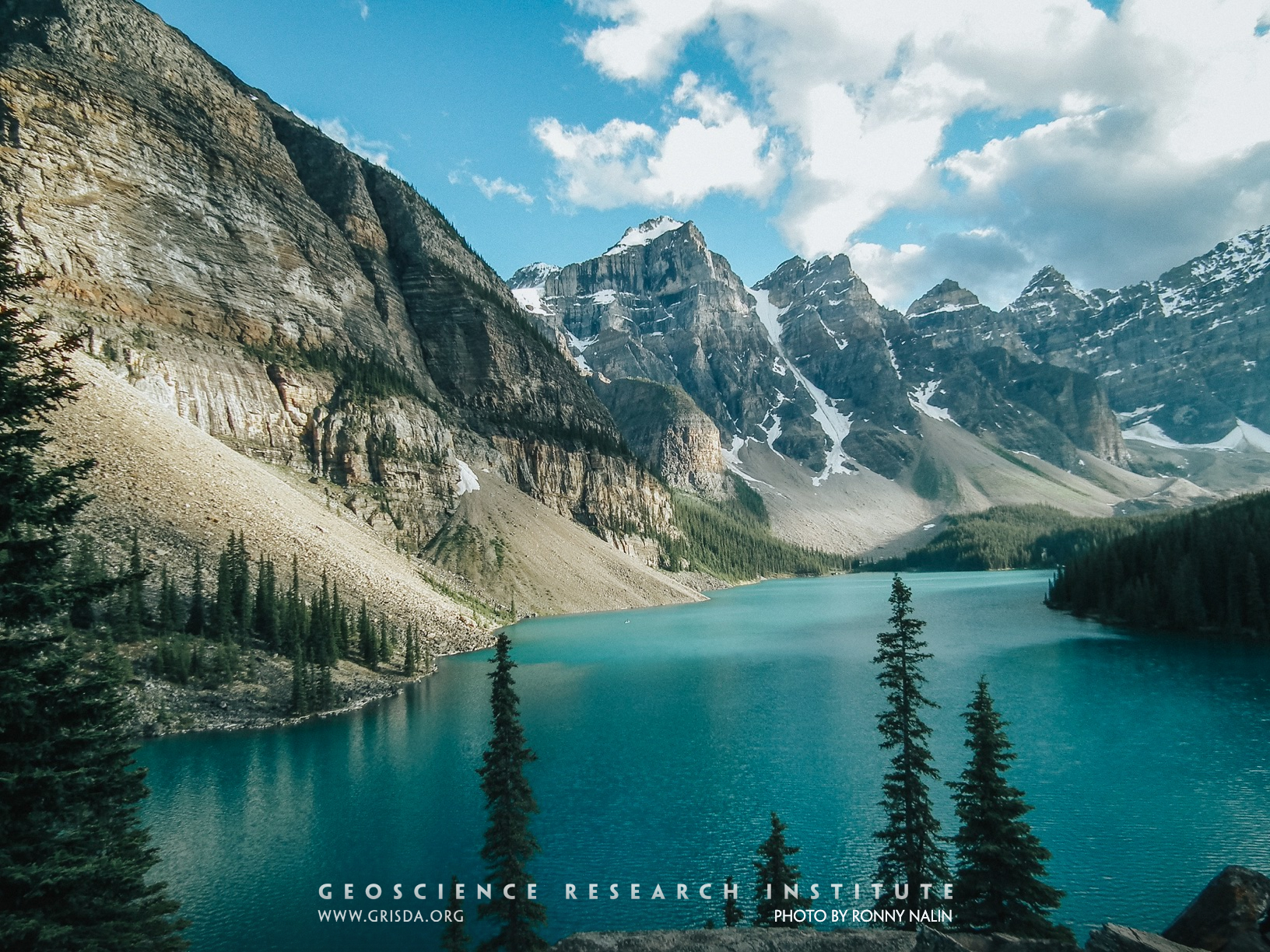
Moraine Lake
Talus cones, a glacial lake, and Cambrian quartzites: a perfect combo for a gorgeous landscape. Banff National Park, Canada.
Valleys
An example of transverse and longitudinal valleys from the Bolivian Andes, Parque Nacional Carrasco, reflecting structural control on geomorphology.
Great Unconformity_2
View of the contact between Precambrian basement and the Cambrian Sawatch Quartzite (marked by the tree line, mid-way through the picture), in the vicinity of Glenwood Canyon, CO, US. This important contact, an erosional discontinuity called "the Great Unconformity," is found over large sections of the North American continent.
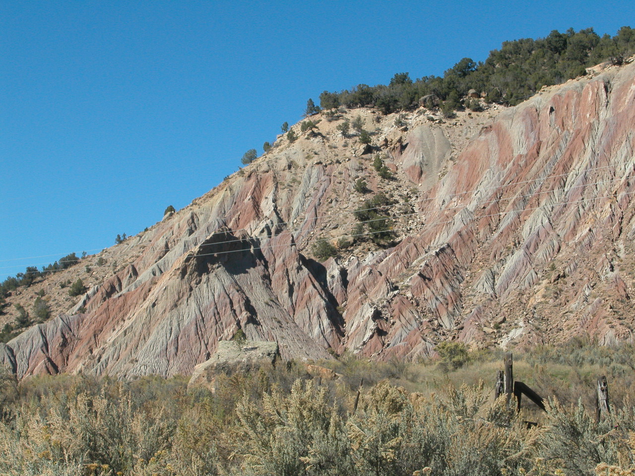
Rt13
Badlands, Wasatch Formation, Rt.13 north of Rifle --- The sandstone has been eroded into badlands and teepee-shaped mounds.
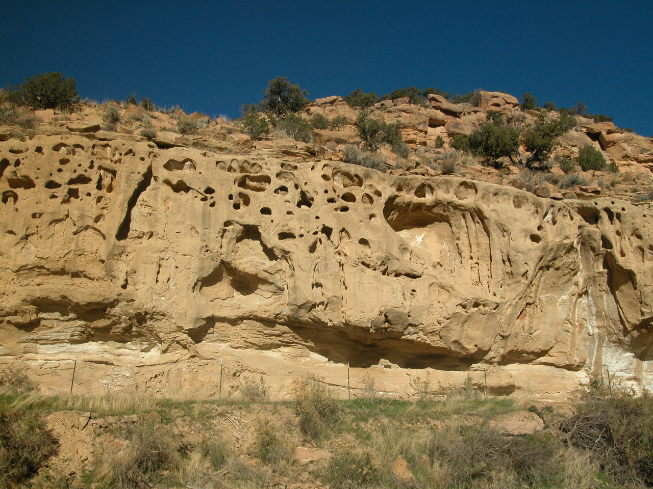
Rt139 MesaVerdeFm
Honeycomb weathering, Mesa Verde Fm, Rt.139 north of Grand Junction --- Freezing and thawing of wet sandstone cliffs loosens the sand grains that are then blown away by the wind.