©Copyright 2018 GEOSCIENCE RESEARCH INSTITUTE
11060 Campus Street • Loma Linda, California 92350 • 909-558-4548
All Galleries


All photos in this gallery are the property of the Geoscience Research Institute, and copyright rules apply. Noncommercial use is authorized with attribution as follows:
“Image copyright © Geoscience Research Institute, www.grisda.org. Used with permission."
Contact GRI for inquiries and further permissions.
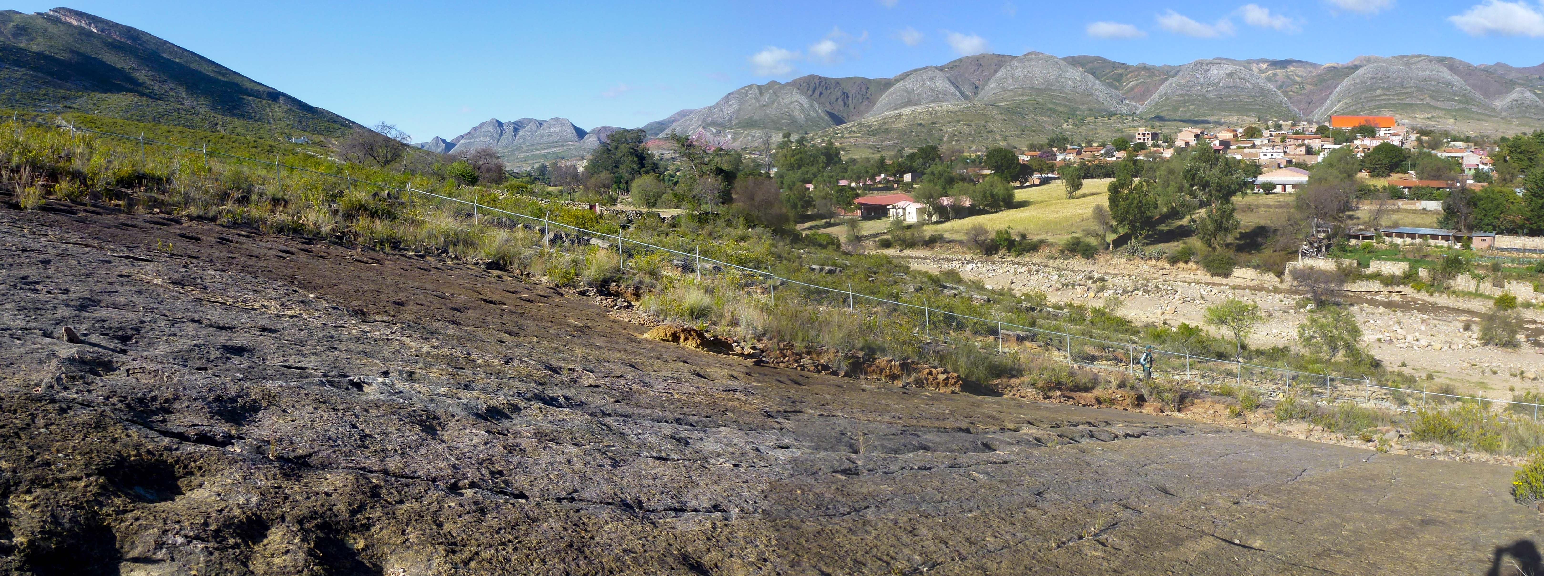
Torotoro syncline
Dinosaur footprints in the town of Torotoro. Torotoro is located in a valley formed by synclinal folding of sedimentary layers, forming a U-shaped regional structure. In the distance, one of the sides of the syncline can be seen, and the other occupies the bottom part of the photo, where the footprints are exposed
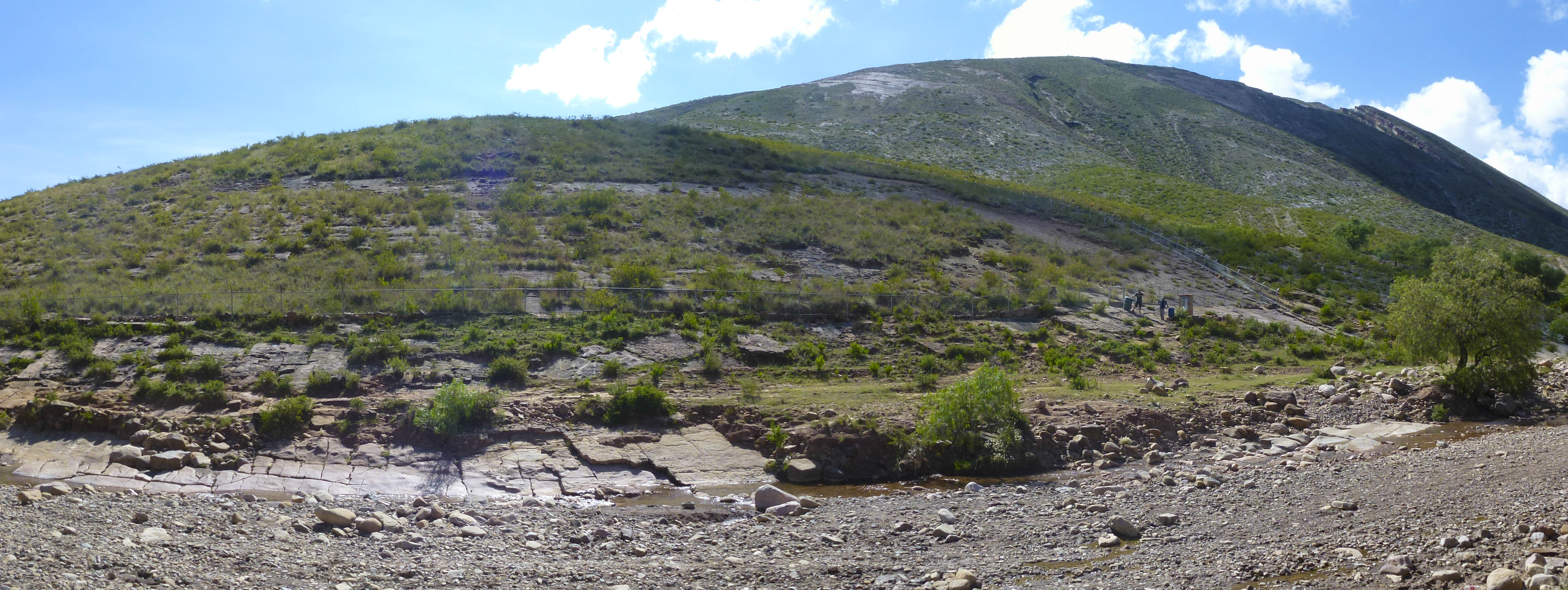
Torotoro site
Panorama of the main site with dinosaur footprints in Torotoro National Park. This place is right at the entrance of the town of Torotoro. Most of the tracks are within a fenced area, which can be visited with local guides under the supervision of the National Park authorities.
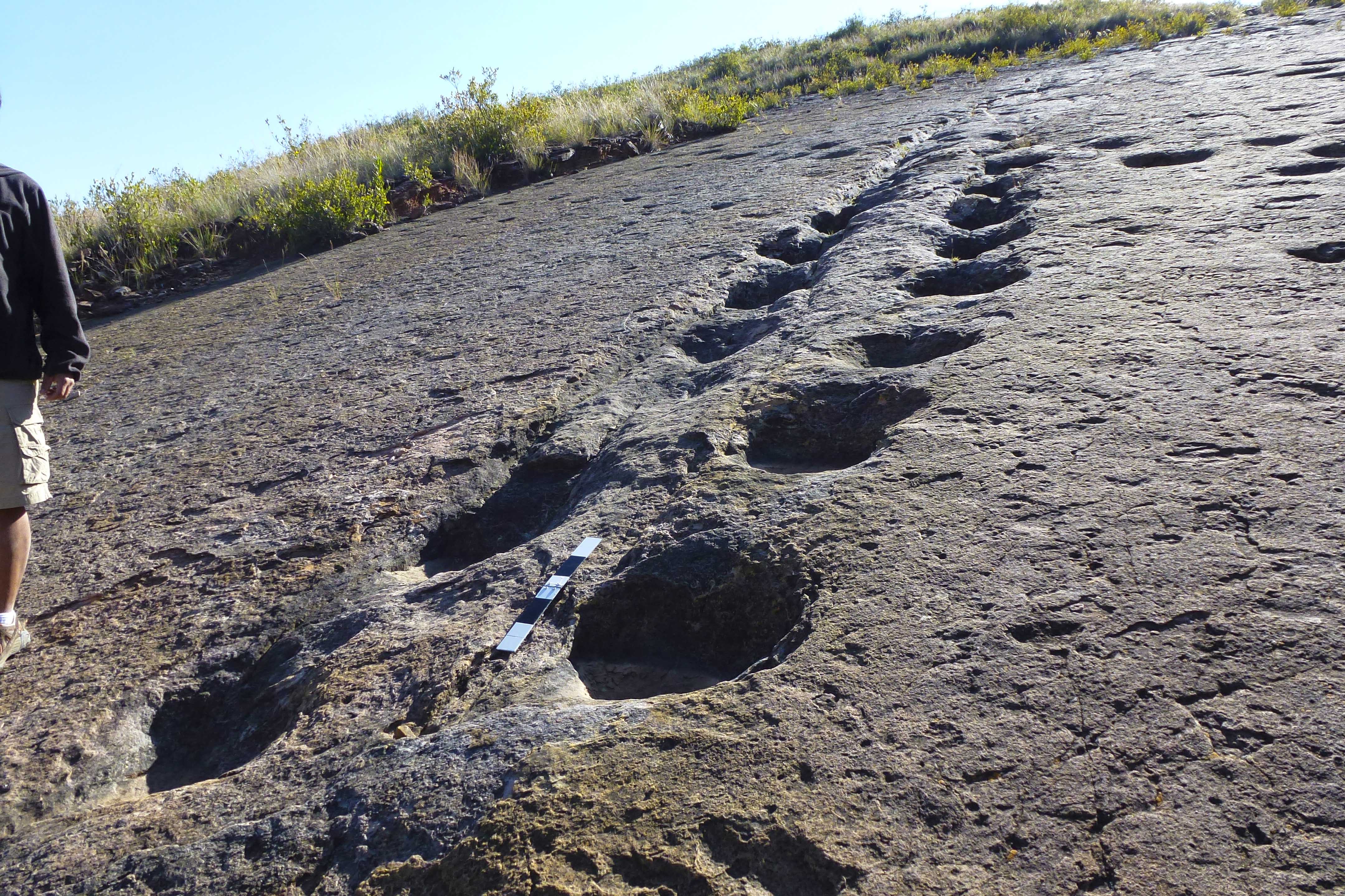
Ankilosaur footprints
Trail of ankilosaur footprints. This track is right at the entrance of the town of Torotoro.
Sauropod trackways
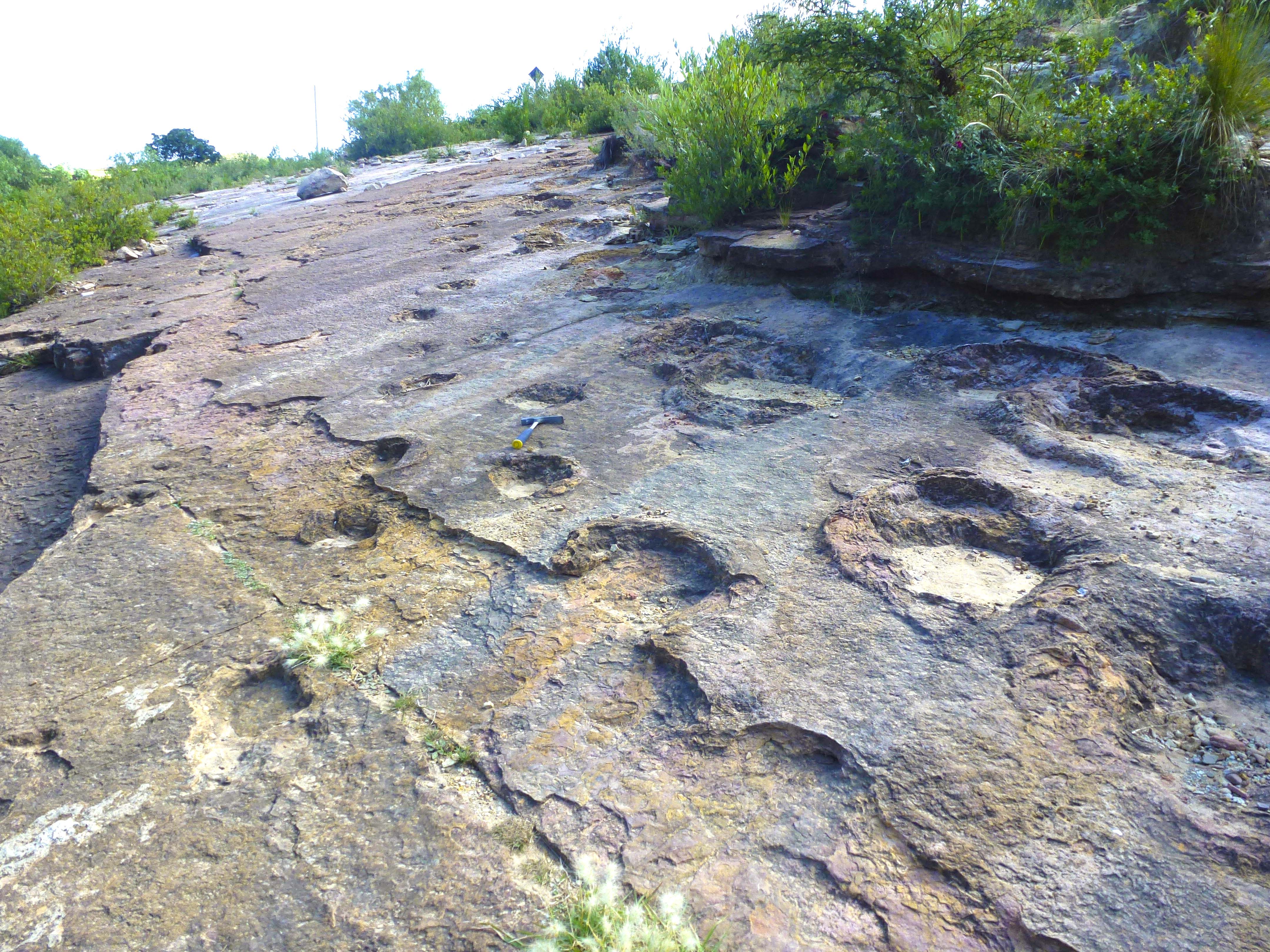
Sauropod dinosaur footprints on the outskirts of the town of Torotoro. The footprints are very well preserved in sandstone rock.
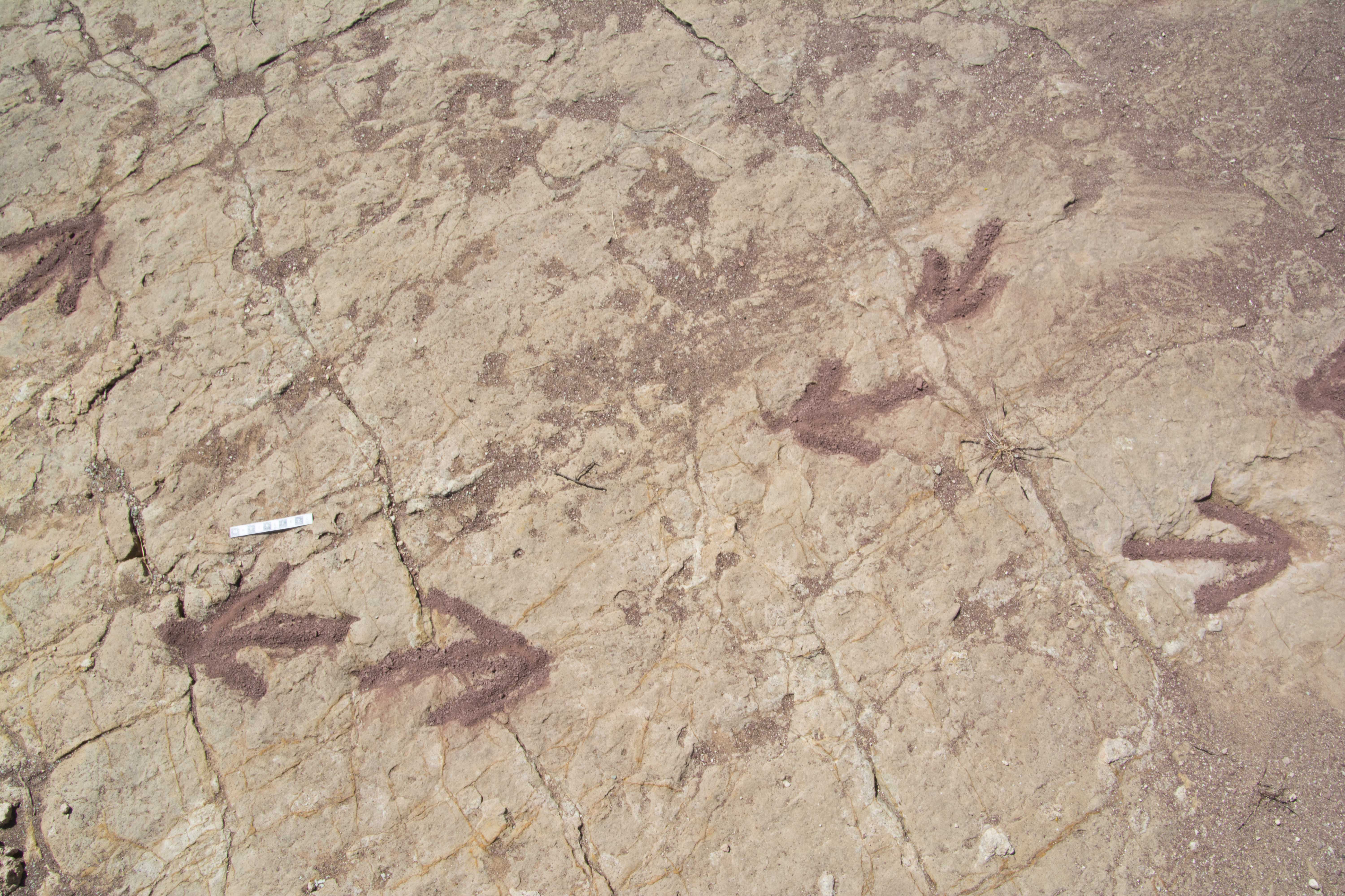
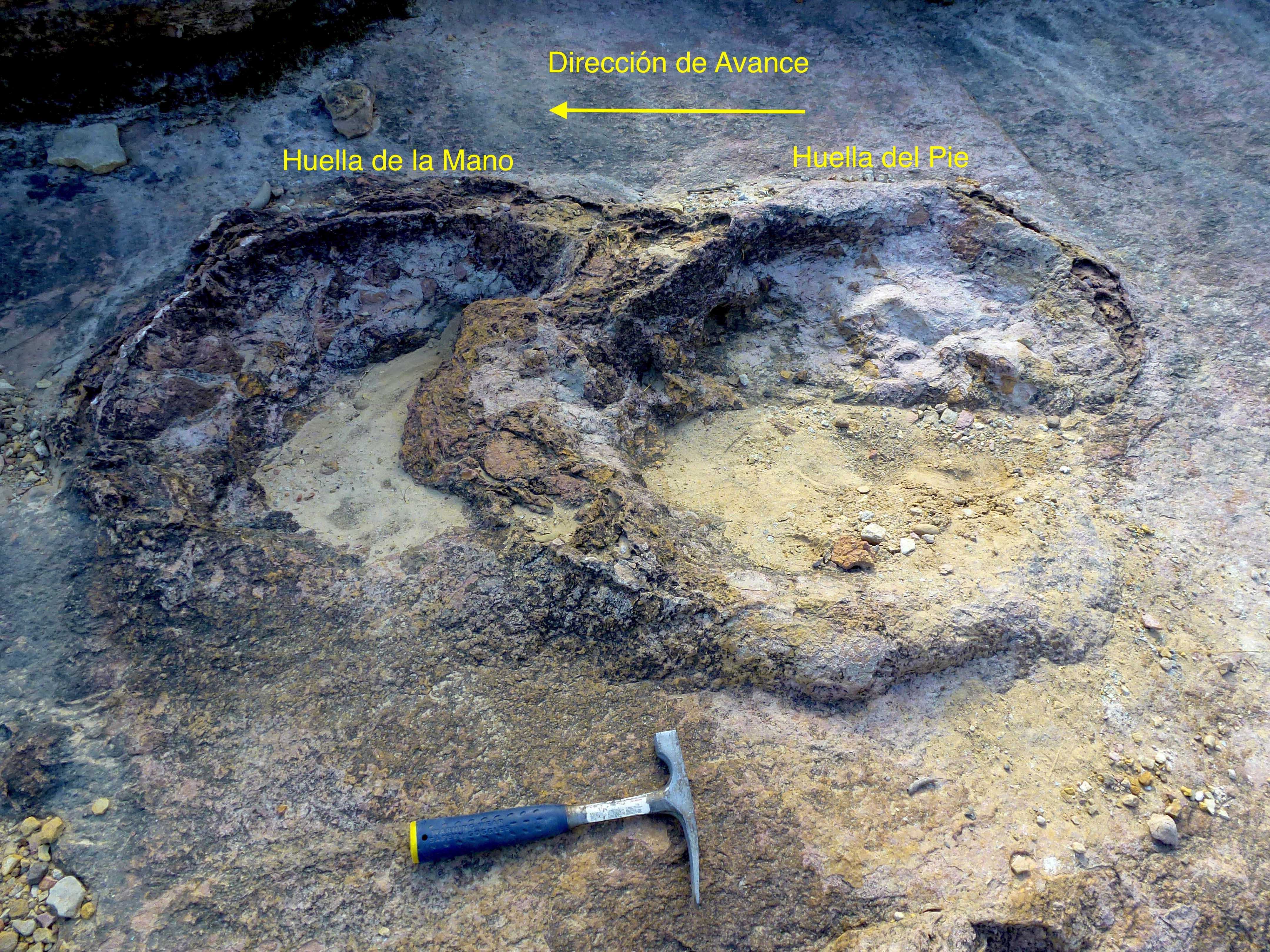
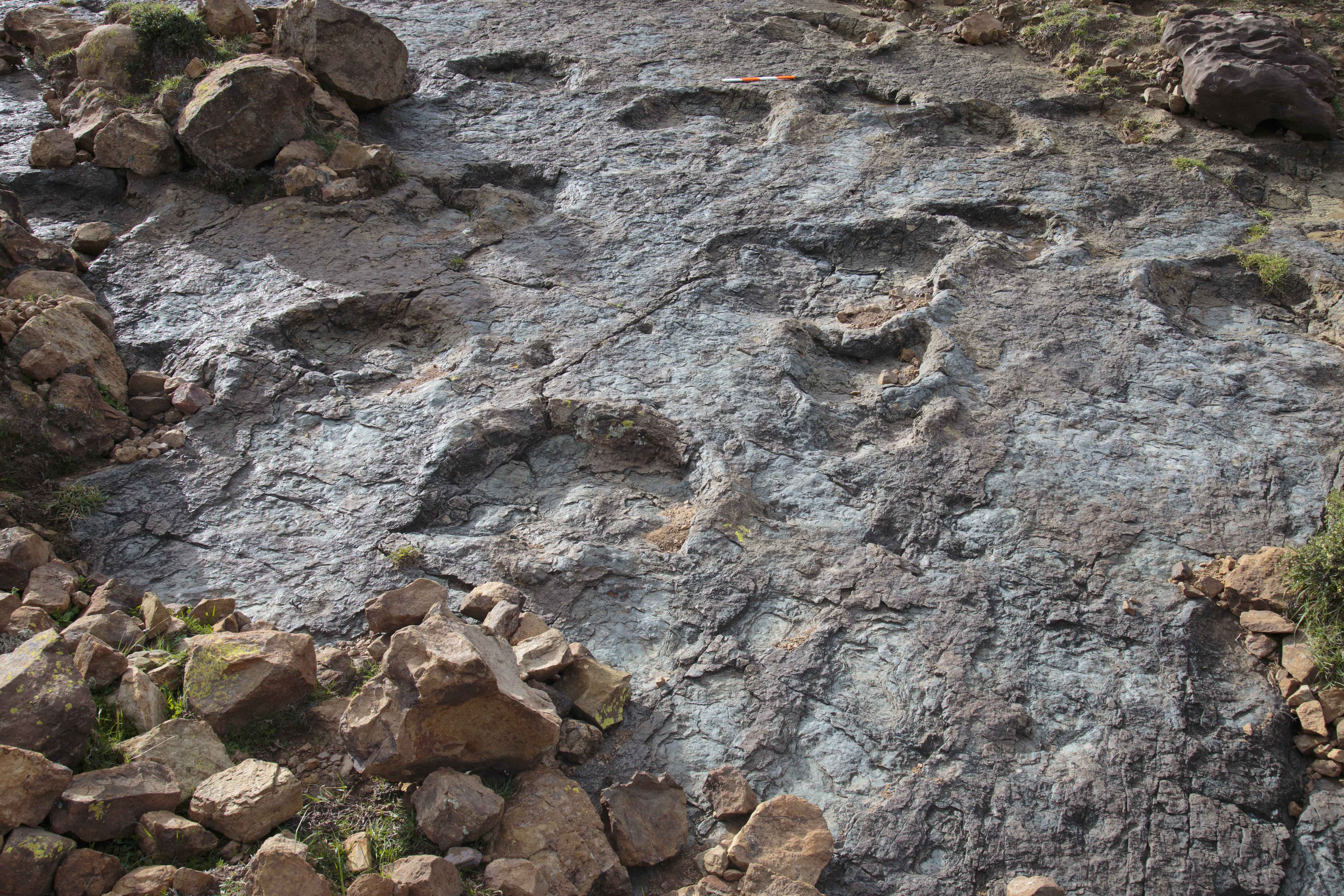
Sauropod footprints
Detail of two sauropod dinosaur footprints. Being quadrupedal, this dinosaur left four impressions, corresponding to two hands and two feet. In the photo, the left footprint corresponds to one hand (front leg), and the right to one foot (rear leg). When walking, the quadrupedal dinosaur first laid down the hand and then the foot, whose footprint partly overlapped with the footprint left by the hand.
Paleocene Maragua Bolivia
Succession of Upper Cretaceous and Cenozoic sediments in the Maragua syncline region, Bolivia
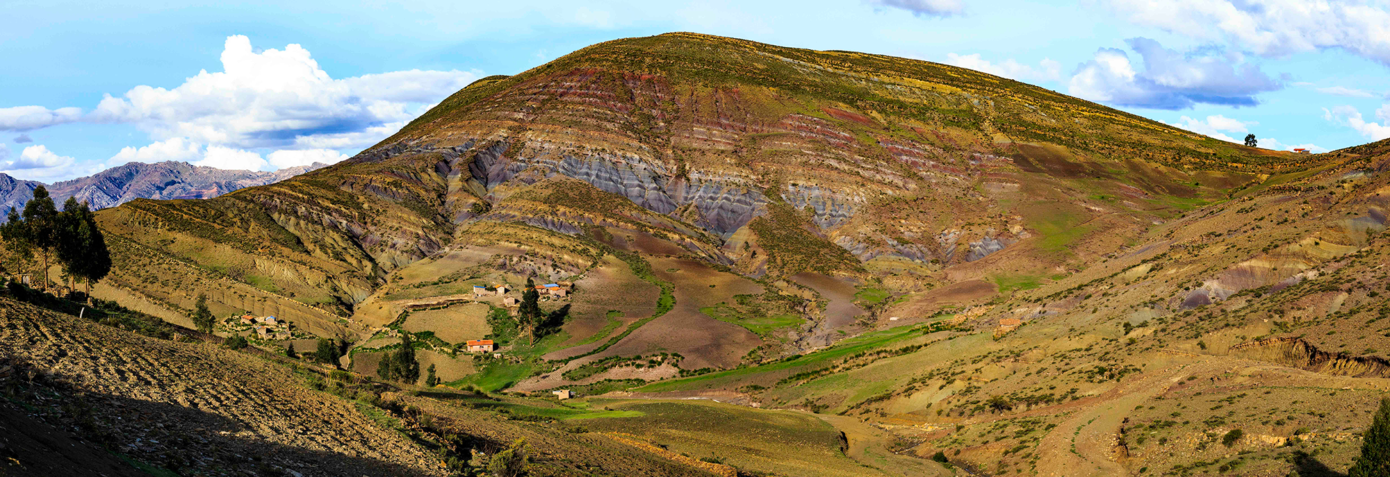
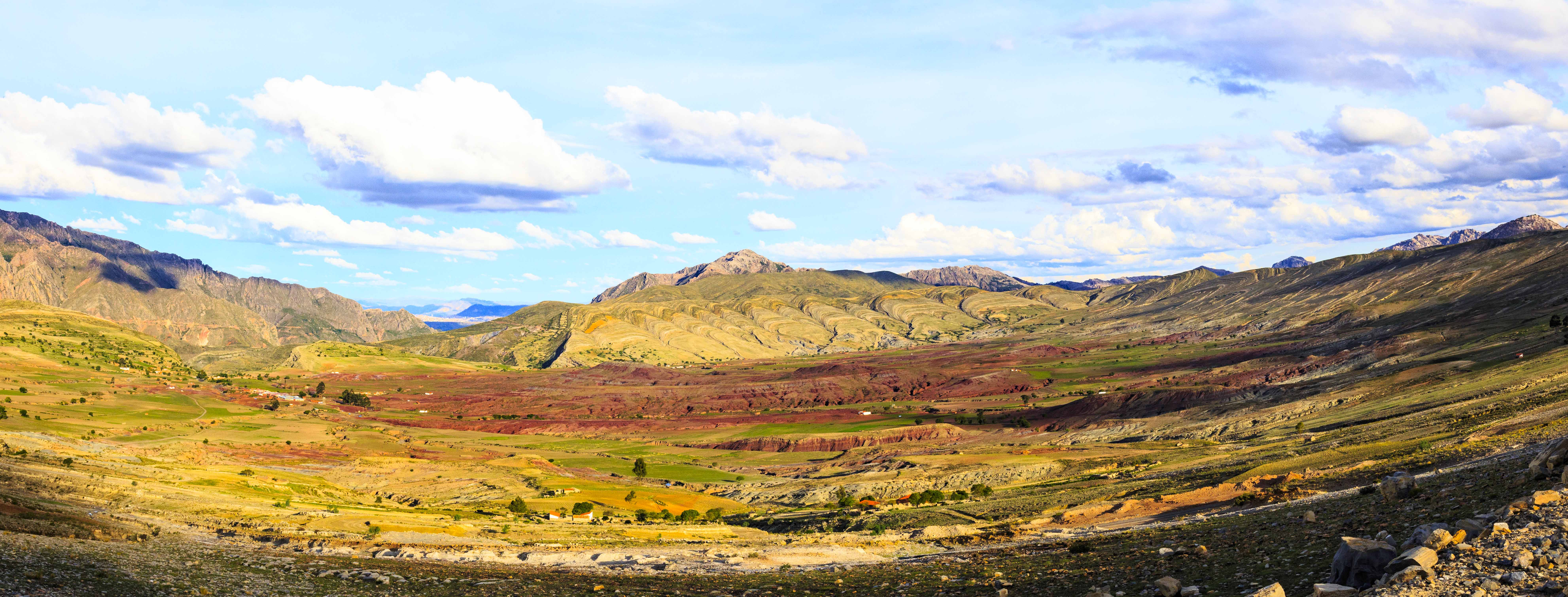
Maragua syncline
View of part of the Maragua syncline, known locally as “El Crater”. The pale colored layers correspond to Cretaceous sandstones and marine limestones. In the center, the red fill consists of layers of sandstone of continental origin that are more recent than those at the edges.
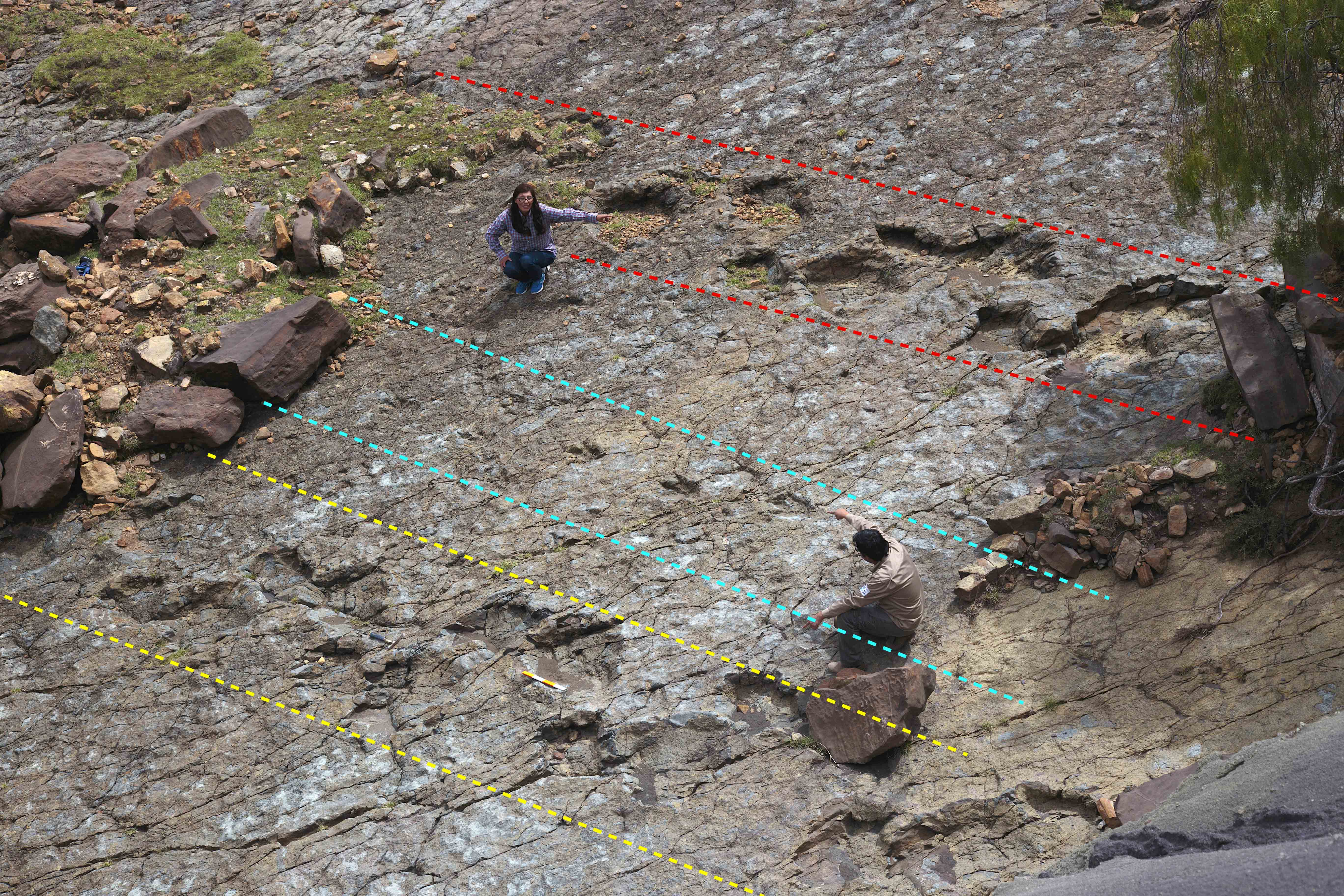
Parallel dinosaur trackways
Three trackways of dinosaur footprints. The middle one was made by a bipedal dinosaur, and those on both sides by quadrupedal dinosaurs (sauropods). The rocky substrate consists of sandstones formed on a beach or coast at low tide. The substrate was originally wet and firm, but deformable. The direction of movement of the dinosaurs was to the left.
Dinosaur-tracks
Various sauropod footprints exposed on the surface of a sandstone bed. Scale (red and white) is 40 cm long
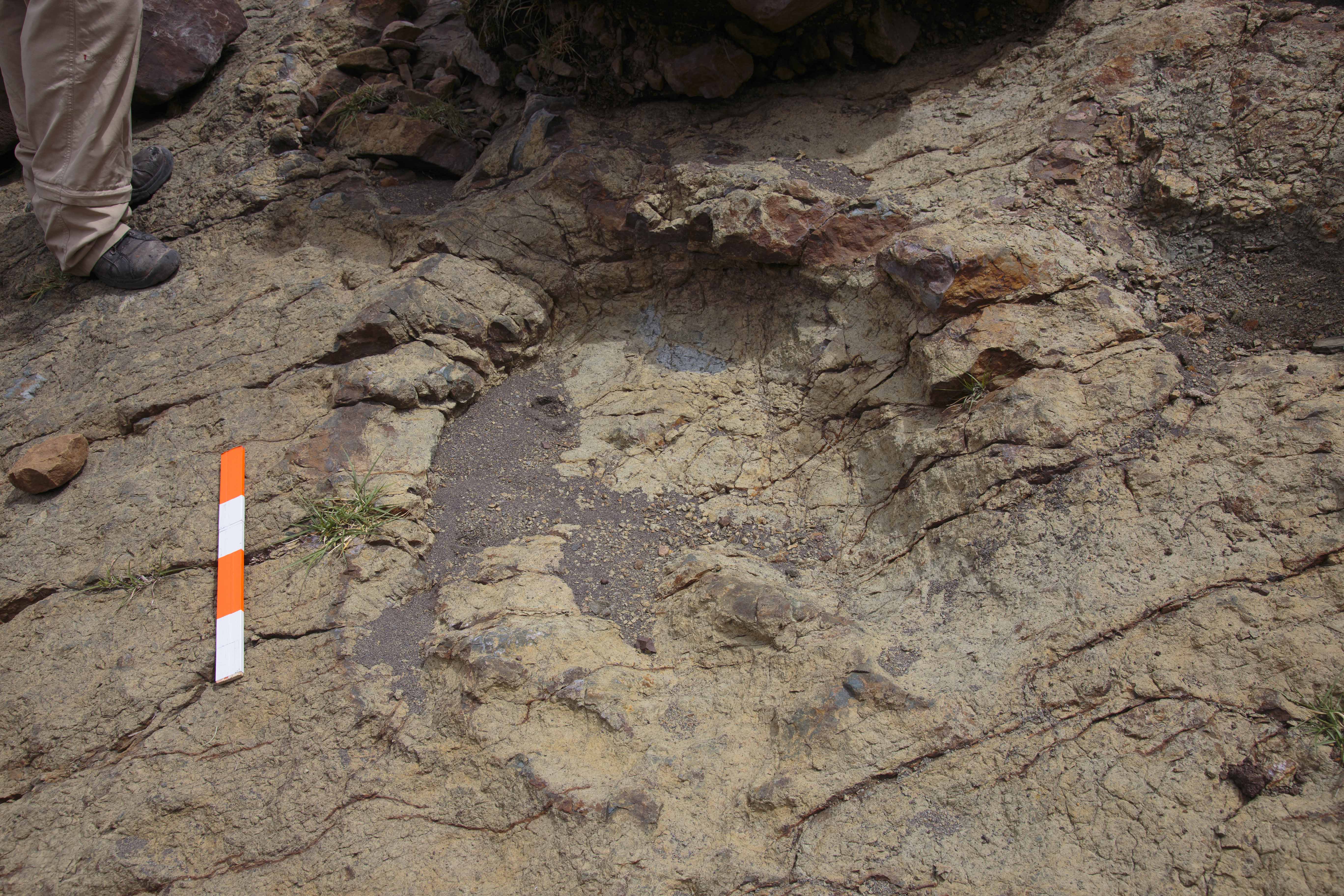
Abelisaurus footprint
This footprint is the largest Abelisaurus footprint found to date. It is located near the Maragua syncline. The scale is 40 cm long.
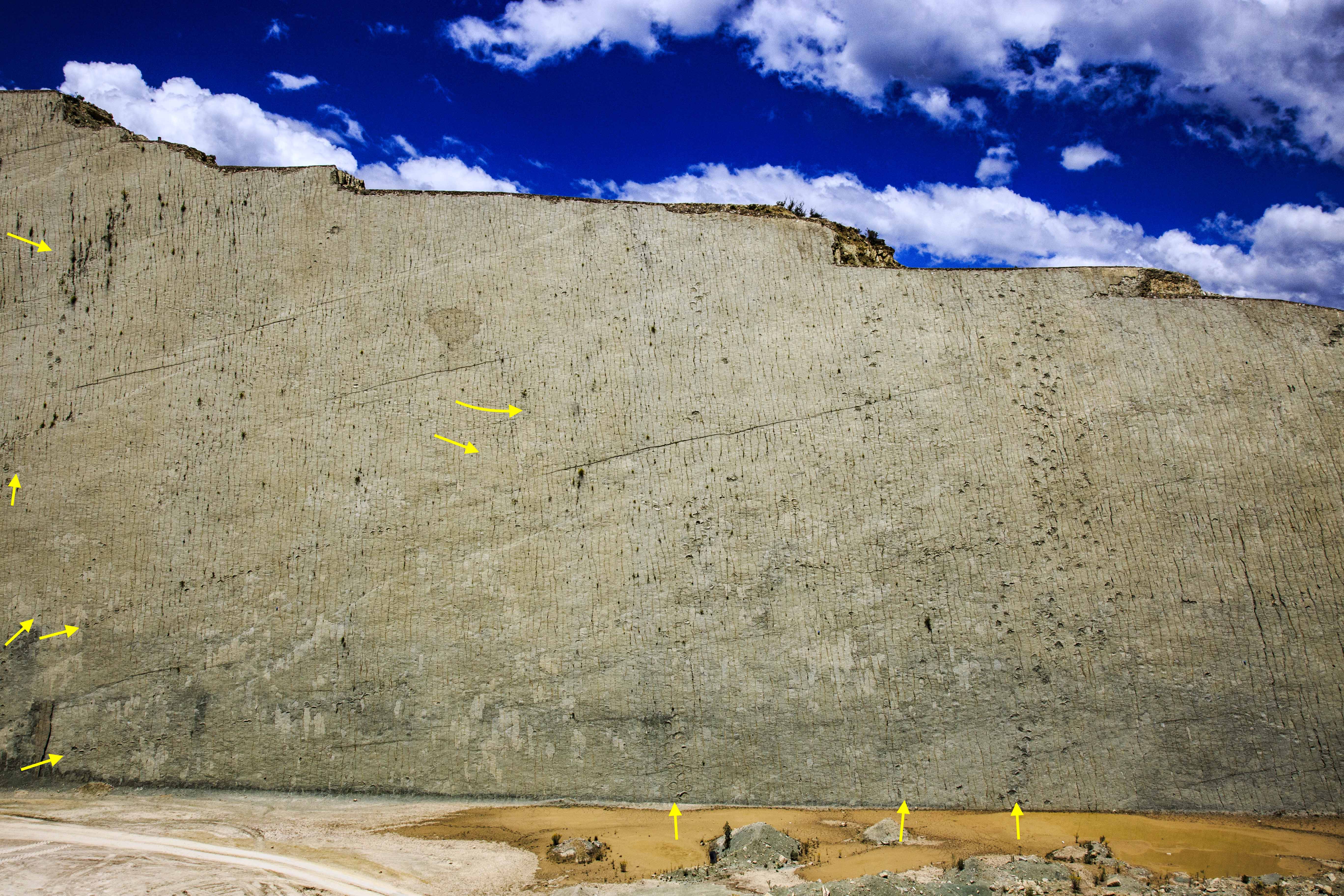
Cal Orcko dino trackways
Site of dinosaur footprints of Cal Orcko, in Sucre, where more than twelve thousand prints have been found on numerous trackways in this wall of limestone and sandstone inclined at about 70 degrees, 1200 m long, and 80 m high. Researchers have found almost 300 ichno species on this exposure.